Special thanks to James Greenhalgh for initial content on this page.
This page was last updated October 14, 2012
Send questions, comments, and photos here.
LRT in
San Diego


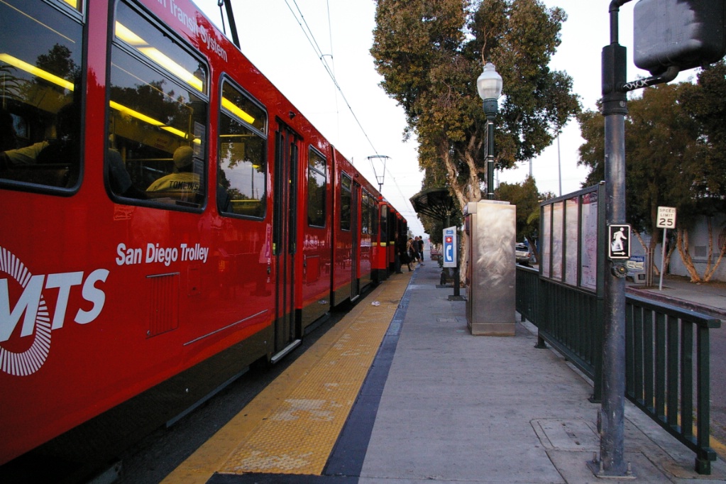
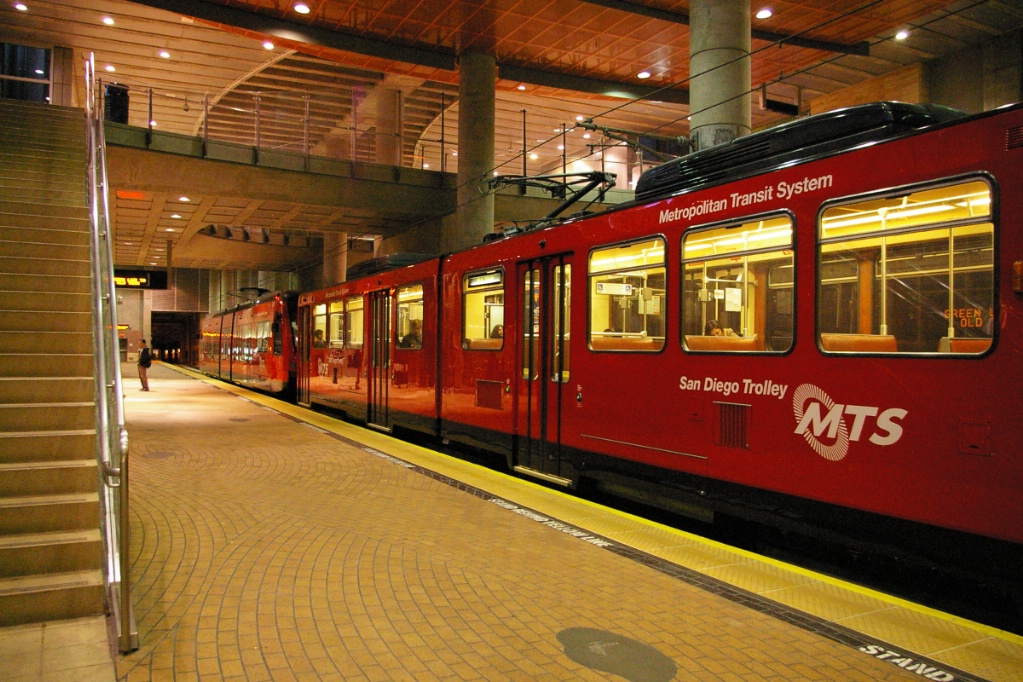
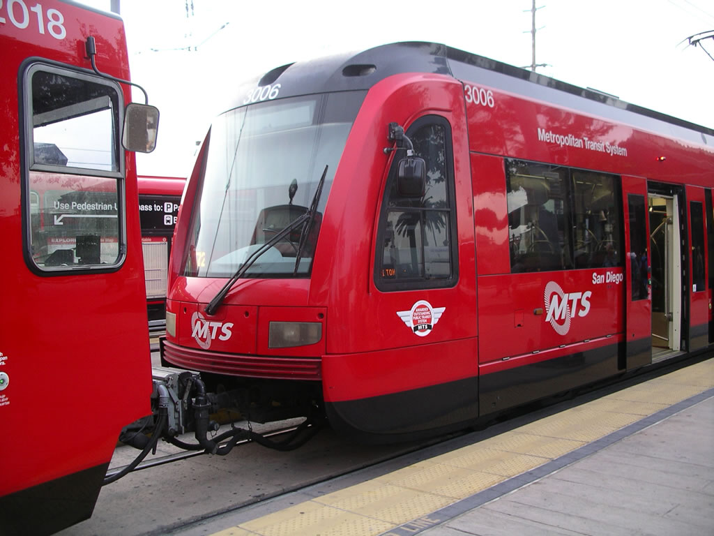
The LRT system in San Diego is operated by San Diego Trolley Inc. (SDTI), a subsidiary of the Metropolitan Transportation System (MTS). In addition, MTS owns the San Diego Transit Corporation (SDTC) - the operator of 82 bus routes in the region, the San Diego & Arizona Eastern (SD&AE) Railway Company, which owns 108 miles of track and right-of-way, and the San Diego Vintage Trolley, Inc., a non profit corporation established to restore historic trolley vehicles MTS also contracts with the San Diego & Imperial Valley (SD&IV) Railroad and the Carrizo Gorge Railway (CZRY) to provide freight service to San Diego shippers over the SD&AE right-of-way. SD&IV shares certain tracks with SDTI, operating during non-service trolley hours.
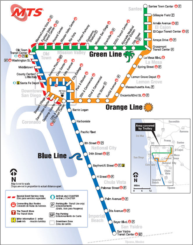
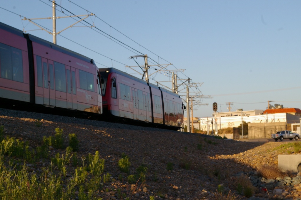
SDTI operates 3 trolley routes - the Blue, Orange and Green lines for a total of 53 stations over 86 km. The first leg of the trolley opened in July 26, 1981, and operated on the Main Line of the San Diego and Arizona Eastern Railway (SD&AE). The initial line was a single track which was eventually double tracked in 1984. The next extension in March of 1986 operated along the La Mesa Branch of the SD&AE Railway.
Contents
Toronto Comparison
The Siemens S70 vehicles have similar characteristics to the type of vehicle to be used for Transit City Light Rail system. The S70 is a similar length, has doors on both sides, has cabs at both ends and has wheelchair access. However, the S70 is only about 70% low-floor while Transit City vehicles will be 100% low floor.
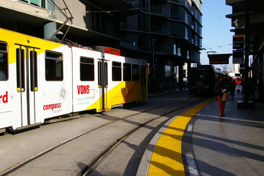
The San Diego Trolley is a good example of LRT implementation with the following features:
- Actual rapid transit implementation in outer areas with some stations spaced close to 2 km
- Route interlining
- Downtown transit mall
- Fenced-in surface right of way, sometimes parallelling railway right of way
- Separated median in roadway
- Short tunnel section
System Highlights and Route Details
| Item | Notes |
|---|---|
| Number of lines | 3 |
| Total length | 86 km |
| Total stations | 53 |
| Right of way | |
| Loading | Low level platform, cars have steps Platform 20 cm above track |
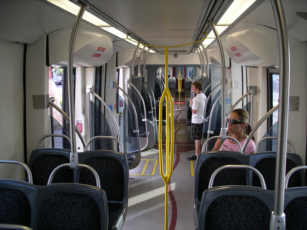
| Fleet |
60 Siemens-Duewag U2 |
| U2 details |
Seats 64 passengers; up to 86 standees |
| SD-100 details | Seats 60; up to 86 standees 24.4 m long - high floor 91.4 cm above rail 4 double plug doors per side, 1.3 m wide |
| S70 details | Seats 64 passengers; up to 99 standees 27.7 m long - boarding 35.6 cm above rail Click here to see S70 brochure (4.4 MB) |
| S70 "custom" | 24.4 m long - boarding 35.6 cm above rail |
| Fare collection | Self service, barrier free, proof of payment |
| Fare integration | Transfers between trolley and bus are not allowed with a one-way
ticket. Day Passes are good for unlimited rides on most MTS Bus and Trolley routes; Advanced day passes include access to express routes and Coaster trains |
| Airport service | No direct service; Bus route 992 provides airport connection from America Plaza and Santa Fe Depot stations |
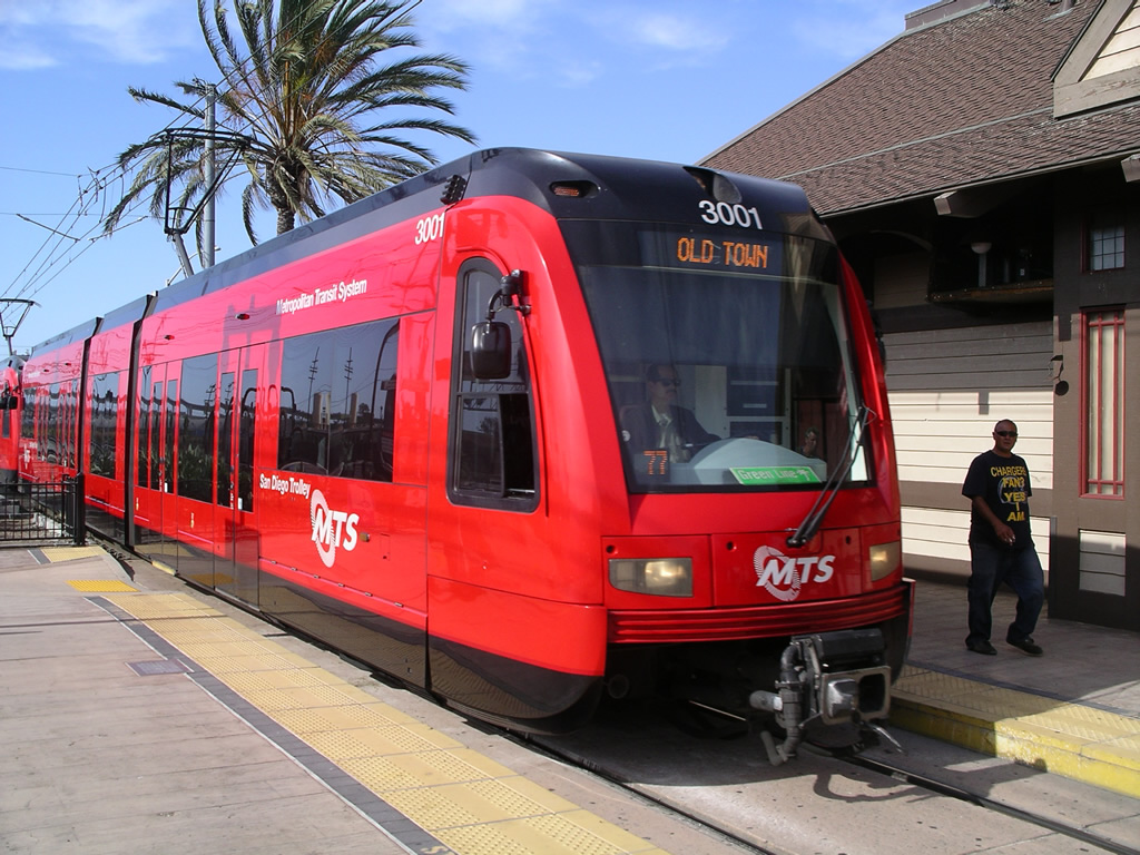
| Blue
Line |
|
| Length | 30 km |
|---|---|
| Stations |
23 |
| Right of way |
South: Fenced right of way shared with freight line |
| Service frequency | 7.5 minutes rush hours 15 minutes midday 30 minutes late evenings |
| Opening | July 26, 1981 Orignally named South Line Downtown south to Tijuana/Mexico border July, 1992 Downtown north to County Center/Little Italy June 13, 1996 County Center/Little Italy north to Old Town November 23, 1997 Old Town to Mission San Diego Station Renamed Blue Line This portion transferred to the Green line on July 9, 2005 |
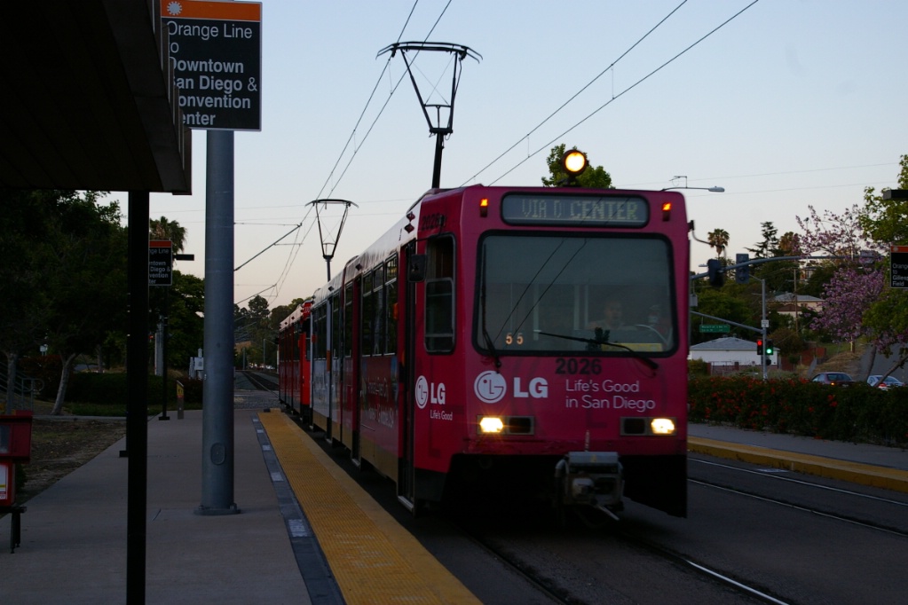
| Orange
Line |
|
| Length | 33.1 km |
|---|---|
| Stations | 23 6 are shared with Blue Line 5 are shared with Green Line |
| Right of way | Downtown: Roadway median Commercial Avenue: Mixed with traffic East: Side-of-road right of way |
| Service frequency | 15 minutes daytime 30 minutes late evening, weekend morning and evenings |
| Opening | March 23, 1986 Orignally named East Line Downtown east to Euclid May, 1989 Euclid to Spring Street June 25, 1989 Spring Street to El Cajon Transit Center June 30, 1990 Downtown west and south to Gaslamp Quarter November 23, 1997 Renamed Orange Line August, 1995 El Cajon to Santee Town Center Scaled back to Gillespie Field Station on July 9, 2005 |
| Green
Line |
|
| Length | 30.1 km |
|---|---|
| Stations | 19 1 is shared with Blue Line 5 are shared with Orange Line |
| Right of way | Mostly fenced right of way at grade, with elevated portions Tunneled at San Diego State University |
| Service frequency | 15 minutes daytime 30 minutes late evening, weekend morning and evenings |
| Opening | July 9, 2005 Old Town to Santee Town Center |
Ride Descriptions
The description of where the Blue and Orange Lines interline downtown will be described with the Blue Line. Where the Orange and Green lines interline between Grossmont Transit Center and Gillespie Field will be described with the Orange Line.
| Corridor | Notes | Initial Opening |
|---|---|---|
| Blue Line | Describes the entire route of the Blue Line | July 26, 1981 |
| Orange Line | Describes the route of the Orange Line except where it interlines with the Blue Line | March 23, 1986 |
| Green Line | Describes the route of the Green Line except where it interlines with the Orange Line | July 9, 2005 |
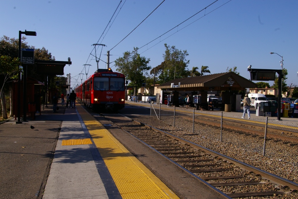
Blue Line
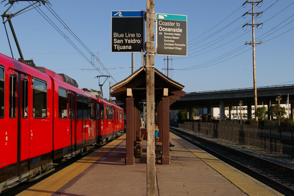
A trip on the Blue Line takes approximately 56 minutes.
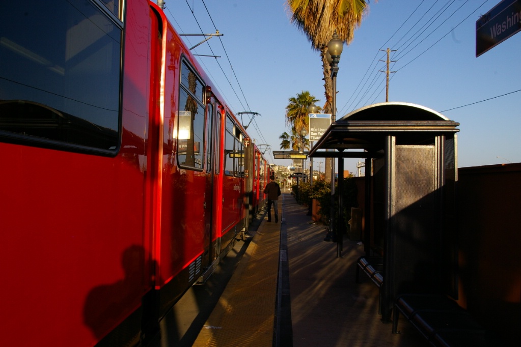
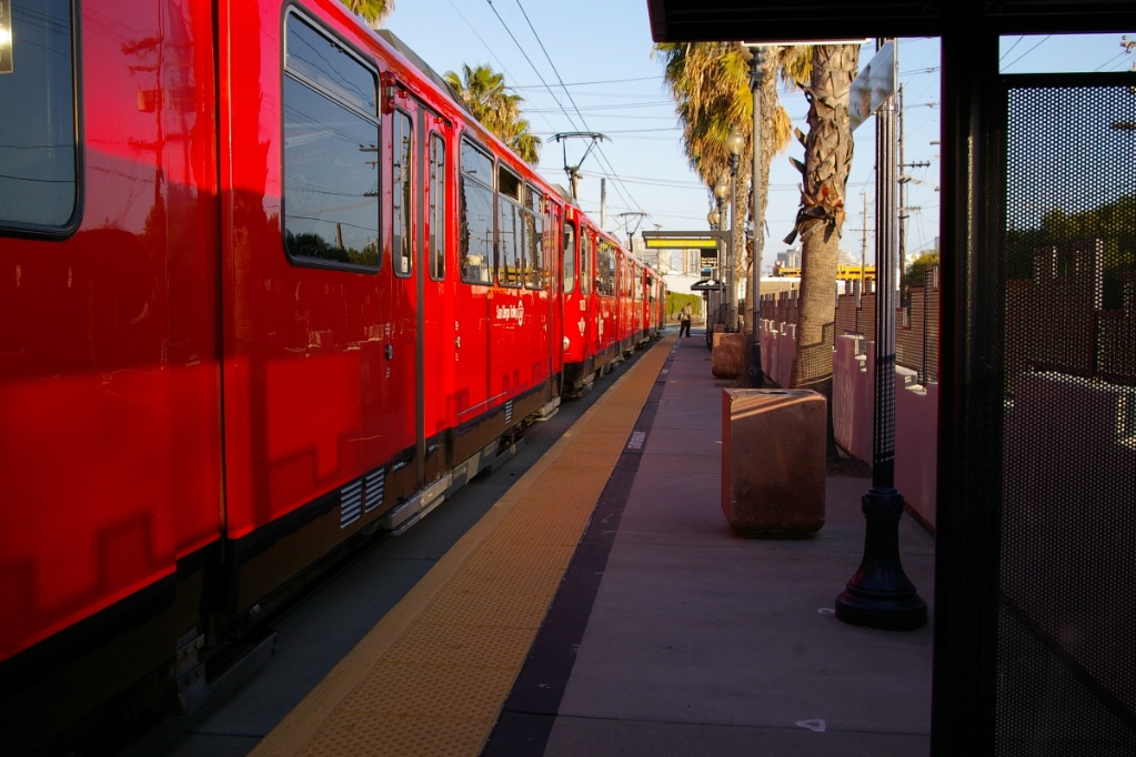
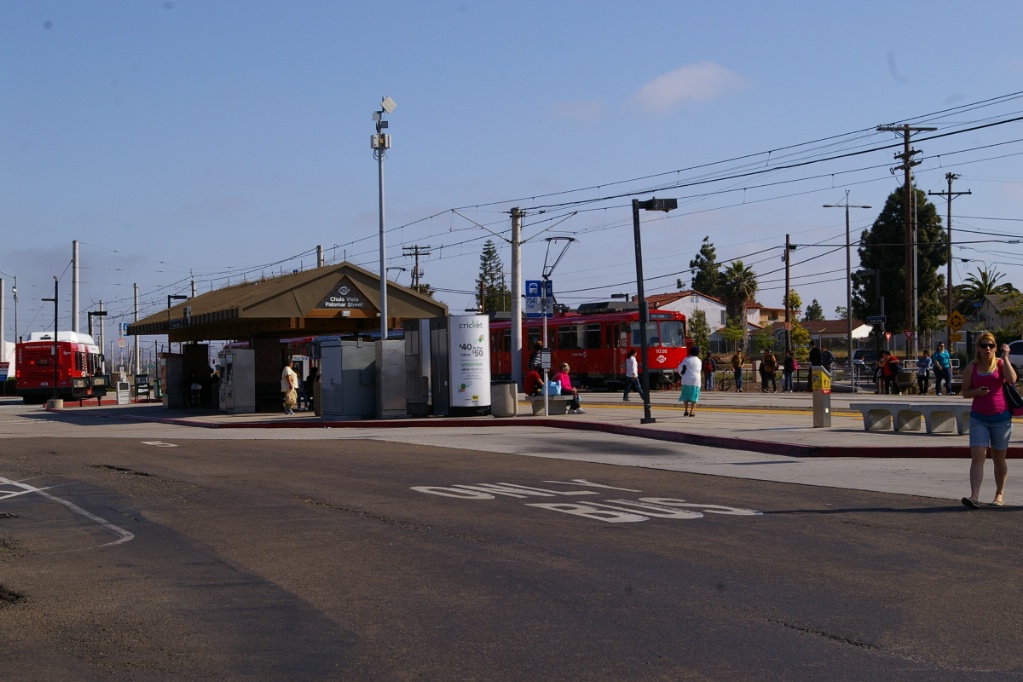
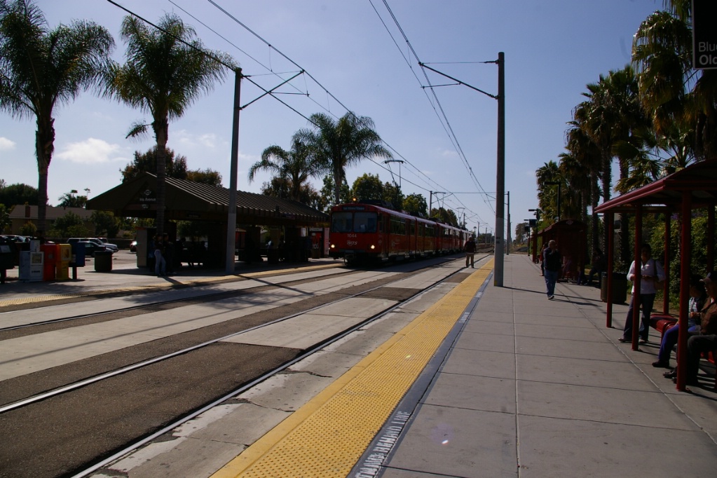
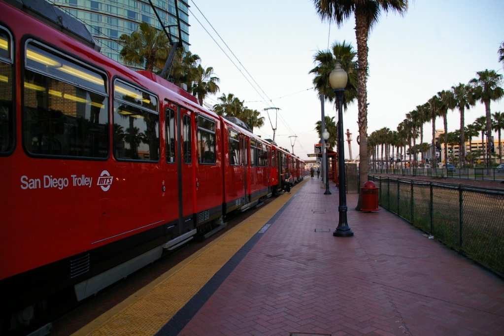
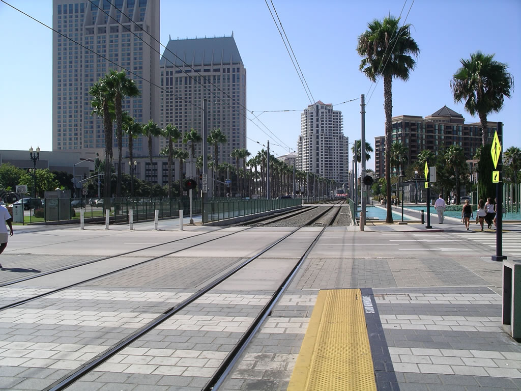
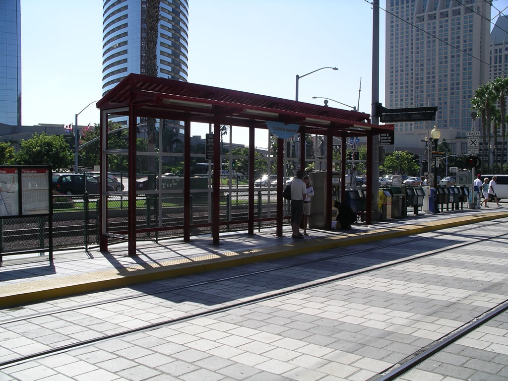
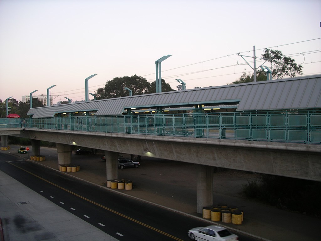
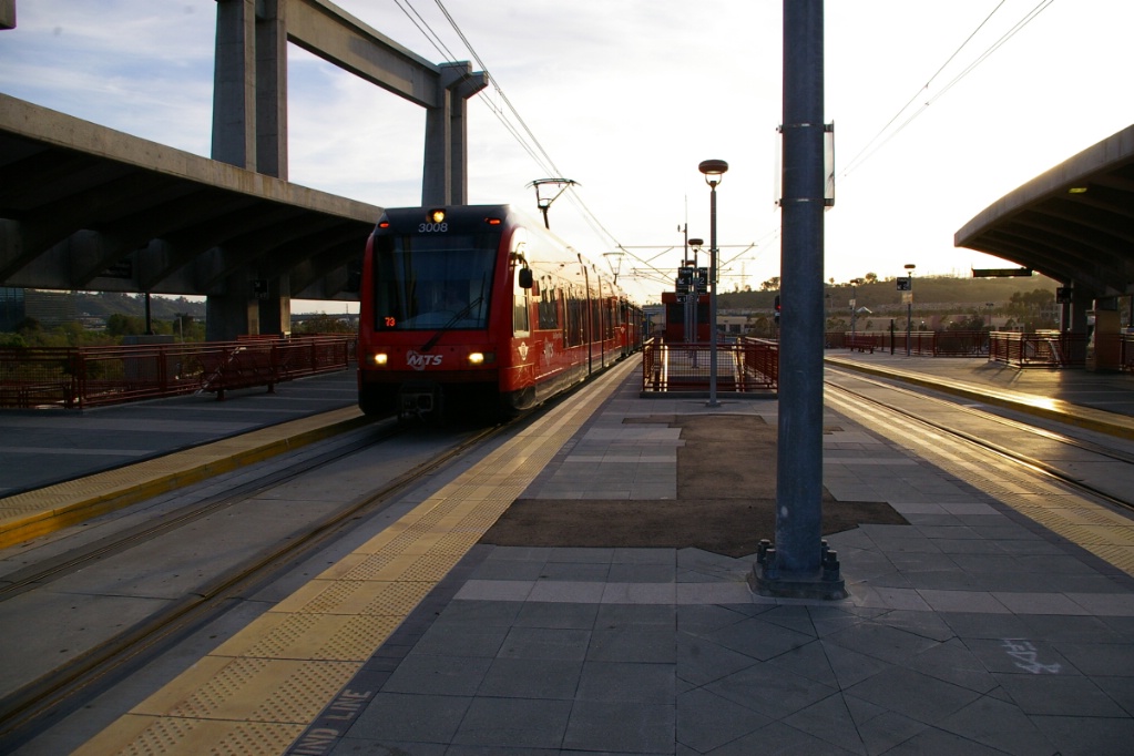
This line starts out at the Old Town Transit Center station which has connections with local buses, Amtrak and the Coaster Commuter Rail line.

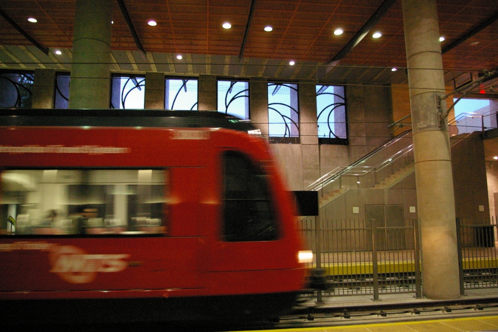
Additional views of Old Town Transit Center station.
|
Trolleys proceed south on their own right of way, parallel to the railway line towards Downtown San Diego. Many level crossings along this stretch of the line have a single set of signals that operate when either a Trolley or a train pass.
The first stop is Washington St. followed by Middletown, with the line remaining at grade with the railway.
South of Middletown, the line rises to pass over West Laurel Street and West Juniper Street while the railway remains at grade. This is followed by a drop that goes below grade to pass under West Hawthorn Street and West Grape Street before returning to grade and arriving at County Center/Little Italy station.
West Hawthorn and Grape Streets are one-way streets that provide main access between downtown and the San Diego Airport.
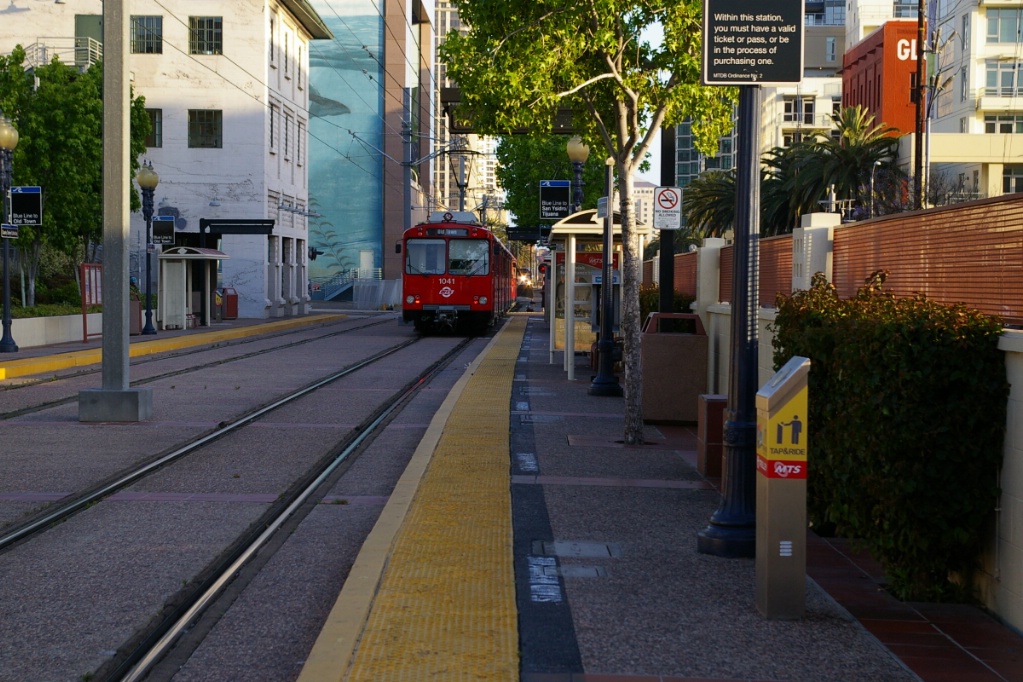
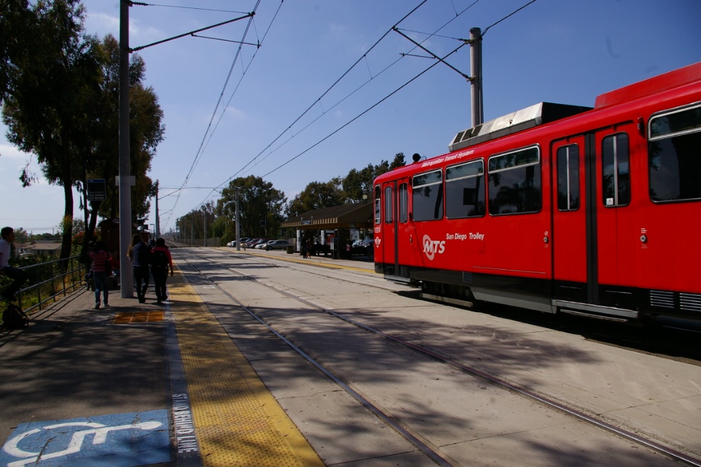
There is a short distance from County Center/Little Italy to Santa Fe Depot. This station also has connections to Amtrak and the Coaster.
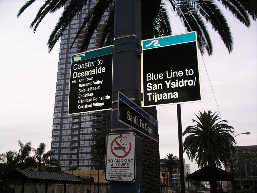
Signage at Santa Fe Depot station.
|
Northbound at Santa Fe Depot station.
|
the curve at America Plaza.
Just south of Santa Fe Depot, the line turns east where it interlines with the Orange line. The east alignment is for a short block before the line curves back to the north to enter America Plaza. Essentially, America Plaza is located across the street from Santa Fe Depot, hence the U-turn movement.
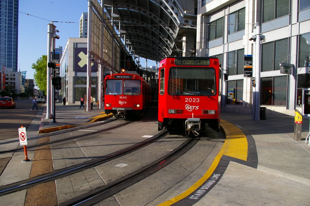
America Plaza station is covered with a high curved roof and is situated on a curve, with its other end facing east. At the end of rush hour service, some northbound runs on the Blue Line run as trippers to America Plaza, where they go out of service and head along the Orange Line's route to get back to the maintenance facility next to the 12th & Imperial Transit Center.
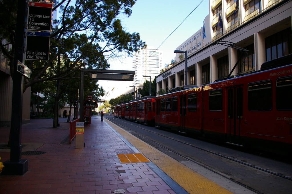
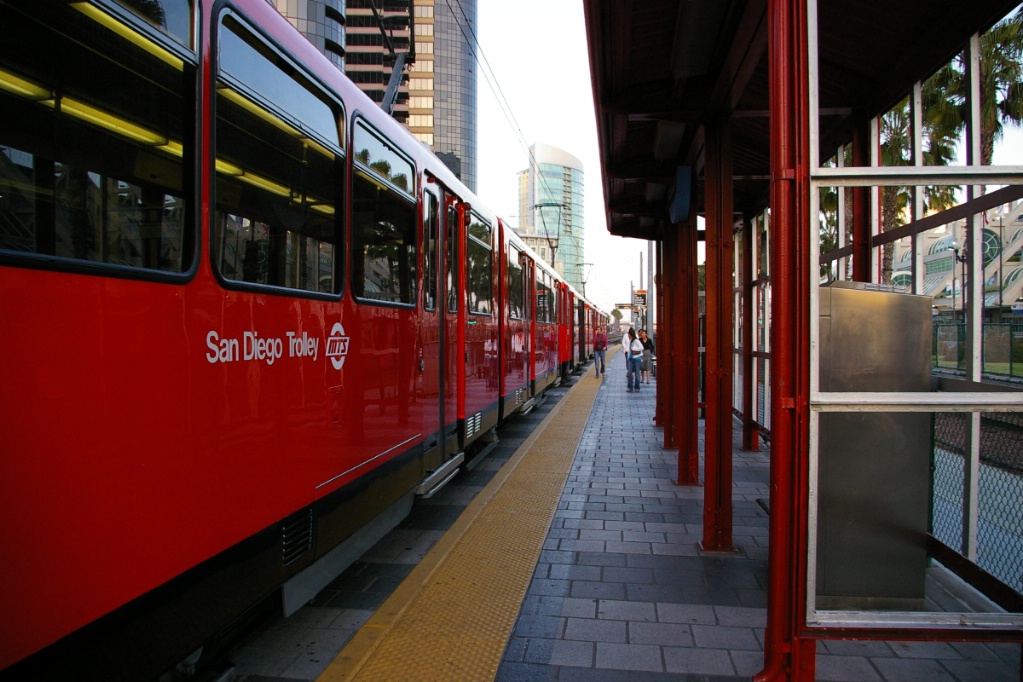
Leaving the east-facing end of America Plaza, trolleys travel along C Street stopping first at Civic Center station.
Southbound Blue Line at Fifth Avenue.
|
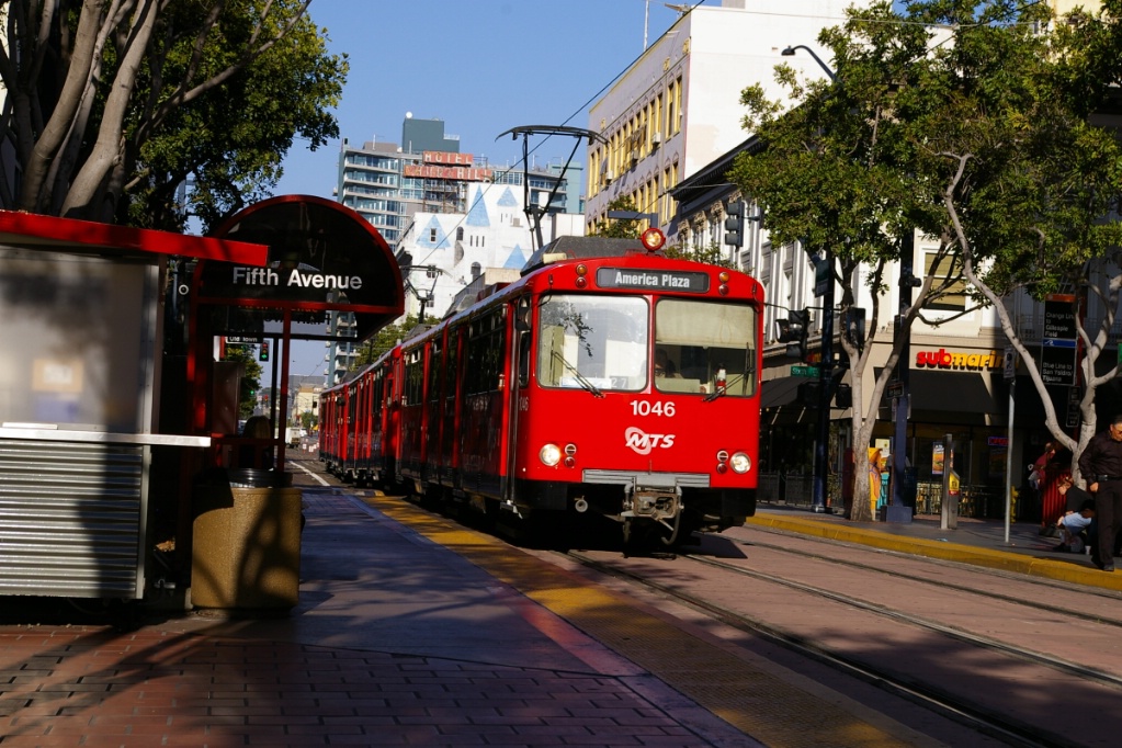
Blue Line tripper at Fifth Avenue.
|
Along C Street, the line is sometimes in a transit mall and somtimes on stretches of road partially shared with vehicles for a block or two. Where the street is shared with other traffic, the other traffic is restricted to its own lane and is one-way only, with the traffic lane on the left side of the tracks. Some additional photos along C Street can be seen in the description of the Orange Line.
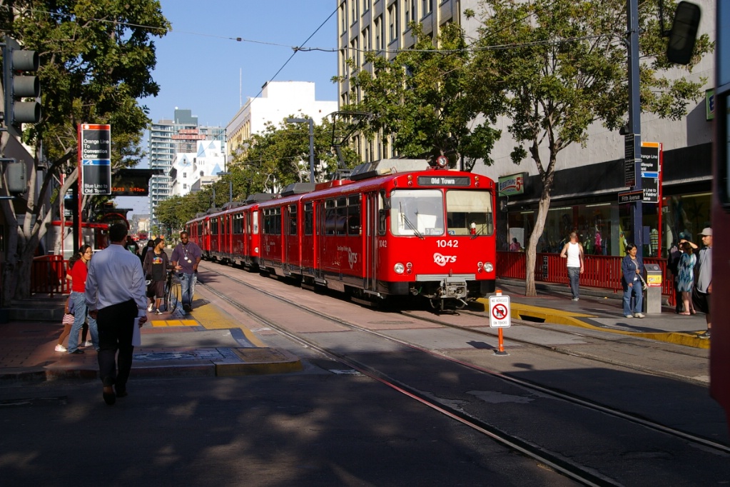
After Civic Center, the next stop is Fifth Avenue, followed by City College.
City College station is also situated on a curve as the line turns south along 12th Street, which is also partially shared with other vehicles.
At 12th & Imperial Transit Center station, the Orange line turns east while this line continues south.
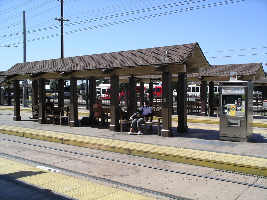
This station has bus connections and it is in close proximity to Petco Park. The station is also nearby the main MTS offices and the LRV Maintenance facility.
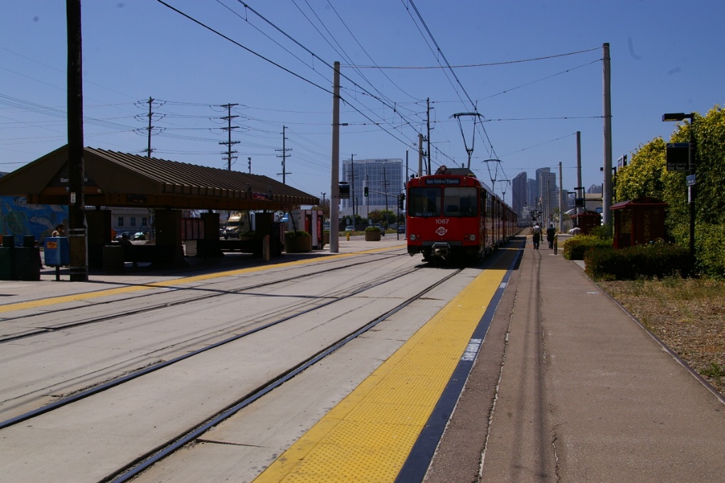
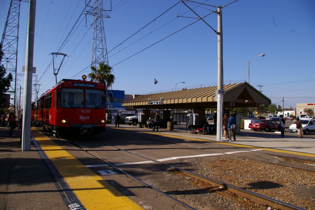
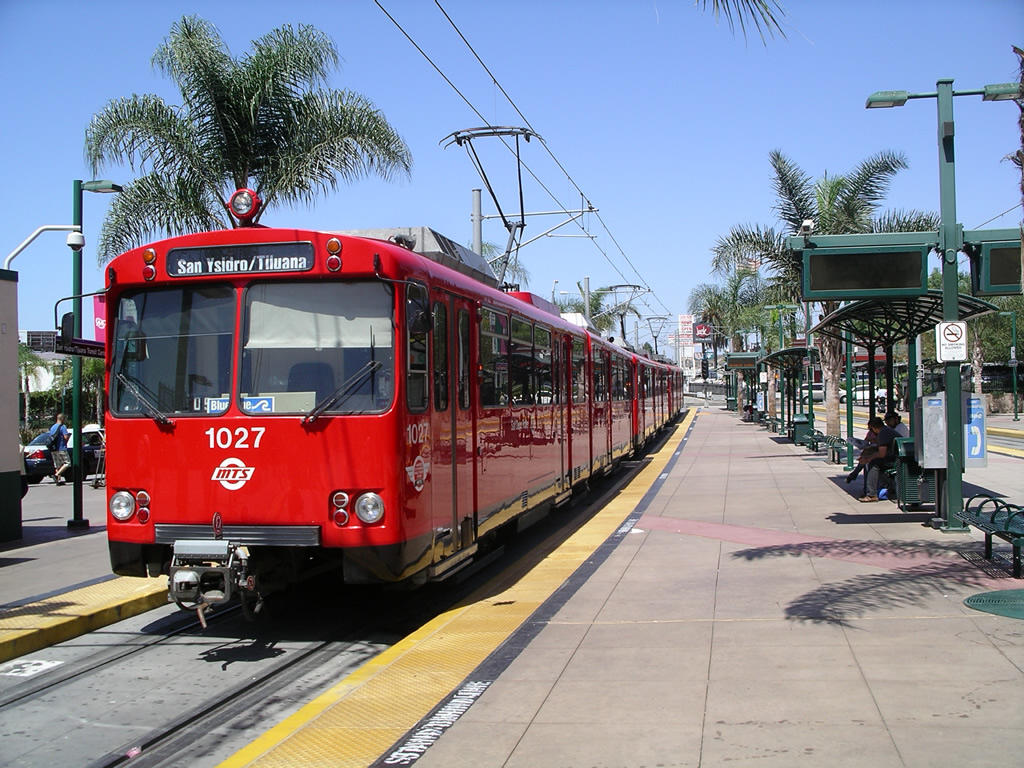
After leaving 12th & Imperial, the Blue Line runs in its own right of way, roughly parallel to Interstate 5 for 23 kilometres to the San Ysidro/Tijuana Transit Center where the international border is located.
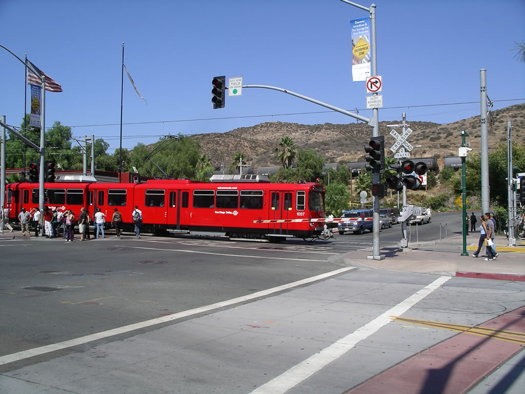
The portion of track from downtown to the Mexican border was originally the main line of the San Diego and Arizona Eastern Railway. Trolleys share tracks with freight trains along this stretch and stations do not have a raised curb for boarding. Freight operation is limited to night when trolleys are not running. Trolleys can reach speeds of up to 80 km/h and stations are between 1 and 2 kilometres apart.

The first stop south of 12th & Imperial is Barrio Logan. Stations on this part of the line have a common design. On the west side (southbound platform) the platform is concrete and may have one or two small shelters. On the east side (northbound platform) there is generally a larger covered area with seats, timetable information and sometimes vending machines.
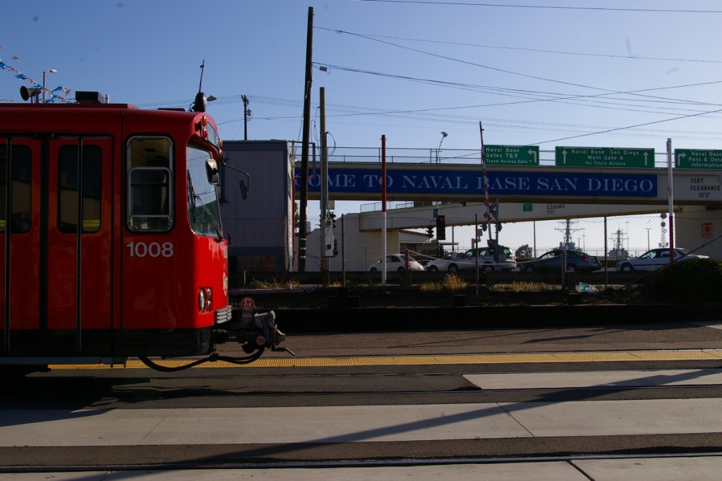
The next stop heading south is Harborside. The following stop is Pacific Fleet, named after the naval base located next to the station.
Several of the stations along this line have the tracks encased in concrete for the entire length of the station, making crossing on foot easy. Some stations have pavement for crossing only in the centre section in front of the covered area on the east side.
The next station after Pacific Fleet is 8th Street. All stations from 8th Street south have connecting bus routes. The next station is 24th Street, the first station south of downtown where only the section of track in front of the covered area is paved.

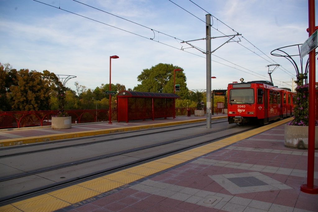
Southbound at Bayfront/E Street.
|
The next stop is Bayfront/E Street. At this stop, there is a third track embedded in the pavement between the northbound track and the platform, but this track is not connected to anything at either end of the station.
The next station is H Street, another station where only the section of track in front of the covered area is paved.
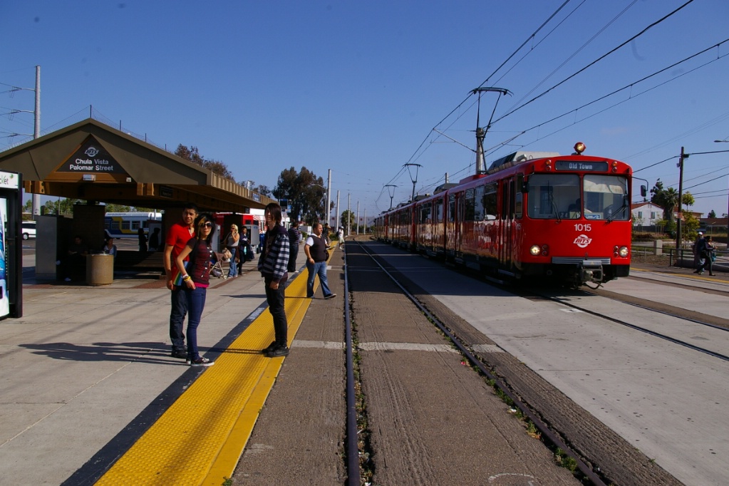
Following the H Street stop is Palomar Street. This station has a third track east of the northbound track, but unlike Bayfront/E Street, this third track is connected to in-service tracks.
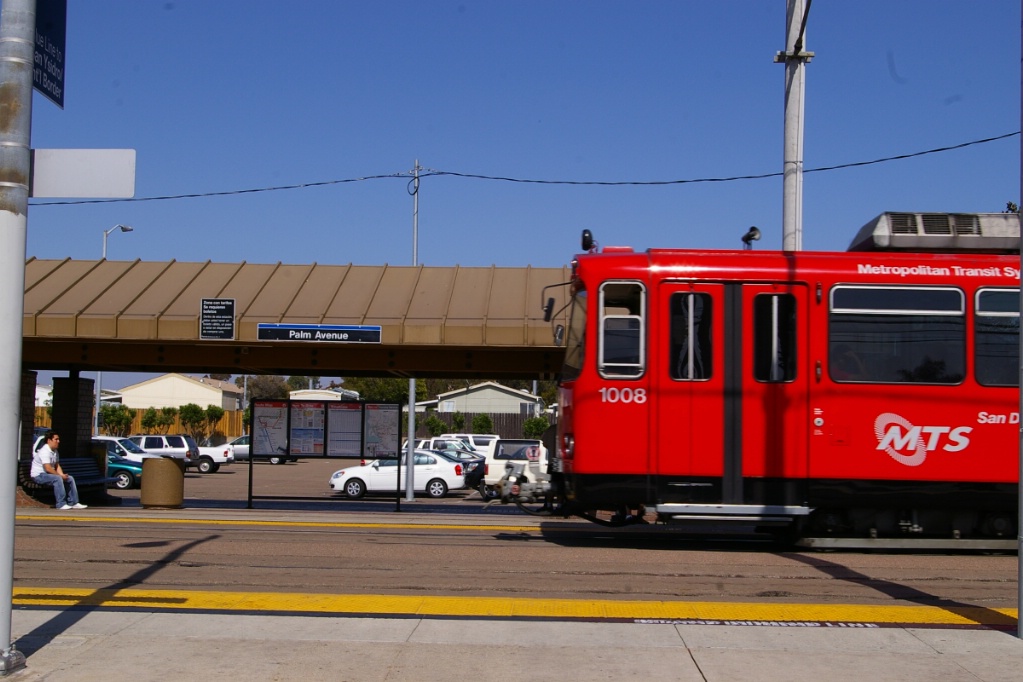
After Palomar Street, the next stop is Palm Avenue, another station where only the section of track in front of the covered area is paved. Unlike the other stations on this part of the line, Palm Avenue has the large covered structure on the west (southbound) side of the tracks.
After Palm Avenue is Iris Avenue, followed by Beyer Blvd, the second last on the line.
Southbound arriving at Iris Avenue.
|
Northbound arriving at Beyer Blvd.
|
After the run from Beyer Blvd, the line rounds a curve, passes the scissors crossover and passes a level crossing before entering the San Ysidro Transit Center. At the south end of the platform at San Ysidro, there is a passageway to a walkway over road traffic to the international border.
Crossing north of San Ysidro Transit Center station.
|
End of the line at San Ysidro Transit Center station.
|
San Ysidro Transit Center looking north.
|
View from the walkway to Mexico.
|

Blue Line at San Ysidro/Tijuana Transit Center station.
|
|
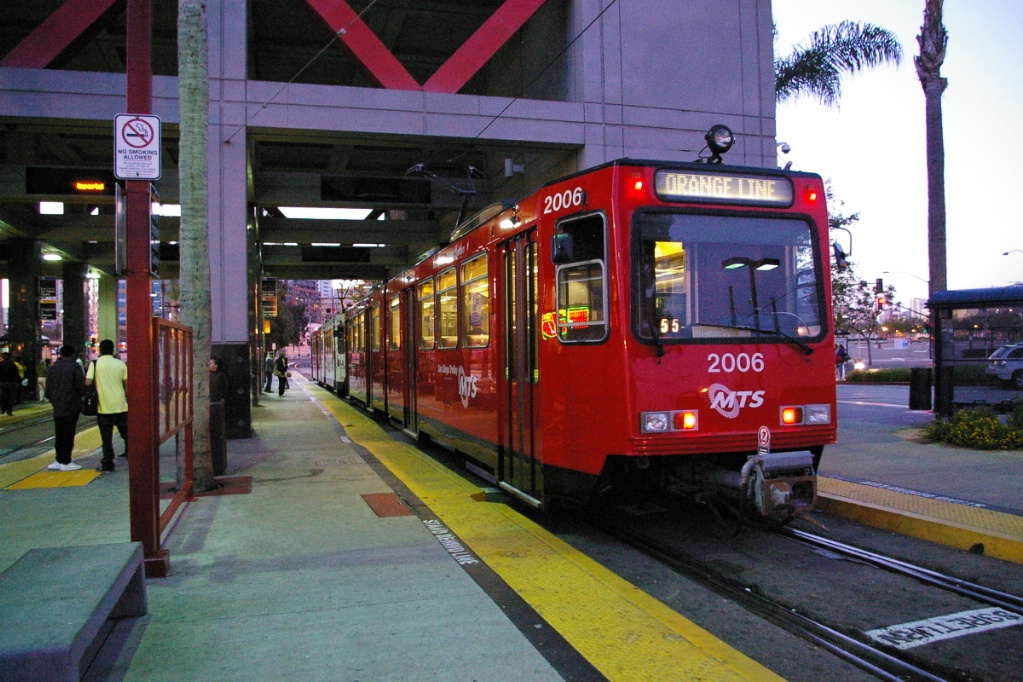
Orange Line
A trip on the Orange Line takes approximately 61 minutes.
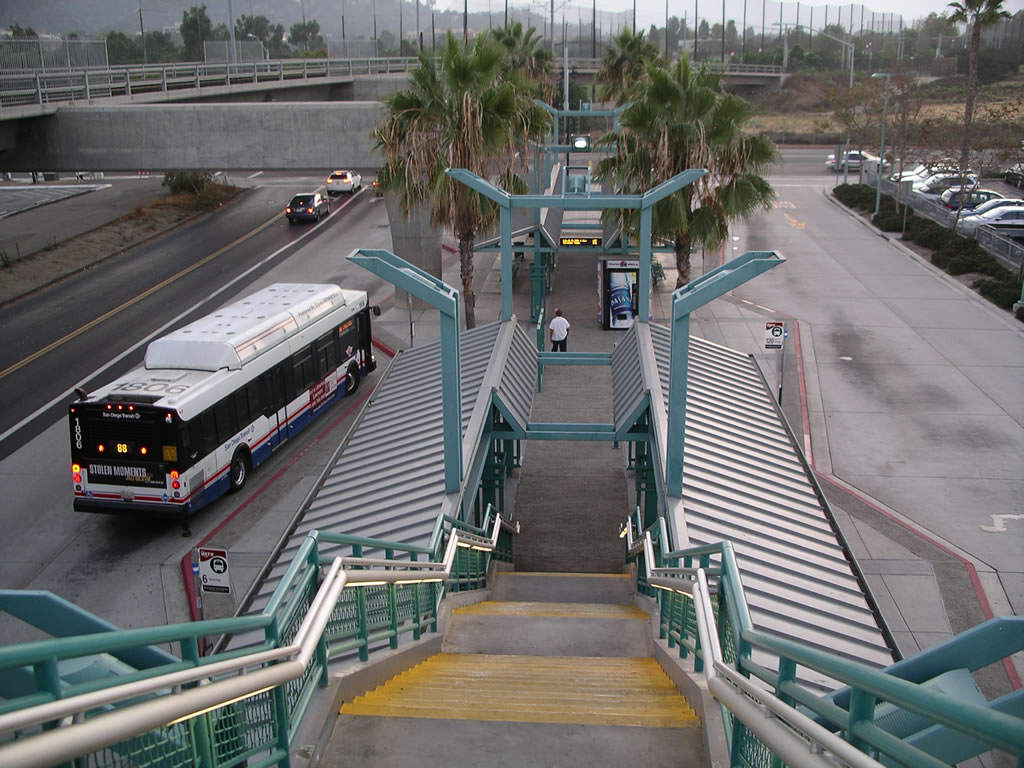
This line starts out at 12th and Imperial station in the southeast quadrant of downtown San Diego. The boarding platform for the terminus of this line is around the corner from the covered platforms at this station for the Blue Line and for the through-service of the Orange Line (after it travels around the downtown area in a loop).
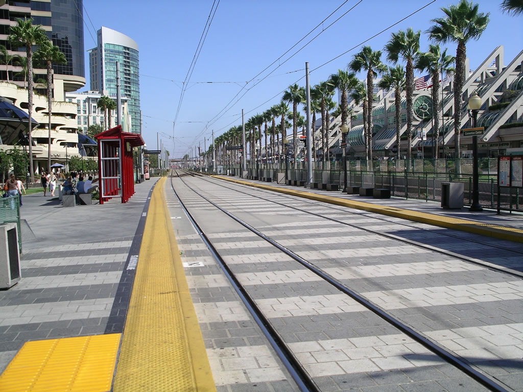
The line heads northwest passing Petco Park and follows the Martin Luther King Jr. Promenade along its own right of way. The first stop is Gaslamp Quarter. Continuing, the next stop is Convention Center followed by Seaport Village providing easy access to these significant San Diego destinations.
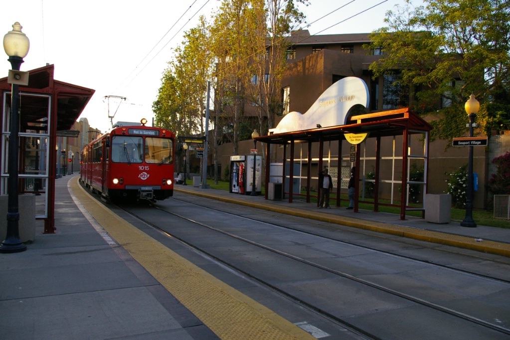
Out of service train passing through Seaport Village.
|
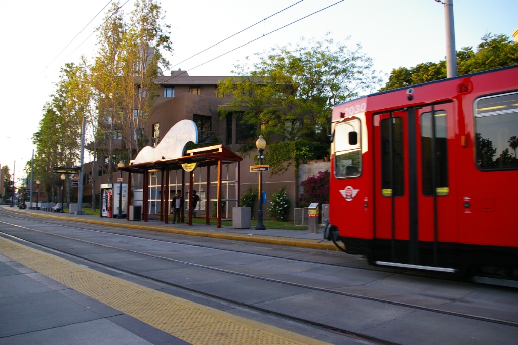
Gillespie-bound train arriving at
Seaport Village. |

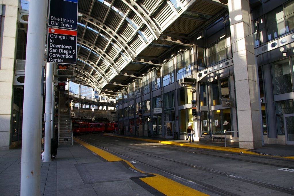
Next, the line jogs east and begins interlining with the Blue Line. The jog is about a block where the line turns north again into America Plaza station. America Plaza station is covered and is situated on a curve, with its other end facing east.
From here, Trolleys travel east along C Street stopping at Civic Center, Fifth Avenue, and City College. City College station is also situated on a curve as the line turns south along 12th Street. Some additional photos along C Street can be seen in the description of the Blue Line.
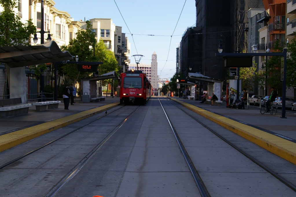
at Park & Market.
Heading down 12th Street, the line makes a stop at Park & Market. After that, it returns to the 12th & Imperial Transit Center where it makes a stop at the covered platforms.
After leaving this station the line turns east, and runs down the centre of Commercial Street. The first stop is at 25th & Commercial. This stop has far-side platforms on opposite sides of 25th Street.
The next stop, 32nd & Commercial, is on a curve just east of 32nd Street. This stop has a centre platform between the two tracks, but also has a side platform on the Downtown-bound track, so these trains may be boarded from either side.
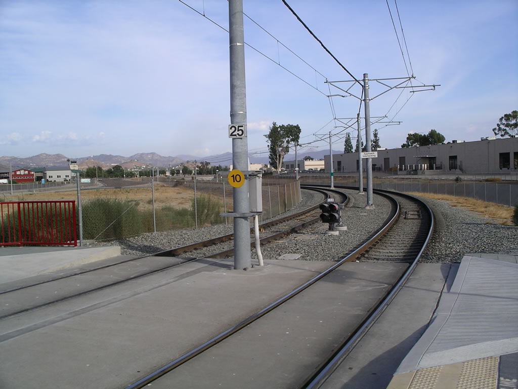
It is here that the line moves onto its own right of way (the old La Mesa branch of the SD&AE Railway) and follows a bit of a horseshoe shape curving to the north and back south again before its next stop at 47th Street.
The next stop is Euclid Avenue and the isolated right of way becomes parallel to and on the north side of Imperial Avenue about 500 metres west of this stop.
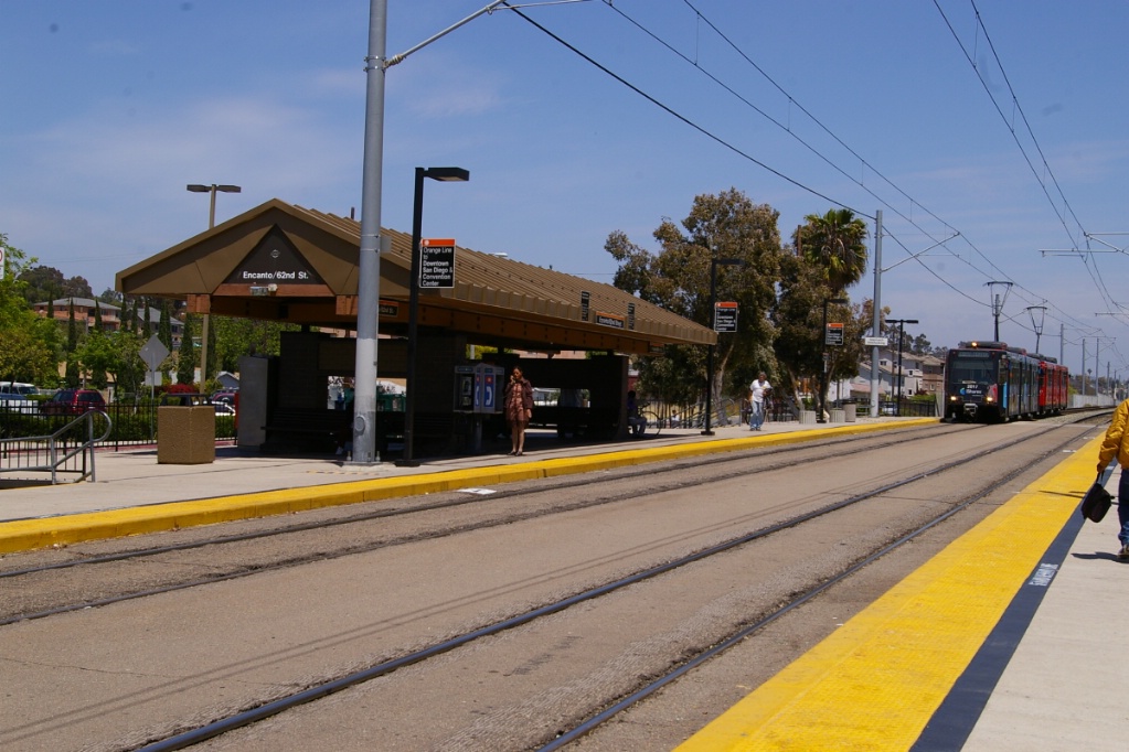
Encanto/62nd St. station.
The line continues along Imperial Avenue for about 3 km before it reaches the Encanto/62nd St. station.
The line continues along Imperial Avenue as it curves more to the northeast and becomes Lemon Grove Avenue before the line reaches the Massachusetts Avenue station, about 3 km from Encanto/62nd Street.
The next station is Lemon Grove, named after the local community. From here, the line enters its own right of way where it crosses over the Martin Luther King Jr. Freeway and continues in its own right of way until it reaches the Spring Street station, about 2 km from Lemon Grove.
Just after the Spring Street station, the line curves to a north-northwest alignment parallel to and on the west side of Spring Street. Initially, the right of way is higher in elevation than Spring Street, but the two elevations merge over the next 500 metres.
Another 500 metres up Spring Street, and the line reaches the La Mesa Blvd. station. The line continues about another 700 metres before it crosses over Interstate 8 (I-8) and curves to the northeast as it merges and interlines with the Green Line.
Downtown-bound is in the foreground.
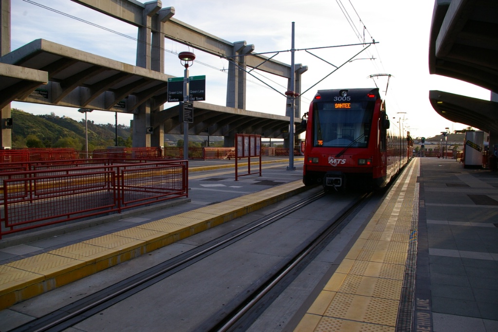
From the junction, the line travels almost 1.5 km before reaching the first station served by both the Green and Orange Lines, Grosmont Transit Center.
Another 900 metres takes the line to Amaya Drive before the line curves to the south, crosses under I-8 for a second time before curving to a northward alignment to parallel I-8 on its east side. The line travels almost 3 km to El Cajon Transit Center station.
The line continues north, crossing under I-8 for a third time where the Interstate curves to the east, and reaches Arnele Avenue approximately 1.3 km from El Cajon.
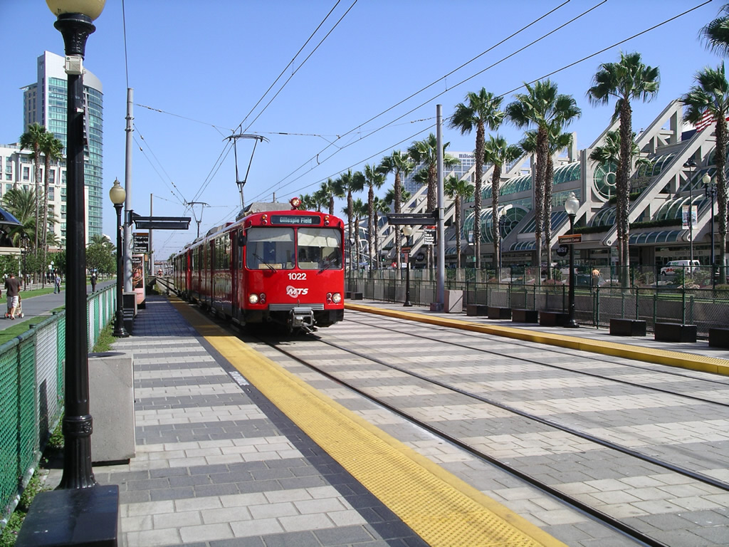
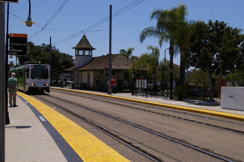
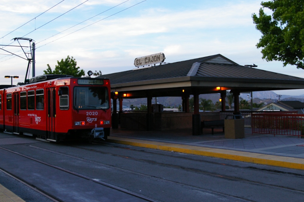
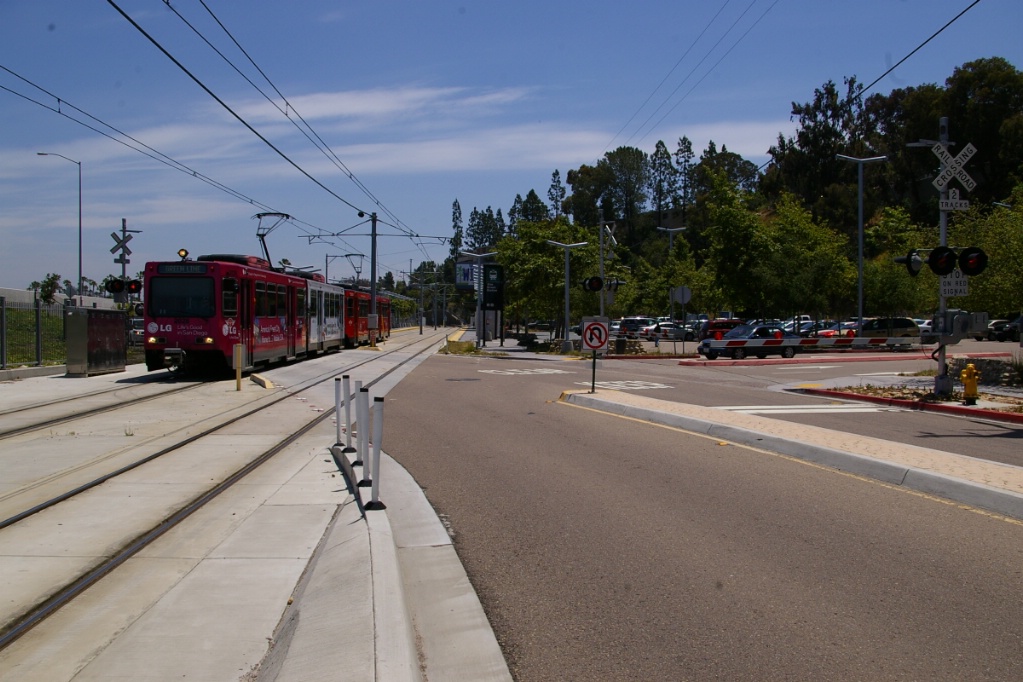
The line continues north, with a jog to the east followed by a curve to a north-northwest alignment before reaching Gillespie Field station. This station is named after the municipal airfield on the east side of the line.

Gillespie Field station.
|

Gillespie Field station platforms.
|
South of Gillespie Field station.
|
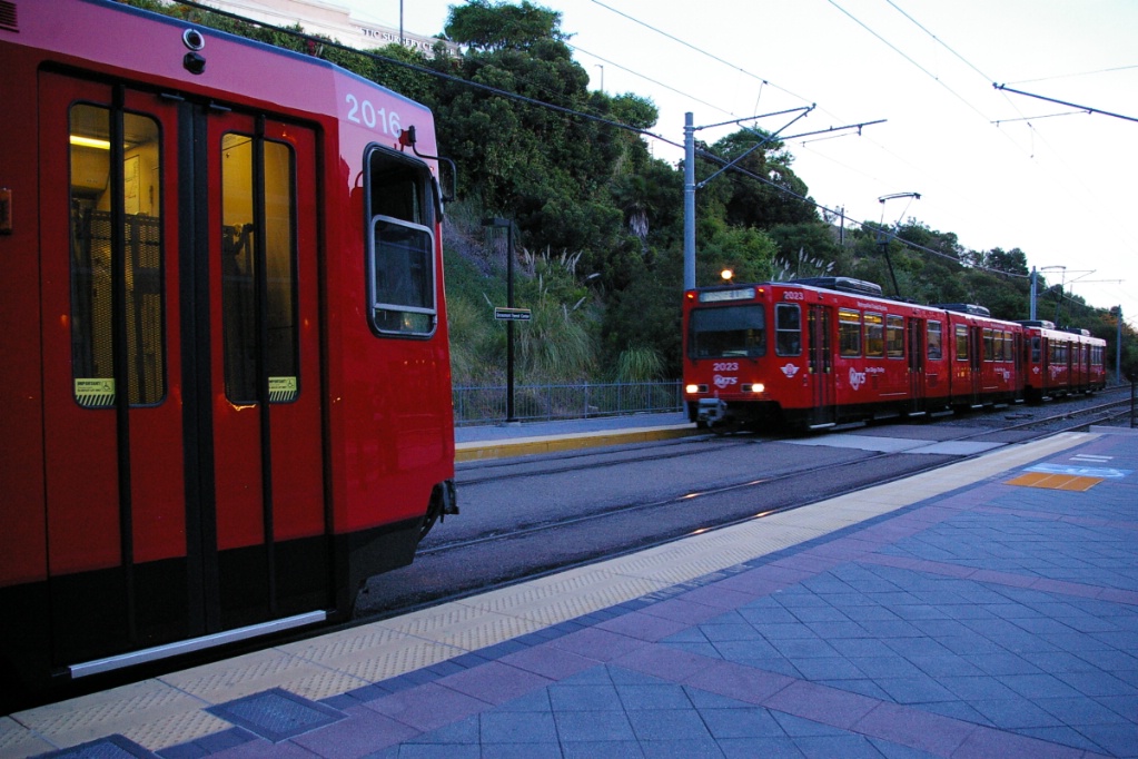
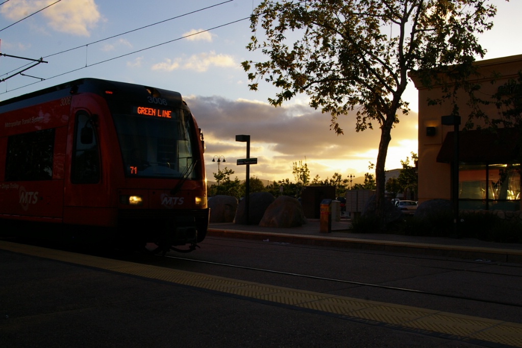
Green Line
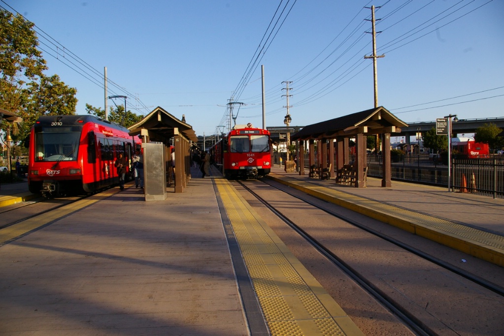
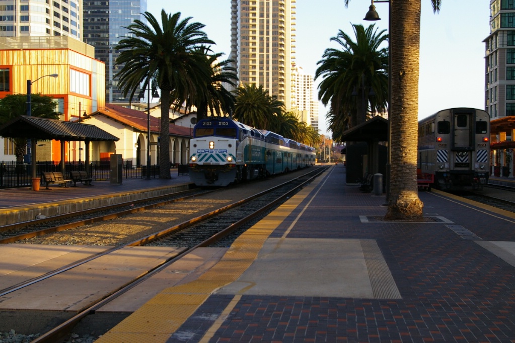
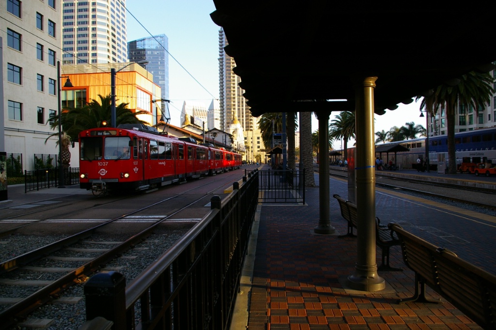
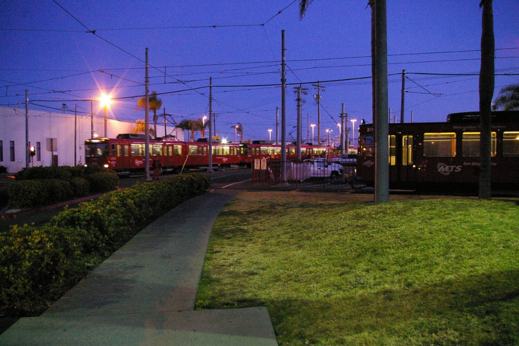
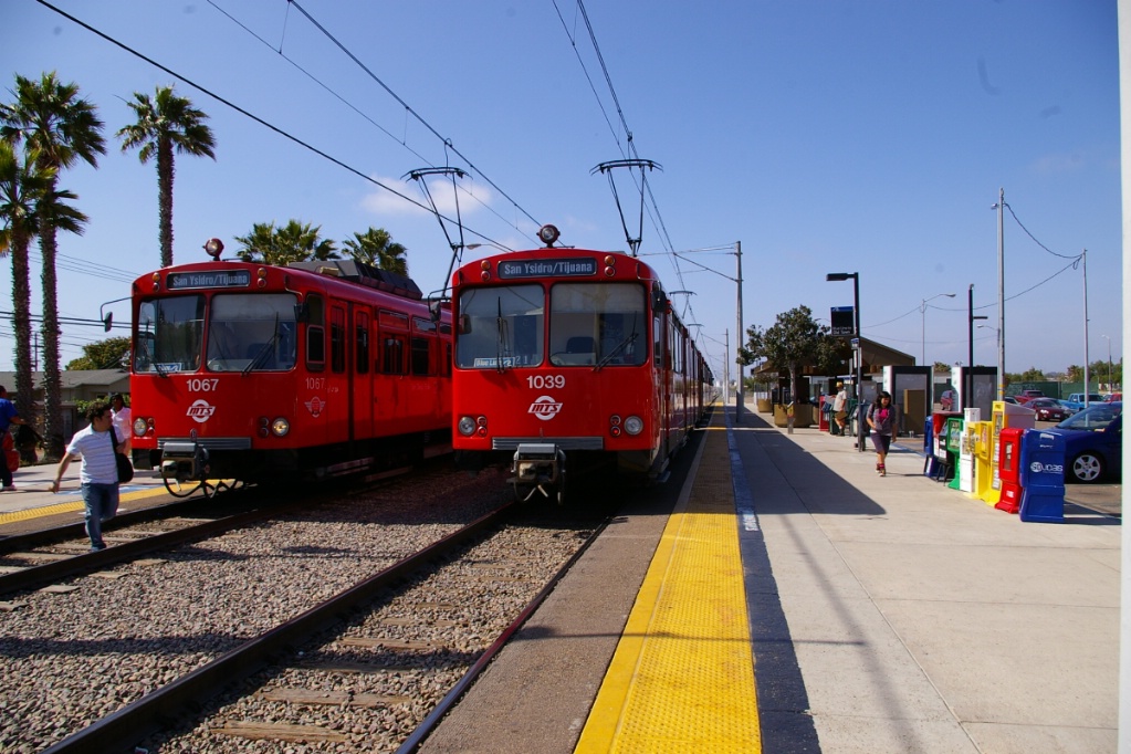
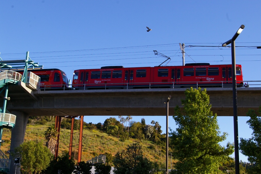
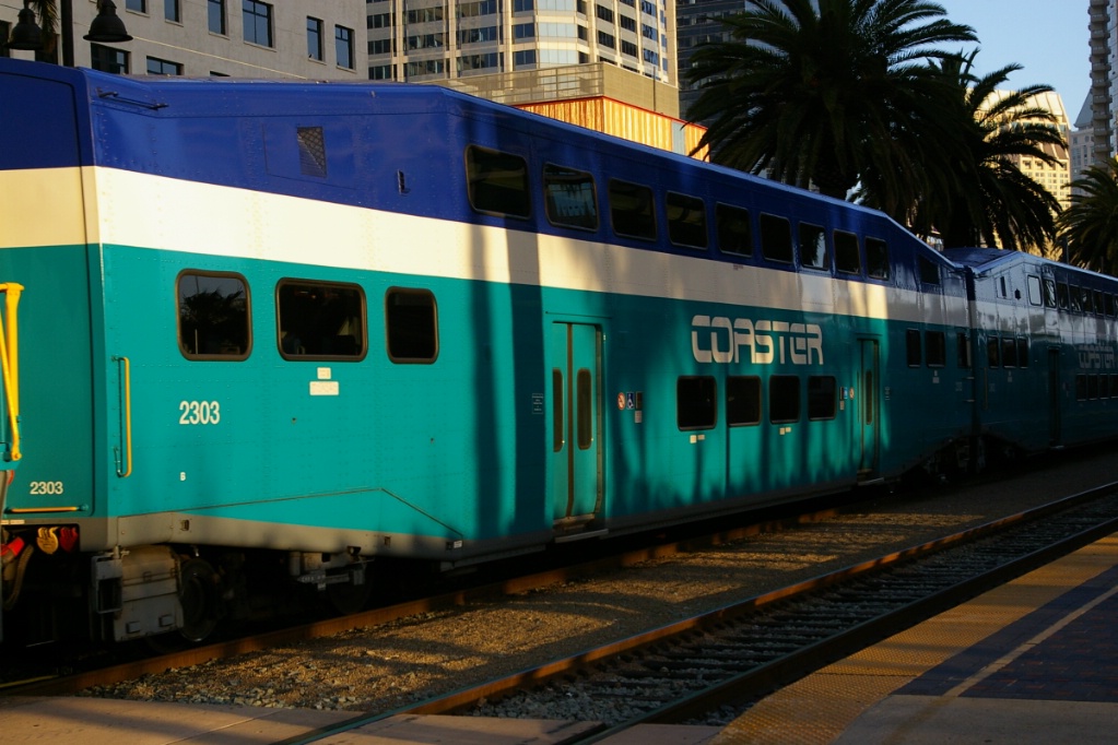
Green Line train is on the left and Blue Line train is on the right - Further to the right are tracks for the Coaster commuter rail service.
A trip on the Green Line takes approximately 47 minutes.
This line starts out at the Old Town Transit Center station which has connections with the Blue Line, local buses, Amtrak and the Coaster Commuter Rail line. Trolleys proceed north in their own right of way for a short distance before turning east towards Mission Valley. From here, the line roughly parallels Interstate 8 (I-8) on its north side.
The first stop is Morena/Linda Vista, followed by Fashion Valley Transit Center. Much of this route, along an east-west alignment parallel to I-8, is along an elevated guide way.
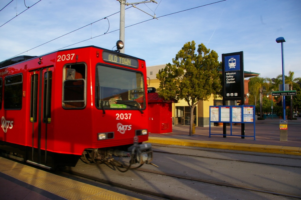
The next stop is Hazard Center, followed by Mission Valley Center. Mission Valley Center station is located at the back of an open air shopping centre.
The next two stops are Rio Vista and Fenton Parkway. These are followed by Qualcomm Stadium station. Qualcomm Stadium station features one center platform and two side platforms. It also has two pocket tracks at either end of the station to assist with special event service.
Old Town-bound traim at Qualcomm Stadium station.
|
Santee-bound train arrives at Qualcomm Stadium.
|
Continuing on an elevated structure, the next station is Mission San Diego situated above the parking lot of a fitness club. Mission San Diego was the original end of this part of the line when service from Old Town to here opened on November 23, 1997. At that time, it was operated as part of the Blue Line. When the gap between Mission San Diego and the Orange Line at Grossmont Transit Center was completed and opened on July 9, 2005 the Blue Line was cut back to Old Town and this line was operated as the Green Line.
The elevated line shifts closer to I-8 for a small distance before curving away and into an S-curve back towards I-8 where Grantville station is located.
Just past Grantville, the line crosses I-8 at about a 45 degree angle but curves to end up parallelling it on its south side cut into the side of a hill.
The line continues along the hill on the south side of I-8 for about 1 km, then it curves to the south away from I-8 and into a tunnel towards San Diego State University (SDSU) station, the system's only underground station. Though underground, the line is not very deep underground as grade level is approximately at the height of the overhead wiring.
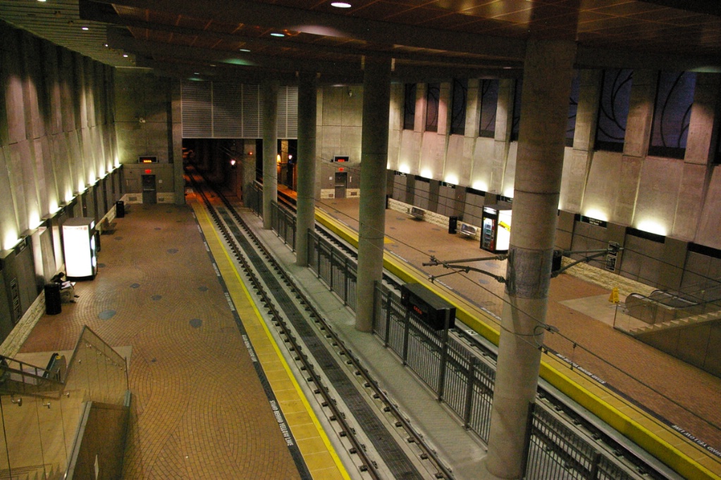
View from the mezzanine level at SDSU station.
|
SDSU station is underground, but just barely!
|
Old Town-bound train at SDSU.
|
East of SDSU, the line then leaves the tunnel, continuing along the south side of I-8, more or less at grade while making stops at Alvarado Medical Center and 70th Street.
East of 70th Street, the line rises in order to again cross I-8 before interlining with the Orange Line for the trip to Gillespie Field. See the section on the Orange Line for a description of the trip from Grossmont Transit Center to Gillespie Field.
North of Gillespie Field, the Green Line continues for almost another 2 km to reach one more stop at Santee Town Center station. Just north of Gillespie Field, there is a level crossing over North Marshall Avenue before the line merges to a single track. In another 150 metres, the line crosses into the median of Cuyamaca Street.
Just after crossing Mission Gorge Road, the line curves to the northeast on its own right of way among the parking lot and shops at Santee Town Center to reach the terminal station. The line branches to two tracks for the station, though the east track is mainly used.
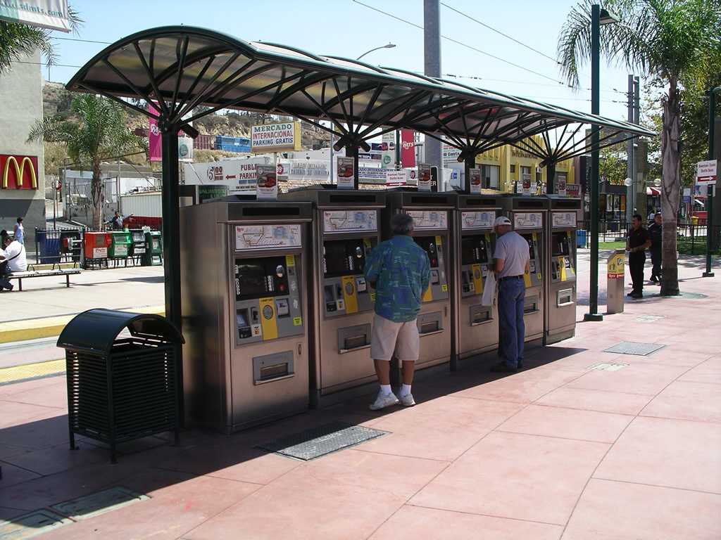
Fares and Fare Collection
One-Way Trolley Tickets, available for US$2.50 from ticket vending machines, are good for travel for two hours from the time of purchase on any MTS trolley travelling away from the point of purchase.
Transfers between trolleys are allowed to complete your one-way trip. Transfers between trolley and bus and round trips are not allowed with a one-way ticket. Tickets must be purchased before boarding the trolley from the ticket vending machines at each station.
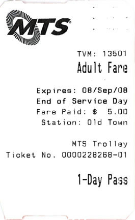
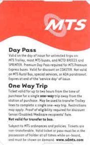
Regional Day Passes are US$5 and are available from ticket vending machines and bus operators. They are good for unlimited rides on most MTS Bus and Trolley routes (except Premium Express, Rural, ADA Paratransit, and Special Services) as well as NCTD BREEZE buses, SPRINTER and FAST.
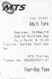
Multi-day passes are available, but are only good for consecutive days. 2-day passes cost US$9, 3-day passes cost US$12, and 4-day passes cost US$15. A regional 14-day pass is available for US$43. A regional monthly pass sells for US$72.
A day pass that includes MTS Premium Express buses and COASTER commuter rail services costs US$12.
Accessibility
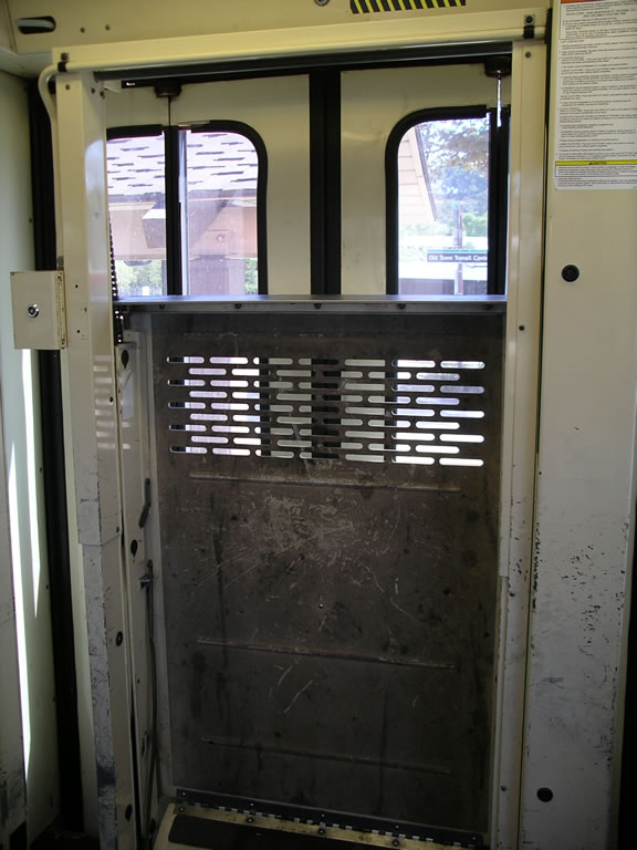
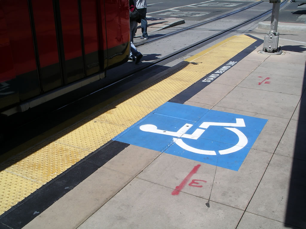
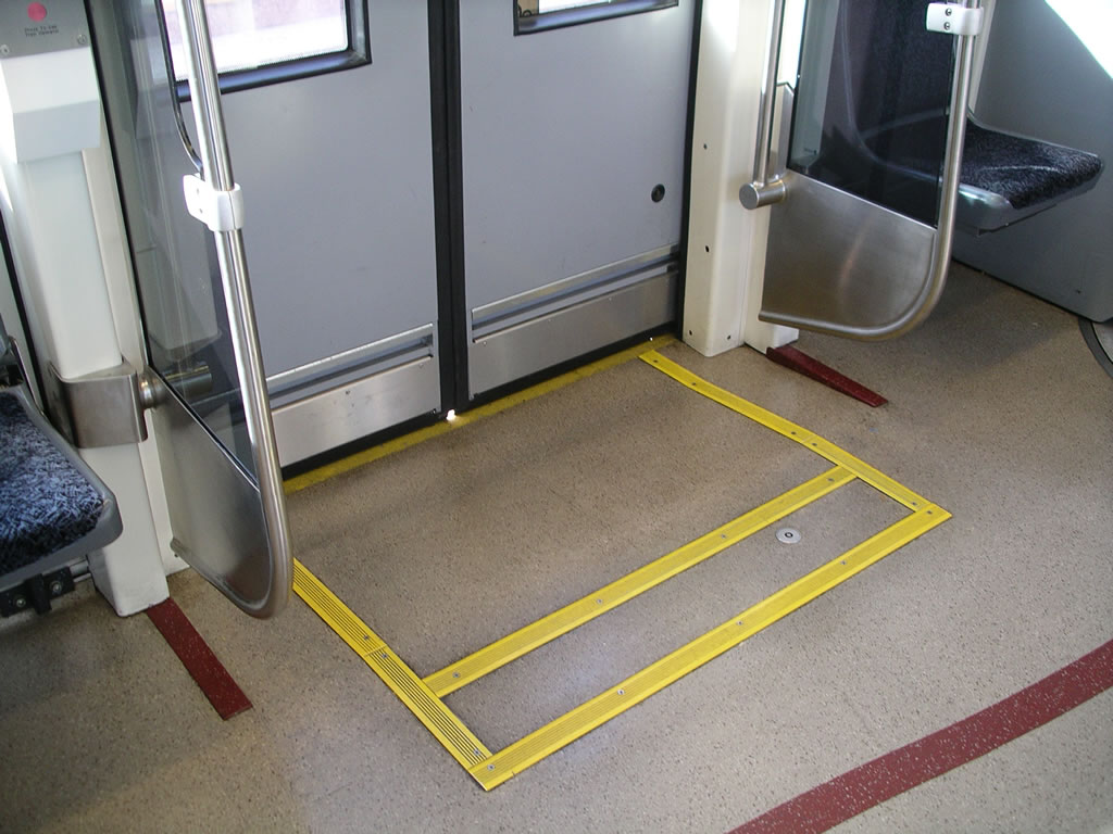
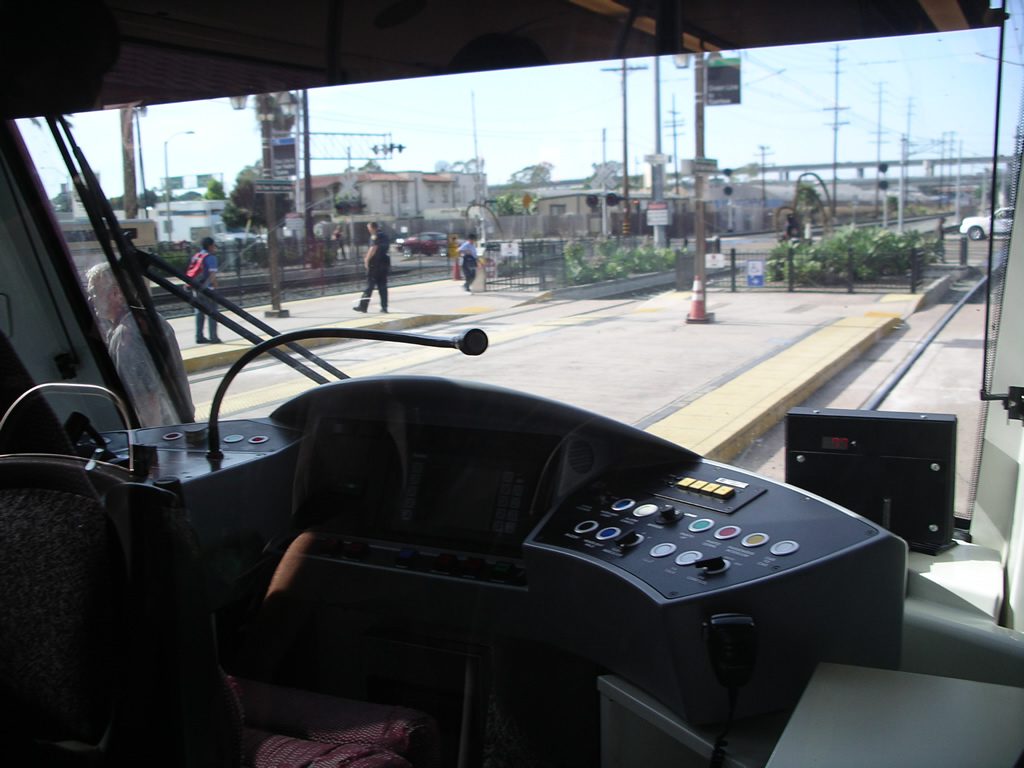
With the fleet of U2 and SD-100 vehicles, accessibility is provided with the use of on-board lifts at the front door of the train. The platform is marked where this door will be spotted.
The S70 vehicles are low floor and are equipped with a ramp that is deployed when requrested.
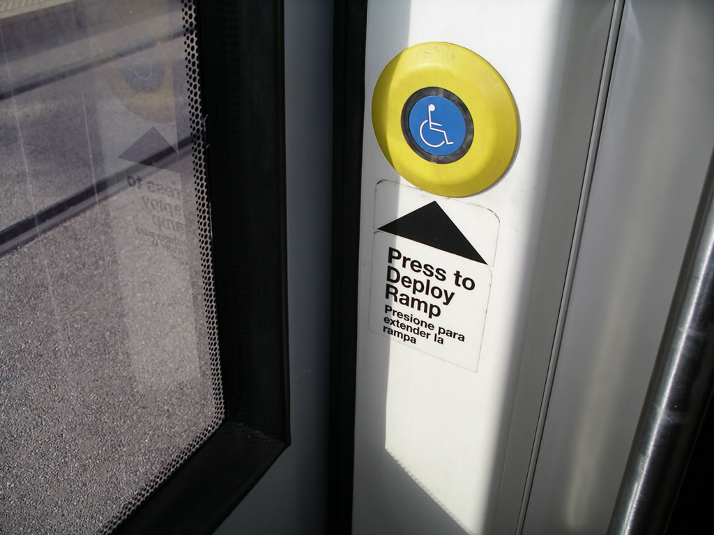
Push button to deploy ramp on S70.
|
Door area on S70.
|
Other Notes
MTS also operates special event trolley service during sporting events at Qualcomm Stadium and/or Petco Park, as well as other major events. The trolleys operate between Qualcomm Stadium station and 12th and Imperial station. This is shown on the route map in red.


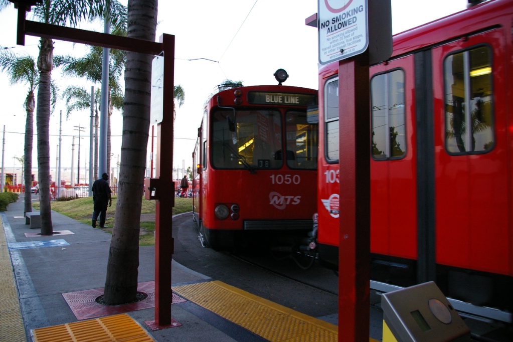
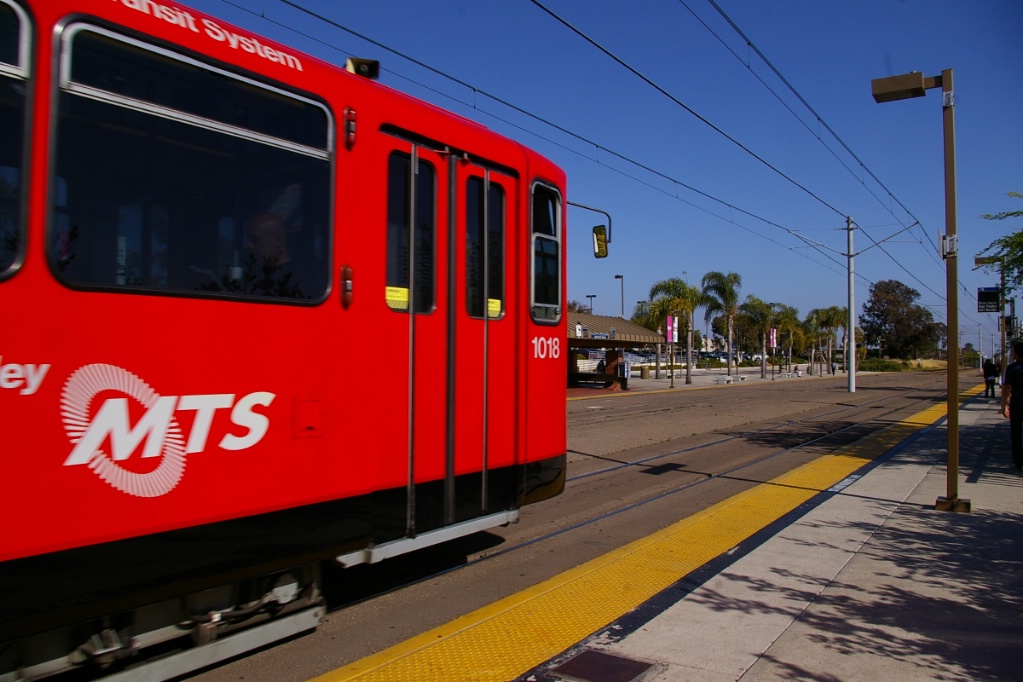
The original fleet consisted of Siemens U2 vehicles, similar to the original fleets used by Calgary and Edmonton. Unlike Calgary and Edmonton, San Diego does not use high-level platforms, so their U2s have steps for boarding.
The U2s will eventually phased out. Eleven of the 71 that were part of the fleet have been sold to the upstart Metrotranvía of Mendoza in Mendoza, Argentina.
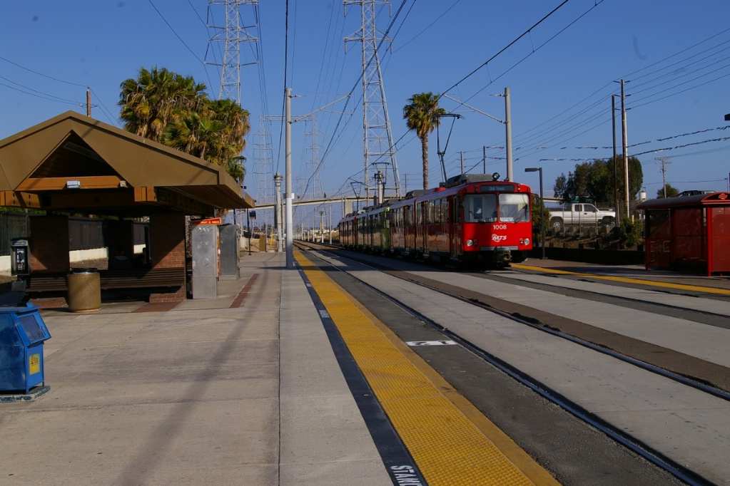
The second model in the fleet is the SD-100, also by Siemens. This model is used in Denver, another city with low platforms.
The thrid model is the S70, again by Siemens. This is a low floor light rail vehicle and is used in cities such as Huston and Charlotte. In San Diego, this model has only been used on the Green Line.
As part of the Trolley Renewal Project, MTS approved the purchase of 57 new S70 light rail vehicles on November 24, 2009. These newer S70s will be a custom version that are the same length as the SD-100 vehicles. Older stations on the Orange and Blue Lines will be renovated to bring their platforms up to the level for boarding with these vehicles.
Current and Planned Expansion
Trolley Renewal Project
Trolley Renewal is a $720 million project to rebuild the Orange and Blue Line Trolleys. When complete in 2015, new low-floor trolleys will operate on the entire MTS Trolley network, making trips faster, more comfortable and more convenient for all passengers. Work will include new station platforms, next-arrival electronic signs, shelters, track, switches, overhead electric wire and more. The work will require station closures, temporary station relocations and substitute bus services.
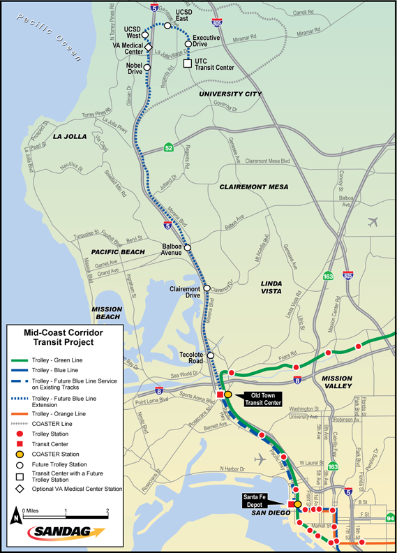
Mid-Coast Light Rail Extension
The Mid-Coast Corridor Transit Project proposes to extend light rail transit service from the Old Town Transit Center to the University City community serving major activity centers such as the University of California, San Diego (UCSD), University Towne Center (UTC), Old Town, and Downtown San Diego.
The route for this extension was chosen on July 23, 2010. It is intended that this would be operated as a northern extension of the Blue Line that will continue north where the Green Line turns to the east north of Old Town. The length of the extension is roughly 18 km, and will have 8 stations, with the possibility of a ninth station.
The project is currently going through preliminary engineering.