Photos by page author unless otherwise credited
This page was last updated October 20, 2022
Send questions, comments, and photos here.
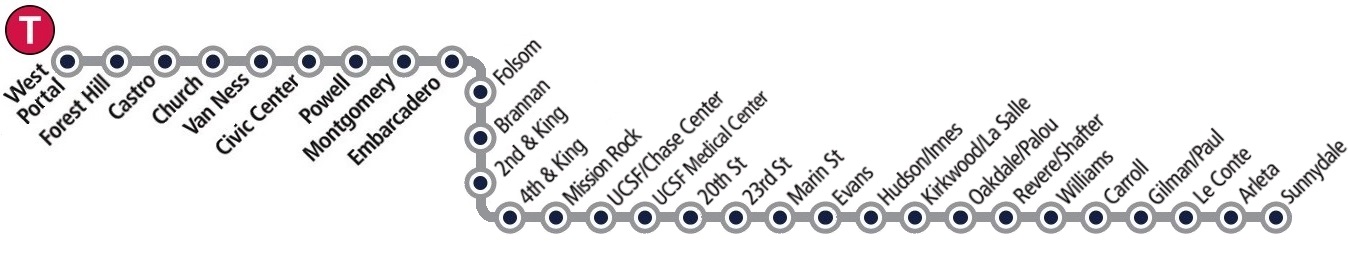
LRT in
San Francisco


The San Francisco Municipal Transportation Agency (SFMTA) is a department of the City and County of San Francisco responsible for the management of all ground transportation in the city. The SFMTA has oversight over the Municipal Railway (Muni) public transit, as well as bicycling, paratransit, parking, traffic, walking, and taxis. SFMTA's story is unlike any transportation agency in the country. Established by voter mandate in 1999, the SFMTA aggregated multiple San Francisco city agencies, including the Department of Parking and Traffic, Muni, and since 2007, the Taxi Commission.
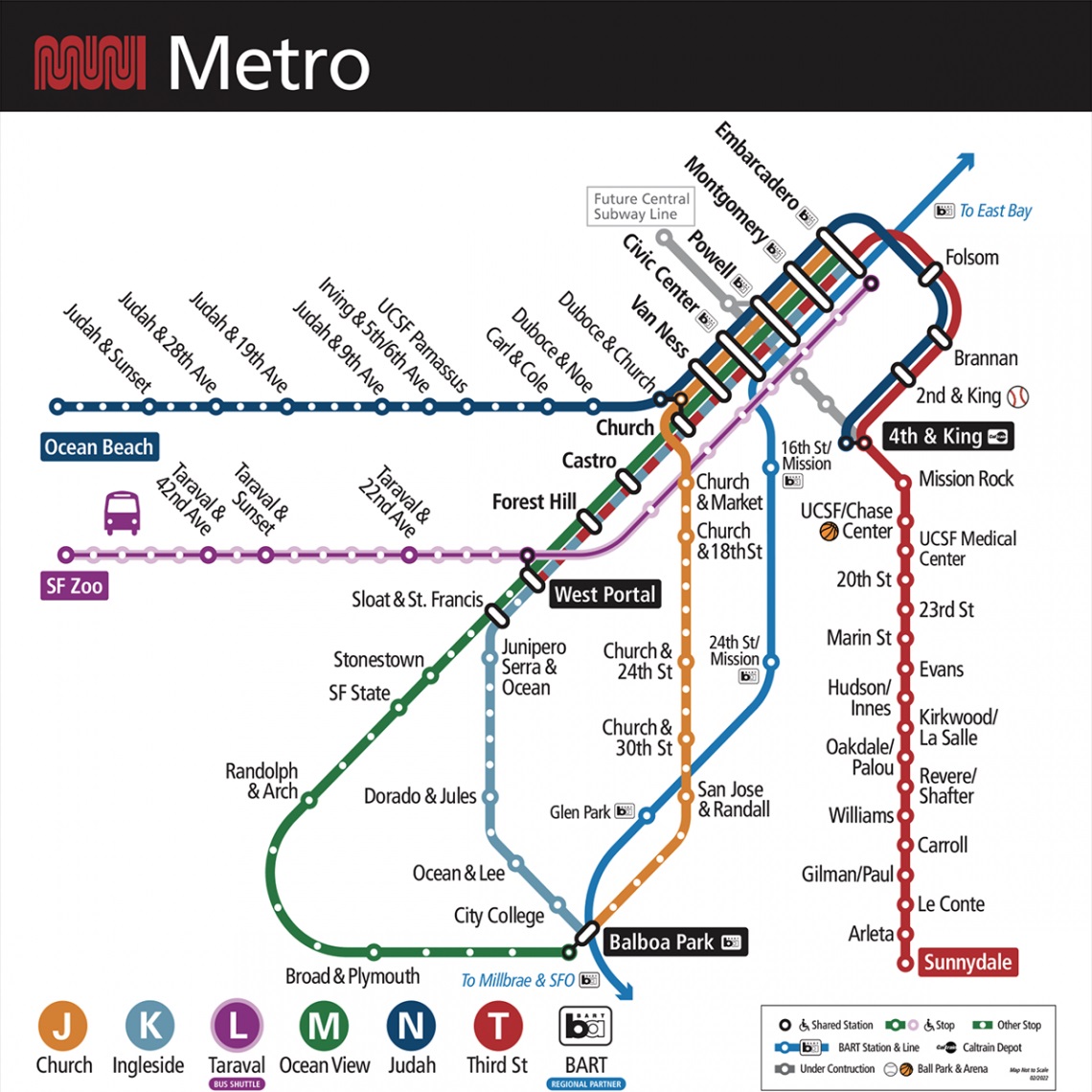
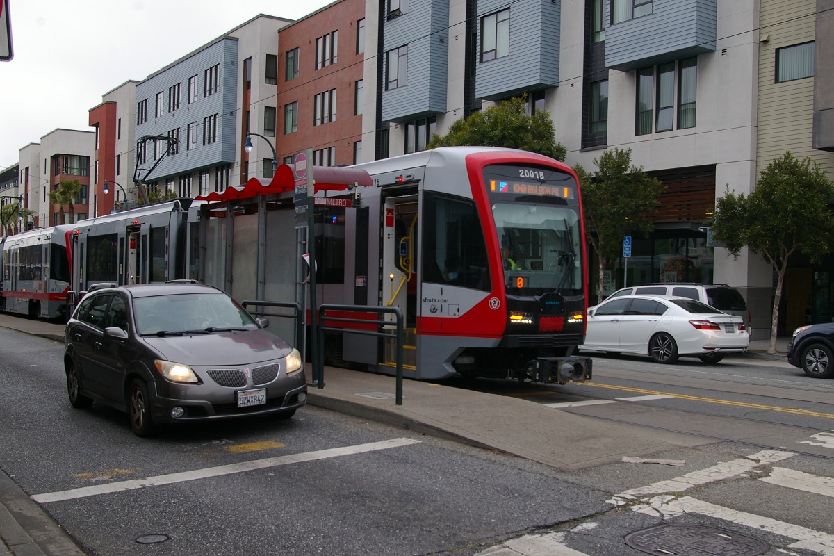
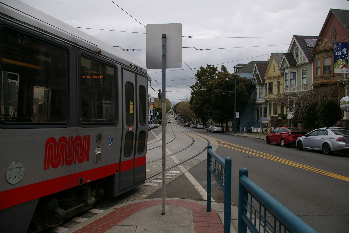
SFMTA's LRT system, known as Muni Metro, is the second busiest light rail system in the USA with a average weekday ridership of 157,700.
Contents
Toronto Comparison
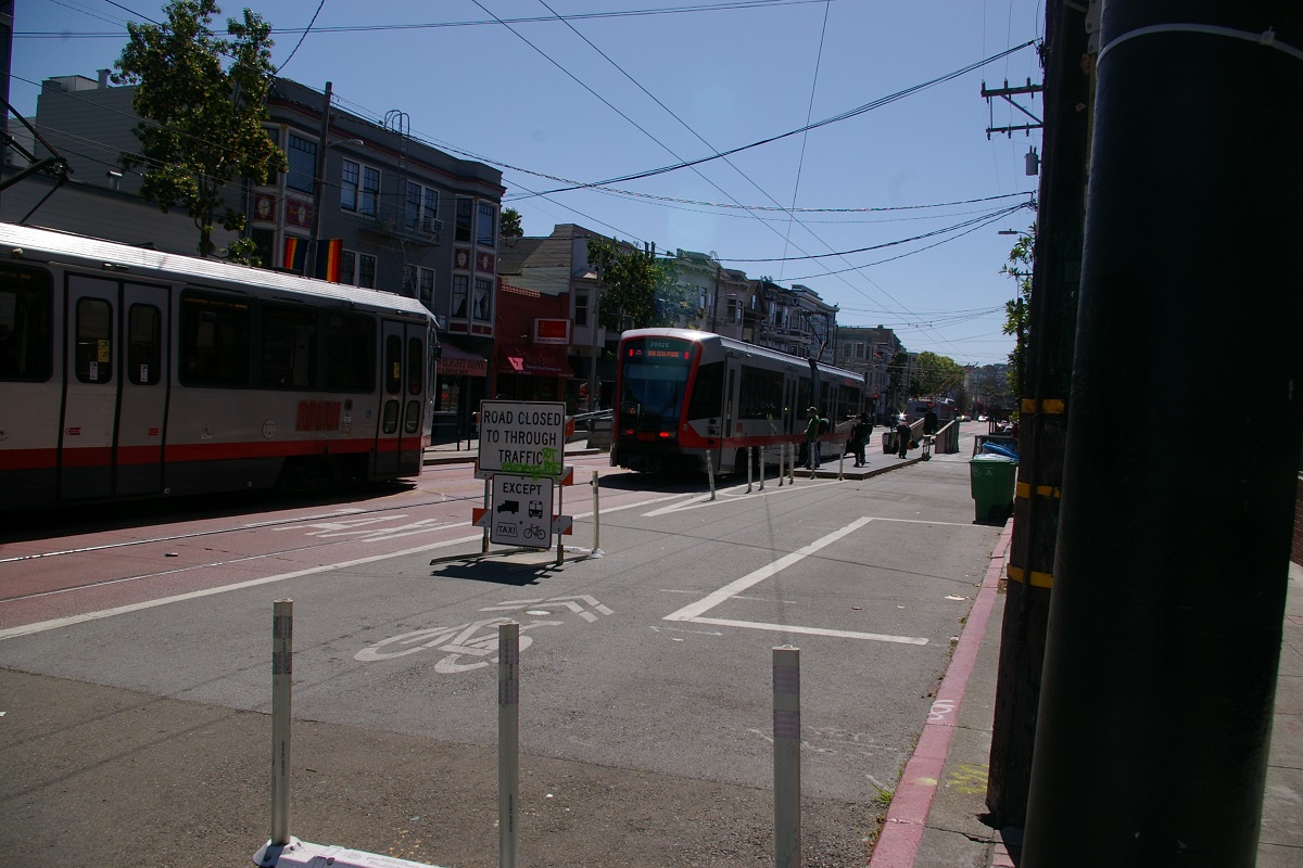
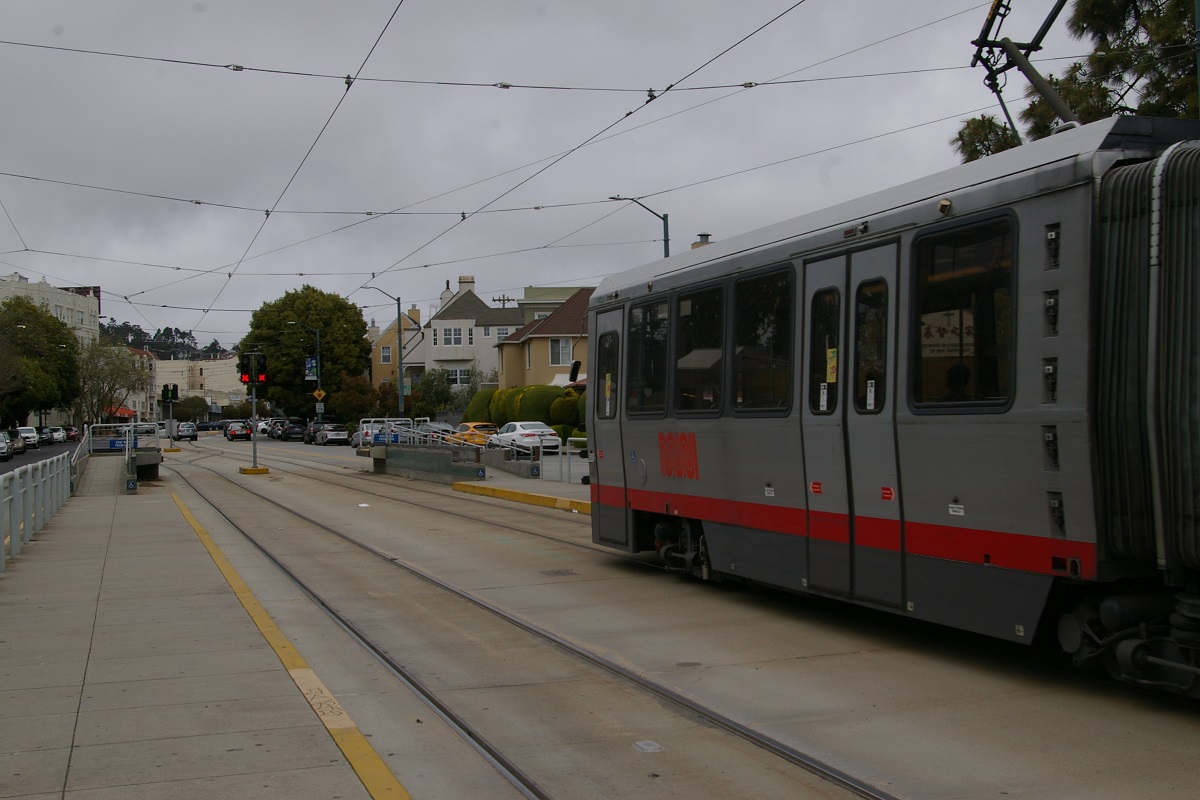
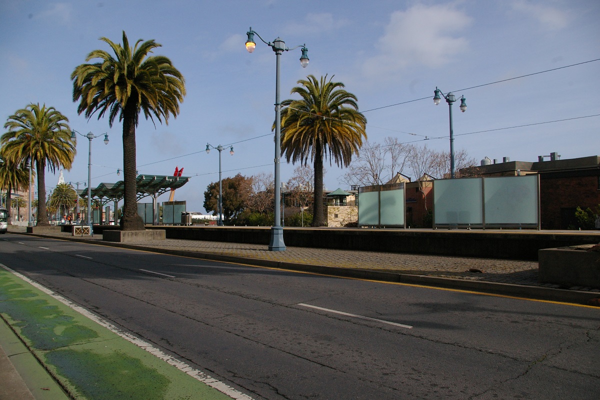
San Francisco had a streetcar system that eventually became its LRT system. Only one former streetcar route was retained as a historical/tourist line on Market Street and the Embarcadero using PCC streetcars painted in the livery of North American transit agencies that previously operated PCCs.
Similar to options in Toronto, Muni Metro makes use of a variety of right of ways, including:
- Mixed with traffic
- Separate median right-of-ways
- Separate side-of-the-road right-of-ways
- Tunnels
System Highlights and Route Details
| Item | Notes |
|---|---|
| Number of routes | 7 |
| Total length | 115.1 km (71.5 miles) |
| Total stations | 9 subway stations, 24 surface platform stations, and 87 surface stops |
| Right of way | Tunnels, private ROW, median ROW, and mixed with traffic. |
| Loading | Level boarding at subway and surface platform stations Step access at surface stops; some stops have a ramp platform |
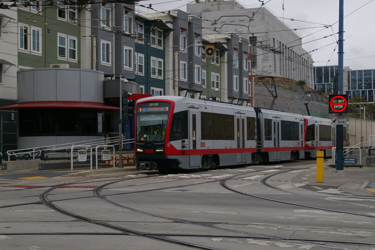
| Fleet | LRV2/LRV3: 151 Breda LRVs (in 2014) LRV4: 249 (ordered) Siemens S200SF LRVs |
| LRV2/3 details: | 23 metres long (75') - Maximum capacity of 218, 60 seated |
| LRV4 details: | 23 metres long (75') - Maximum capacity of 203, 60 seated |
| Fare collection | Self service and attendant entrance at subway stations Self-serve at other stations, proof of payment Fare purchase also available through the Muni App |
| Fare integration | Fare good for 120 minutes on all Muni vehicles except Cable Cars Combined fare discount when traveling with other transit agencies, including BART |
| Airport service | Transfer to BART for direct airport connection |
|
|
| Length | Approximately 10.4 km (6.45 miles) |
|---|---|
| Stations/Stops | 25 5 subway stations and 19 surface stops (7 accessible), plus 1 inbound-only stop
|
| Right of way | Market Street Subway (Embarcadero to Van Ness) Private ROW over Dolores Heights between 18th and 22nd Streets Remainder mostly in mixed traffic with some median ROW |
| Service frequency | Morning and mid-day: 15 minutes Evening and late night: 20 minutes Operated with single car trains |
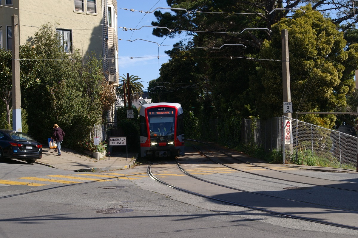
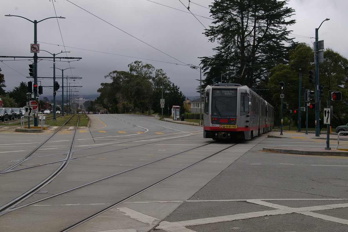
| Opening | August 11, 1917 (streetcar line) Converted to LRT service on December 17, 1980 Service extended from 30th Street to Balboa Park June 19, 1993 |
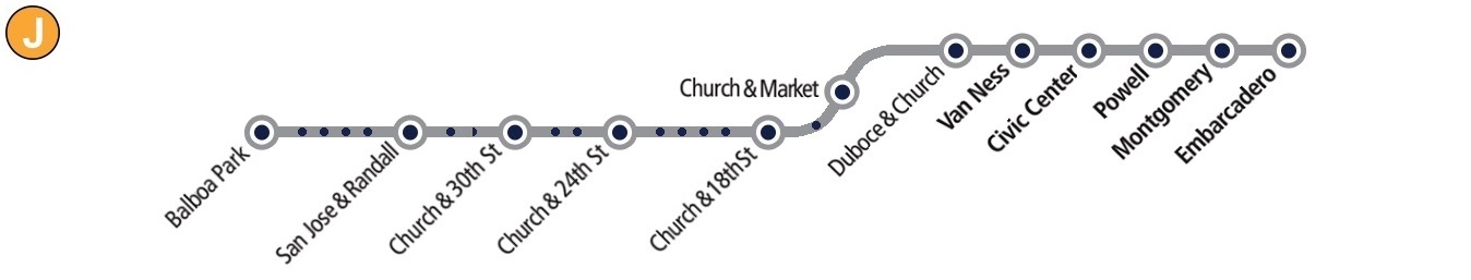
 Church
|
|
| Length | 9.2 km (5.73 miles) |
|---|---|
| Interlining | Currently interlined with T - Third Street Signed as T - Third Street inbound from West Portal |
| Stations/Stops | 21 9 subway stations and 12 surface stops (6 accessible)
|
| Right of way | Tunnel (Embarcadero to West Portal) Mix of median ROW and mixed traffic |
| Service frequency | Mornings: 9 minutes weekdays, 8 minutes weekends Mid-days: 10 minutes weekdays, 12 minutes weekends Evenings: 15 minutes Late night: 10 minutes weekdays, 13-15 minutes weekends Operated with two-car trains |
| Opening | February 3, 1918 (streetcar line) Converted to LRT service on December 17, 1980 |
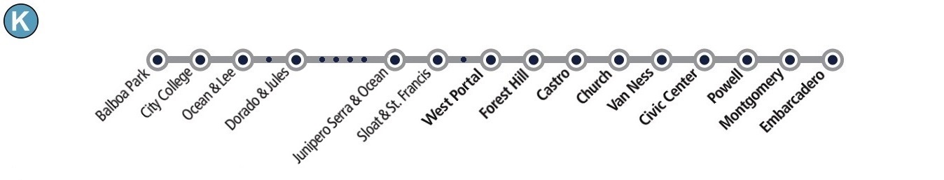
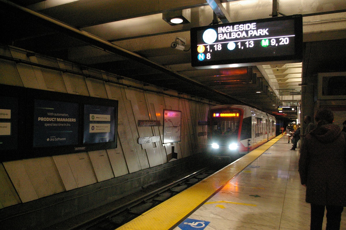
 Ingleside
|
|
| Length | 12.8 km (7.99 miles) |
|---|---|
| Stations/Stops | 25 9 subway stations and 15 surface stops (3 accessible), plus 1 inbound-only stop |
| Right of way | Tunnel (Embarcadero to West Portal) Mix of median ROW and mixed traffic |
| Service frequency | Mornings: 10 minutes weekdays, 12 minutes weekends Mid-days: 10 minutes weekdays, 13 minutes weekends Evenings: 10 minutes weekdays, 12 minutes weekends Late night: 15 minutes |
| Opening | April 12, 1919 (streetcar line) Converted to LRT service on December 17, 1980 |
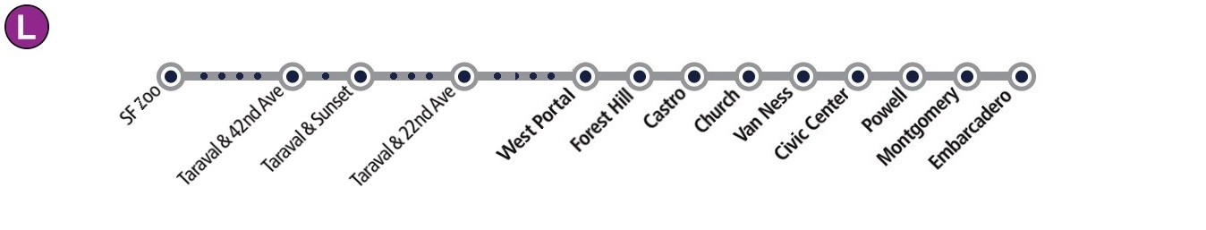
 Taraval
|
|
| Length | 14.3 km (8.9 miles) |
|---|---|
| Stations/Stops | 26 9 subway stations and 17 surface stops (6 accessible) |
| Right of way | Tunnel (Embarcadero to West Portal) Mix of median ROW, private ROW, and mixed traffic |
| Service frequency | Mornings: 11 minutes Mondays to Saturdays, 12 minutes Sundays Mid-days: 10 minutes weekdays, 12 minutes weekends Evenings: 11 minutes weekdays, 13 minutes weekends Late night: 15 minutes weekdays, 17-20 minutes weekends Operated with two-car trains |
| Opening | October 6, 1925 (streetcar line) Converted to LRT service on December 17, 1980 |
 Ocean View
|
|
| Length | 11.15 km (6.93 miles) |
|---|---|
| Stations/Stops | 32 5 subway stations, 4 surface platform stations, and 23 surface stops (10 accessible) |
| Right of way | Tunnel (Embarcadero to West Portal) Mix of median ROW, private ROW, and mixed traffic |
| Service frequency | Mornings: 10 minutes weekdays, 9 minutes weekends Mid-days and evenings: 10 minutes weekdays, 12 minutes weekends Late night: 10 minutes weekdays, 9-11 minutes weekends Operated with two-car trains |
| Opening | October 28, 1928 (streetcar line) Converted to LRT service on December 17, 1980 Extended to 4th and King/Caltrain on August 22, 1998 |
 Judah
Judah
|
|
| Length | 8.4 km (5.25 miles) 5.12 km (3.2 miles) Market Street Subway plus 3.28 km (2.05 miles) Twin Peaks Tunnel
|
|---|---|
| Stations/Stops | 9 subway stations (Twin Peaks Tunnel & Market Street Subway) |
| Right of way | Tunnel |
| Service frequency | Weekday rush hours: 6 to 9 minutes Operated with two-car or three-car trains |
| Opening | April 2, 2001 (originally named S Castro Shuttle) |
 Shuttle
|
|
| Length | 19.25 km (11.95 miles) |
|---|---|
| Interlining | Currently interlined with K - Ingleside Signed as K - Ingleside outbound from Embarcadero |
| Stations/Stops | 3 9 subway stations and 21 surface platform stations |
| Right of way | Tunnel (Embarcadero to West Portal) Mix of median ROW, private ROW, and mixed traffic |
| Service frequency | Mornings: 9 minutes weekdays, 8 minutes weekends Mid-days: 10 minutes weekdays, 12 minutes weekends Evenings: 15 minutes Late night: 10 minutes weekdays, 13-15 minutes weekends Operated with two-car trains |
| Opening | Limited service started January 13, 2007 Full service started April 7, 2007 Central Subway is planned to open (weekends initially) November 19, 2022 |
 Third Street
Ride Descriptions
Since all lines make use of the Market Street Subway, and several also use the Twin Peaks Tunnel, this section will be described on its own and the outer parts of each route will be described separately:
| Corridor/Route | Notes | Opened |
|---|---|---|
| Tunnel/Subway | All routes currently make use of part or all of this corridor | Twin Peaks Tunnel: February 3, 1918 Market Street Subway: February 18, 1980 |
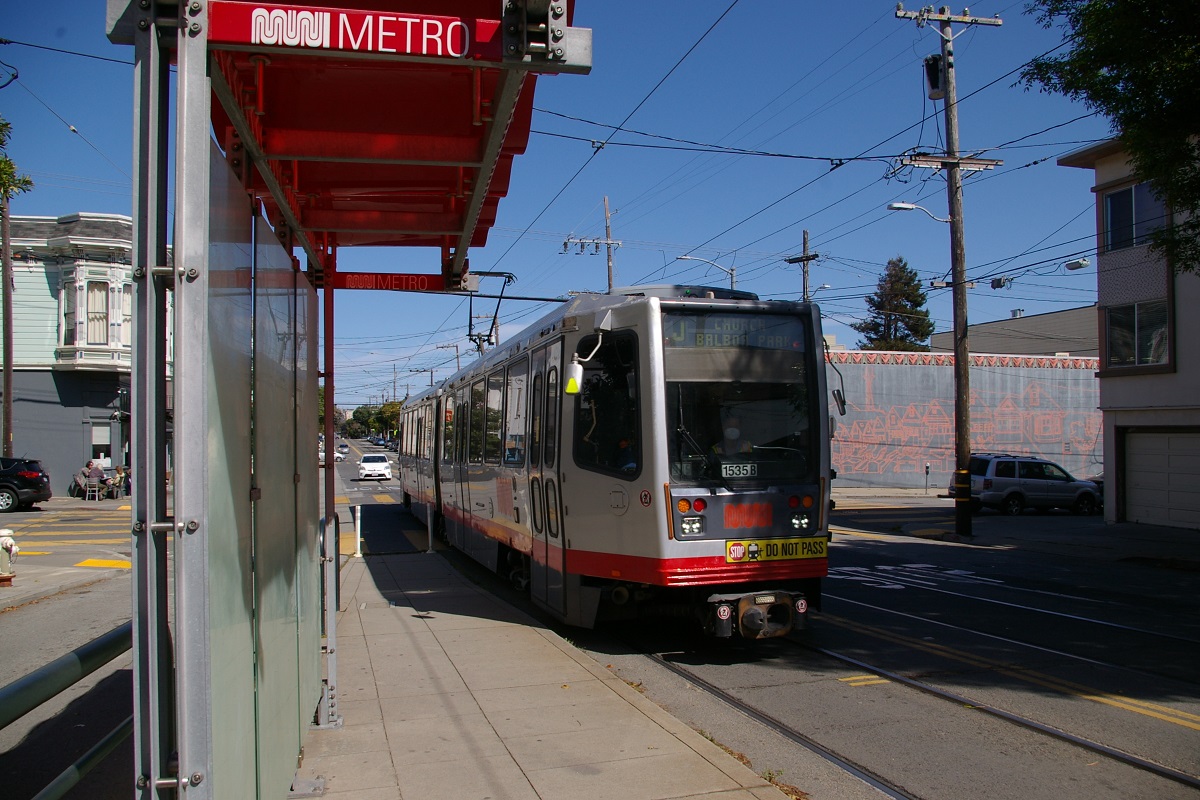
| J - Church | From the Church & Duboce Portal to Balboa Park | August 11, 1917 |
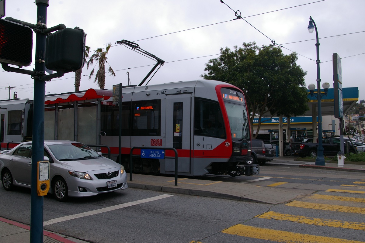
| K - Ingleside | From West Portal to Balboa Park | February 3, 1918 |
| L - Taraval | Currently operates with bus substitution | April 12, 1919 |
| M - Ocean View | From West Portal to Balboa Park | October 6, 1925 |
| N - Judah | From the Church & Duboce Portal to Ocean Beach | October 28, 1928 |
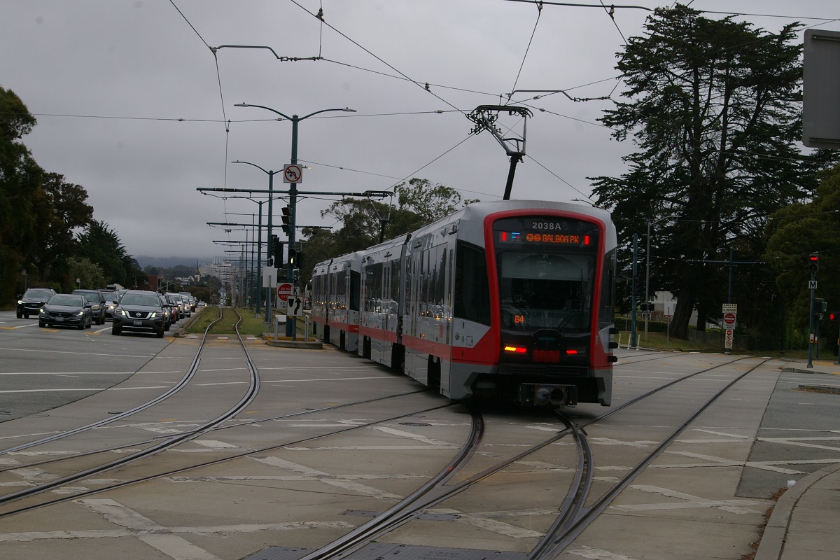
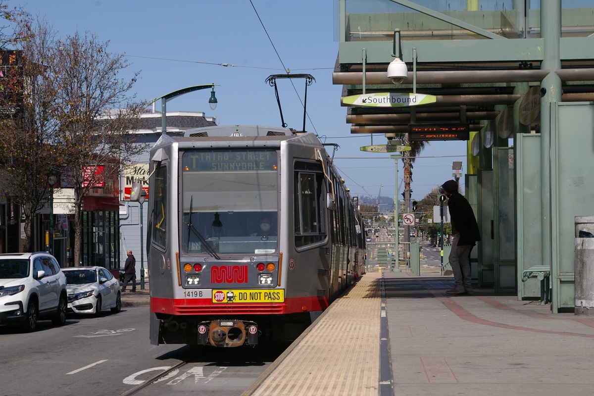
| T - Third Street | From Embarcadero to Sunnydale | April 7, 2007 |
Tunnel/Subway
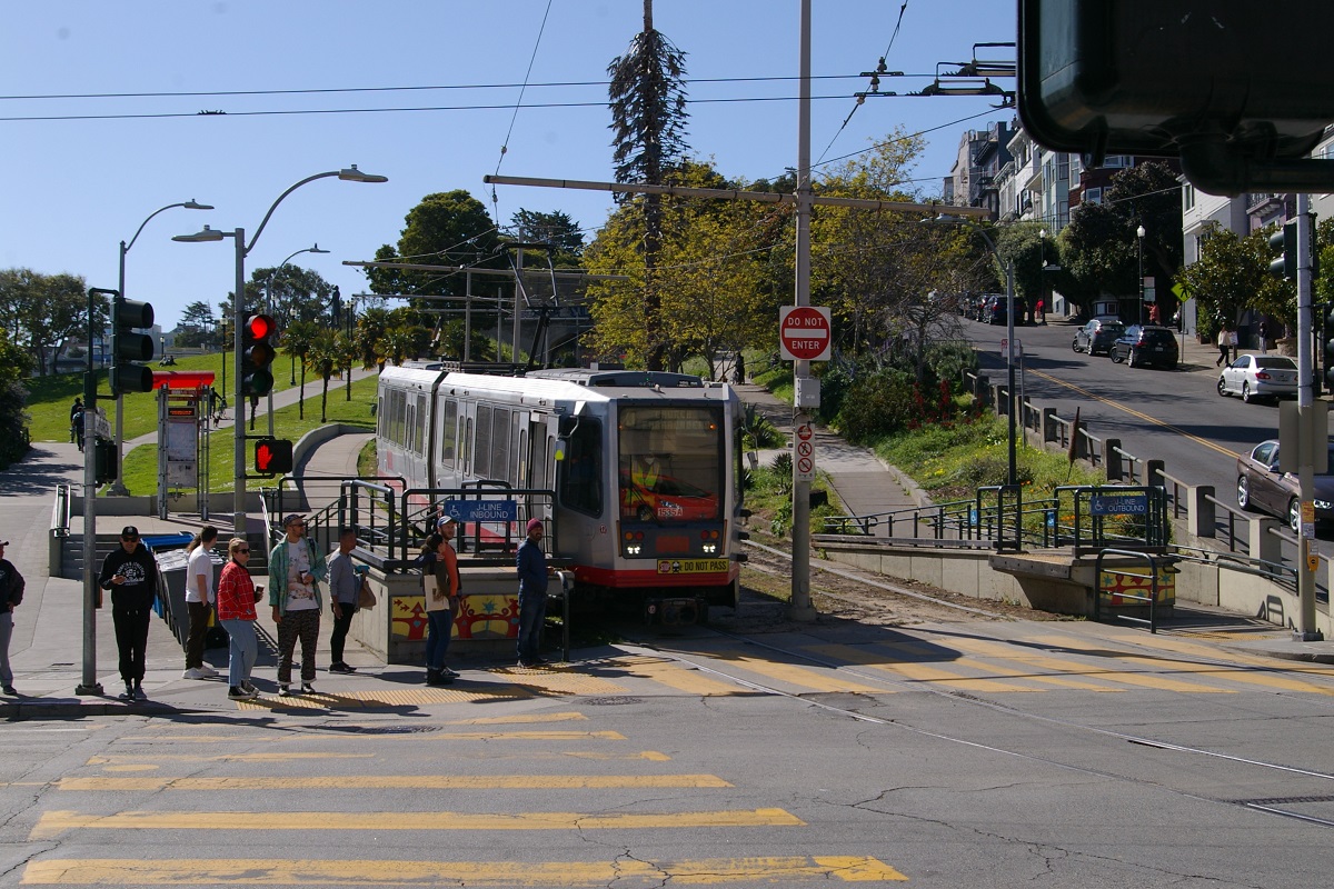
Platform sign shows route K
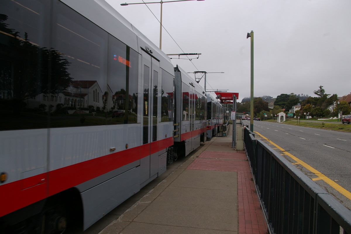
The 8.4 km underground section is comprised of the Market Street that runs 5.12 km from Embarcadero Station to just west of Castro Station where the Twin Peaks Tunnel begins and continues another 3.28 km to West Portal Station. Embarcadero Station is a centre platform station, with its outbound (westbound) platform shown in the photo to the right. From Embarcadero to Civic Center, BART runs underneath the Muni Metro and connections are available at each station.
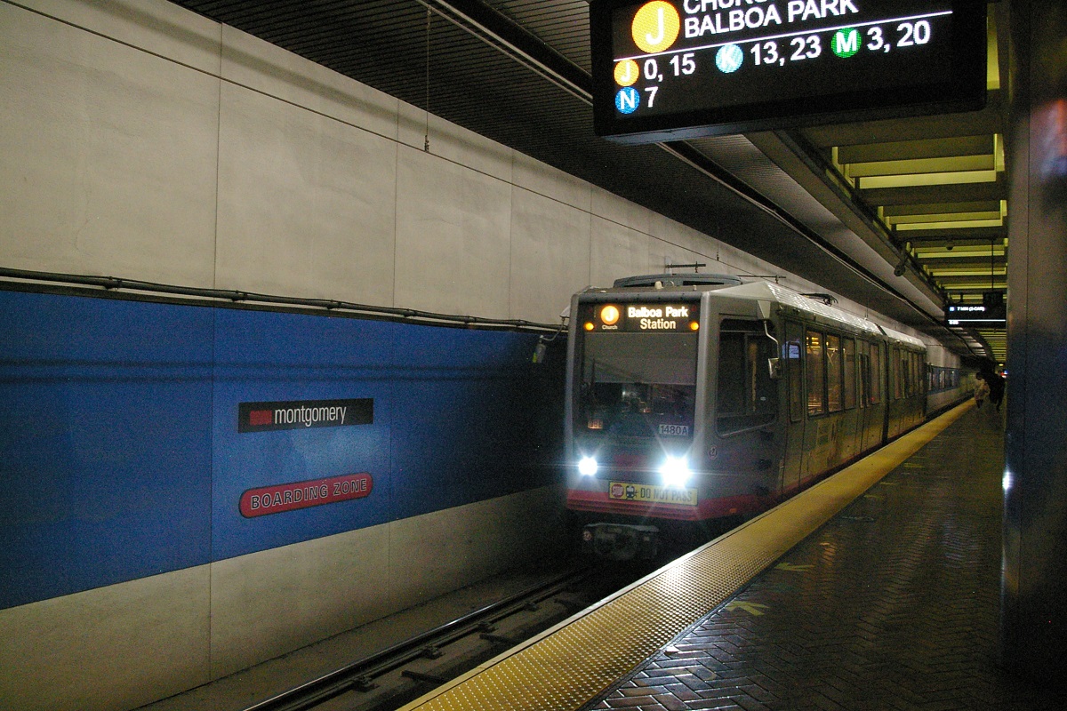
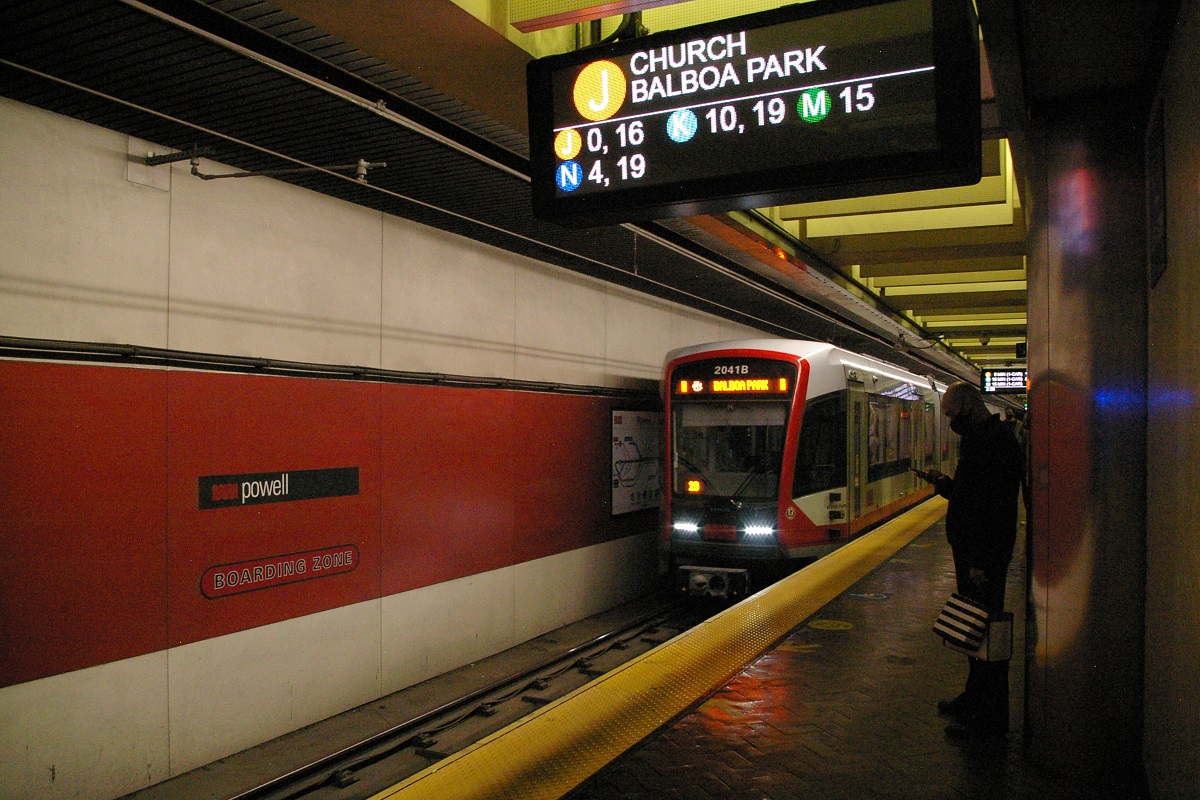
The next stop is Montgomery, another centre platform station shown in the far left photo, followed by Powell, also a centre platform station in the immediate right photo. When the Central Subway opens, there will be a connection at Powell with the Union Square Station.

The next stop is Civic Center Station. Shown in the photo to the right, this is the western-most station that has a connection to BART.
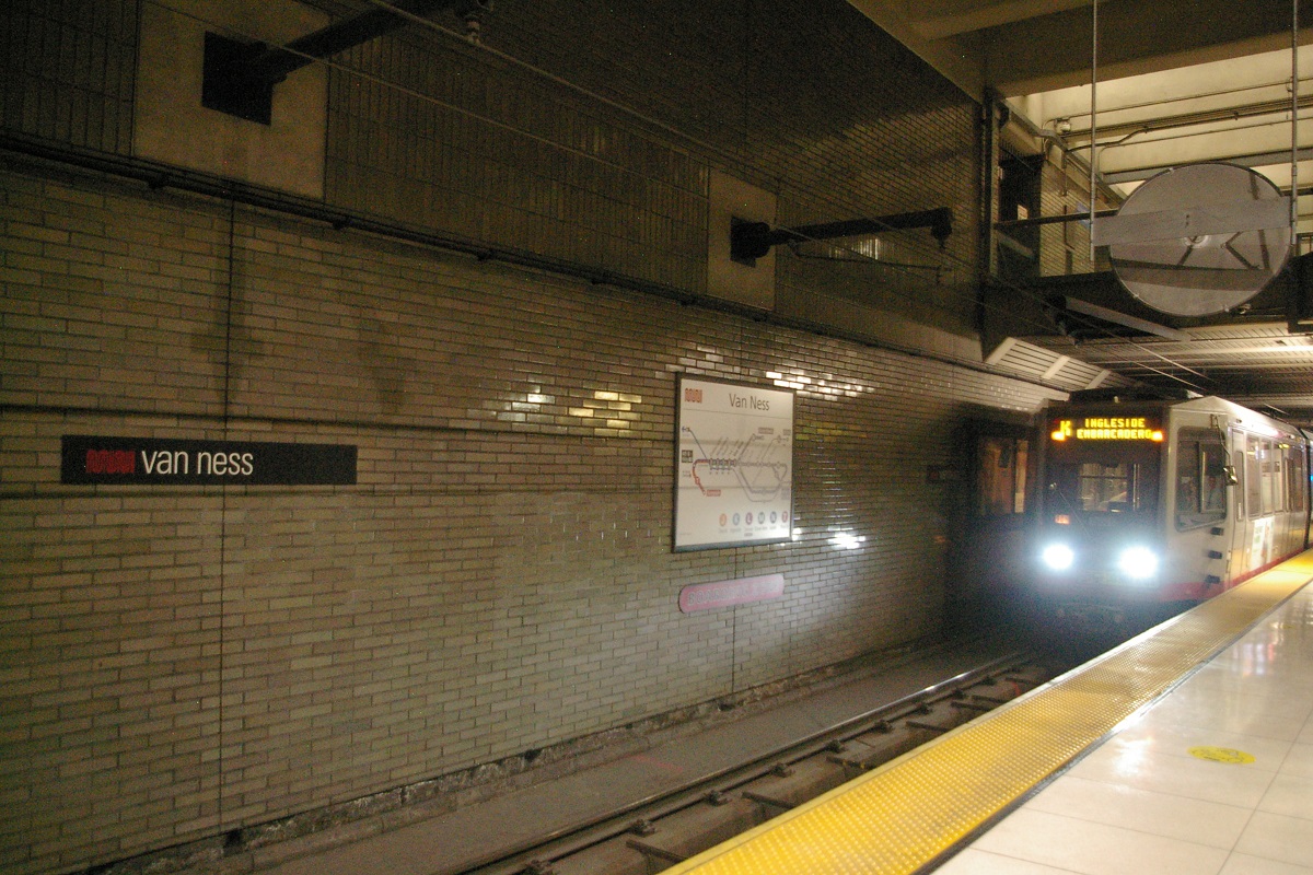
Van Ness Station is next, the western-most underground station with a centre platform, shown in the photo to the left.
Continuing westbound, route J and route N trains leave the subway at the Duboce Avenue Portal which branches from the subway to the north of Market Street before it reaches Church Station.

Church Station is shown in the two photos to the right.
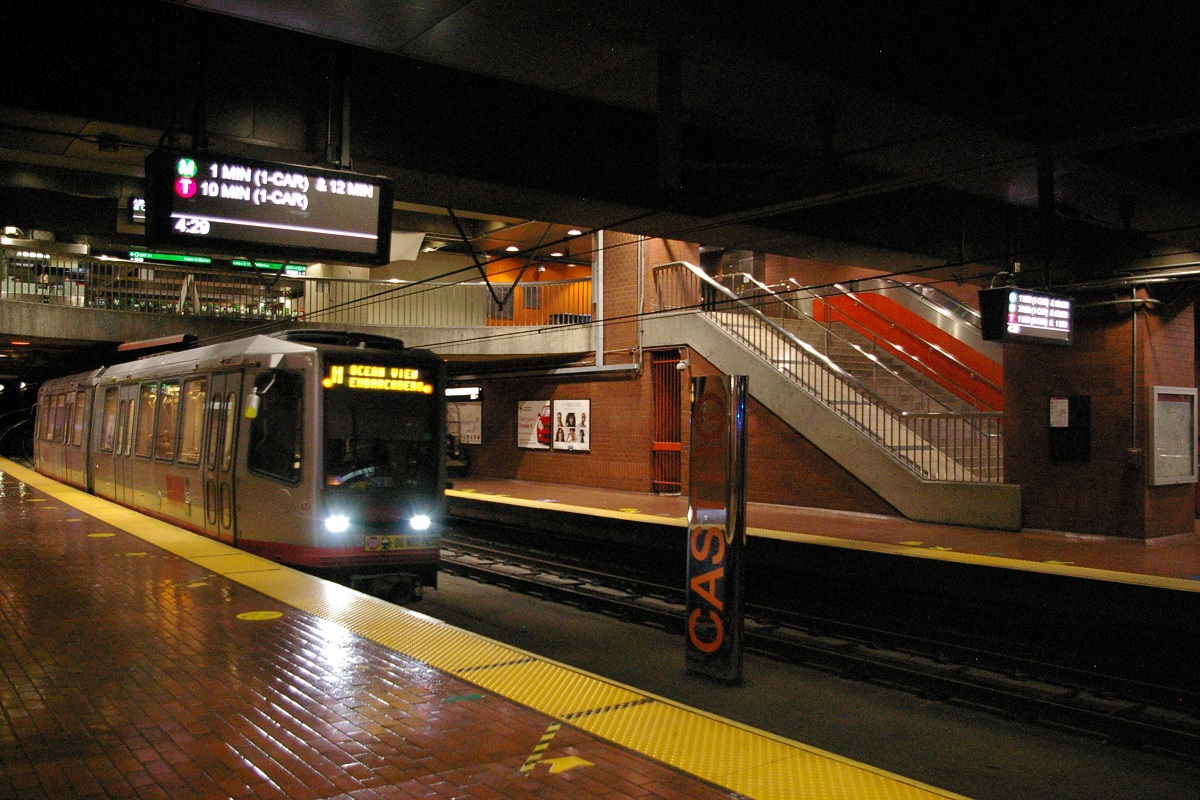
Continuing west, the next station is Castro. This is the west end of the Market Street Subway, shown in the left two photos below.
To the west of Castro Station is where the Market Street Subway ends and the Twin Peaks Tunnel begin. During the construction of the Market Street Subway, new access ramps were built that remain in place though no longer in use. The ramps are visible from trains passing in the tunnel, and on Market Street just west of Castro Street, as shown in the two right photos below.

south side of Market Street
north side of Market Street
To the west of Castro Station is where the Market Street Subway ends and the Twin Peaks Tunnel begin. During the construction of the Market Street Subway, new access ramps were built that remain in place though they are no longer in use. The ramps are visible from trains passing in the tunnel, and on Market Street just west of Castro Street, as shown in the two right photos below.
Immediately to the west of where the ramps are located is the site of the now abandoned Eureka Valley station that was closed in 1972 to be functionally replaced by Castro Station.


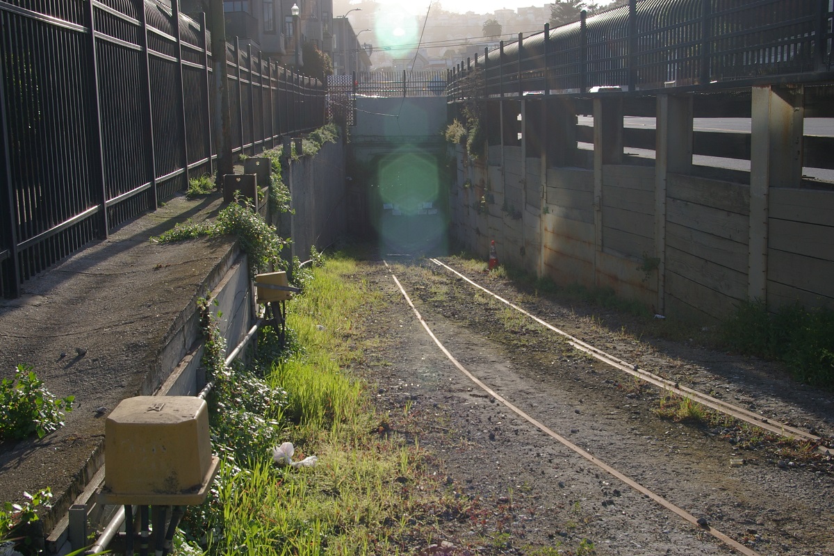
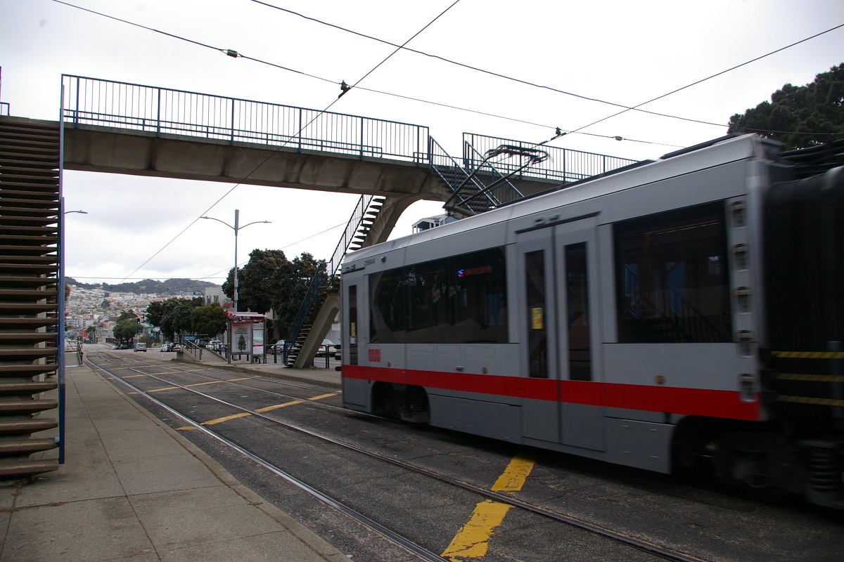
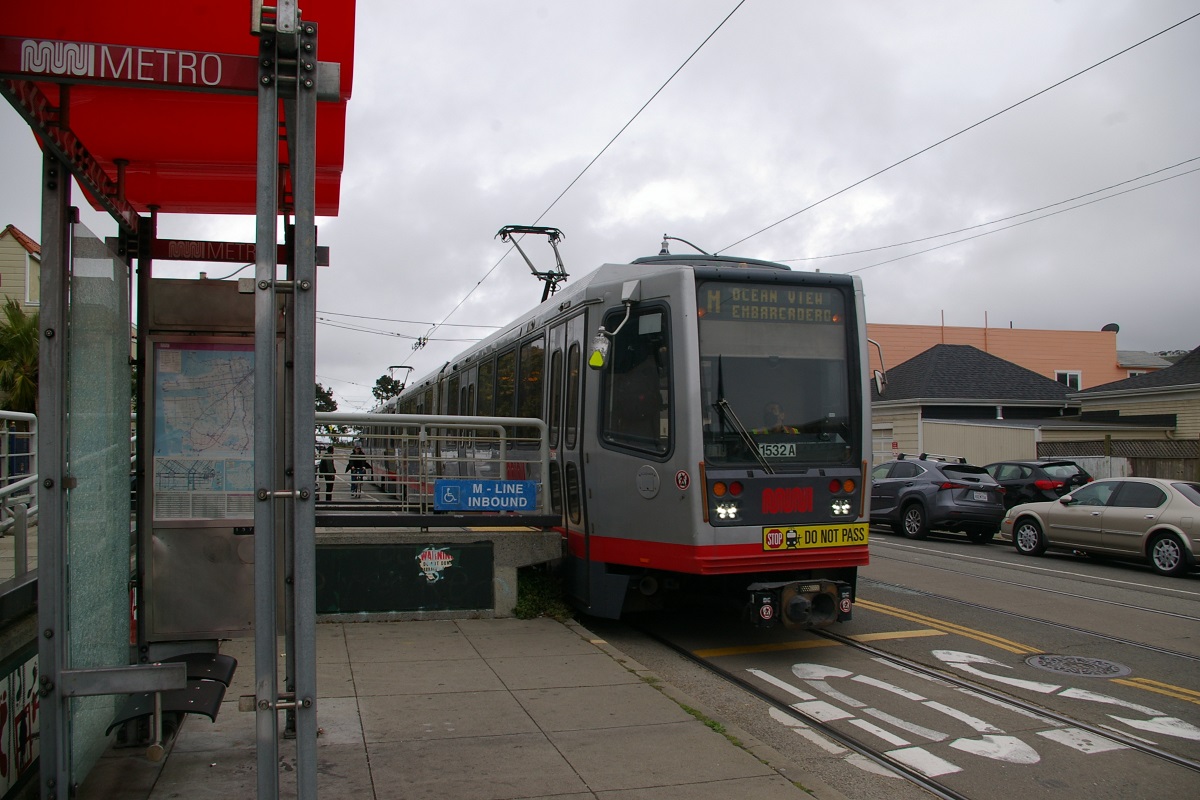
About two thirds the way through the Twin Peaks Tunnel is Forest Hill Station, seen in the far left photo. Originally, when the Tunnel opened in 1917, this station was named Laguna Honda, after the intersection above where Laguna Honda Boulevard meets Dewey Boulevard. Prior and during construction, promotional material and signage (like in the near left photo) indicated this station's name would be Forest Hill, possibly because it was built on a 21 acre donation of land from Newell-Murdoch who was developing the Forest Hill neighbourhood at the time. Upon opening it was known as Laguna Honda, but sometime in the mid-1920s, it was renamed to Forest Hill. The name Laguna Honda is carved in the station headhouse.

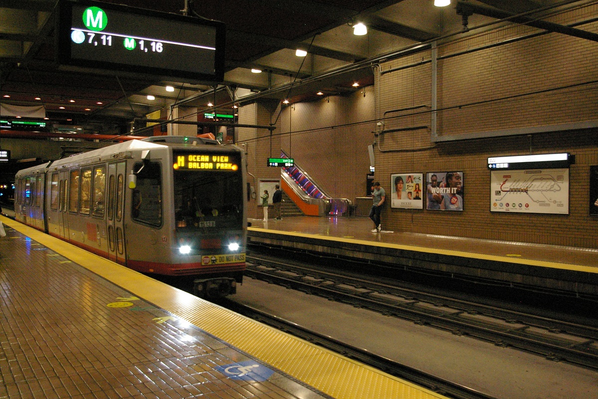
At the west end of the Twin Peaks Tunnel is West Portal Station. This side-platform station has exits onto West Portal Avenue at the intersection with Ulloa Street. Exits from the platforms are at the west end of the platforms at street level.
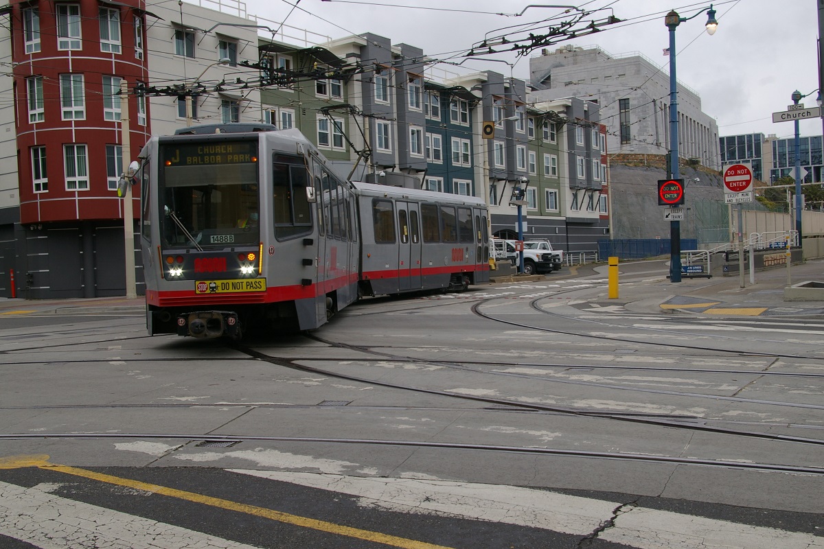
J - Church
After departing Van Ness station, the J Church line leaves the Market Street Subway via the Duboce Avenue Portal, arriving at the intersection of Duboce and Church, where an accessible ramps are located for both directions just to the east of the intersection. The line turns left (south) to arrive at the Duboce and Church stop a block south at 14th Street. The inbound stop, is just south of the intersection of Duboce and Church.
The next stop is at Market Street, with both inbound and outbound stops located south of Market Street. This is also an accessible stop.
Continuing south, there is a stop at 16th Street. At 17th Street, there is a track connection that is used by the F Market heritage line to enter and leave service. At 18th Street, there is an accesible stop.

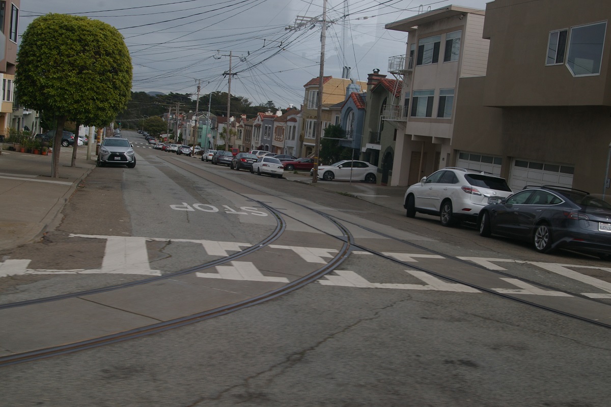
At 18th Street, the line moves off Church Street to a private right of way just east of Church at the west side of Dolores Park, as seen in the photo to the right. This is needed as there are very steep slopes on Church between here and 22nd Street. Even so, the private right of way has some grades approaching 9%.
Continuing on the right of way, there is a stop at 20th Street that serves the south end of Dolores Park. South of 20th Street, the right of way threads itself between private homes, making a turn to the east and back south again before reaching the stop at Liberty Street. The right of way is straight from there to the next stop at 21st Street.
South of 21st Street, the right of way makes an S-curve to place it about half way between Church Street and Chattanooga Street, but as it approaches 22nd Street, it curves to the west in order to re-join Church Street after its stop at the northeast corner of 22nd Street and Church, as shown in the photo to the far left.
The next stop is 24th Street, shown in the photo to the immediate left. It is an accessible stop. Continuing south, there are stops at Clipper Street and at 27th Street. While there remains an inbound-only stop just north of 30th Street, the accessible stop is located further north, with the inbound stop at 29th Street, and the outbound stop just south of Day Street, in the photo to the right.

The line turns to the east at 30th Street, but there is a turnback spur on 30th Street to the west of Church, seen in the photo to the left. This served as the southern terminus of the route from its 1917 opening until the line was extended south to Balboa Park with all day service starting on June 19, 1993. The extension opened on August 31, 1991 but was only by LRVs starting or ending their run.


Heading east on 30th, the next stop is at Dolores Street. Continuing for a short block east, the line turns south at San Jose Avenue. A little south of the turn, there is an accessible stop at Randall Street, shown in the two photos to the right.
The next stop is on San Jose Avenue at Glen Park (named after the neighbourhood).


After passing under I-280, the next stop is at Santa Rosa Avenue followed by one at Santa Ynez Avenue.
The final stop on San Jose is at Ocean Avenue where the line turns west for a short distance before it turns into the maintenance facility for its final stop at Balboa Park. LRVs return into service on San Jose Avenue a little south of Ocean Avenue and make an inbound stop at Ocean.
on Junipero Serra Boulevard
K - Ingleside
Upon departing West Portal westbound, the K Ingleside line (and the M Ocean View line) passes through the intersection with Ulloa Sreet and continues two blocks along West Portal Avenue where there is a stop at 14th Avenue.

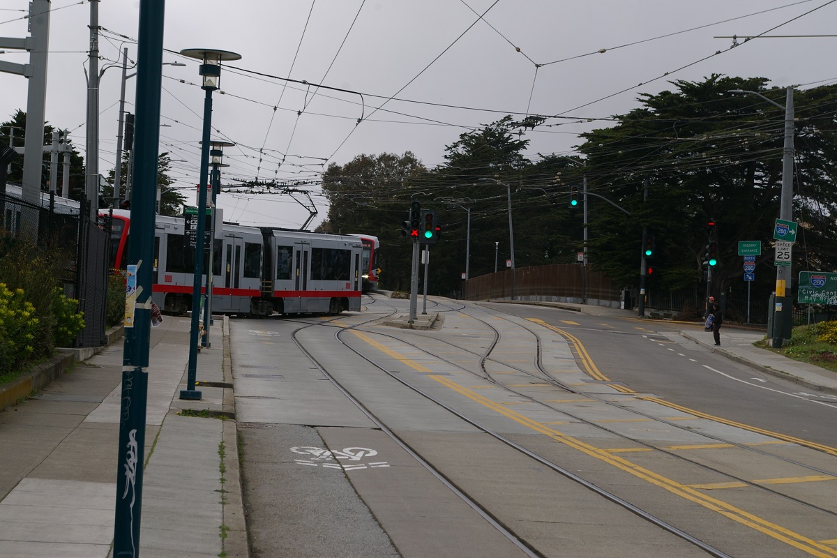
Continuing another two blocks, it reaches the accessible stop at the intersection where West Portal Avenue, Sloat Boulevard, St. Francis Boulevard, Portola Drive, and Junipero Serra Boulevard all meet. The accessible ramps are located at the north end of both islands, as seen in the near right photo. The stop is named on route maps as Sloat & St. Francis. From here, the K Ingleside line continues south on Junipero Serra Boulevard, shown in the far right photo, while the M Ocean View line enters a private right of way on the southwest corner of the intersection.

On Junipero Serra Boulevard, there is an accessible stop at Ocean Avenue where the line turns east-southeast to for the remaining trip to Balboa Park, shown in the two photos to the right.
Heading along Ocean, the next two stops are at San Leandro Way and at Aptos Avenue. The next stop is at the intersection with Westgate Drive (on the north side of Oceannd) and Cerritos Avenue (on the south side). Next is at the intersection with Fairfield Way (on the north side of Oceannd) and Victoria Street (on the south side).
Continuing outbound, the next stop is an accessible stop at Dorado and Jules. Dorado Terrance is on the north side for the inbound stop, shown in the photo to the left, and Jules Avenue is on the south side for the outbound stop.
The next stop is at Miramar Avenue, followed by an accessible stop at Lee Avenue, shown in the photo to the left.
The next stop is located under the pedestrian bridge at City College of San Francisco. This is an accessible stop, shown in the photo to the right.
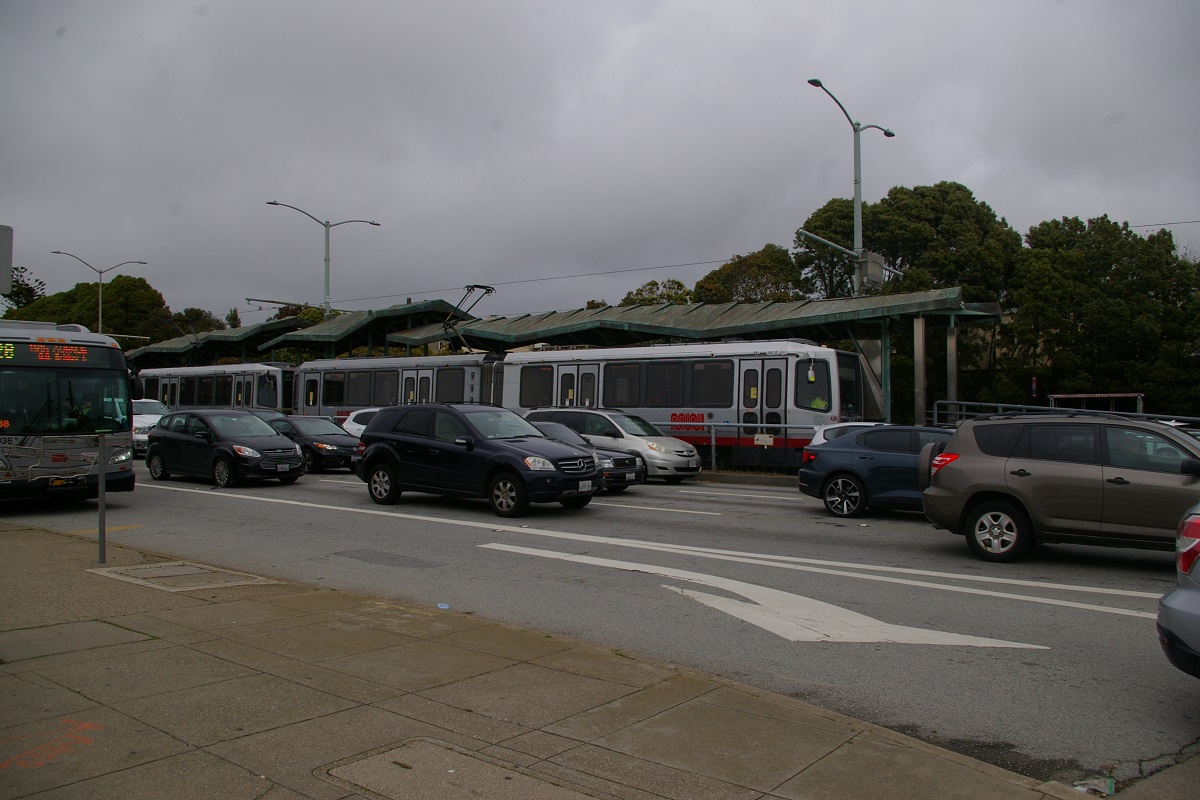
A short distance east of City College, Ocean Avenue crosses over I-280 and the line makes a right turn, shown below to the far left, into the maintenance facility where a platform for off-loading allows passengers to transfer to BART at Balboa Park, shown arriving in the second photo below. After off loading passengers, the train can lay over in the maintenance facility before continuing around the property and returning to Ocean where it left, as seen in the two right photos below.
 |
 |
 |
 |
| K train turning off Ocean into Balboa Park | Arrivng at Balboa Park platform | Departing K train as an arrival on Ocean is about to turn in |
K train departing |
L - Taraval

Upon departing West Portal westbound, the L Taraval line turns right outside the station at Ulloa Sreet and makes its first stop three blocks away at Forest Side Avenue. In another three blocks, the line turns right at 15th Avenue and travels one block north to reach Taraval Street where there is a stop before it turns left (west). The next outbound stop is at 19th Avenue, though there is an inbound-only stop at 17th Avenue.
After the stop at 19th Avenue, the line reaches the 22nd Avenue stop, the first stop with an accessible ramp. Both inbound and outbound stops are in the block between 22nd Avenue and 23rd, with the outbound stop at 23rd, as shown in the photo to the immediate right. The the inbound stop is at 22nd, shown in the photo to the far right.
Continuing outbound, the next three stops are at 26th Avenue, 30th Avenue, and at 32nd Avenue. Two blocks before reaching the next stop, there is a turnback spur on 35th Avenue running north of Taraval, as shown in the photo to the far left.
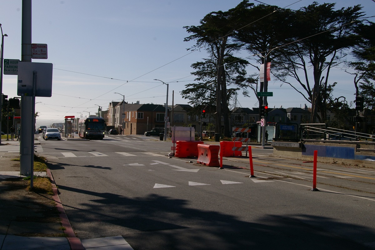
The next stop is at Sunset Boulevard, shown in the photo to the near left, is an accessible stop. The photo was taken in March 2022, and the first segment of the L Taraval Improvement Project has been completed so the inbound stop and track in the background has been rebuilt, while the outbound stop and track in the foreground is under construction as it is part of the second segment.
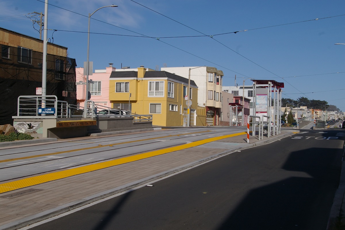
The next stop is at 40th Avenue, followed by another accessible stop at 42nd Avenue. At this stop, in both directions, the main stop is on the near side of 42nd, while the accessible ramp is on the far side.
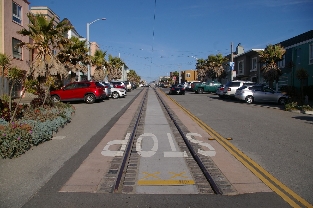
Continuing outbound, the next stops are at 44th Avenue and 46th Avenue. At 46th Avenue, the line turns left (south). A spur continues west where it converges into a single track on the west side of 47th Avenue and ends at Great Highway. See Current and Planned Expansion for L Taraval for a photo of the spur track.
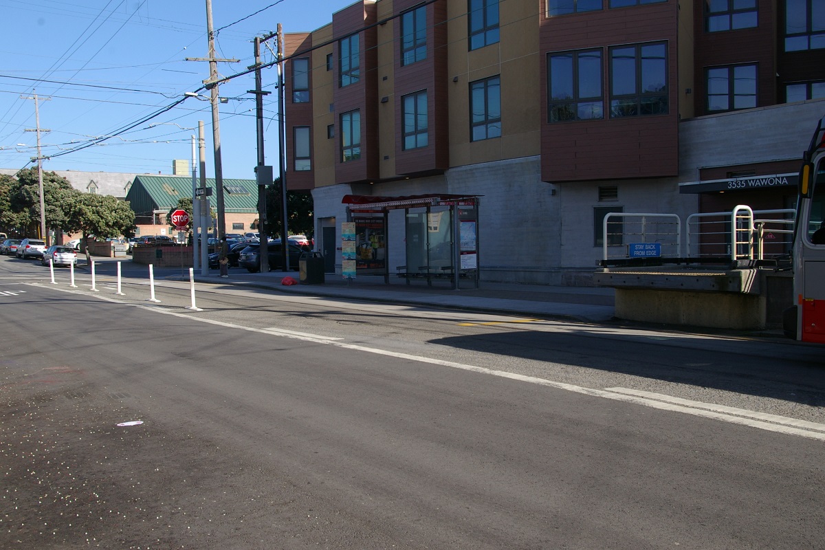
Heading south on 46th Avenue, there is a stop at Ulloa Street and another at Vicente Street. The outbound direction turns right (west) at Vicente for a block where it turns south again on 47th Avenue. One block south, it turns east again at Wawona Street where it reaches the terminus stop at 46th Avenue, shown in the photo to the far right. This stop is accessible and the San Francisco Zoo is a block south of this stop.
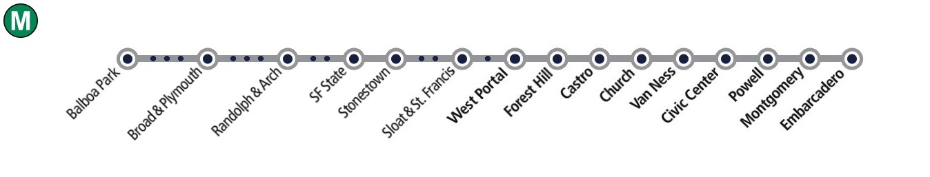
M - Ocean View
Upon departing West Portal westbound, the M Ocean View line (and the K Ingleside line) passes through the intersection with Ulloa Sreet and continues two blocks along West Portal Avenue where there is a stop at 14th Avenue.

at Sloat & St. Francis
the private right of way
Continuing another two blocks, it reaches the accessible stop at the intersection where West Portal Avenue, Sloat Boulevard, St. Francis Boulevard, Portola Drive, and Junipero Serra Boulevard all meet. The stop is named on route maps as Sloat & St. Francis. From here, the M Ocean View line enters a private right of way on the southwest corner of the intersection, as shown in the photos to the right. The K Ingleside line continues south on Junipero Serra Boulevard.
On the right of way, there is a stop where the line crosses Ocean Avenue and another where it crosses Eucalyptus drive. Just south of Eucalyptus, the line crosses Rossmoor Drive where it meets 19th Avenue and continues to a median right of way in the middle of 19th. About 300 metres south, there is a surface platform station at Stonestown, where the Stonestown Galleria is located, shown in the photo on the left.

inbound on left, outbound on right
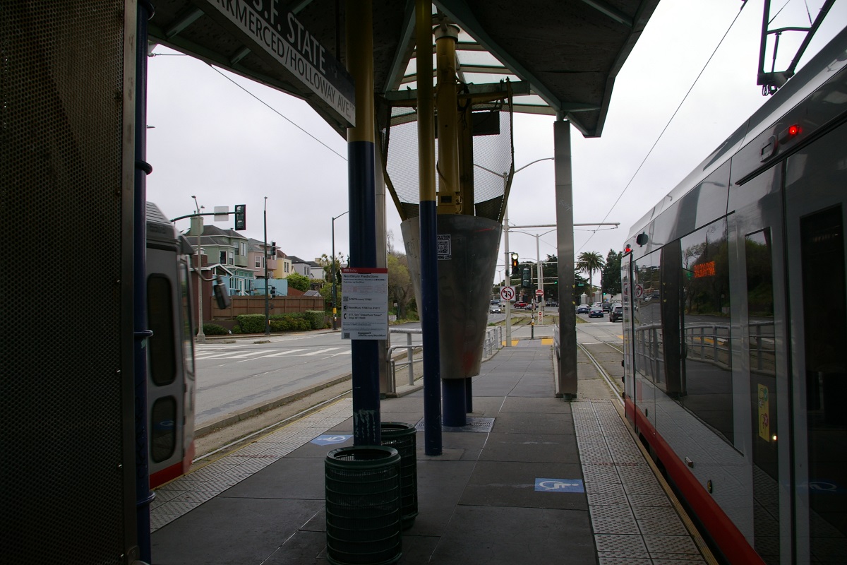
The next stop is about 700 metres south and is another surface platform station, serving San Francisco State University, at Holloway Avenue shown in the photos to the right.
Continuing south on 19th Avenue, the road curves to the southeast a little south of Holloway. The next stop is at Junipero Serra Boulevard followed by another stop at Randolph Street. From here, the line continues on 19th Avenue for about another 250 metres where 19th meets Randolph Street again and the line turns east along Randolph.
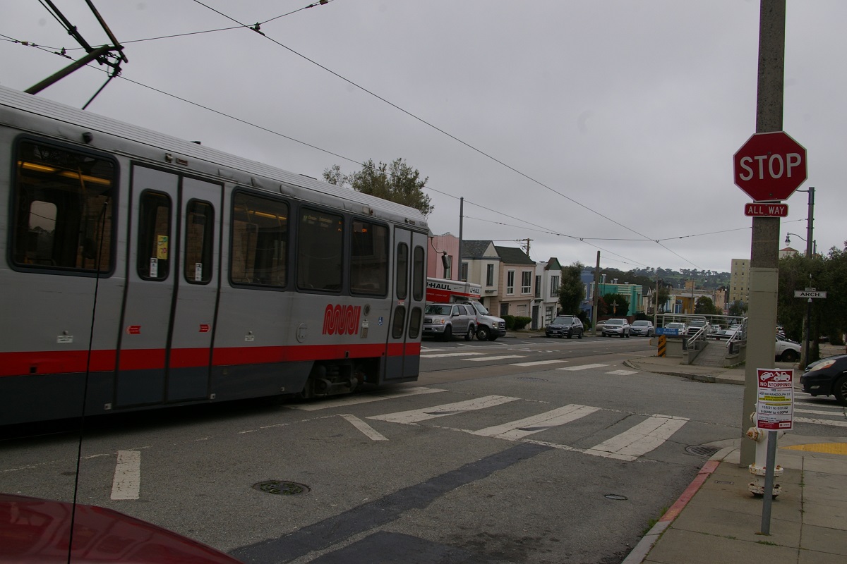
Heading east on Randolph for about 230 metres, the line reaches the accessible stop at Randolph and Arch. The stops here are on the near side of the intersection and, as seen in the photo to the left, the accessible ramp is on the far side of the intersection. The next stop is at Randolph and Bright Street. Just east of Bright Street, the line turns south for a block at Orizaba Avenue then turns east again at Broad Street where it stops at Broad & Orizaba. Heading east on Broad, the next stop is 300 metres away at Capitol Avenue.

The next stop is another accessible stop at Plymouth Avenue. At this stop, the accessible ramp is located on the same side of the intersection with the rest of the stop.

Niagara Avenue and Geneva Avenue
The line continues along the rest of Broad Street for 230 metres where it then turns to the northeast to follow San Jose Avenue, stopping about 150 metres up San Jose at Farallones Street, followed by a stop at Lakeview Avenue. The last stop before Balboa Park is at Mt. Vernon Avenue, just before passing over I-280.
The M Ocean View line ends by using the Cameron Beach Yard to turn around, located on the east side of San Jose between Niagara Avenue and Geneva Avenue. This yard is directly south of the maintenance facility used by the J Church and K Ingleside lines to turn around.
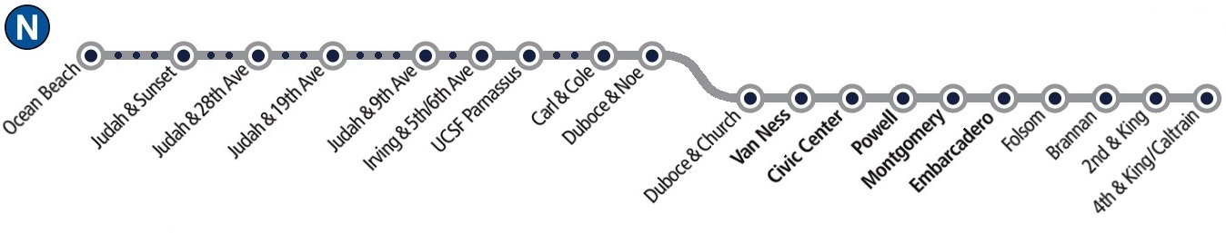
N - Judah

The N Judah line starts at the Caltrain surface station located on King Street west of 4th Street running on a median right of way, as seen in the photo to the left. West of the station is a turnback/layover facility beyond where King Street becomes ramps to/from I-280, as seen in the photos to the right.

Traveling northeast on King Street, there is another surface station just before reaching 2nd Street. The 2nd & King station serves Oracle Park, where the San Francisco Giants play, seen in the near photo on the right.
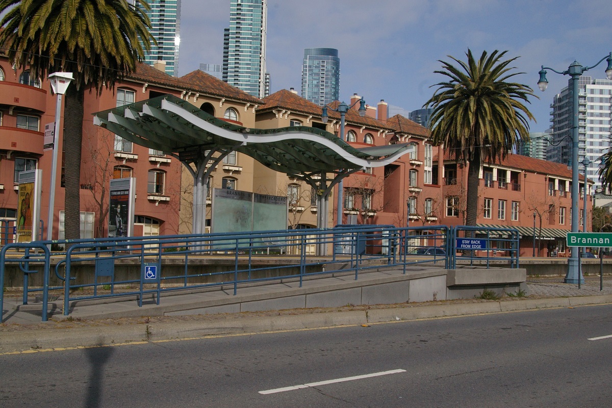
A short distance northeast of the 2nd & King station, King Street begins to curve north and becomes The Embarcadero. The next station is Brannan, located just south of Brannan Street, seen in the far photo on the right.


Continuing about 500 metres north on The Embarcadero, the line passes under the Bay Bridge as The Embarcadero curves to the northwest. The next station is just before reaching Folsom Street, seen in the photo on the left.
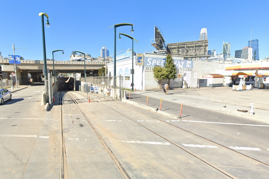
After Folsom Street, the line descends into the portal to enter the Market Street Subway, as seen in the two photos to the right. This N Judah line uses the Market Street Subway as far as Van Ness station. See the Tunnel/Subway description for that part of the line.

ramp at Duboce and Church
as an inbound J Church enters the portal
After departing Van Ness station, the N Judah line leaves the Market Street Subway via the Duboce Avenue Portal, arriving at the intersection of Duboce and Church, where an accessible ramp is located before passing through the intersection, where the main stop is located on the west side.
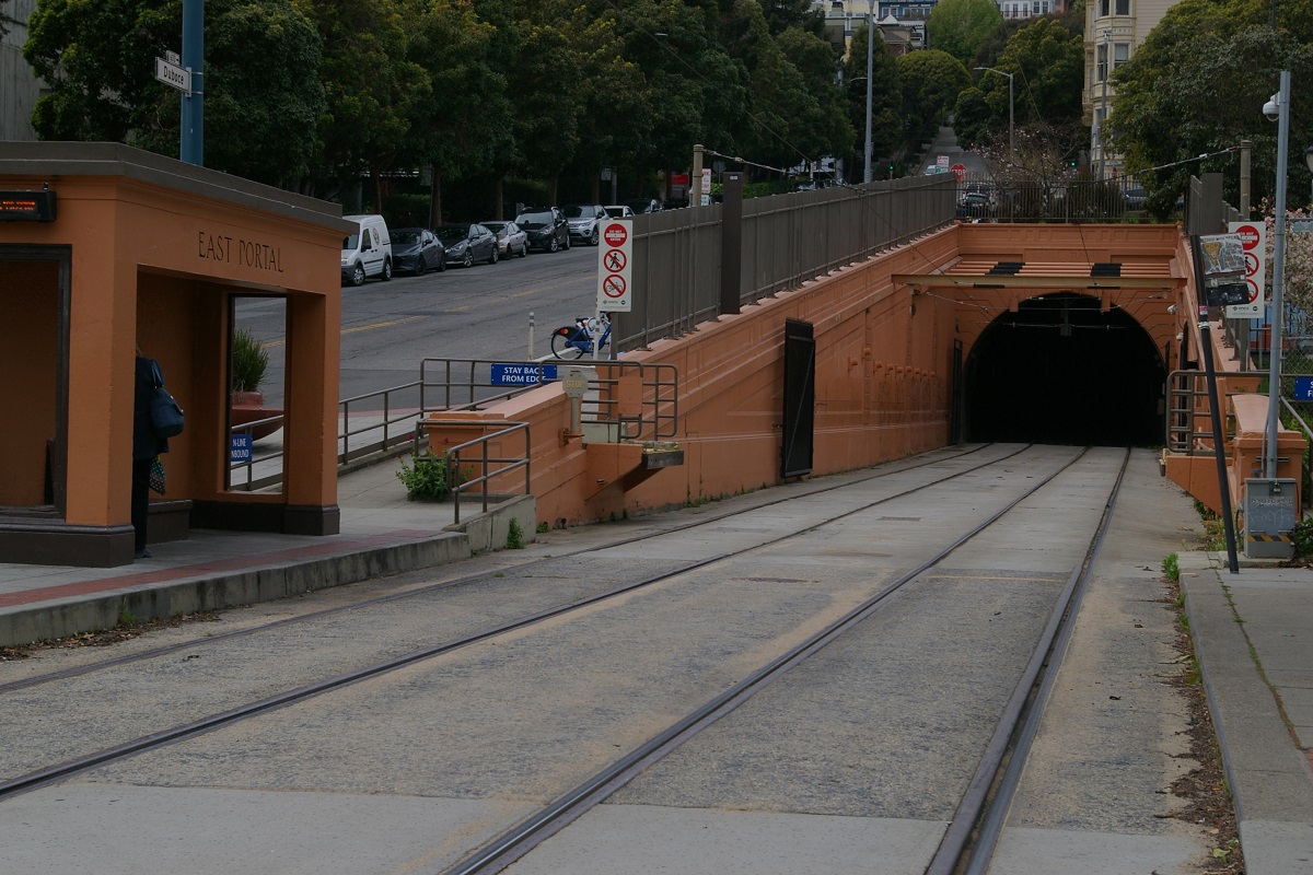
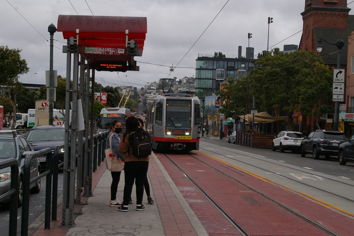
The line continues west on Duboce Avenue for about 350 metres where it leaves the road to stop at Duboce & Noe, an accessible stop at the east portal of the Sunset Tunnel, seen in the photo to the right.
The Sunset Tunnel is almost 1.3 km long with no stations in it. Just outside of the west portal of the Sunset Tunnel is where the accessible ramps are located for the Carl & Cole stop, as seen in the near right photo below.


From this location, line enters Carl Street where it makes a stop at just west of this location at Cole Street, seen in the photo to the far right. Continuing west on Carl Street, the line makes stops at Stanyan Street and at Hillway Avenue. Just west of Hillway, the line curves to the south at Arguello Boulevard briefly and continues west on Irving Street.
Once on Irving Street, there is an accessible stop that serves UCSF Parnassus, shown in the photo to the left.

Next is an accessible stop located between 5th Avenue and 6th Avenue, shown in the photo to the near right. Continuing west, there is a stop on Irving between 8th Avenue and 9th Avenue. At 9th Avenue, the line turns south to travel to Judah Street, about 200 metres.

At Judah, the line turns to the west and arrives at the Judah & 9th accessible stop. From here to 19th Avenue, the LRT runs in a median that is separated from traffic by a curb. Continuing along Judah, there are stops at 12th Avenue and another block away at Funston Avenue. Then the next stop has each direction a block apart, with the inbound stop at 15th Avenue and the outbound stop at 16th Avenue.
The next stop is the accessible Judah & 19th. The outbound accessible ramp is a block east, while the inbound ramp is right at the 19th Avenue end of the inbound stop.
Continuing west, the next stop has each direction a block apart, with the inbound stop at 22nd and the outbound stop at 23rd. This is followed by a stop for both directions at 25th Avenue, followed by an accessible stop at 28th Avenue, shown in the photo to the right.
Before reaching the next stop, there is a turnback wye located on 30th Avenue on the north side of Judah, as seen in the photo to the far left. Then, the next two stops are at 31st Avenue and 34th Avenue.

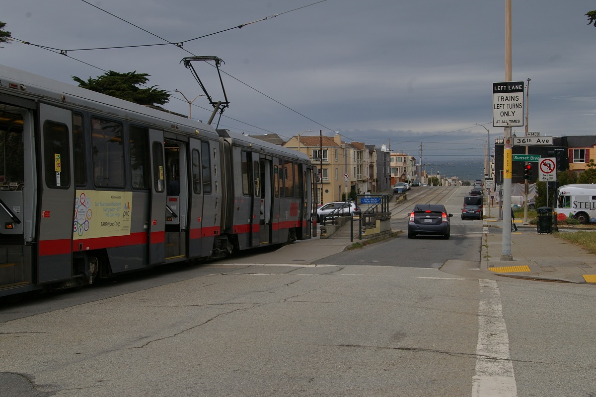
Next is an accessible stop at Sunset Boulevard, located between 36th Avenue and 37th Avenue, it is seen in the photo to the immediate left.
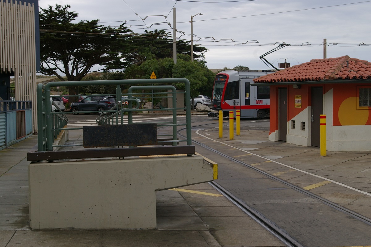
Continuing west, the next stops are at 40th Avenue, 43rd Avenue, and 46th Avenue. Trains offload passengers at 48th Avenue before laying over on the loop at La Playa Street, as seen in the photo to the right. The place where the trains lay over on the loop is situated in teh space between La Playa Street and the Great Highway, as seen in the two left-most photos below.
 |
 |
 |
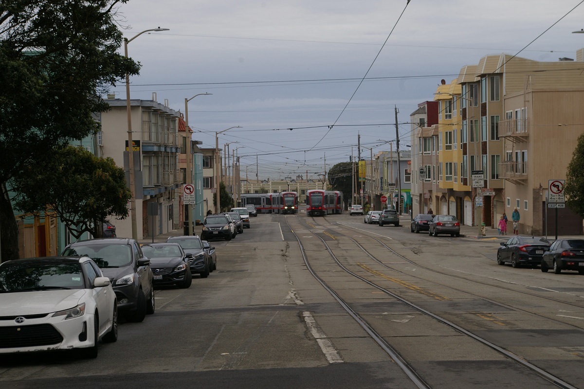 |
| Train on Ocean Beach loop viewed from east | Train on Ocean Beach loop viewed from south | Accessible ramp at Ocean Beach loop | Ocean Beach Loop viewed from east of 47th Avenue |
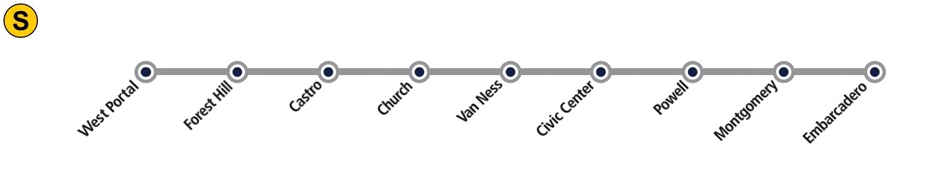
T - Third Street
Muni Metro uses the terms Inbound and Outbound to describe train directions, and inbound is defined as the direction heading through the Market Street Subway towards Embarcadero. Most of the T Third line is beyond this, heading south. Despite traveling away from downtown, that makes the direction Inbound. Station platforms on Third Street are signed as either Southbound or Downtown, so this is used here. It is expected that when the Central Subway opens, this will be the derections.
This route description will follow the "inbound" (southbound) direction. The T Third line currently starts at West Portal and for the description of the route through the Twin Peaks Tunnel and the Market Street Subway, see the Tunnel/Subway description. For the description of the route from where it emerges from the Market Street Subway onto The Embarcadero, see the first part of the N Judah description.


Caltrain station in background on northwest corner
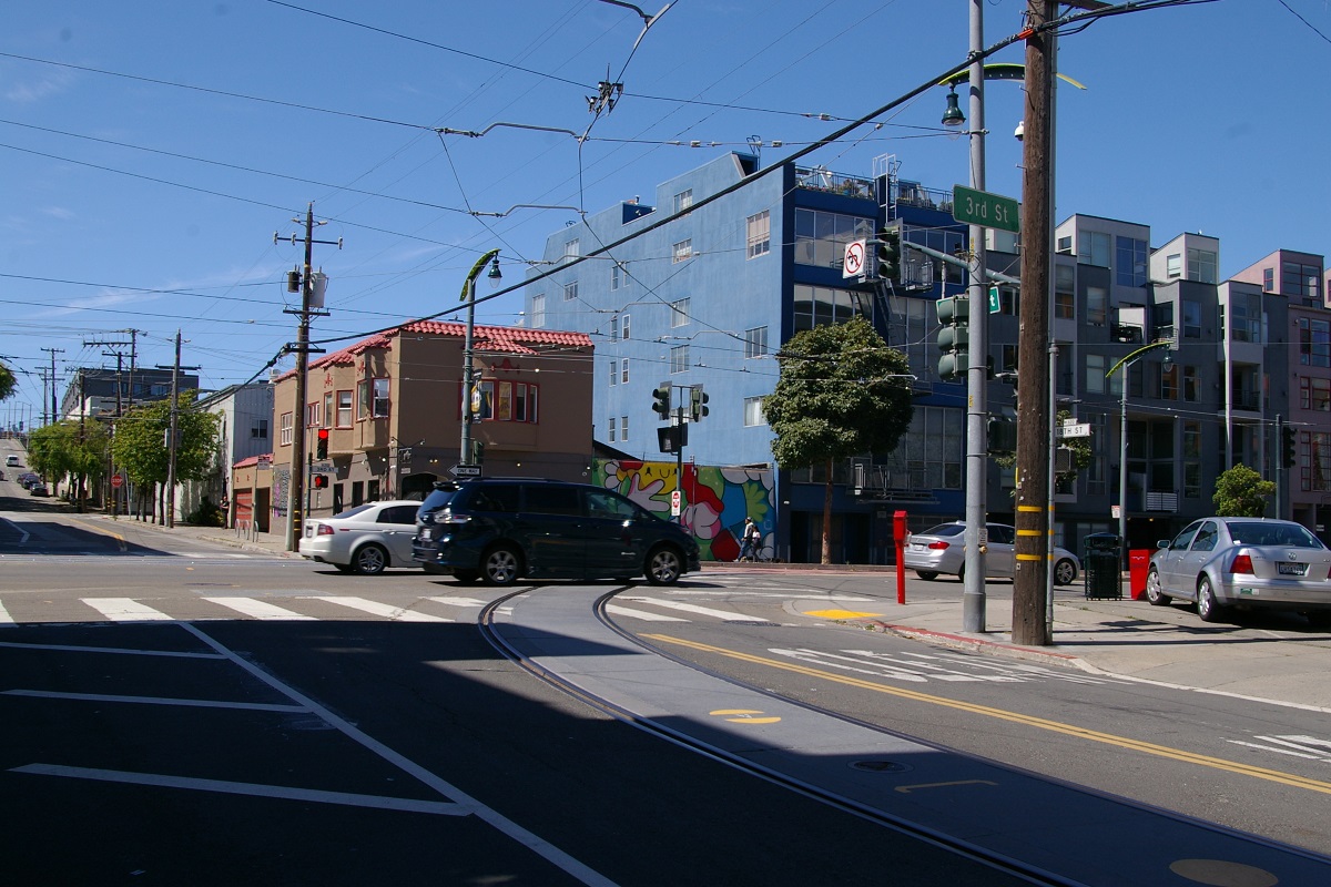
When the line arrives on King Street at 4th Street, this route turn to head south on 4th Street where its 4th & King surface station is located, as seen in the near photo to the right. This is a separate platform station from the 4th & King that is located west of the intersection where the N Judah line makes its terminal stop.
About 150 metres south of 4th & King, the line crosses the 4th Street Bridge, seen in the photo to the far right. This is the first of two draw bridges on this route.
southbound platform in foreground
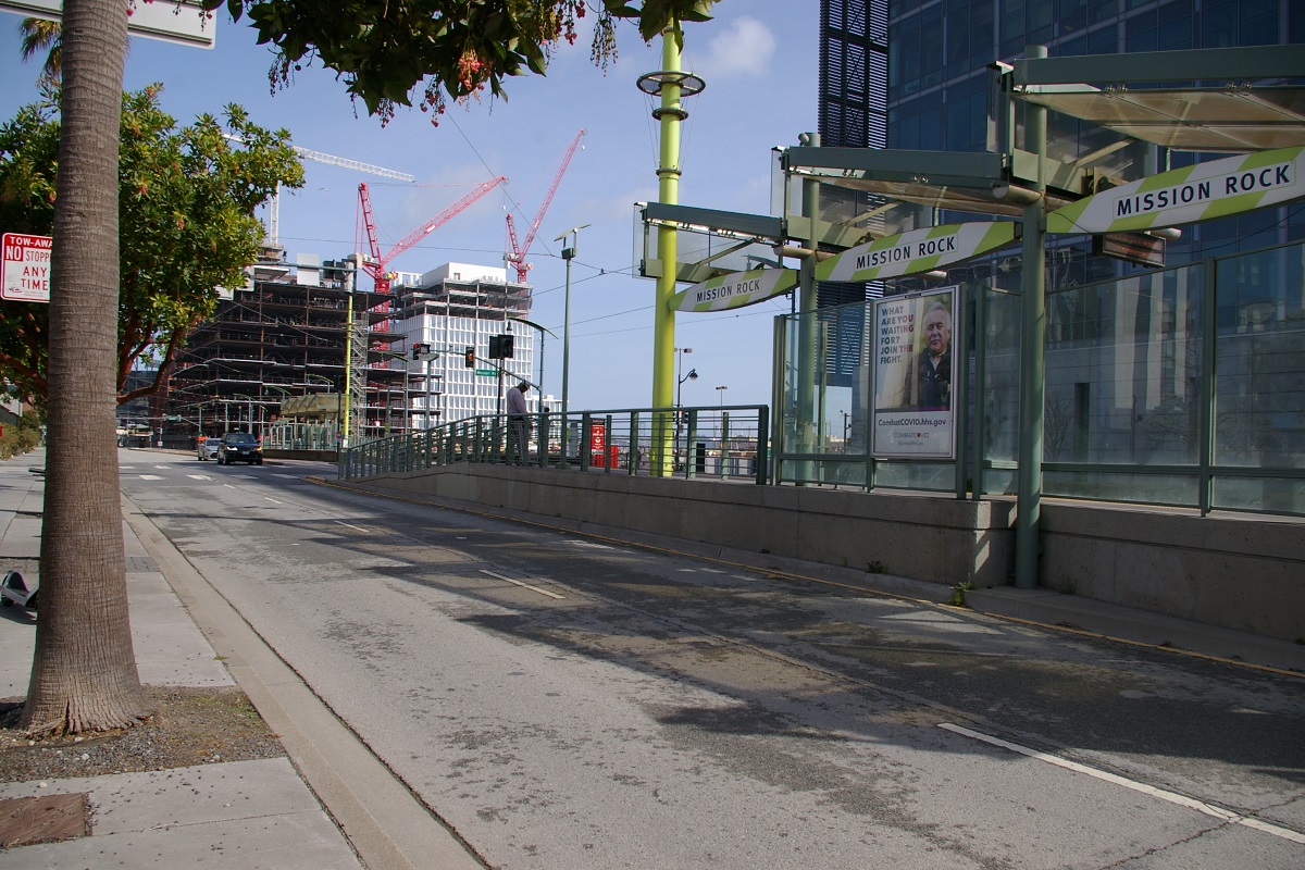
South of the bridge, the line turns east at Channel Street for a block before turning south again at Third Street where it enters a median right of way. In two more blocks, it reaches the Mision Rock station at Mision Rock Street. This station has platforms on the outside platforms, with the downtown platform located north of Mission Rock Street, and the southbound platform to the south.
southbound platform in foreground
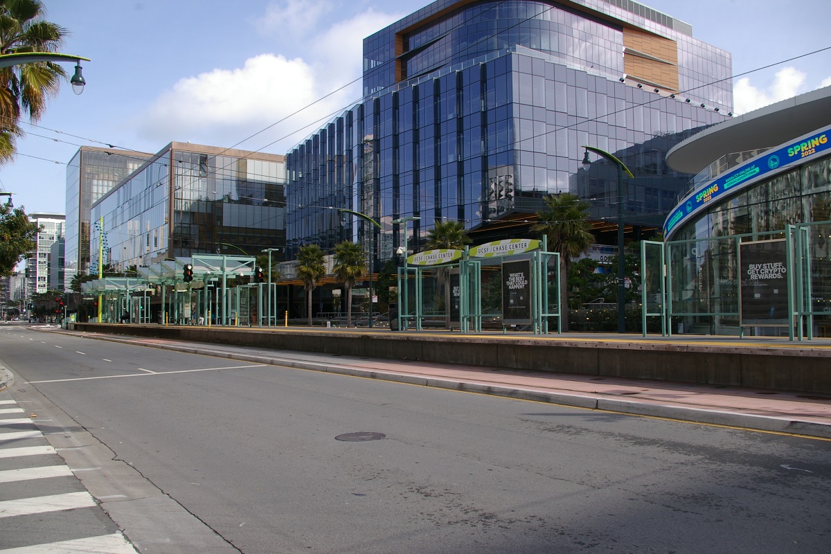
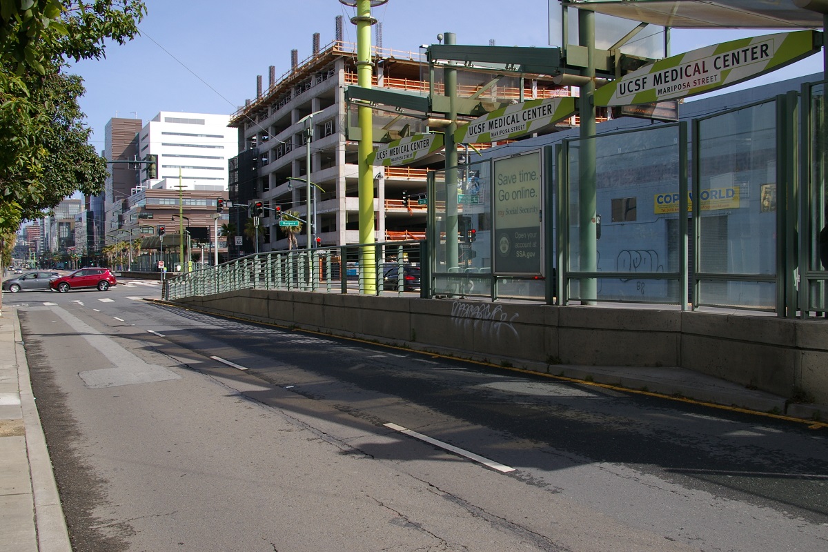
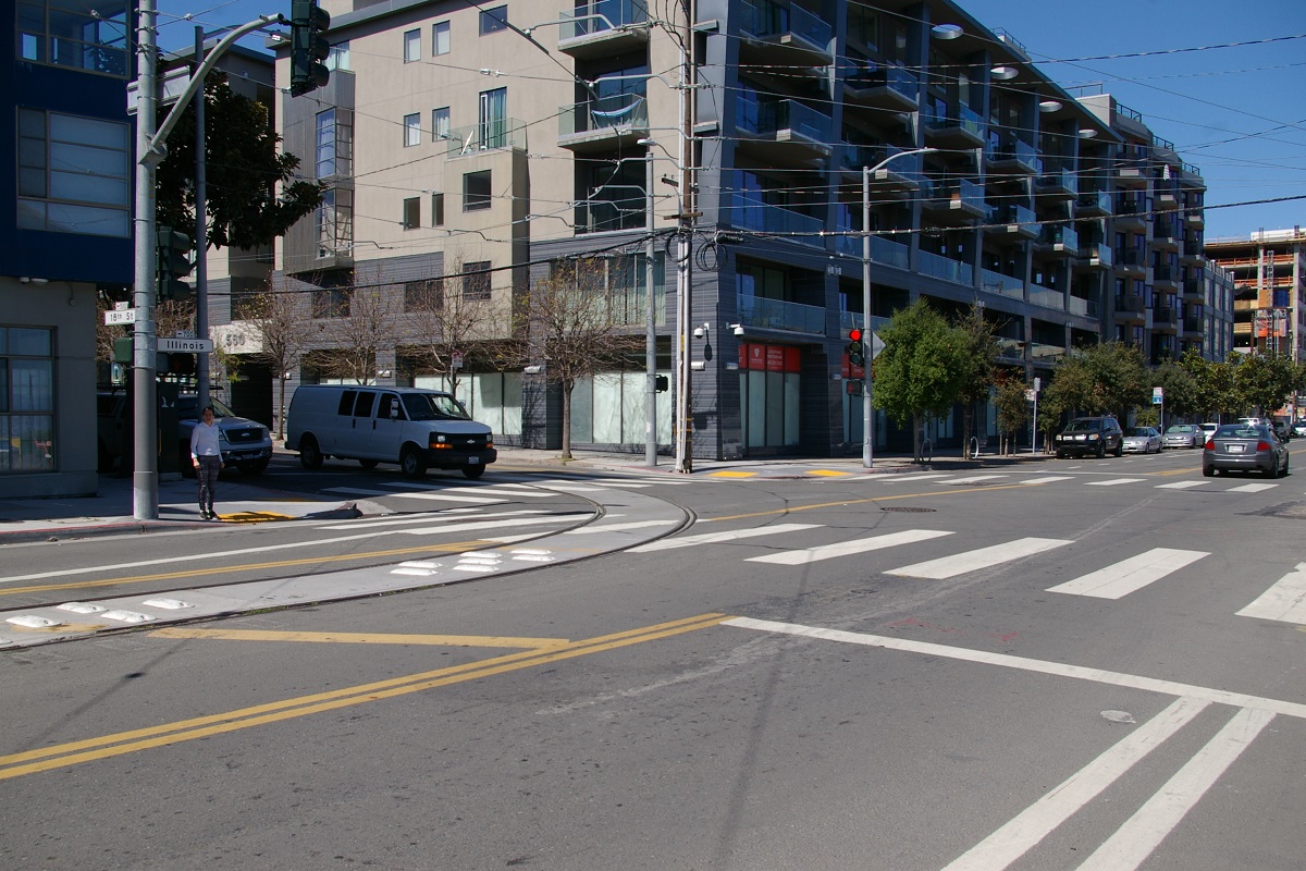
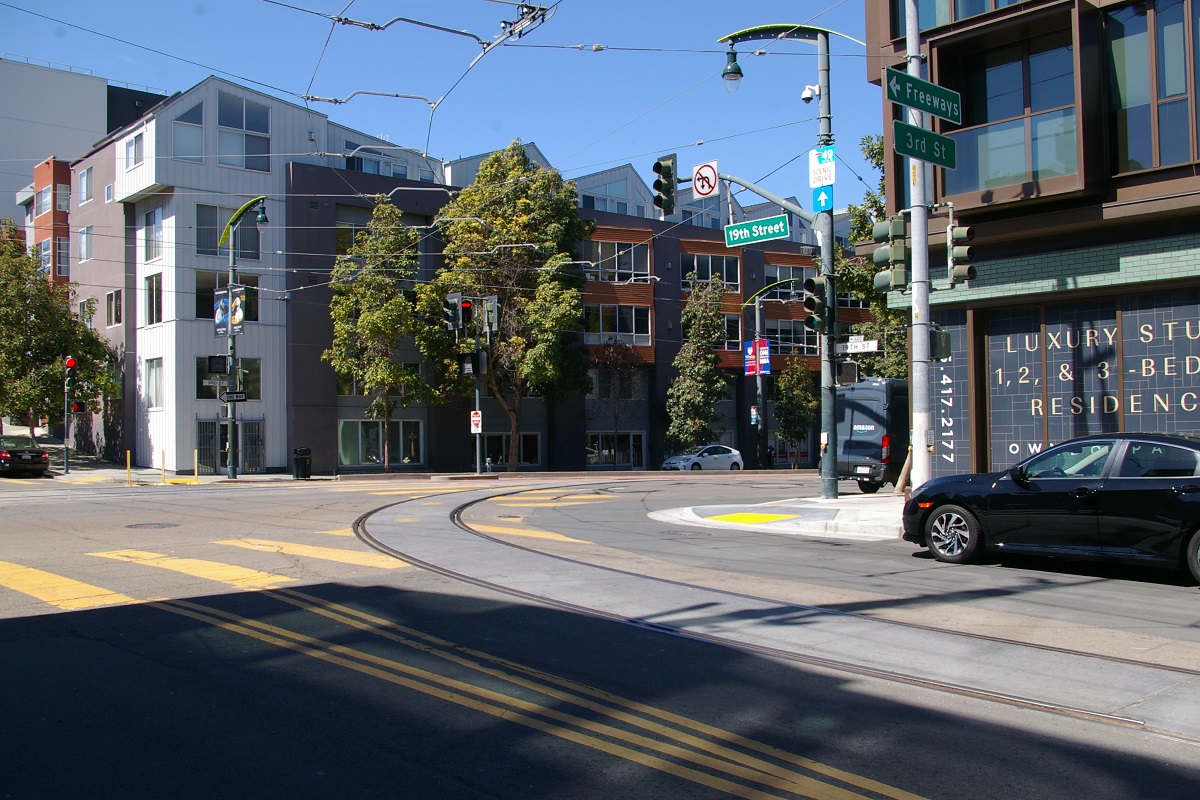
The next station is about 500 metres away, just south of Warriors Way called UCSF/Chase Center, shown in the near right photo. This centre platform station is located at the Chase Center where the Golden State Warriors play. The following statiom, UCSF Medical Center, a side platform station at Mariposa Street with each platform past the intersection, and can be seen in the far right photo. Before reaching the next station, there is the Mission Bay Loop to turn trains back north. The loop is entered at 18th Street and returns to Third at 19th Street. This will be used for service on the line when the Central Subway fully opens in 2023. See the description of the Central Subway for details and photos.

southbound platform in foreground
southbound platform in foreground
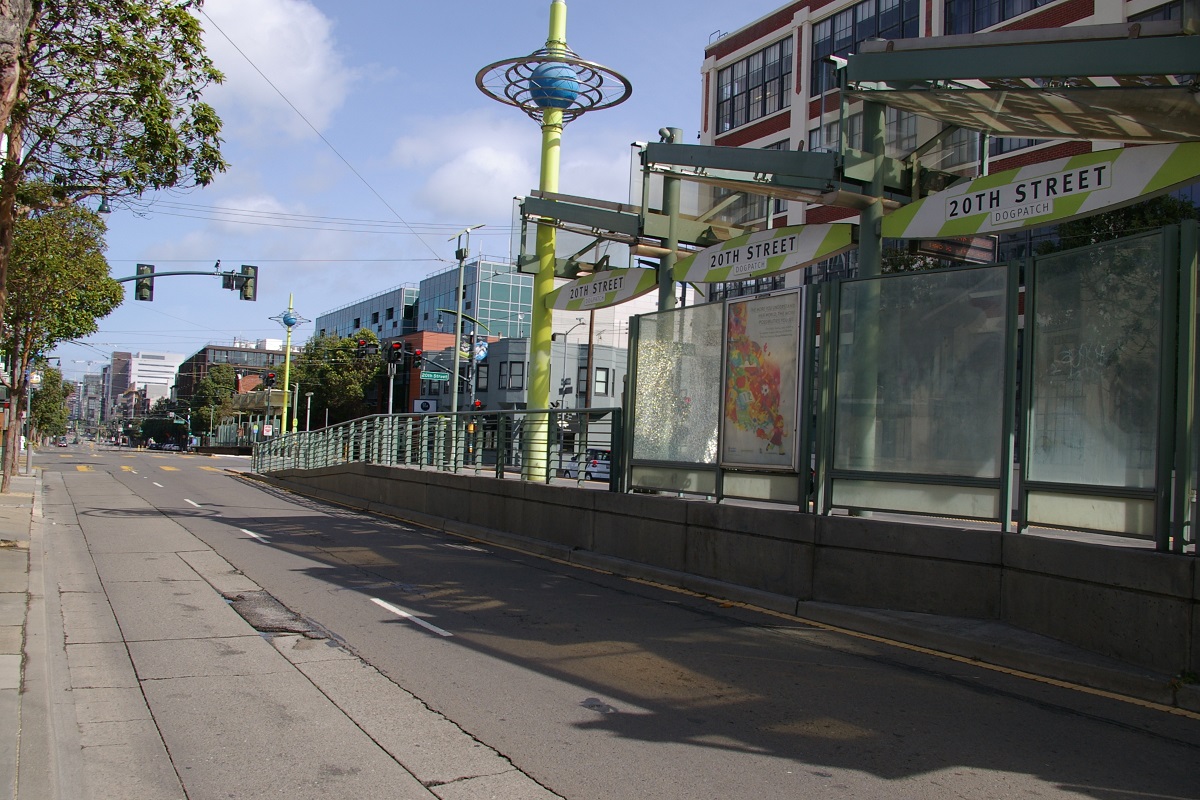
Just south of the loop is the next station at 20th Street, in the area called Dogpatch, shown in the photo to the far left. This is another side platform station with each platform past the intersection. A little further south is the 23rd Street station, in the near left photo, with the same platform arrangement.

view from roof looking east
Two blocks south, an eastward branch at 25th Street leads into the East Maintenance Facility, shown in the photo to the right. The maintenance facility is a block away, east of Illinois Street. The facility stretches two blocks to the south, where there is another branch from the line on Third at Cesar Chavez.

downtown platform in foreground
Before reaching the next station, an eastward branch at 25th Street leads into the East Maintenance Facility, shown in the photo to the right. The maintenance facility is a block away, east of Illinois Street. The facility stretches two blocks to the south, where there is another branch from the line on Third at Cesar Chavez.

southbound platform in foreground
The next station is Marin Street, located in the area called Islais Creek, shown in the photo to the left. This is a side platform station, but unlike the other side platform stations on Third Street, the downtown platform is south of the intersection and the southbound platform is north of the intersection.
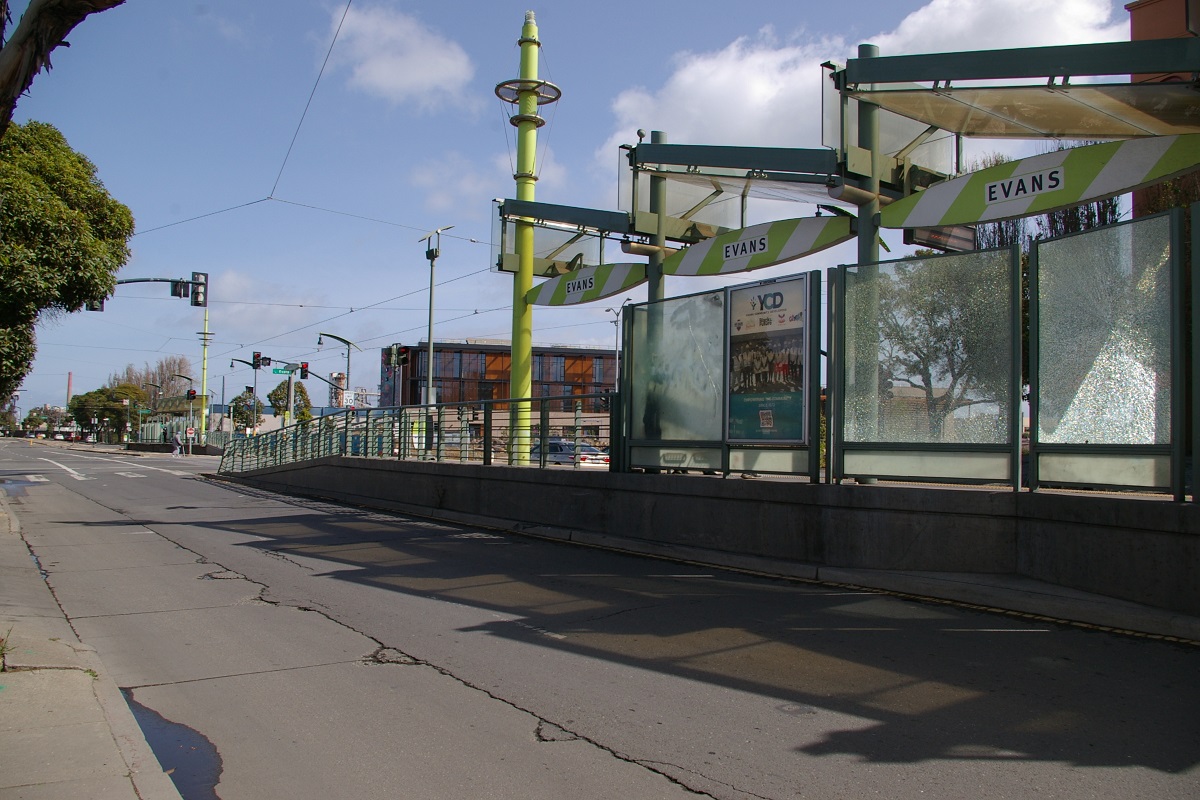
Just south of Marin Street, the line passes over the Levon Hagop Nishkian Bridge, the second drawbridge on this line, shown in the near right photo. Just before reaching the intersection with Arthur Avenue and Cargo Way, there is a level railway crossing. A few more blocks south, and the line reaches Evans Station, shown in the far right photo. This station is another side platform station with each platform on the far side of the intersection.

viewed from the downtown platform
with a southbound train arriving
Continuing south on Third for about 300 metres, the line reaches the next station located in the block between Hudson Avenue and Innes Avenue, called Hudson/Innes shown in the photo to the far left. Another 300 metres takes the line to similar looking station in the block between Kirkwood Avenue and La Salle Avenue, named Kirkwood/La Salle, shown in the near left photo.
viewed from the southbound side platform
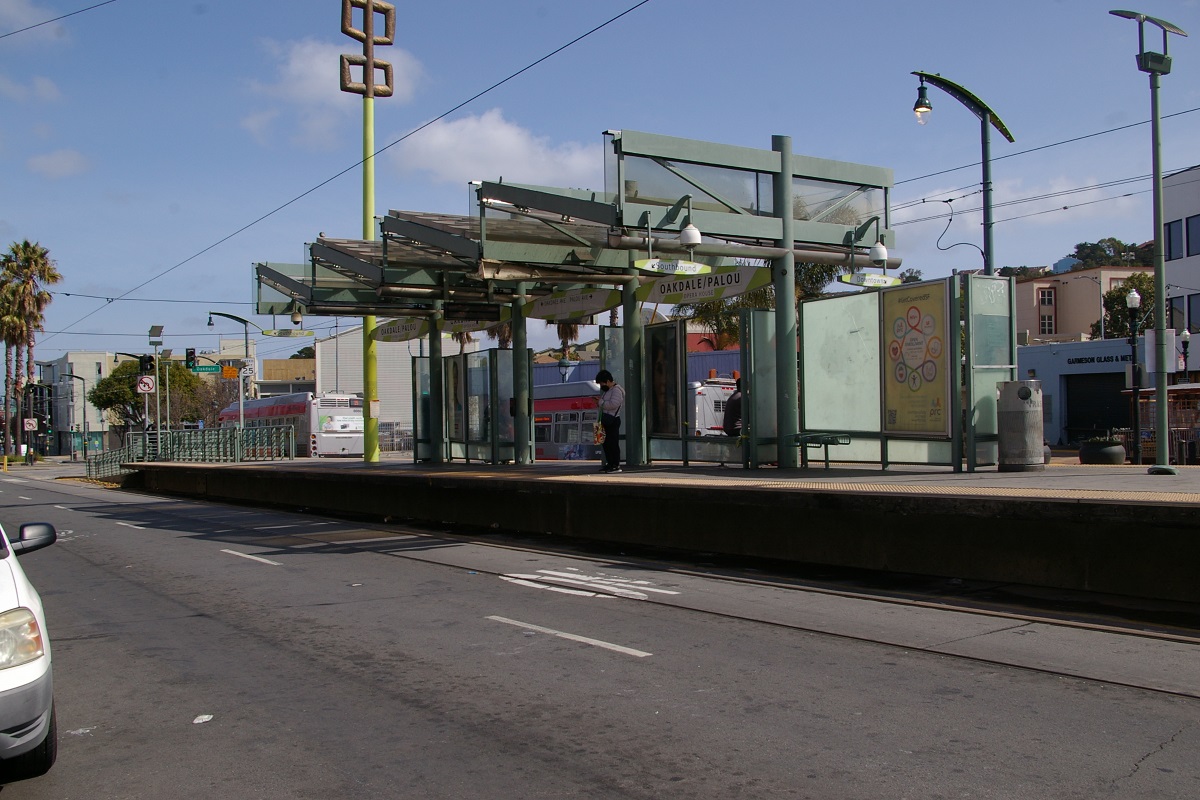
The next station is about 370 metres further south and has a similar look, located in the block between Oakdale Avenue and Palou Avenue. Called Oakdale/Palou in the area called Opera House, it is shown in the photo to the right.

viewed from the southbound side platform
the southbound platform in the foreground
The fourth station with this similar look is a little under 300 metres further south. Located in the block between Revere Avenue and Shafter Avenue, it is named Revere/Shafter, shown in the far right photo.
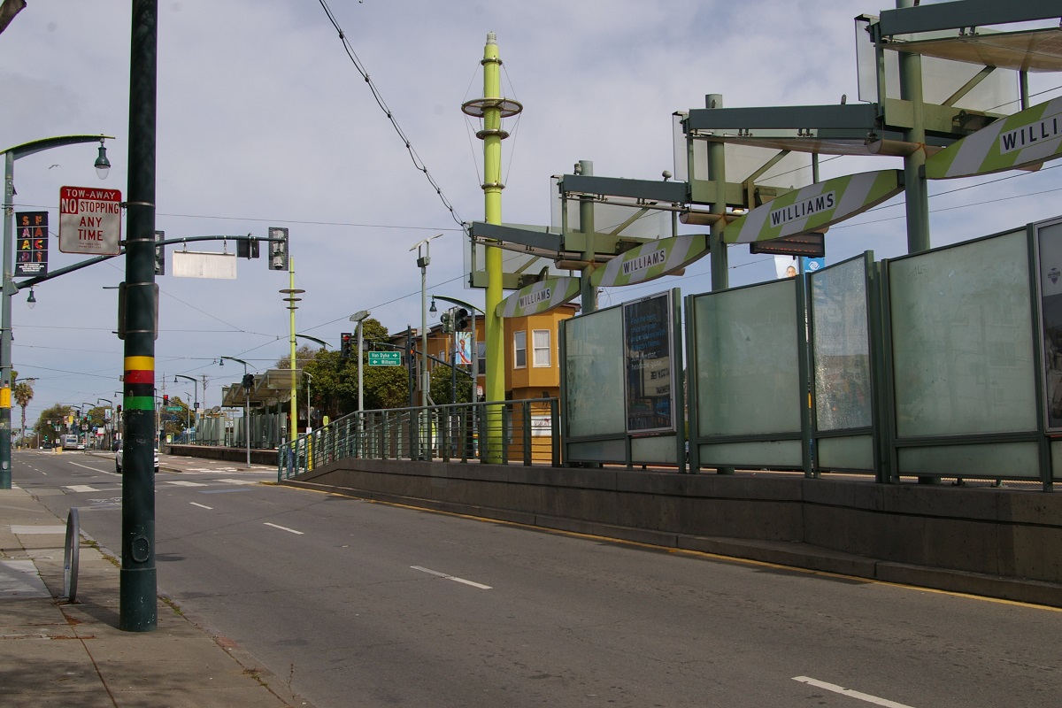
The next station is located at the intersection with Williams Avenue (to the west) and Van Dyke Avenue (to the east), called Williams shown in the near left photo.

the southbound platform in the foreground
southbound platform in the foreground
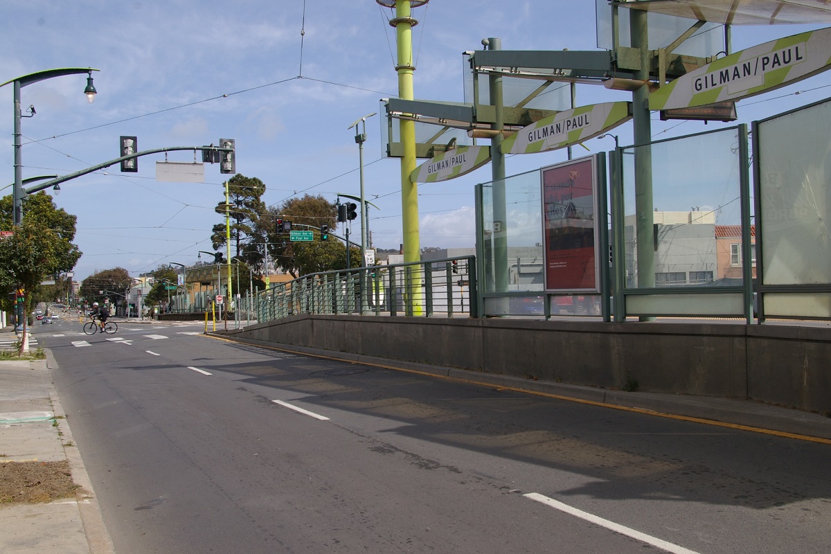
The next station, Carroll, is located about 450 metres further south at the intersection with Carroll Avenue, shown in the near right photo. Just over another 350 metres is the station shown in the far right photo, Gilman/Paul. This is a side platform station located at the intersection with Gilman Avenue (to the east) and Paul Avenue (to the west).
downtown platform on left, southbound on right
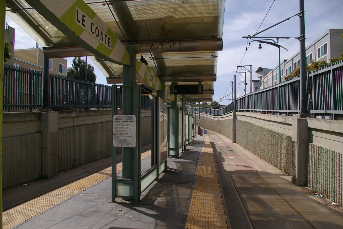
The next station is about 430 metres south, just south of the intersection with Le Conte Avenue. The station, named Le Conte is located where Third Street climbs in elevaion as it approaches US 101, shown in the photo to the left.

the downtown platform in the foreground
southbound platform in the foreground
After crossing over US 101, the line is in the median of Bayshore Boulevard and continues about 450 metres to the next Station at Arleta, in the area called Visitacion Valley. This centre-platform station is shown in the near right photo.
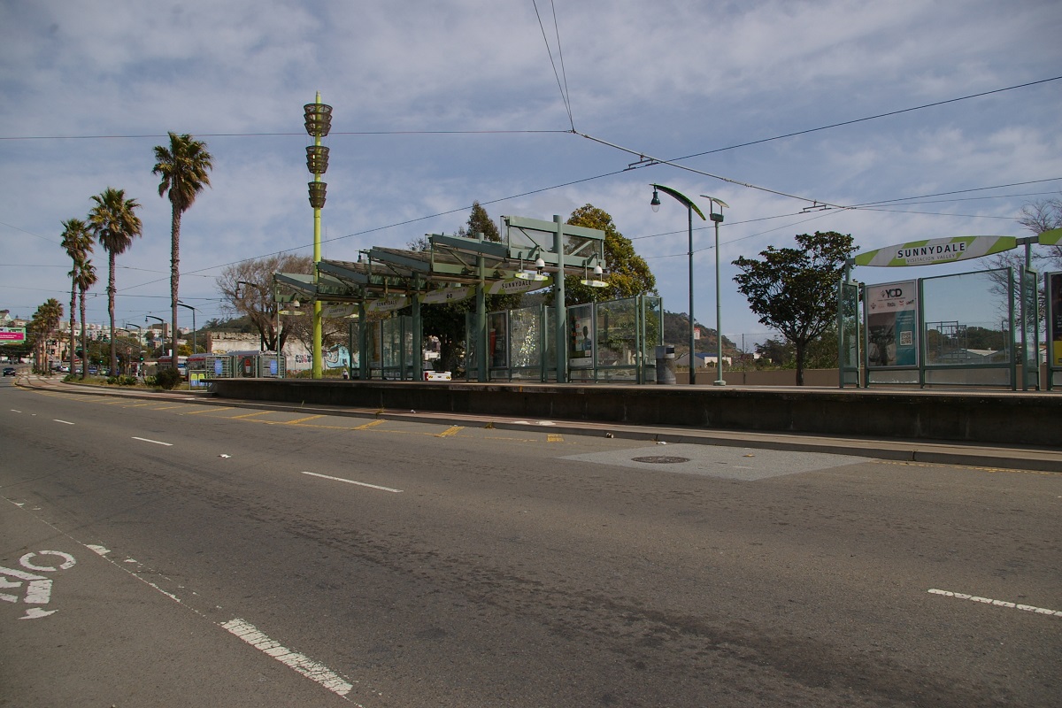
Continuing nearly 450 metres further, the line reaches its terminus at Sunnydale, shown in the far right photo. Arriving trains unload on the southbound platform, then pull past the station where it can be turned back to cross over to the side of the downtown platform.
Fares and Fare Collection
Cash fare on Muni is $3.00 and is good for 120 minutes of travel on LRVs, busses, trolley busses, and historic streetcars. Cable Cars have a separate fare that is $8.00 per ride.
The fare is only $2.50 when using the MuniMobile App, or when using the Clipper card (which is also used for BART fares).
At underground Muni Metro stations, fare collection involves using automated fare gates or entering at a collector's booth. At other locations, Muni uses all-door loading and Clipper cards are tagged (tapped) at a reader near the entrance door. Tagging after 8:30 pm provides unlimited travel until the end of service.
A 50 cent fare discount is provided when transferring from any connecting agency to Muni within specified time limits when using Clipper, including BART, AC Transit, Golden Gate Ferry and Transit, SamTrans, Caltrain, and WETA.
A Day Pass is available through MuniMobile for $5.00 that provides unlimited travel until the end of service for the day. Additionally, a Visitor Passport is available that provides unlimited travel including Cable Cars for $13 for a single day, $31 for three consecutive days, or $41 for seven consecutive days.
Fares for youth 18 and under are free.

Accessibility
All subway stations are fully accessible. All street platforms on the T Third line are also fully accessible
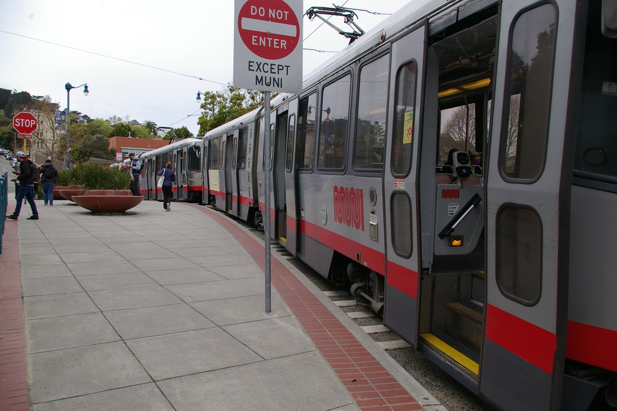
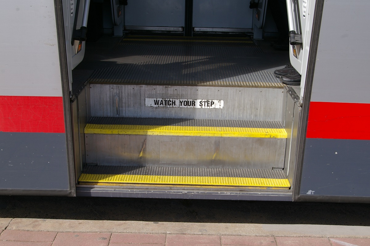
Only some stops have accessible ramps to provide accessible access, often with the ramp located away from the usual stopping location, requiring the train to make a separate stop to accomodate passengers needing the ramp.
LRVs have steps at each door that are raised for high platforms or lowered for street level stops as shown below.
 |
 |
 |
 |
| LRV3 with stairs lowered | LRV3 with stairs raised | LRV4 with stairs lowered | LRV4 with stairs raised |
Current and Planned Expansion
J - Church
In November 2019, the SFMTA announced the J Church Improvement Project, which will make preliminary changes to the line while funding is sought for the full Rapid project.
With the completion of the proposed but unfunded M Ocean View subway, the J Church would be re-routed to connect with the M Ocean View at a new four-track subway station at SF State. The J line would enter a new portal on 19th Avenue near Monticello Street with a subway tunnel following approximately the current M line alignment between Monticello Street and Holloway Avenue along 19th Avenue.
K - Ingleside
Future plans for the K line include an extension on Geneva Avenue from the Balboa Park station to Bayshore Boulevard, with a connection to the T Third Street line and a possible connection to the Bayshore Caltrain station in Brisbane. Additional plans include a subway with a portal entrance south of Saint Francis Circle on Junipero Serra Boulevard that connects to the existing Twin Peaks Tunnel. This plan would coincide with the construction of the M Ocean View subway project.
L - Taraval
L Taraval Improvement Project construction began in August 2019, beginning with the replacement of underground utilities. Construction on the segment of the project between Sunset Boulevard and 46th Avenue began in September 2019 and was completed July 2021. Bus substitution was scheduled to start for train service covering a superset of the segment from the Zoo to Sunset in Spring 2020. Bus substitution for both segments of the L Taraval Improvement Project, from the Zoo to West Portal, was implemented following the onset of the COVID-19 pandemic and continued after the completion of the first segment. As part of the first segment work, the original spur track extending west on Taraval past 46th was taken up and replaced. The granite "Belgian block" cobblestones used to buffer the track from the pavement were saved and re-set next to the new tracks. Construction on the second segment, from Sunset Boulevard to Ulloa St near West Portal, was delayed until January 2022. The second segment work is expected to last through 2024.
M - Ocean View
A full-subway option is being looked into for development and named the Muni Subway Expansion Project (MSXP). Under the preliminary concept for MSXP, the rail line would remain underground past West Portal station. K Ingleside would branch off from the underground line and surface on Junipero Serra Boulevard just south of Saint Francis Circle. M Ocean View will remain underground along the current right of way under West Portal Avenue and 19th Avenue, branching off at Holloway to Parkmerced. The underground line would continue with J Church service along 19th until surfacing just east of the intersection of 19th and Junipero Serra, then continuing on to Balboa Park via Randolph, Broad, and San Jose.
The current West Portal station will most likely have to be redesigned as a two-level station with the J/K/M lines on the lower level and the L line on the upper level. New underground stations would be constructed at Saint Francis Circle (J/K/M lines), Winston Drive (J/M, serving Stonestown), Holloway (J/M, serving SF State), and Parkmerced (M). A potential infill station could be constructed at Ocean Avenue in Lakeside Village. Several existing surface stations would be removed; in most cases, they would be replaced by underground stations except for the Ocean View, Merced Heights, and Ingleside stop near Junipero Serra and 19th.
The proposed full subway line would continue past Parkmerced with a long tail track; that tail track may be extended in the future to connect to the Daly City BART station via the M line.
N - Judah
Future plans, according to the SFMTA Rail Capacity Strategy, include a new subway tunnel which connects to the Market Street subway to 9th Avenue. Additionally, the N Judah line will be rebuilt to run three car trains. Further plans include a non-revenue L Taraval to N Judah connector, which may run on 46th Avenue.

T - Third Street
The current T Third route its first phase. The second phase, currently under construction, is also known as the Central Subway project, and will reroute T-Third north of the 4th and King Station.
The southern segment from Sunnydale to 4th and King Street will remain as-is, operating on street-level tracks in the median of Third Street and Bayshore Boulevard. After 4th and King, the line will cross King Street instead of turning onto it, and proceed to a new 4th and Brannan Station, shown in the photo to the immediate right. Three blocks north, the line then burrows to subsurface level at Bryant Street Portal, near where 4th passes under Interstate 80, shown in the photo to the far right.
The plan for opening is to open the Central Subway intially as a shuttle service from Chinatown-Rose Pak to 4th and Brannan on November 19, 2022 on weekends only. In the new year, full service will extend to Sunnydale as the T route as described below.
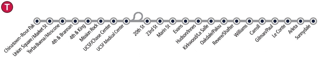
Route Line Diagram with Central Subway
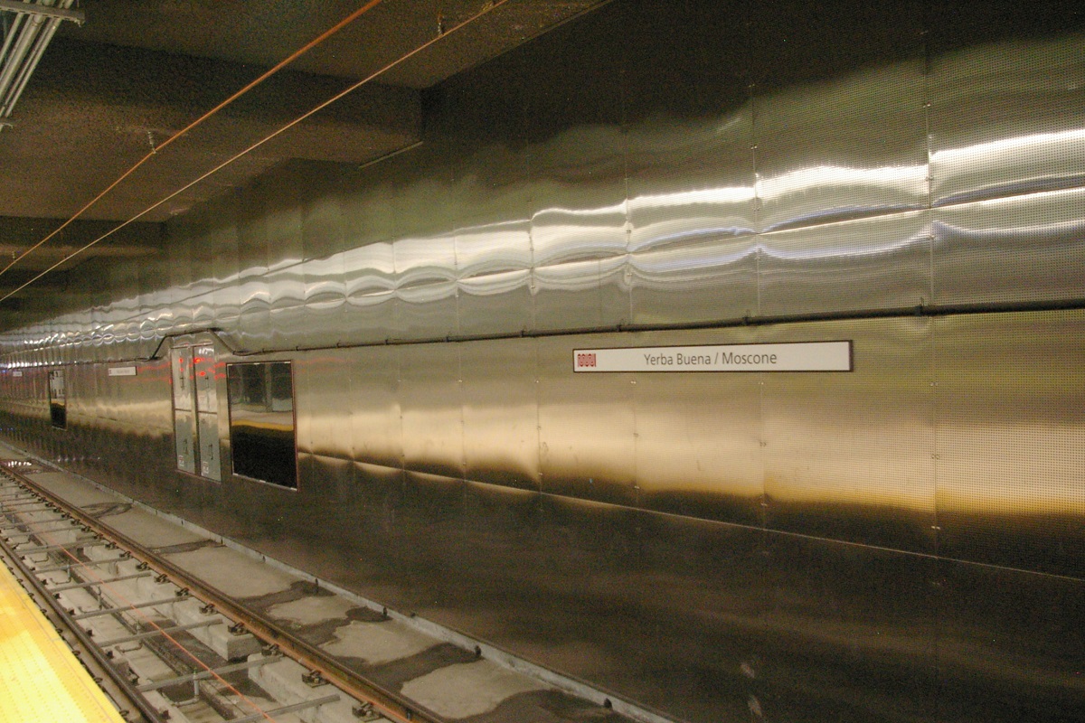
The tunnel continues under Fourth Street, to Yerba Buena/Moscone Station, as seen in the photo to the left.

In the northbound tunnel approaching Union Square/Market Station
|

Southbound track at Union Square/Market Station
|
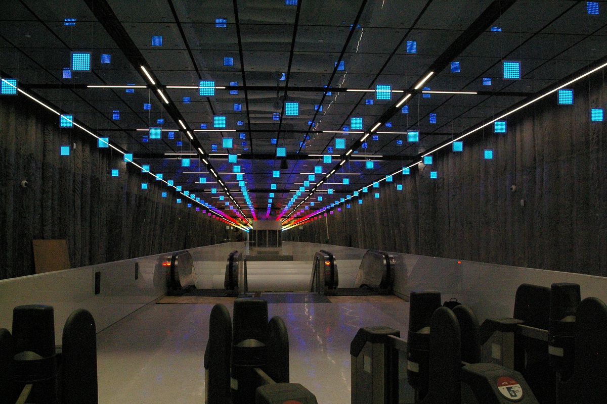
Mezanine at Union Square/Market Station
|
Continuing further north, after crossing Market Street, the line turns slightly to continue under Stockton Street to reach Union Square/Market Station, where a transfer with the Market Street subway MUNI or BART lines may be made.


Continuing north from Union Square/Market Station, the line runs underneath Stockton Street and terminates at Chinatown-Rose Pak Station. A double crossover exists south of Chinatown-Rose Pak Station, and each track has a tail track north of the station with enough room for a pair of two-car trains.

In preparation for the next phase, the tunnels were bored past Chinatown Station, and the tunnel boring machines were extracted from the intersection of Powell and Columbus, near Washington Square. This is about 500 metres beyond the end of track, though there is no access into the tunnel beyond the end of track, as seen in the photo to the right.
The Mission Bay Loop project added a short turn loop using 18th Street, Illinois Street, and 19th Street, was constructed to supplement the Central Subway operations. The loop was originally designed in 1998 as part of the Third Street Light Rail project, but was deferred. Construction started in July 2016, and was completed in 2019. When the Central Subway is complete, Muni intends to split the T Third service into short-line and long-line services.
It is expected that the short-line service would run from Chinatown station to the Mission Bay Loop with 4-minute headways, while the long-line service would run the full route from Chinatown to Sunnydale station at 7.5-minute headways.
A proposed third phase would build an extension beyond Chinatown, including new stations at Washington Square in North Beach and Fisherman's Wharf. Multiple options are being studied for third and a fourth phases.