This page was last updated May 8, 2012
Send questions, comments, and photos here.

LRT in
Denver


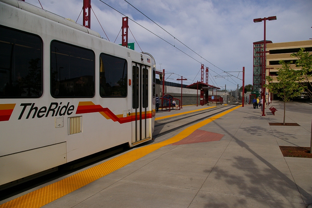
The transit system in Denver is operated by The Regional Transportation District (RTD), also known as "The Ride". RTD operates buses, a Light Rail system, and an airport bus service known as skyRide. Construction is underway to also provide some heavy rail commuter lines to their operation.
Contents
Toronto Comparison
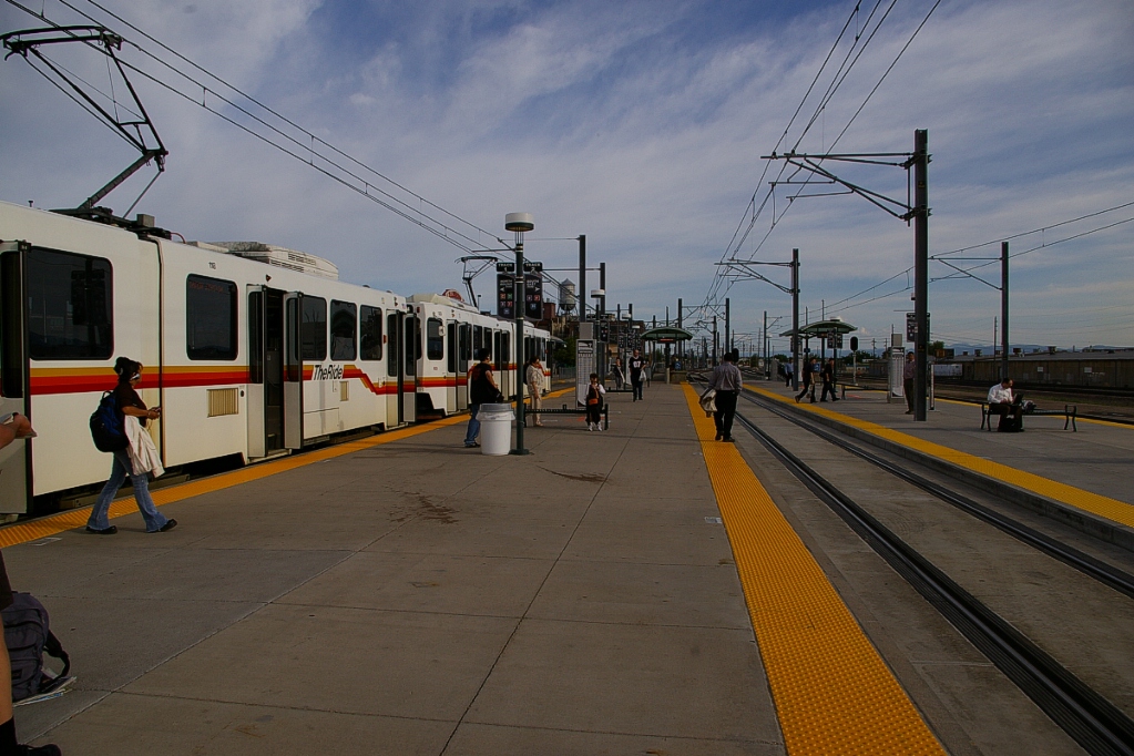
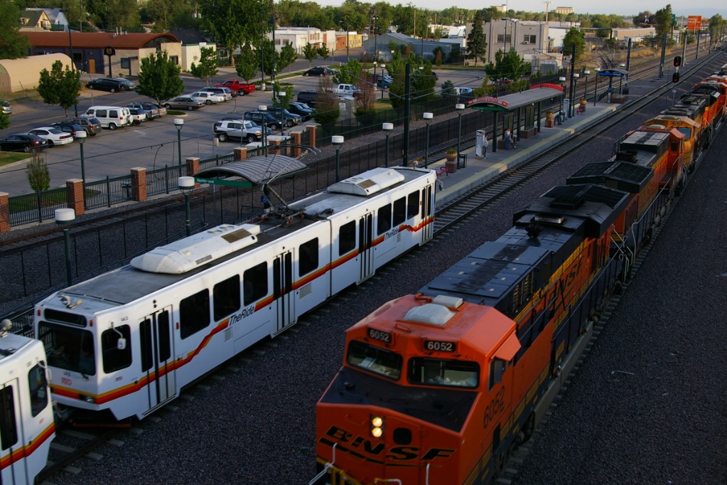
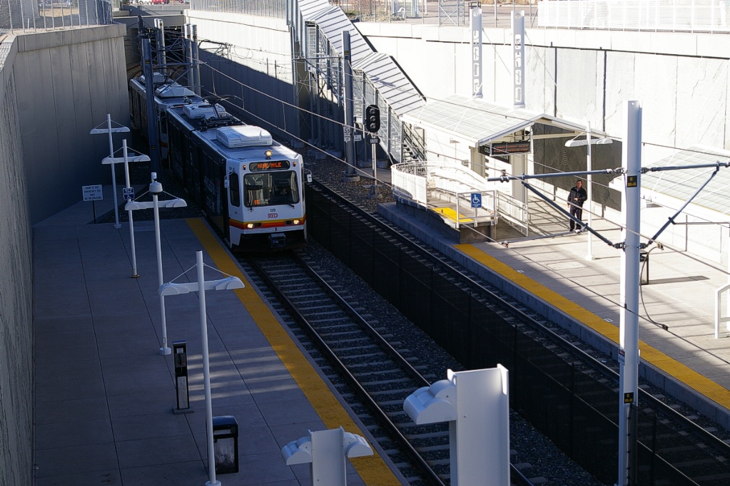
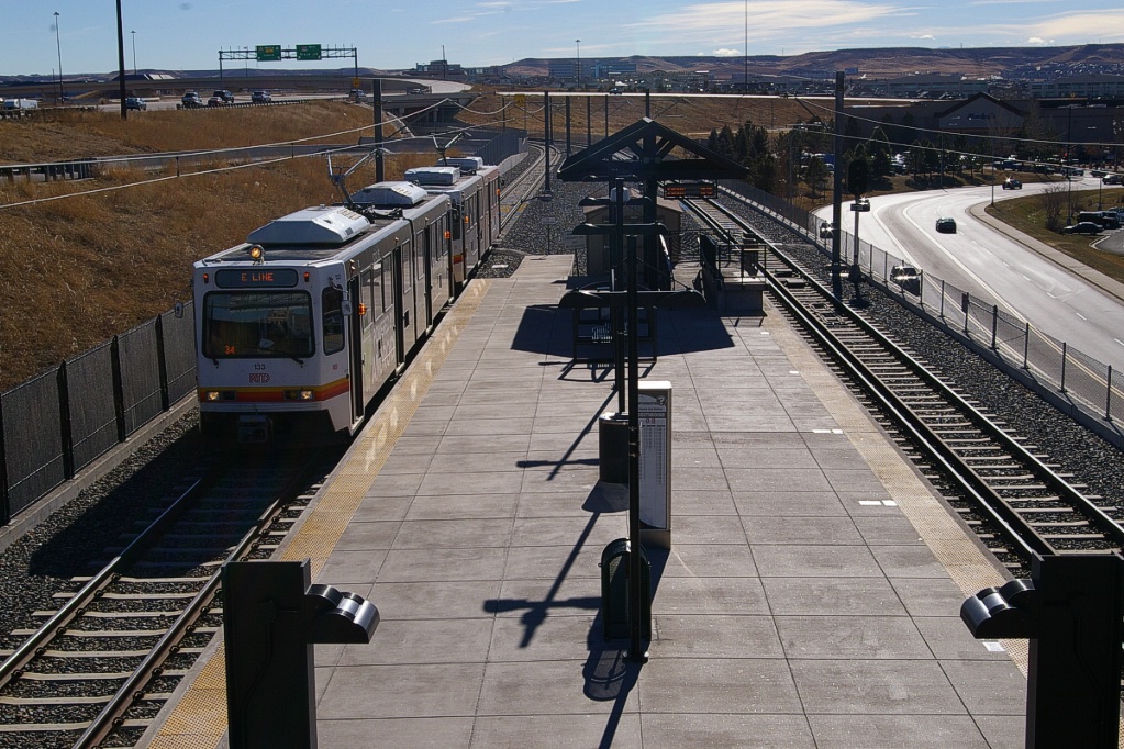
RTD Light Rail predates low floor technology, so it uses high floor vehicles with steps to a low loading platform. Wheelchair/stroller access has been provided by a high-level platform and bridge located at the front of the train behind the operator's cab. RTD Light Rail does provide a good example of some ways that the right of way can be implemented:
- fenced-in surface right of way and elevated sections
- downtown streets in reserved lanes
- ROW parallelling railway ROW and expressways
Additionally, RTD Light Rail is an excellent example of interlining that provides a higher frequency of service and multiple destination choices for the majority of its riders.
System Highlights and Route Details
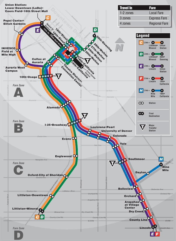
Item Notes Number of lines 5 (various lines are inter-lined with each other) Total length 55.9 km Total stations 36 Right of way Southwest: dedicated, parallel to railway
Southeast: dedicated parallel to expressway
I-255: dedicated in expressway median
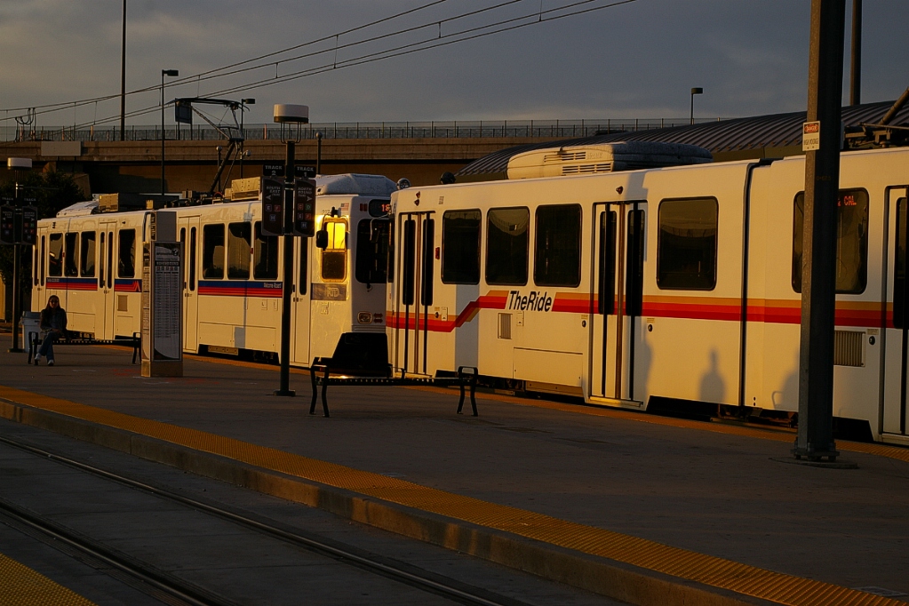
Downtown: on-street in separate curb laneLoading Low level platform, cars have steps
Platform 20 cm above trackFleet 49 Siemens SD-100
76 Siemens SD-160 (47 more on order)
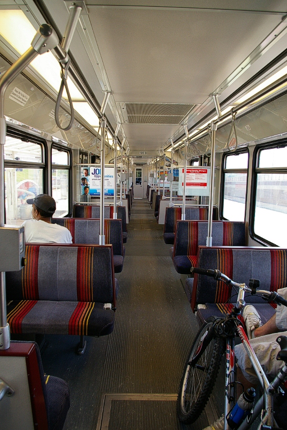
90 km/h top speedSD-100 details Seats 64 - room for 121 standees
24.4 m long - high floor 91.4 cm above rail
4 double folding doors per side, 1.3 m wideSD-160 details Seats 60 - room for 121 standees
24.4 m long - high floor 91.4 cm above rail
4 double sliding/plug doors per side,
1.3 m wideFare collection Self service, barrier free, proof of payment Fare integration Single ride LRT tickets may be used to board a bus at a station Airport service No direct service - RTD operates skyRide bus service from several Light Rail stations
| C-Line | |
| Length | 20.8 km (approximately) |
|---|---|
| Stations | 12 4 stations shared with E-Line 3 stations shared with D-, E-, F-, and H-Lines 5 stations shared with D-Line |
| Right of way | Entire line parallels railway right of way Some elevated sections |
| Service frequency | 30 minute all day (starting about 5 am) Last trips: north about 7 pm; south about 9 pm |
| Opening | April 5, 2002 |
| D-Line | |
| Length | 24.4 km |
|---|---|
| Stations |
19 (4 downtown stations on one-way streets) |
| Right of way | Exclusive lanes and off-street downtown LRT is opposite traffic flow on one-way streets South of downtown, parallel to railway with some elevated sections |
| Service frequency | 15 minutes most of the day, all days 30 minutes late/early (4-5 am, 11:30 pm-2:00 am) |
| Opening | October 8, 1994 Original 8.5 km 30th-Downing to I-25-Broadway July 14, 2000 13.9 km south to Littleton-Mineral December 6,2004 Convention Center-Performing Arts station opened replacing 14th-Stout and 14th-California stations Station renamed Theatre District-Convention Center in 2009 |
| E-Line | |
| Length | 31.9 km |
|---|---|
| Stations | 18 4 stations are shared with C-Line 3 stations are shared with C-, D-, F-, and H-Lines 5 stations are shared with F- and H-Lines 6 stations are shared with F-Line |
| Right of way | North of I-25-Broadway: Parallel to railway at
grade
South of I-25-Broadway: Parallel to expressway at grade, elevated, and in cut |
| Service frequency | 30 minute weekdays no service between 9:30 am and 3:30 pm 15 minute weekday evenings (7:30 - 10:30 pm) 15 minutes on weekends 30 minutes early mornings/late evenings |
| Opening | November 17, 2006 |
| F-Line | |
| Length | 31.9 km |
|---|---|
| Stations | 20 6 stations are shared with D- and H-Lines 3 stations are shared with C-, D-, E-, and H-Lines 5 stations are shared with E- and H-Lines 6 stations are shared with E-Line |
| Right of way |
Exclusive lanes and off-street downtown |
| Service frequency | 15 minute service all day (4:30 am to 9:30 pm) No weekend/holiday service |
| Opening | November 17, 2006 |
| H-Line | |
| Length | 22.6 km |
|---|---|
| Stations | 16 6 stations are shared with D- and F-Lines 3 stations are shared with C-, D-, E-, and F-Lines 5 stations are shared with E- and F-Lines |
| Right of way |
Exclusive lanes and off-street downtown |
| Service frequency | 15 minute service all day (4:30 am to 9:30 pm) 30 minute service early mornings Sundays and holidays |
| Opening | November 17, 2006 |
| G-Line - Currently Discontinued | |
| Length | 20.5 km (Nine Mile to Lincoln) |
|---|---|
| Stations | 8 2 stations are shared with H-Line 6 stations are shared with E- and F-Lines |
| Right of way | Expressway median Nine Mile to Belleview Parallel to expressway at grade, elevated, and in cut south of Belleview |
| Service frequency | 30 minute service (5 am - 11 pm) |
| Opening | November 17, 2006 |
| Discontinued | May 3, 2009 - to be reinstated with completion of FasTracks I-225 |
Ride Descriptions
Due to interlining, providing a description of a trip on each line would repeat many portions. The descriptions will be broken up into corridors:
| Corridor | Notes | Opened |
|---|---|---|
| Central Corridor | The original line from 30th-Downing to I-25-Broadway | October 8, 1994 |
| Southwest Corridor | The extension from I-25-Broadway to Littleton-Mineral | July 14, 2000 |
| Central Platt Valley Spur | The branch off the Central Corridor between Colfax at Auria and 10th-Osage | April 5, 2002 |
| Southeast Corridor | The extension from I-25-Broadway to Lincoln | November 17, 2006 |
| I-225 Corridor | The branch off the Southeast Corridor in the median of I-225 to Nine Mile | November 17, 2006 |
Central Corridor
The trip from 30th-Downing to I-25-Broadway (8.5 km) takes approximately 23 minutes. Only the D-Line route travels this entire corridor. All lines travel on this corridor between 10th-Osage and I-25-Broadway, while the F- and H-Lines use it as far north as the downtown loop on California and Stout.
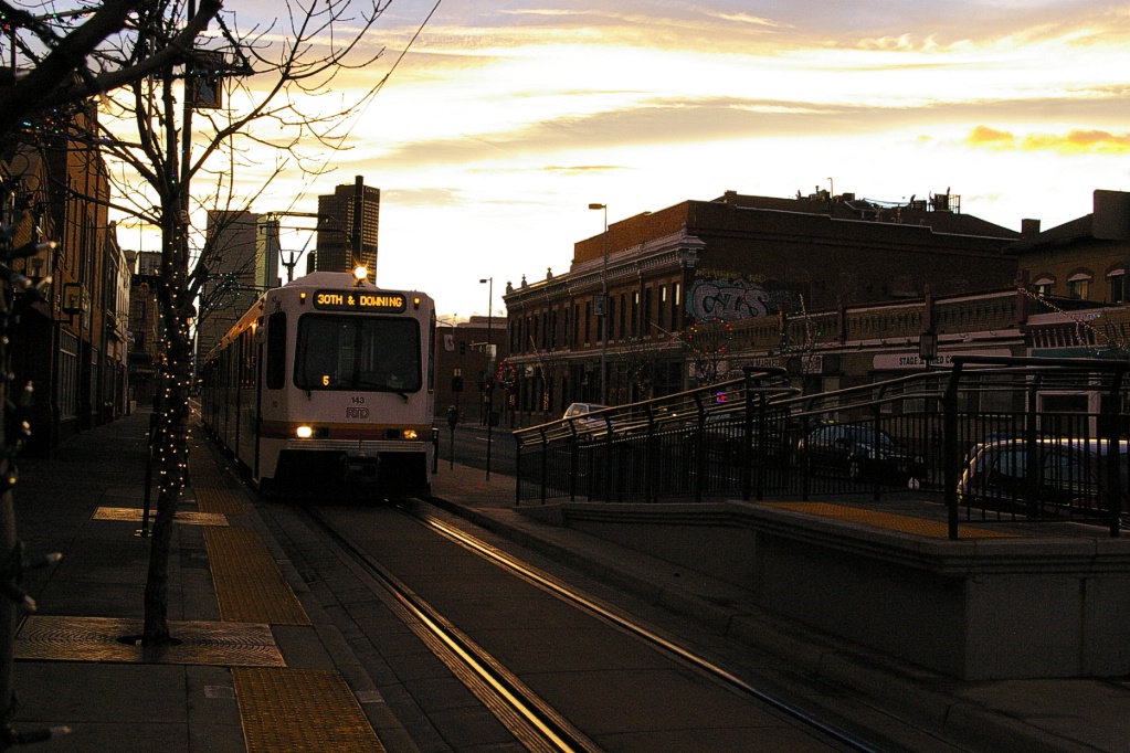
The trip starts at 30th-Downing with a stub-end station with side platforms. The west platform is shared by buses and the east platform is a street sidewalk. This station has parking for 27 vehicles, and bike rack space for 10 and bike lockers for 8.During most of the day, LRT departures from 30th-Downing are scheduled to be shortly after the next LRT arrives. When a train departs 30th-Downing, it curves to the right to head down Welton Street in reserved lanes. Within a block, the two tracks merge into a single track where it travels in the reserved east lane of Welton Street.
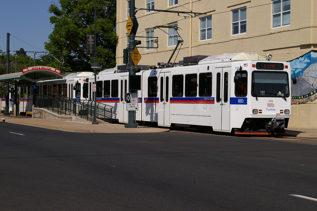
Along the single-track section on Welton Street, there are three stops. The first is 29th-Welton which has a sheltered platform on the west side of the track (between the track and the traffic on Welton).
The next stop is 27th-Welton, which is perhaps the most frugal station on the entire system. There is a platform on the west side of the track, but it is only used for accessible entry and has no shelter.
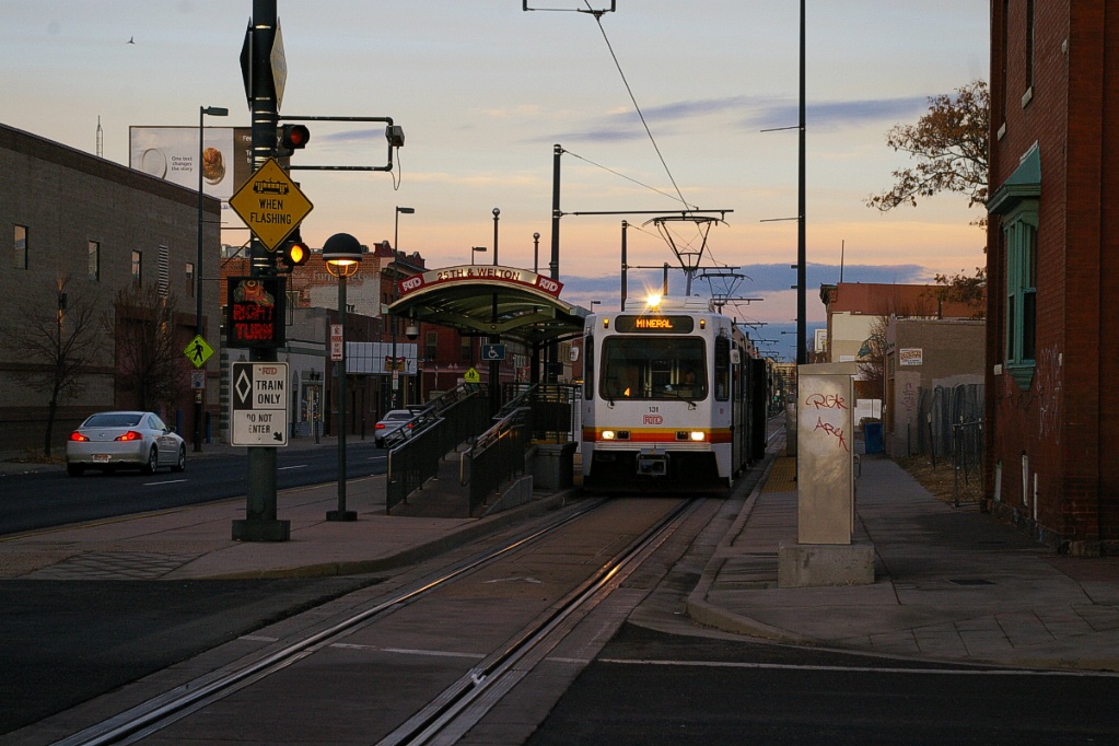
The last of the single-track stops is 25th-Welton and has a similar design as the 29th-Welton stop. South of this station, at 24th Street, the track splits back into two tracks.
The next station, 20th-Welton has a centre island platform. Between this station and Theatre District-Convention Center, the line splits with opposite directions one block apart from each other.
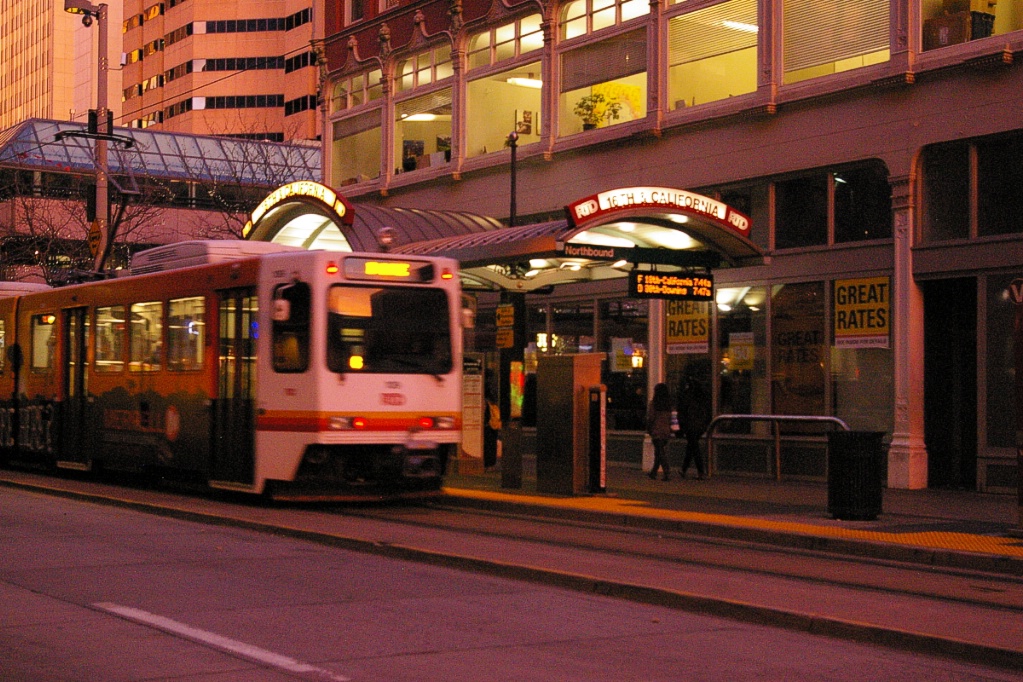
Southbound trains use the west lane of Stout (this street is one-way northbound for traffic), and northbound trains use the east lane of California (this street is one-way southbound for traffic).
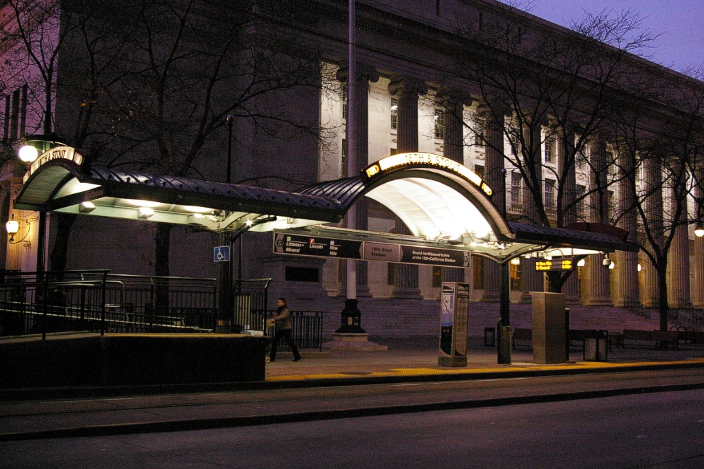
There are two stops on each of these streets. The north-most pair is at 18th Street: 18th-California and 18th-Stout.
The next pair to the south are at 16th Street, 16th-California and 16th-Stout. All of these four stations use the sidewalk to the right of the train for loading and unloading.
Between intersections, the track is raised slightly above the road surface. Trains use signals at intersections that display white horizontal bar (stop) and vertical bar (proceed) aspects. These separate signal aspects prevent confusion with motorists' red-yellow-green aspects. The design of having LRTs running opposite to one-way traffic was chosen as studies have shown that it increases safety by making motorists more aware of LRT movements.
Only the D-Line travels as far north as 30th-Downing. The F- and H-Lines share the downtown one-way street loop with the D-Line.
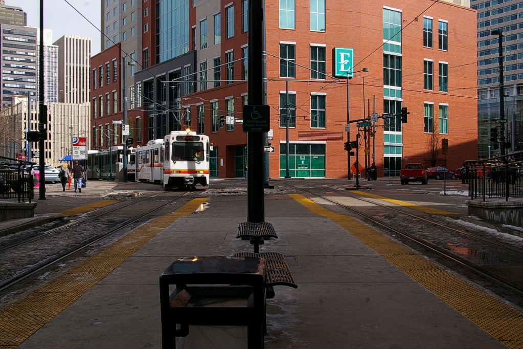
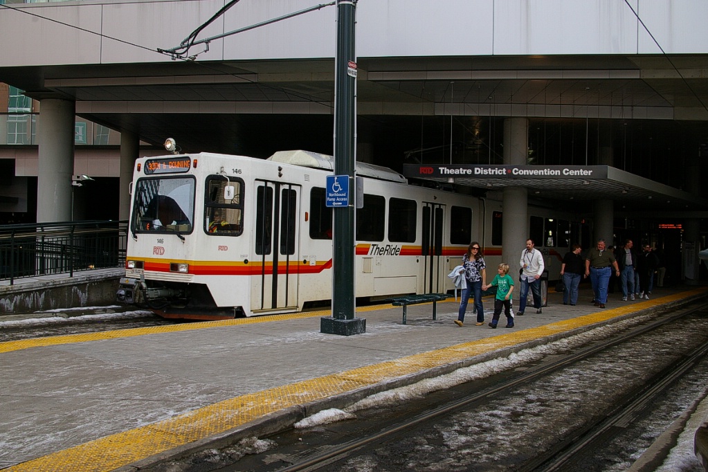
Originally, Stout and California each had a third LRT stop at 14th Avenue. In the early 2000s, the Convention Center was built over the off-street right of way of the LRT, and a new station replacing those two openend on December 6, 2004. Originally named Convention Center-Performing Arts, this station is covered by the convention center building and was renamed Theatre District-Convention Center in 2009. This station has a centre island platform plus a west side platform, so southbound trains open both doors. There is an east side platform that is normally not used, but it has the accessible ramp for northbound trains.
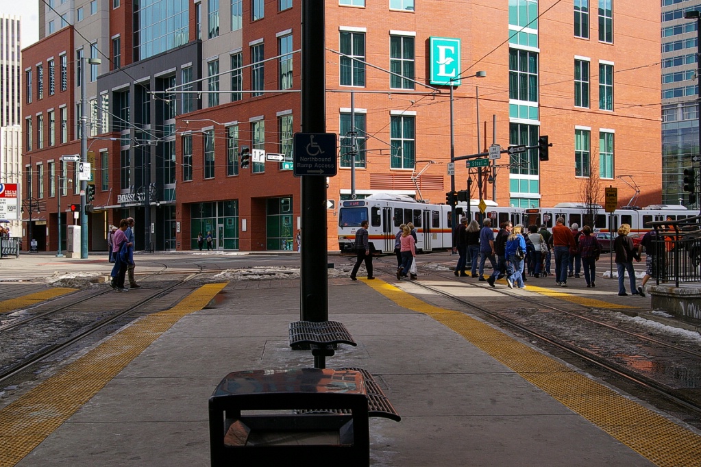  Looking north from Theatre District-Convention Center station: Left image shows a northbound H-Line departing heading along 14th St. Right image shows a southbound D-Line arriving from Stout St. |
  View from north end of Theatre District-Convention Center station: Left image: Northbound D-Line arriving. Right image: Platform on the left of northbound track is only used for ramp access. |
From here, LRTs run on a right of way that is on the north side of Colfax Avenue, stopping at Colfax at Auraria Station which has side platforms. The LRT right of way remains at grade as Colfax Avenue climbs to a bridge over the South Platte River, a railway right of way, and I-25. As the LRT curves to the south, there is a full wye connection with the Central Platte Valley spur used by the C- and E-Lines. Tracks exist for connection from downtown to the spur, but are not used for revenue service.
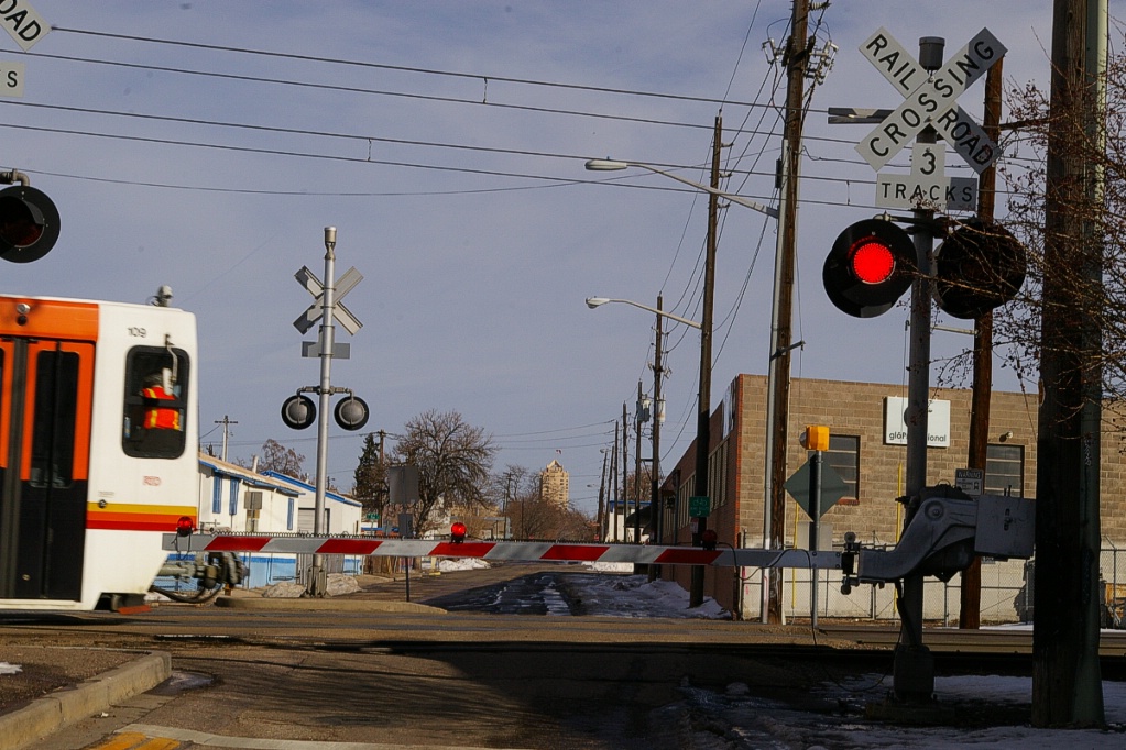
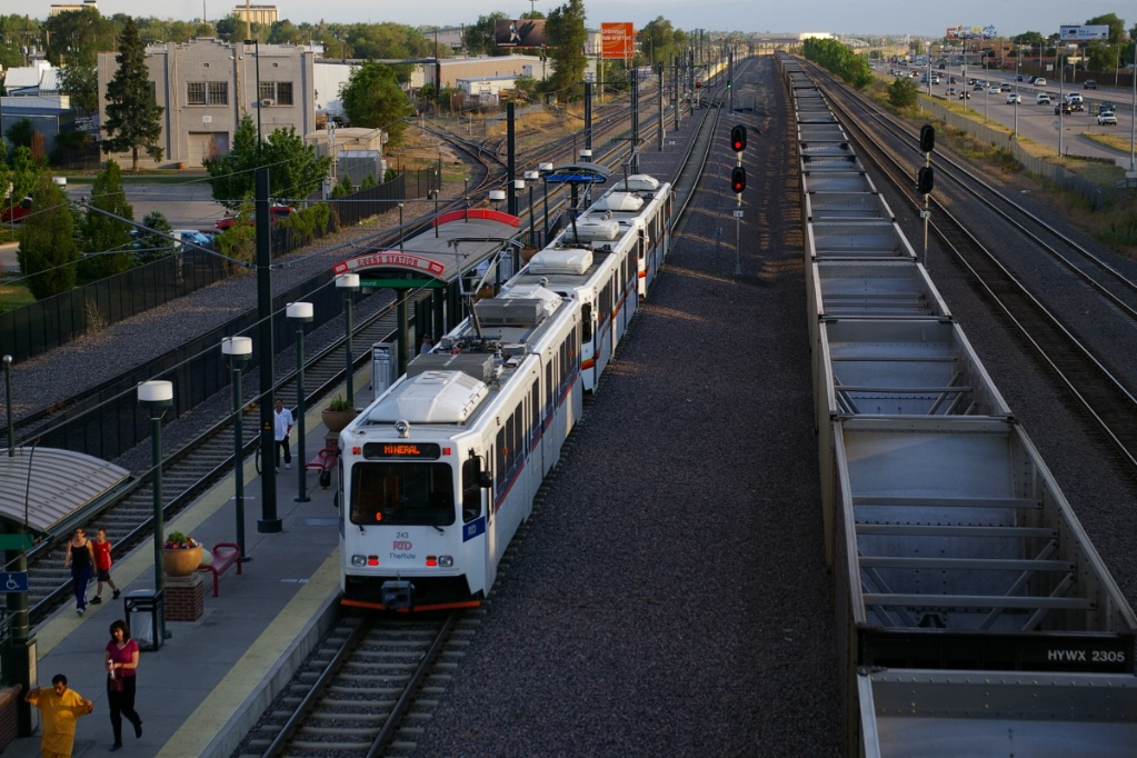
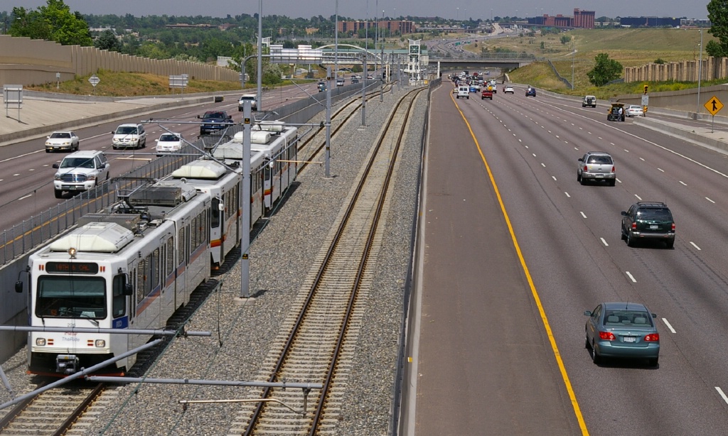
From here, the D-Line is parallel to a railway right of way. At this point, the railway right of way is on the west side of the LRT right of way. In the few places where roads cross at grade, a single set of railway crossing signals and gates are provided for both the LRT and the railway.
  Two images from the west side of the crossing at Bayaud Avenue. |
The first station along this part of the route is 10th-Osage which has a centre and east side platform - northbound trains open both sides. This is the northern-most station shared by five lines.
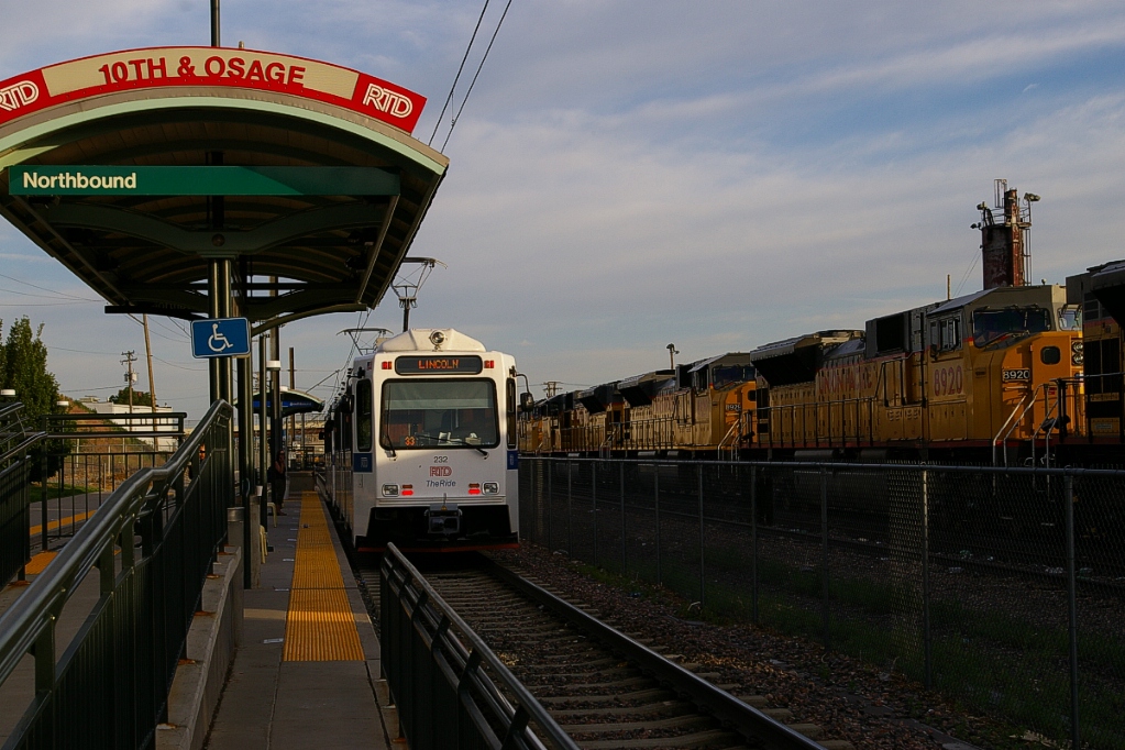
Southbound E-Line at 10th-Osage.
|
E-Line trains at 10th-Osage.
|
Continuing south from 10th-Osage, the line moves slightly east and climbs a flyover to take it over W 3rd Avenue, Kalamath Street, W 1st Avenue, and Santa Fe Drive. This flyover is almost a kilometre in length.
The next station is Alemeda and it has the same platform arrangement as 10th-Osage with a centre platform and an east-side platform. This station has parking for 302 vehicles, and bike rack space for 12 and lockers for another 8.
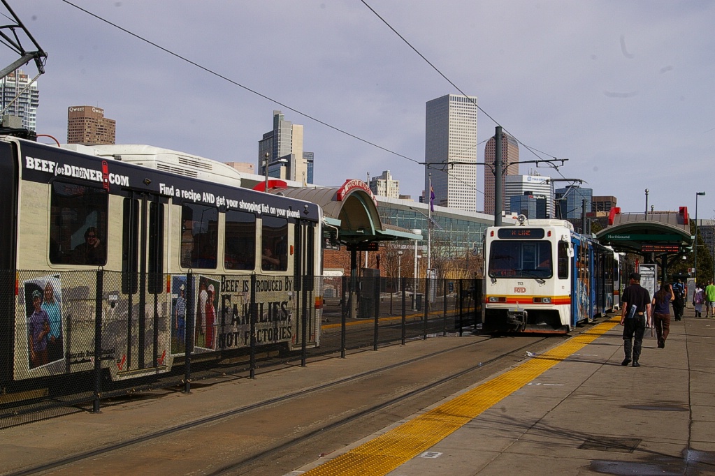
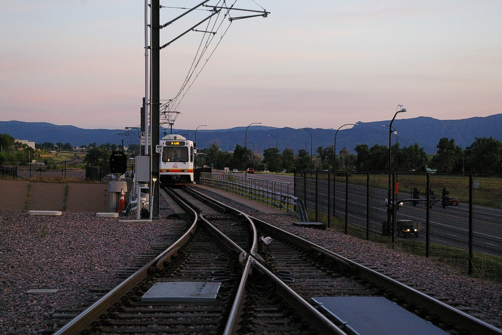
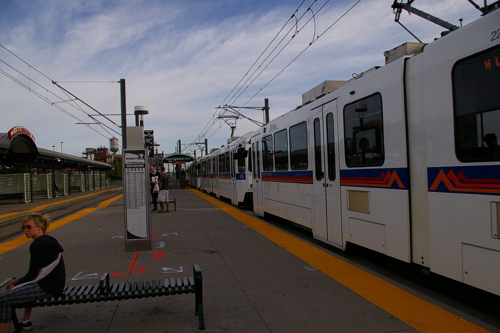
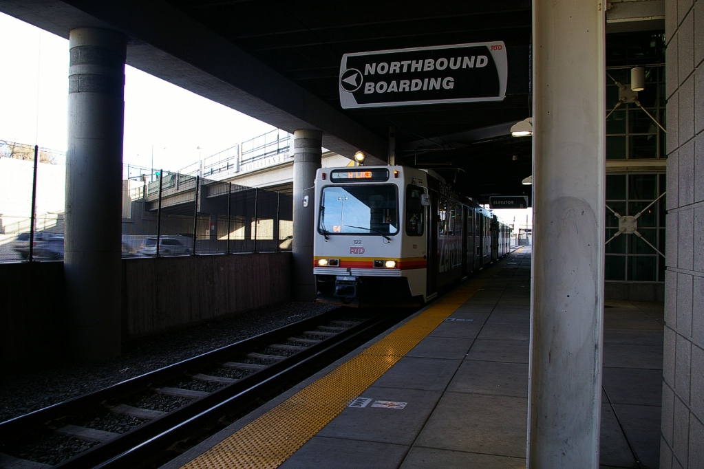
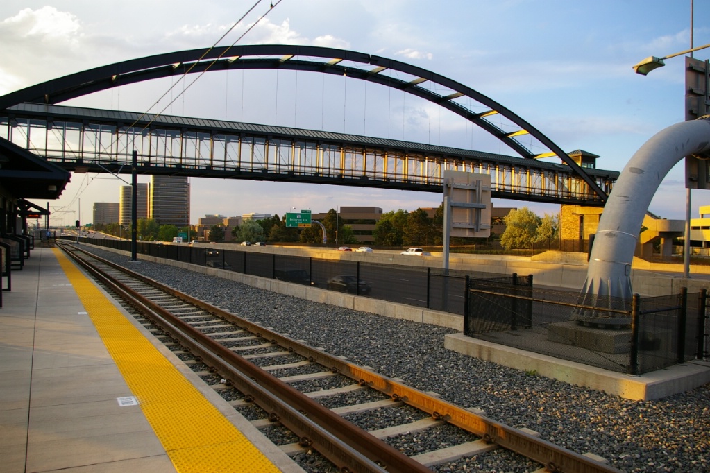
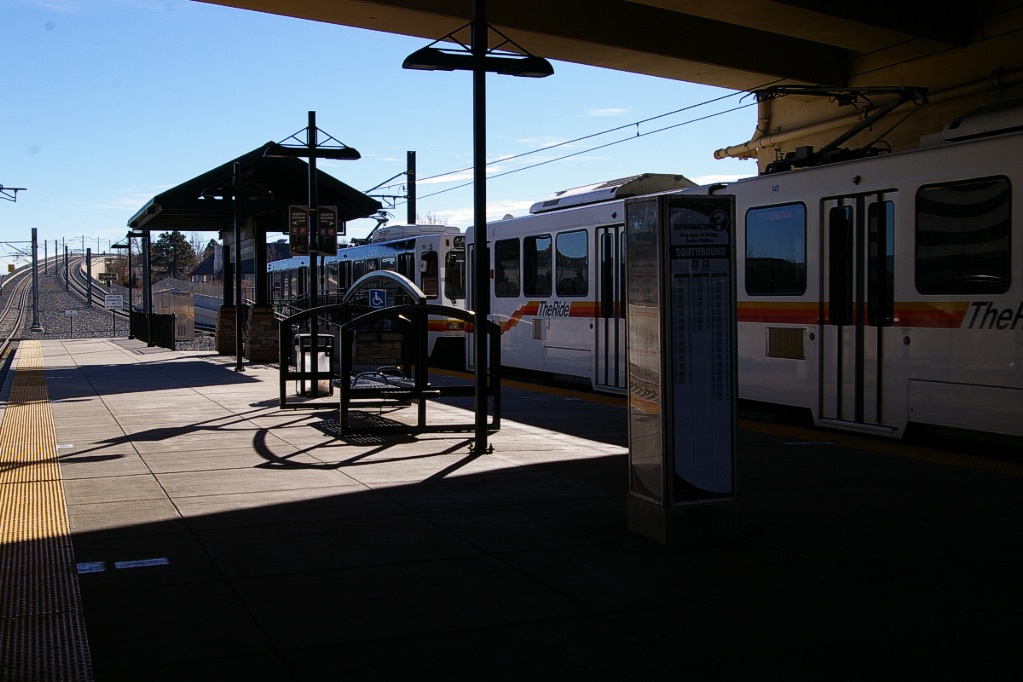
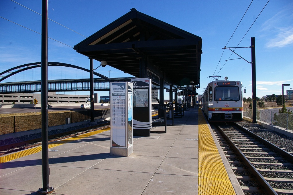
The next station, I-25-Broadway, is the southern-most station shared by five lines, and was the original southern terminal in 1994. To accommodate the split between the southeast and southwest corridors, the southbound track branches into two tracks just north of the station.
is on track 1.
The I-25-Broadway station has three tracks, two island platforms, and one platform on the east side of track 1. Track 1 is for all northbound trains, track 2 is for the southeast lines (E-, F-, and H-Lines) and track 3 is for the southwest lines (C- and D-Lines). This station has parking for 1248 vehicles, and bike rack space for 18 and bike lockers for 30.
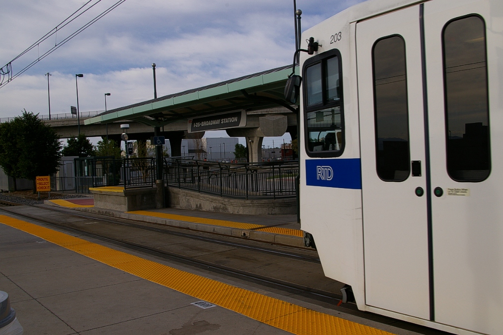
A northbound F-Line train arrives at I-25-Broadway approaching the
wheelchair/stroller platform where the front door will be spotted.
|
Southwest Corridor
The C- and D-Lines continue to the southwest, branching just south of I-25-Broadway station. This junction has a full wye connection including connecting tracks between the Southwest and Southeast branches that are not used in revenue service. The right of way continues to follow the railway to its west side with some occasional short elevated sections. The trip from I-25-Broadway to Littleton-Mineral (13.98 km) takes approximately 16 minutes.
The next stop is Evans which has an island platform. At this location, there is one railway track on the east side of the LRT that serves a few industries. The pedestrian exit of the Evans station crosses this track with signals and gates. This station has parking for 99 vehicles, and bike rack space for 10 and lockers for 8.
   Evans station. |
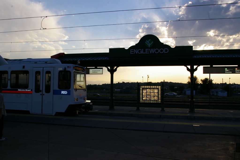
The next station is Englewood. It has an island platform and an east side platform, so northbound trains usually open doors on both sides. This station has parking for 910 vehicles, and bike rack space for 24 and bike lockers for 32.
The following station is Oxford-City of Sheridan, with a single island platform.
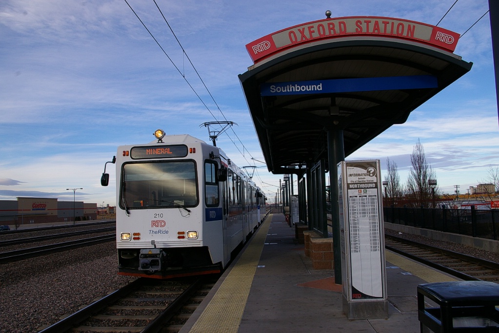
Oxford-City of Sheridan and Littleton-Downtown.
Continuing south, the LRT right of way shifts from the east side of the railway to the west side about half way to the next station. The line climbs a flyover to accomplish this.
At Littleton-Downtown, there is an island platform and a west side platform allowing southbound trains to open both doors. This station has parking for 361 vehicles (261 at the station, and 100 south of Powers on Rio Grande), bike rack space for 28 and bike lockers for 12.
This part of the line is built along a railway corridor that has its tracks immediately to the east of the LRT line. Both the LRT and railway lines are in a cutting, but the railway line is slightly deeper than LRT line, creating a vertical separation between the two.
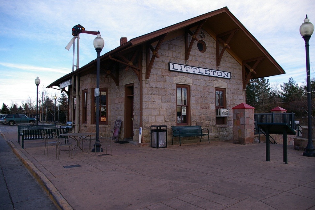
The original Littleton D&RGW depot, originally built in 1875, is now located at the site of this station. This building remained in its original location until 1984 when it was relocated to Crestline Avenue and Rio Grande Street and renovated. In 1998 it was moved to its current location for use at the new light rail station.
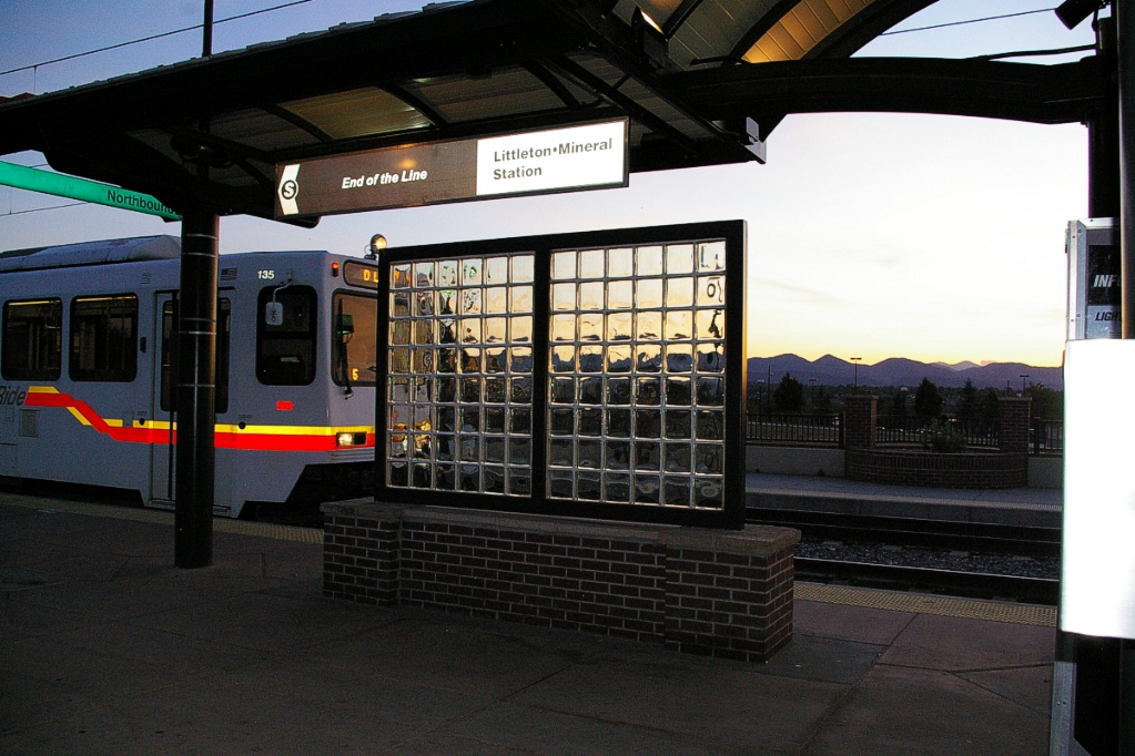
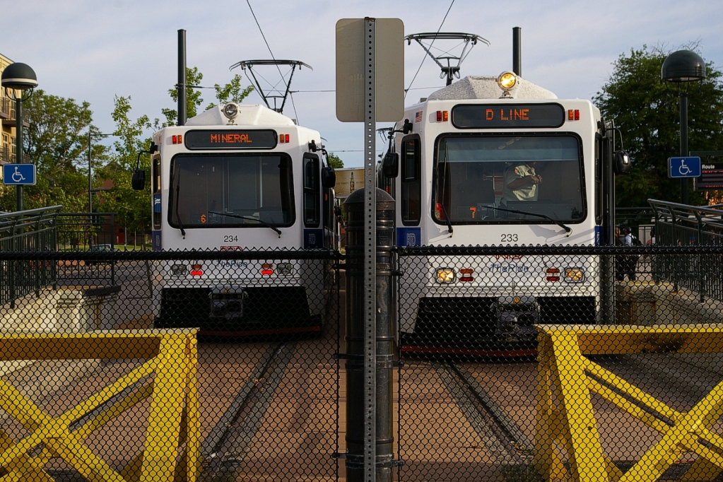
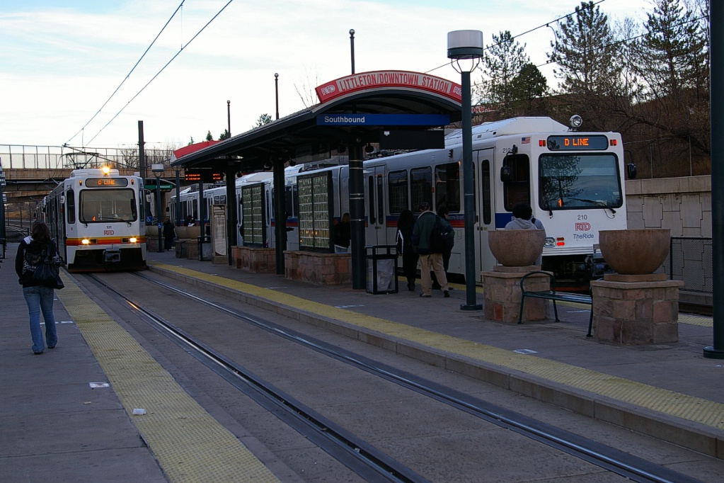
The final station on the line is Littleton-Mineral. This station has side platforms. Southbound arrivals unload on the west track, then pull beyond the station to change directions and return on the east track.
The two tracks merge into a single track south of the station to cross over Mineral on a single track bridge. The single track splits into two tail tracks south of Mineral for train storage. This station has parking for 1227 vehicles, bike rack space for 10 and bike lockers for 30.
Central Platt Valley Spur
On April 5, 2002 the Central Platte Valley spur was opened branching off the D-Line's route just north of 10th-Osage station. This spur follows the railway right of way to Union station and is 2.9 km in length. The trip from 10th-Osage to Union station takes approximately 8 minutes.
The C-Line began operation on that day, covering the same stations as the D-Line from Littleton/Mineral to 10th-Osage. The E-Line began operation using this branch on November 17, 2006.
Heading north from 10th-Osage, the line proceeds straight through the junction where the D-, F-, and H-Lines head downtown. As this part of the line is close to a railway right of way, all road crossings are of the railway level crossing type with lights and gates.
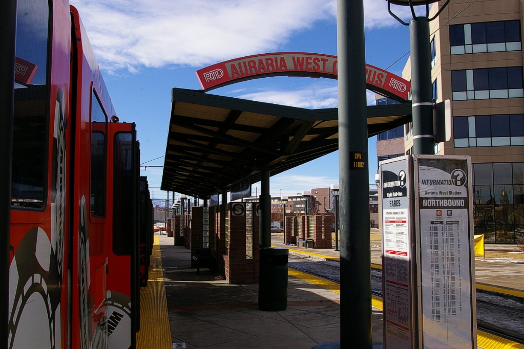
Once clear of the underpass at Colfax Avenue, the line curves to the west and reaches Auraria West Campus station. This station has both an island platform and a north-side platform (serving northbound trains). After leaving Auraria West Campus, the line makes a sharp turn to the north again. The connection with the West Corridor (see Expansion) will be built at this location and the Auraria West Campus station will be relocated to just north of here when that line opens in 2013.
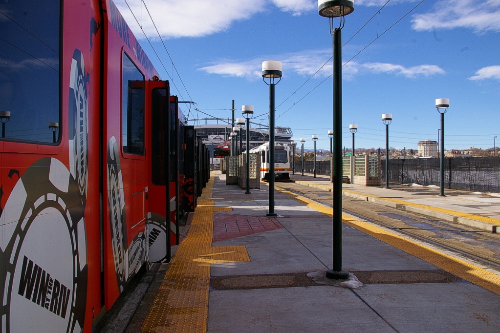
The next station is INVESCO Field at Mile High, serving the stadium. It has an island platform and both side platforms, so trains in both directions may open doors on both sides.
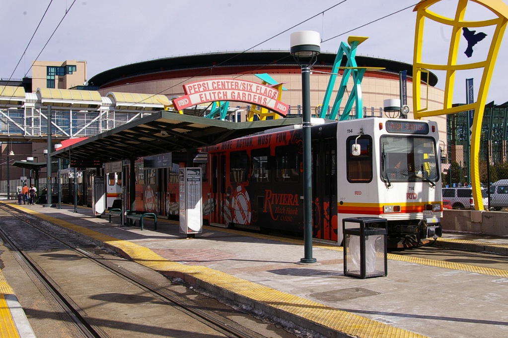
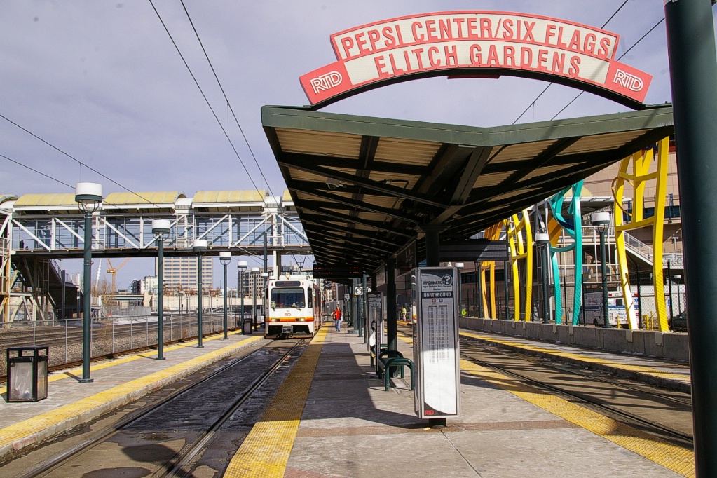
The next station is Pepsi Center-Six Flags Elitch Gardens where there are three tracks through the station with two island platforms and a narrow east-side platform.
Under normal operation, the west track is not used. Northbound trains use the east track, and southbound trains use the centre track.
The final station is Union Station: Lower Downtown (LoDo)-Coors Field- 16th Street Mall, and it has island and two side platforms.
As part of the Denver Union Station redevelopment project, this station will be relocated in the summer of 2011 to be adjacent to the rail platforms.
Southeast Corridor
On November 17, 2006 the Southeast and I-225 Corridors opened, adding 30.6 km of line and 13 new stations. Four new lines were added to the network, including the G-Line that ran between two suburbs without entering the downtown area. The G-Line was discontinued on May 3, 2009 but will be reinstated when the I-225 corridor extension is built (see Expansion section below). Travel time from I-25-Broadway to Lincoln (24.5 km) is about 27 minutes.
at I-25-Broadway.
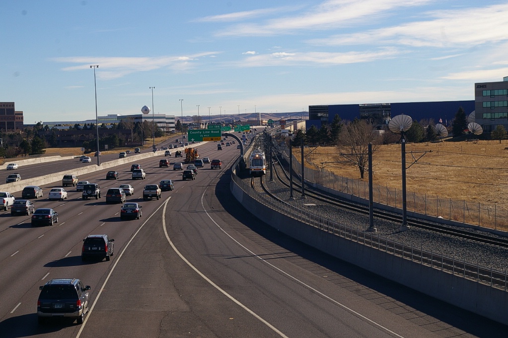
As the line curves to the east immediately south of I-25-Broadway, it climbs to an elevated structure that curves to the southeast as the right of way parallels I-25 on its west side.
The line returns to grade level as it approaches Louisiana-Pearl station. This station has an island platform that is under cover of the intersection of two roads that pass over it and I-25.
Louisiana-Pearl is the only station on the southwest corridor to have no parking facilities.
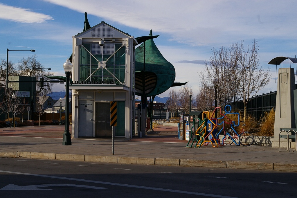  Louisana-Pearl station: left image shows street entrance; right image shows Northbound H-Line train arriving |
The line continues at grade to the University of Denver station with its island and west side platforms. Southbound trains open doors on both sides. The west side platform is shared with buses. This station has parking for 540 vehicles, bike rack space for 10 and bike lockers for 12.
About half way from University of Denver station to Colorado station, the line passes through a short tunnel section before returning to an open cut to Colorado station.

Colorado station itself is in a cut with side platforms and parking for 363 vehicles, bike rack space for 8, and bike lockers for 24.
The next station south is Yale. It is at grade with a centre and a west side platform. This station has parking for 129 vehicles, bike rack space for 10, and bike lockers for 27.
After that, Southmoor station is the most southern station before the H-Line branches to the east on the I-225 Corridor. This station has a centre platform and no exit on the east side of I-25. Exit is via a tunnel under I-25 to the west side. This station has parking for 788 vehicles, bike rack space for 16, and bike lockers for 12.
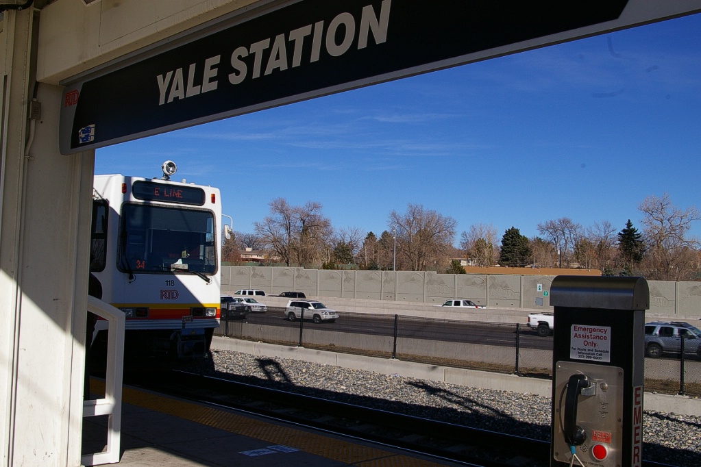
Northbound E-Line train arrives at Yale station.
|

Northbound H-Line train arrives at Yale station.
|
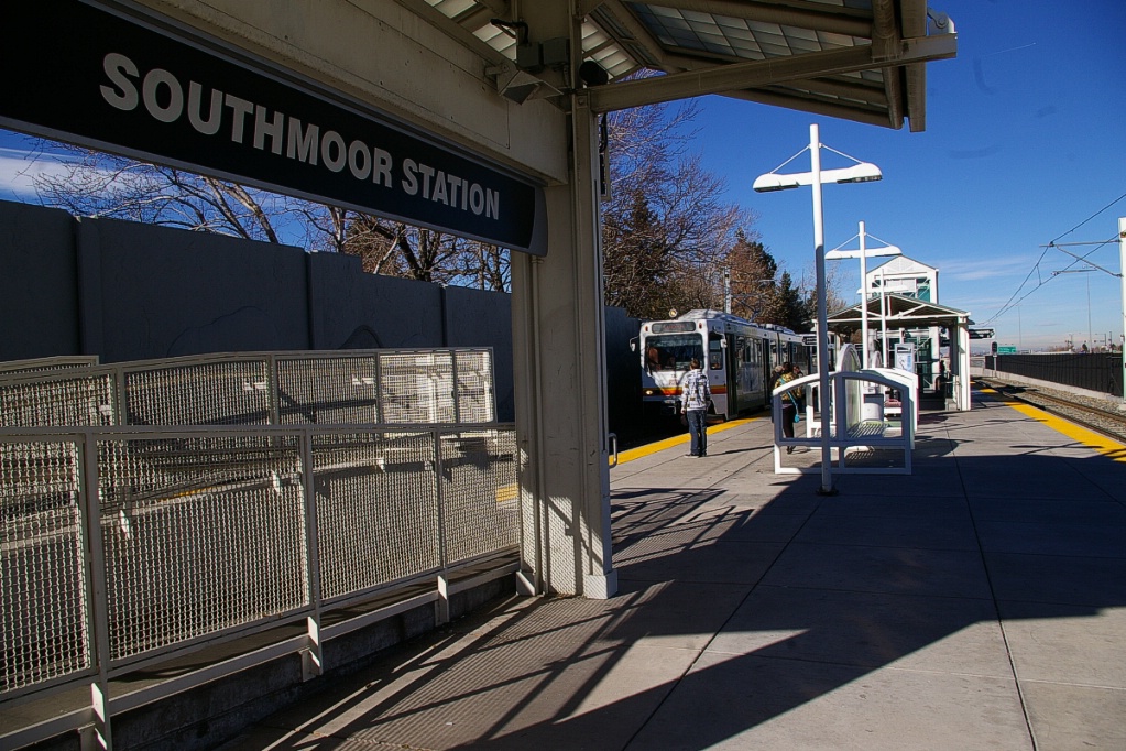
Southbound E-Line train arriving at Southmoor station.
|
South of Southmoor, the southbound track descends into a cut to provide a wye connection with the I-225 Corridor, avoiding grade crossings with the wye connection for the northbound track.
This side has a platform on both sides sharing this side platform with buses.
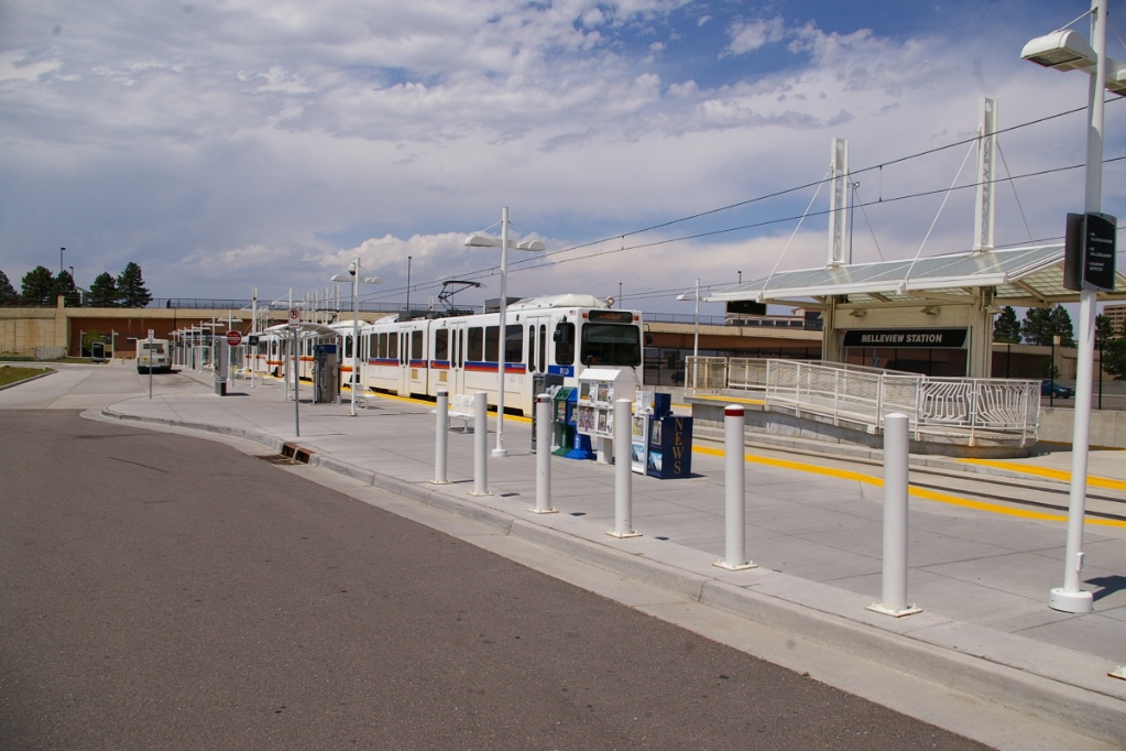
The next station is Belleview with a centre and a west side platform. The west side platform is shared with buses. This station has parking for 59 vehicles, bike rack space for 12, and bike lockers for 12.
Pedestrian bridges over I-25 at several southern stations look similarly to
this one at Orchard Station.
|
Southeast corridor runs along the west side of I-25 similar to this view south
of Dry Creek station.
|
Most of the stations south of Belleview have a single centre platform and a distinctive pedestrian bridges to cross to the east side of I-25.
The first of these stations is Orchard station, though like Belleview station this station has a west side platform in addition to the centre platform. This station has parking for 48 vehicles, and bike rack space for 6.
This part of the line also has several stretches of elevated structure to take the line over roads intersecting with I-25.
Arapahoe at Village Center station.
Arapahoe at Village Center station.
The next station is Arapahoe at Village Center. This station has parking for 817 vehicles in a multi-level structure, bike rack space for 22, and bike lockers for 10. The parking garage and bus connections are on the east side of I-25 connected to the LRT station by a bridge.
Continuing south, the next stop is Dry Creek station. This station is slightly elevated next to I-25 and has parking for 235 vehicles and bike rack space for 6.
A northbound E-Line train stops at Dry Creek station.
|
A northbound E-Line train at Dry Creek station.
|
A northbound E-Line train at Dry Creek station.
|
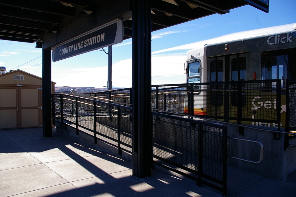
County Line station is right across the street from the Park Meadows Mall. There is a secured pedestrian access bridge connecting the station to the mall. A ticket must be obtained, free of charge, for access to the bridge.
This station has parking for 388 vehicles, bike rack space for 8, and bike lockers for 16.
The southern terminal of this corridor (and the southern-most station on the entire system) is Lincoln. This station has parking for 1734 vehicles, bike rack space for 8, and bike lockers for 16.
I-225 Corridor
On November 17, 2006 the I-225 Corridor opened along with the Southeast Corridor. This corridor is approximately 6 km long and branches off the Southeast Corridor with a full wye connections with flyovers between the Southmoor and Belleview stations. Travel time on this corridor is about 8 minutes between Southmoor and Nine Mile station.
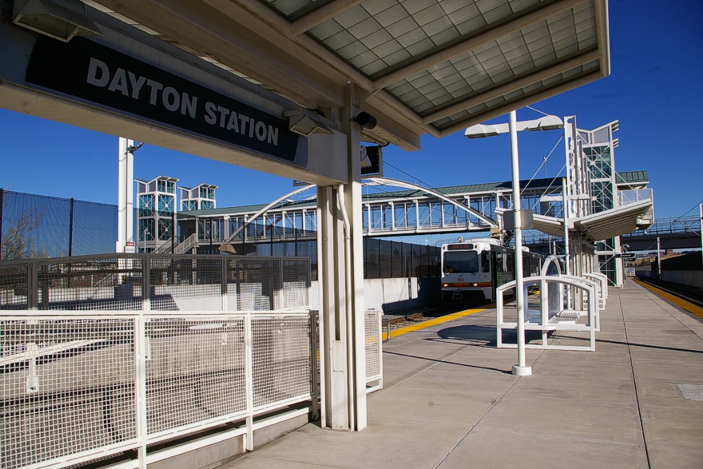
at Dayton station.
This branch is located in the median of I-225 heading up into Aurora. The interchange is fairly elaborate, as a full wye exists with grade-separated crossings along with the highway interchange where I-225 ends with its junction with I-25.
The first station on this line is Dayton with a centre platform and bridge access to parking and drop-off facilities on the western side of I-225. This station has parking for 250 vehicles, bike rack space for 16 and bike lockers for 8.
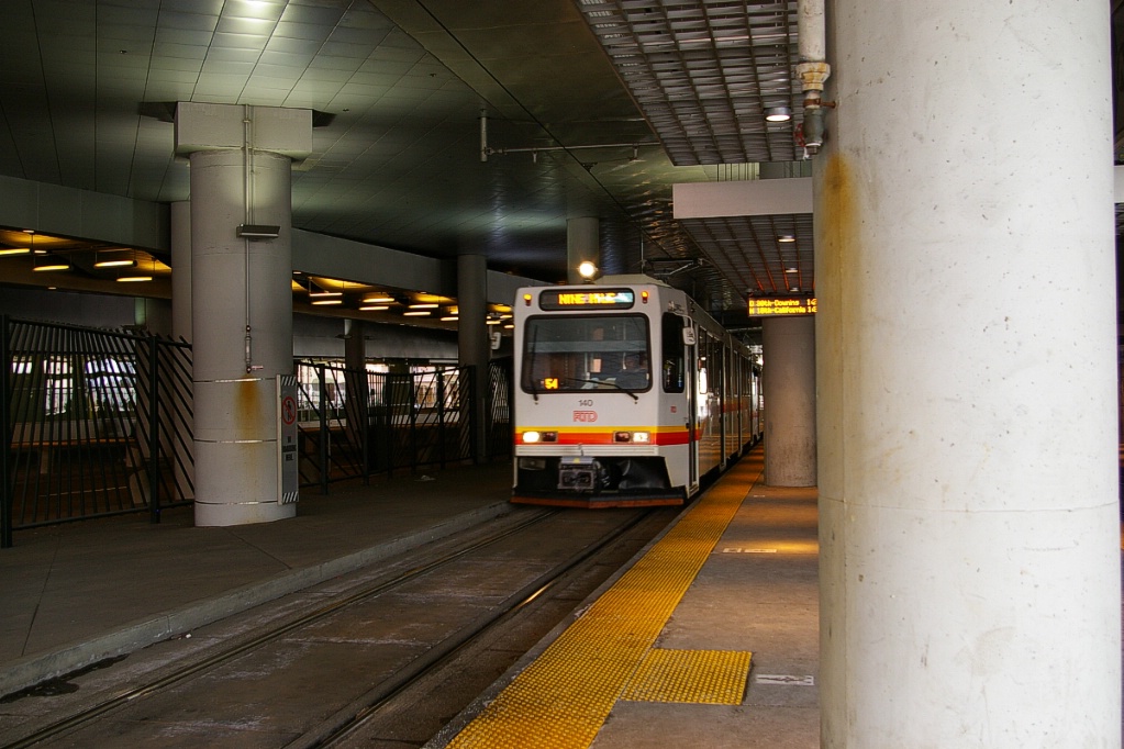
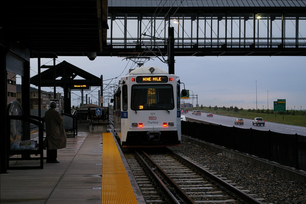
The current final station on this branch is Nine Mile. This station also has a centre platform, and trains are turned back using tail tracks beyond the station. This station has parking for 1225 vehicles, and bike rack space for 16 and bike lockers for 28.
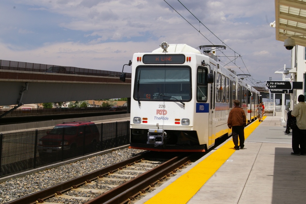
H-Line train at Nine Mile.
|
Fares and Fare Collection
RTD operation is divided into circular fare zones around downtown, though current LRT lines only extend southeast and southwest from downtown.
A "Local" fare allows travel within a single zone or two adjacent zones. An "Express" fare allows travel within three adjacent zones and a "Regional" fare allows travel within all four zones.
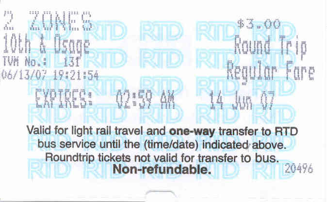
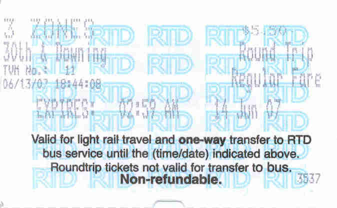
round trip ticket below.
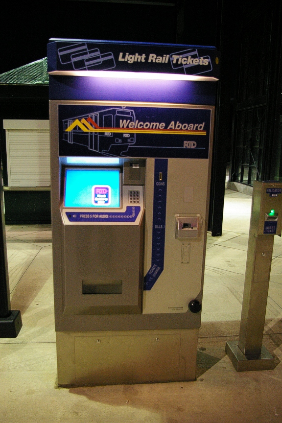
At LRT stations, fares may be purchased from vending machines at entrances or on platforms.
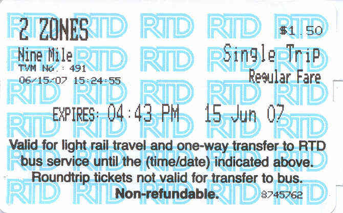
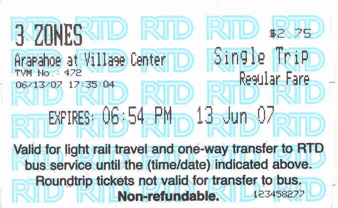
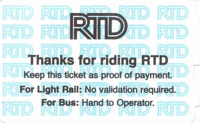
Single direction fares allow travel away from issuing station for a duration of approximately 80 minutes and may be used to board a bus at a Light Rail station. Single direction fares cost US$2.25 for Local, US$4.00 for Express, and US$5.00 for Regional.
Return fare tickets allow travel to and from the issuing station until the end of the day's service, but may not be used for transferring to a bus. Return fares are double the cost of single direction fares.
10-ride Ticketbooks are available: US$20 for Local, US$36 for Express, and US$45 for Regional.
Day passes are available: US$6.76 for Local, US$11.50 for Express, and US$14.00 for Regional. A five-day unlimited pass is available for US$51.25
Monthly passes are also available: US$79 for Local, US$140 for Express, and US$176 for Regional. There is also a 12 month "ValuPass" for the price of 11 monthly passes. The full price must be paid up front, but may be started at any time during the year.
Random fare inspections take place. Being caught without a valid fare can result in a fine of up to US$100 plus court costs.
Accessibility
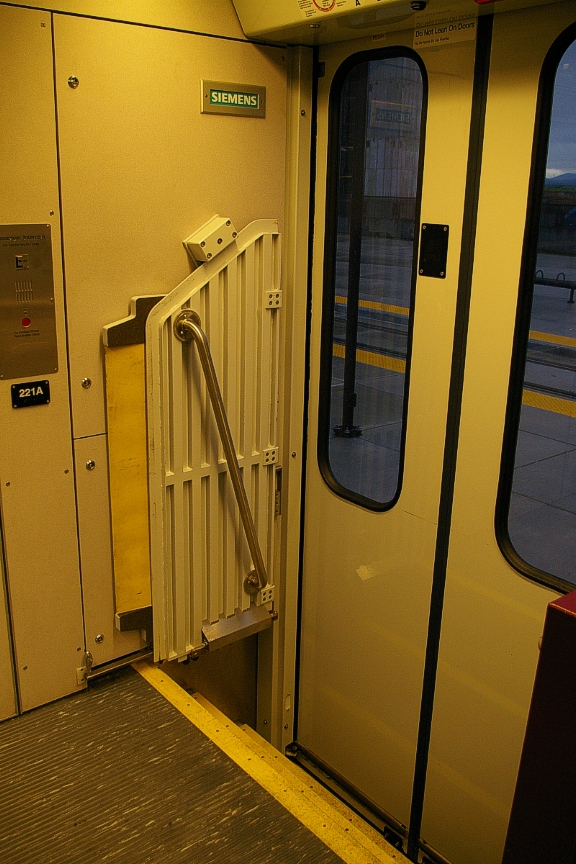
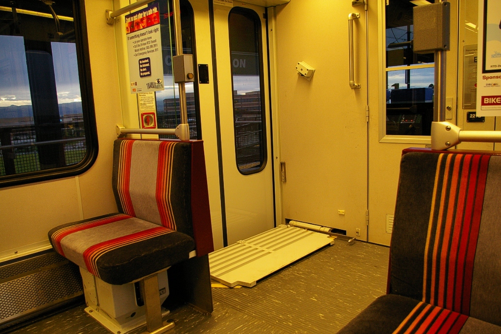
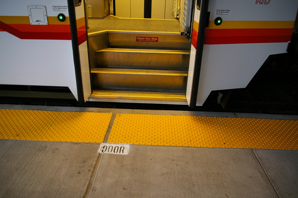
RTD cars are not low floor, but platforms are low. The doors immediately behind the driver's cab have fold-down platforms for wheel chair and stroller access.
During operation, the leading door is spotted at the high-level ramp and the door is only opened if needed.

This photo shows the open doors with the platform's bridge ready to be
deployed.
|
Other Notes
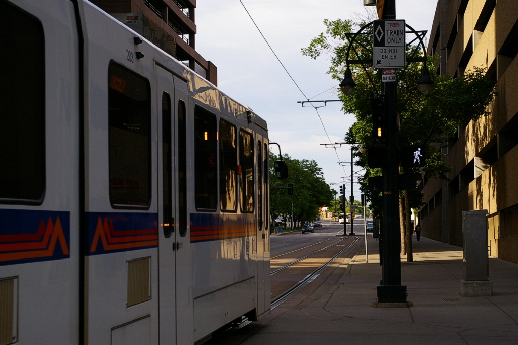
The main visual difference between the SD-100 and SD-160 LRVs is that the 100s have bi-fold doors with visible fold lines and the 160s have plug doors. When the SD-160s first arrived, the obvious difference was the paint details. SD-160 were ordered for the southeast expansion and were the first to have the newer paint with the wide blue stripe.
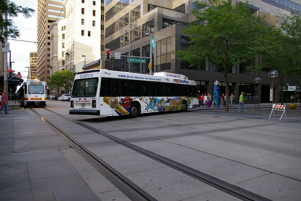
In downtown Denver, the 16th Street Mall is closed to automobile traffic. Only pedestrians, horse carts, and MallRide buses are permitted. The MallRide route connects with the LRT system at California and Stout, and at its western terminus at Union Station. MallRide buses are special CNG-Hybrid vehicles with three sets of doors down each side. There is no fare for MallRide service.
Throughout the system, many platforms are marked where doors are spotted.
Construction of the Southeast and I-225 corridors were part of an expansion project called "T-REX" that also included expressway improvements. Rail manufactured for this project had special markings on it.
Door location marking on platform.
|
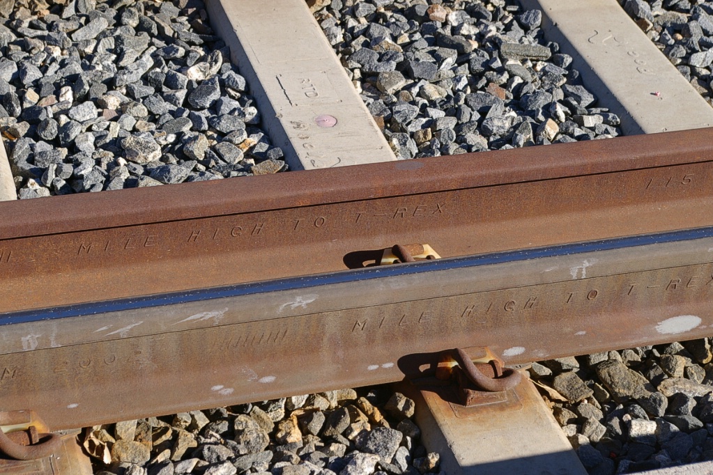
Rail with "Mile High to T-REX" marking.
|
Current and Planned Expansion
There are a number of expansion plans and projects underway in Denver under a larger group of projects called FasTracks that includes new commuter rail and express bus services. Here are the LRT projects:
West Corridor
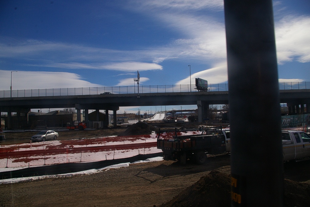
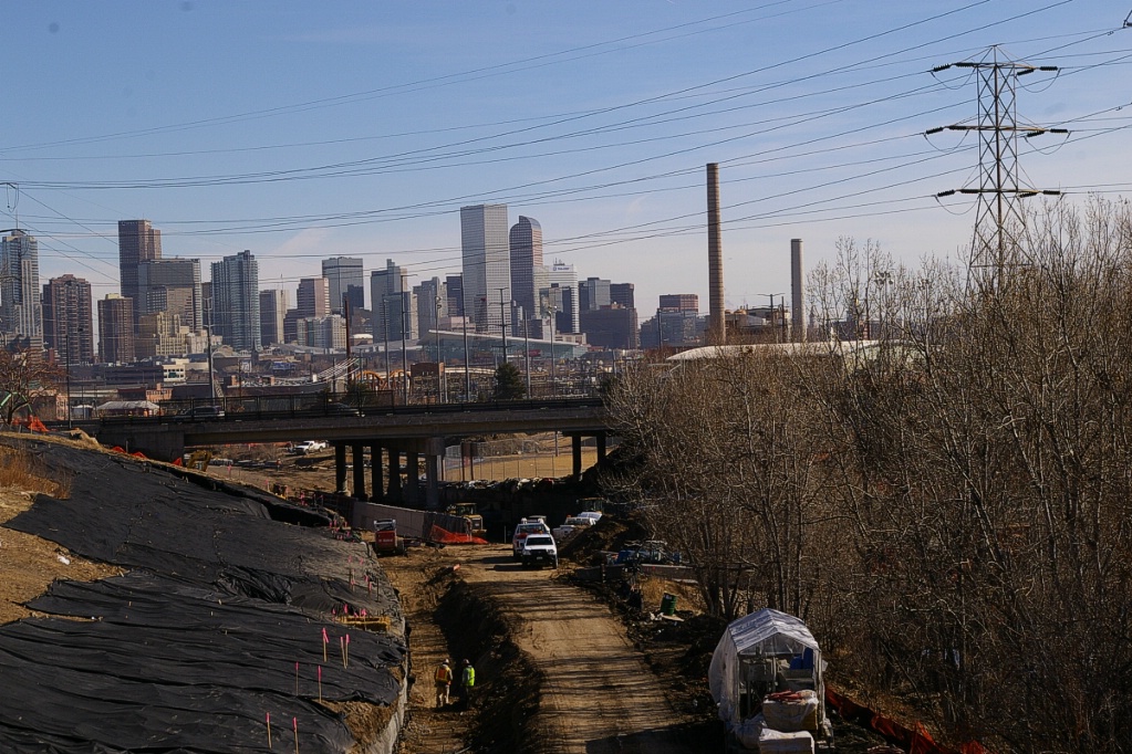
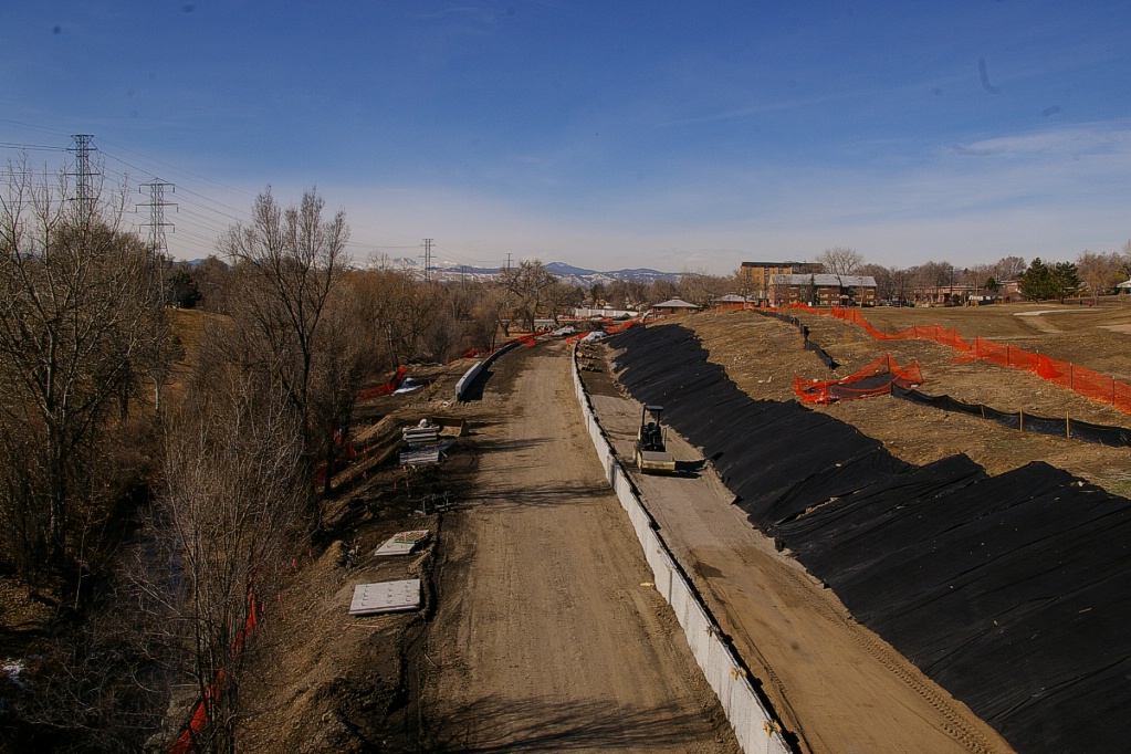
The West Corridor is a 19.3 km light rail transit corridor now under construction. It will run between Denver Union Station in downtown Denver and the Jefferson County Government Center in Golden. The West Corridor will serve Denver, Lakewood, the Denver Federal Center, Golden and Jefferson County by 2013. Pages are available for Information About the Project and on Project History.
Construction of the connection with the Central Platt Valley Spur viewed from
onboard.
|

Railway tracks on the west side of the existing LRT line are being moved
further west.
|
This line will connect with the Central Platt Valley spur on the north-south alignment that is west of the current Auria West Campus station. This station will be relocated to just north of this connection in order for it to be served by trains on this new line (see full map). Current regulations do not permit new LRT lines to be built too close to railway lines and these changes on the Central Platt Valley Spur will require some railway relocation between 10th-Osage and Auria West.
Looking east towards Federal Boulevard where construction is underway on the
West Corridor.
|
Looking west from the same pedestrian bridge as the left photo.
|
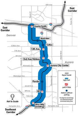
I-225 Corridor Extension
|
The I-225 Corridor is a 16.8 km light rail transit extension proposed to travel through the City of Aurora and one small section of the City and County of Denver. The I-225 Corridor will connect the existing Southeast Light Rail's Nine Mile Station with the planned East Corridor's Peoria/Smith Station and will include eight stations. The final environmental assessment is was completed in the fall of 2009 and this project will be underway once final funding has been approved. When this extension opens, service on the G-line to Lincoln (previously from Nine Mile) will be returned. |
|
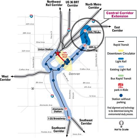
Central Corridor Extension
|
The Central Corridor Extension, as part of FasTracks, would connect the existing downtown light rail service with the planned 38th/Blake Station on the East Corridor alignment. The East Corridor is a commuter rail project to provide train service from Union station to the Denver International Airport. The recommended alternative for the Central Corridor Extension includes in-traffic rail transit operations. Service would be provided by a fleet of single light rail vehicles that complete round trip service between Downtown Denver and the 38th/Blake Station. The recommended alternative for the Central Corridor Extension includes two new stops at 33rd/Downing and 35th/Downing. Once funding has been secured for this, it will move to final design and construction. |
|
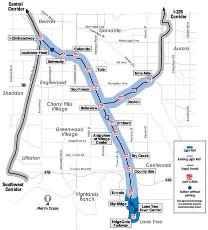
Southeast Corridor Extension
|
This is in the environmental assessment stage, but proposes to add a 3.6 km extension to the southern-most part of the LRT network, adding three additional stations. Two kiss-n-Ride stations at Sky Ridge Medical Center and Lone Tree City Center are proposed, along with a new end-of line station at RidgeGate with a 2000 space park-n-Ride facility. |
|
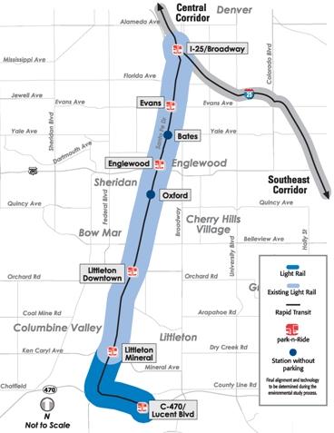
Southwest Corridor Extension
|
The Southwest Corridor Extension will make the Southwest line even more successful by adding 4.0 km of additional light rail and 1,000 space park-n-Ride at the end-of line station at C-470/Lucent Boulevard. The Southwest Corridor Extension will make the Southwest line even more successful than it is today. |
|