This page was last updated June 17, 2022
Send questions, comments, and photos here.

LRT in
St. Louis


The transit system in the St. Louis Missouri and East St. Louis Illinois is operated by the Bi-State Development Agency (doing business as Metro since 2003). The LRT system is known as Metrolink and the bus operation is known as MetroBus.
The LRT system currently consists of two lines. The first line, the Lambert Branch, runs from Lambert-St. Louis Airport, northwest of downtown, through downtown and east into Illinois to Scott Air Force Base in the east. The second line, the Shrewsbury Branch, runs from Shrewsbury southwest of downtown north to the Lambert Branch where it joins it at Forest Park-DeBaliviere station where it continues east through downtown and into Illinois as far as Fairview Heights station.
Contents
Toronto Comparison
The Metrolink system predates low floor technology, so it uses high floor vehicles with high platform loading to accommodate accessibility. While new implementations in Toronto will be low floor for accessibility, Metrolink does provide a good example of the ways that the right of way can be implemented:
- fenced-in and open surface implementation, sometimes using former railway right of way
- elevated right of way
- tunnel (both an abandoned railway tunnel, and new tunneling)
System Highlights and Route Details
| Item | Notes |
|---|---|
| Number of lines | 2 |
| Total length | 74 km |
| Total stations | 34 |
| Loading | Low level platform, cars have steps Platform 20 cm above track |
| Fleet | 31 Siemens-Duewag
SD-400 (DC traction) 56 Siemens-Duewag SD-460 (AC traction) |
| Common details | Seats 72 passengers, plus room for 106 standing 4 bi-fold doors per side, plus low-level emergency exit at each end 90 km/h top operating speed (MetroLink specs) 105 km/h top speed (Siemens specs) 27.4 m (90') long articulated, 6-axle High floor for 100% of seating space and doors |
| Fare collection | Self service, barrier free, proof of payment |
| Fare integration | Other than single-ride fares, all other fares allow full connections between LRT and bus routes. |
| Airport service | Two stations serving Lambert-St. Louis Airport |
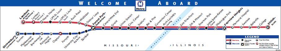
| Red Line (Lambert Branch) | |
| Length | 60.9 km |
|---|---|
| Stations | 28, 12 stations shared with Shrewsbury Branch |
| Right of way | Fenced at-grade right of way for much of route Elevated right of way at Lambert Airport Former and current railway right of way Downtown tunnel (Stadium to Arch-Laclede's Landing) |
| Service frequency | 10 minutes during rush hours (6-9 am, 3-7:30 pm) 15 minutes mid-day 20 minutes early evenings (until 10:30 pm) 30 minutes late evenings (until 1 am) 15-29 minutes early mornings (from 4:30 am) |
| Opening |
July 31, 1993 |
| Blue Line (Shrewsbury Branch) | |
| Length | 12.1 km (new branch) |
|---|---|
| Stations | 9, plus 12 stations shared with Lambert Branch |
| Right of way | Fenced at-grade right of way Tunnel (University-Big Bend to Forsyth) Elevated right of way |
| Service frequency | 10 minutes during rush hours (6-9 am, 3-7:30 pm) 15 minutes mid-day 20 minutes early evenings (until 10 pm) 30 minutes late evenings (until 1 am) 15-40 minutes early mornings (from 4am) |
| Opening |
August 26, 2006 |
Ride Descriptions
Due to interlining, providing a description of a trip on each line would repeat the portion from Forest Park-DeBaliviere to Emerson Park. The descriptions will be broken up into corridors:
| Corridor | Notes | Opened |
|---|---|---|
| Red Line | Full trip from St. Louis Lambert Airport to Shiloh-Scott | July 31, 1993 North Hanley to 5th & Missouri |
| Blue Line | Trip from Shrewsbury to Forest Park-DeBaliviere | August 26, 2006 |
Red Line
The trip on the Red Line from St. Louis Lambert Airport to Shiloh-Scott takes approximately 74 minutes.
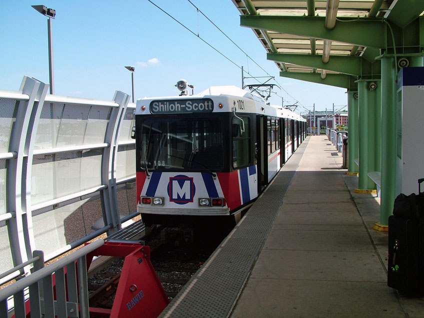
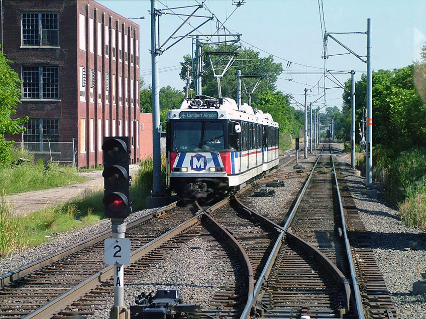
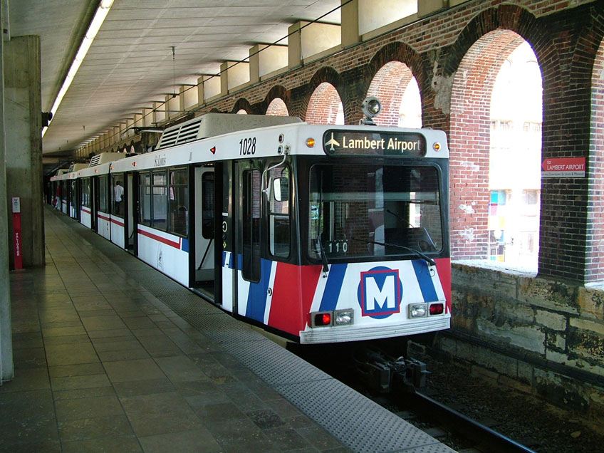
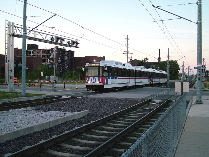
Lambert Airport Terminal 1 station is a island platform stub station built on top of the main airport terminal. Lambert Airport Terminal 2 station is another island platform station built above the east airport terminal. A two-hour fare purchased at these stations cost US$4.00 Note in the photo to the left that ALL destination signs on the LRT show its destination, which has been changed in the photo to reflect its return trip to Shiloh-Scott.
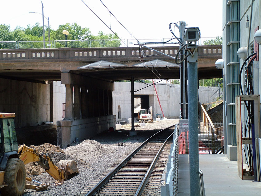
The line is elevated between these stations and continues to be elevated as it swings out parallel to I-70 and soars over the I-70/I-170 interchange before lowering to grade level a little before the North Hanley station. North Hanley is an island platform station with a pedestrian grade crossing entrance at its west end. From North Hanley to UM-St. Louis North, the right of way travels over a viaduct and through a short tunnel due to terrain.
The north University station has an island platform and the south station has side platforms. Between the north and south University stations, the right of way uses another viaduct to cope with terrain before curving southward onto a former Nofolk Southern (former Wabash) railway right of way. It follows this former railway right of way for the next three stations.
The Rock Road station has side platforms and the Wellston station has staggered side platforms, with each platform on opposite sides of a road that crosses the line. Wellston is the only staggered platform station in the system.
original Wabash Delmar station.
Delmar station has side platforms and is located just west of and below the original Wabash Delmar station.
The next station is Forest Park-DeBaliviere station. The junction with the Shrewsbury branch is just west of this station. This station originally had side platforms, but was changed to have an island platform during the construction of the Shrewsbury branch as it permitted more flexibility for passengers needing to change trains.
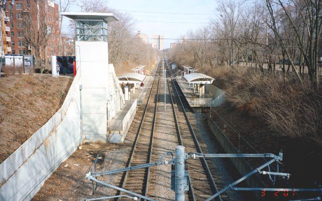
March 2001:
Looking east at Forest Park station. |
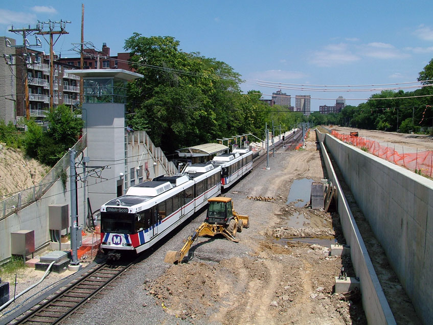
2005 during construction of the Shrewsbury branch:
Operation at this station used only a single track. |
Summer 2005: Looking west from Forest Park station, the portal for Shrewsbury
branch can be seen.
|
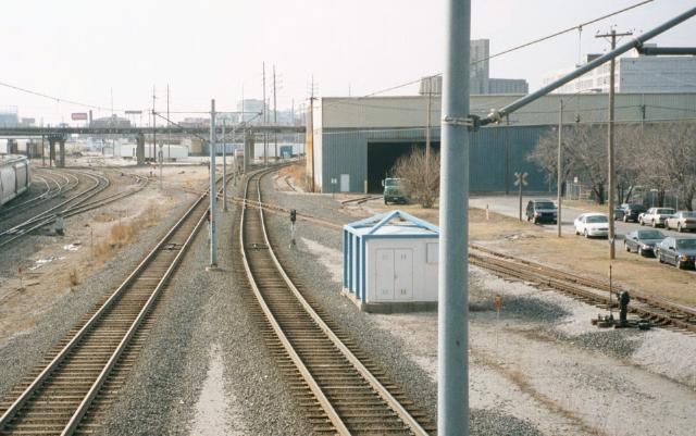
Central West End and Grand stations both have island platforms and are situated along a former Missouri Pacific/Burlington Northern railway corridor. Central West End is located in an industrial area and Grand is located at the west end of a large rail yard. It is near the Grand station that the only rail/LRT grade crossing exists on the system. There is a storage yard and maintenance facility between Grand and Union station.
Union Station is an island platform station situated under the parking lot at the south end of St. Louis Union Station. The railway station has a huge canopy over the area where the stub-end tracks and platforms were located. There are still four tracks for static railway displays, while the rest of the space serves as parking for the shopping centre that is now in the renovated station building.
Heading east, the line makes a sharp turn to the south before entering Civic Center station with an island platform. This station serves the Savvis Center stadium. The line makes another turn to the east after this station to run parallel to I-64/US40 for about 1 km.
The line then turns north and enters Stadium station. This side-platform station is below street level just north of the portal to the downtown tunnel. The station serves Busch Stadium.
Convention Center station.
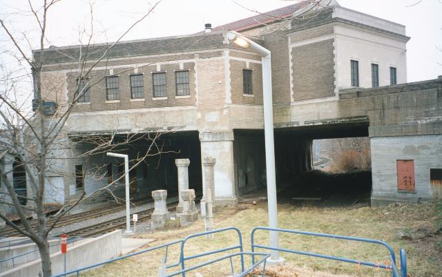
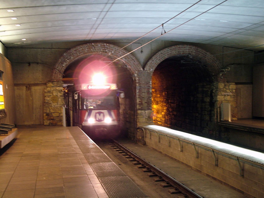
Entering the downtown tunnel under 8th Street, the LRT is heading north to the two subway stations. The first is 8th & Pine and the second is Convention Center. Both of these stations have side platforms and the arched brickwork of the former railway tunnel can be seen at the end of each station. The tunnel curves to an east-west alignment just west of Convention Center station.
Heading east through the tunnel, it exits into the arches of the approach to the Eads bridge where the Arch-Laclede's Landing station is located. Laclede's Landing is the neighbourhood around the station that is known for a large number of restaurants in cobblestone streets. The St. Louis Arch (officially known as the Jefferson National Expansion Memorial) is a short walk south of the station.
the lower level of the Eads bridge.
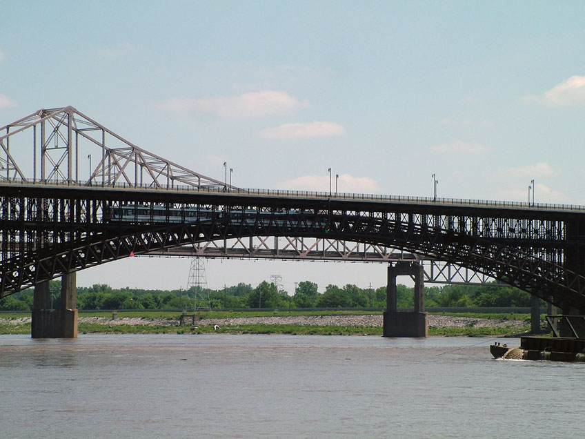
The line crosses the Mississippi River over the Eads bridge, a double deck bridge built in the 1870s. The upper deck originally had road traffic on it but no longer does.
At the east end of the Eads bridge, the East Riverfront station is located on a new elevated structure just beyond the bridge. This station opened almost a year after the line was in operation.
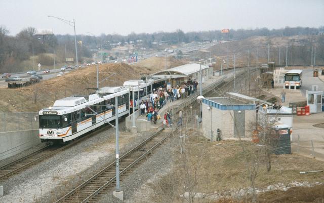
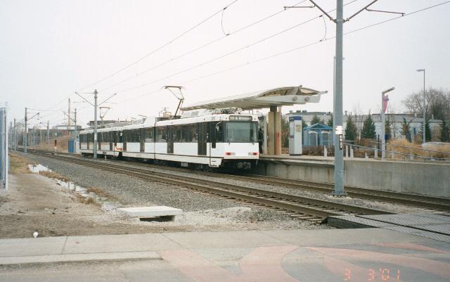
A short distance from East Riverfront station is 5th & Missouri station. This island platform station was the original east end fo the line when it first opened in 1993.
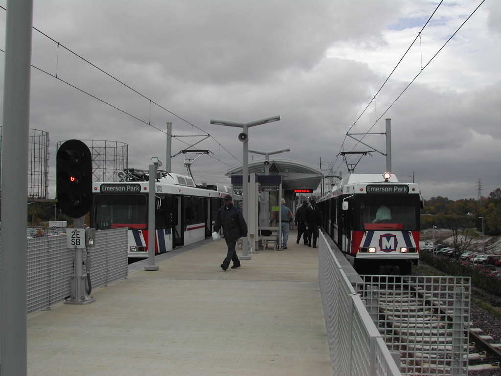
The extension beyond here to College that opened in 2001 mostly follows a former CSX railway right of way. The tracks here are laid on concrete ties. The next three stations, Emerson Park, Jackie Joyner-Kersee Center, and Washington Park are all island platform stations and have a similar spacing between them as other stations on the line. There is a storage yard and maintenance facility between Emerson Park and Jackie Joyner-Kersee Center.
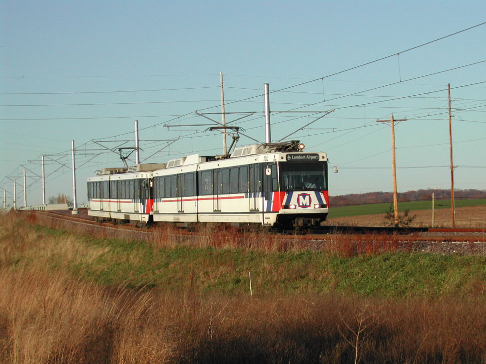
After Washington Park, the distance between stations is further - almost double the spacing compared to the western end of the line. The stations here, Fairview Heights, Memorial Hospital, Swansea, Belleville, College, and Shiloh-Scott are all island platform stations with a similar looking design. As the line moves away from the Mississippi River, the terrain becomes very rural.
Blue Line
The trip from Shrewsbury-Lansdowne I-44 to Forest Park-DeBaliviere takes approximately 17 minutes, while the full trip to Fairview Heights takes approximately 52 minutes.
Shrewsbury-Lansdowne I-44 station.

Shrewsbury-Lansdowne I-44 station.
The author of this site last visited St. Louis about a week before the Shrewsbury branch opened. If anyone has additional photos or a description of the trip on this line, please send them here.
Stations and their layouts are as follows:
Shrewsbury-Lansdowne I-44: Elevated with island platform.
Sunnen: Side platforms; Station is adjacent to the only road grade crossing on this line.


Maplewood-Manchester: Side platforms
Brentwood I-64: Side platforms.
Richmondn Heights: Island platform.
Clayton: Island platform.
Forsyth: Below grade open air station.
University City-Big Bend: Below grade station.
Skinker: Below grade station.
Fares and Fare Collection

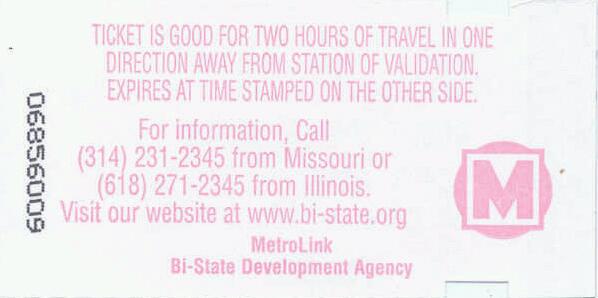
Fares are purchased from vending machines on Metrolink platforms. Adult cash base fare is US$2.25 and are good travel away from the location of issue, with no transfer privileges. Single fares are valid for two hours from time of purchase.
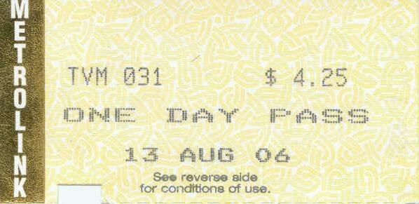
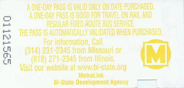
A 2-hour pass is available for US$3.00 and a day pass is US$7.50, both good for unlimited travel on LRT and buses during their validity period. A 2-hour pass from Lambert Airport is $4.00
A book of 10 2-hour passes sells for US$20 (passes must be cancelled at a ticket vending machine before use).
Weekly passes sell for US$25 and the monthly pass is US$72.
Random fare inspections take place on the LRT. Fare inspectors will confiscate an expired ticket and require the passenger to leave the train at the next stop to purchase a new fare for completion of the trip. Fare inspectors may issue a citation and fine for having an invalid fare.
Accessibility
All stations have high-level platforms for level boarding of trains. Stations are equipped with ramps or elevators for access to platforms.
Other Notes
Current and Planned Expansion
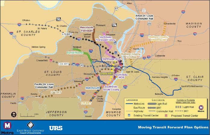
A comprehensive, thirty-year plan for transit improvements titled Moving Transit Forward has been produced with three goals in mind:
- Providing and enhancing transit service in the near and long-term,
- Retaining existing riders while attracting new ones, and
- Increasing the overall efficiency of the St. Louis regional transit system.