Special thanks to Jon Bell for some photos used on this page.
Additional thanks to Mike Stokes for updates and corrections.
This page was last updated May 8, 2012
Send questions, comments, and photos here.
LRT in
Pittsburgh


The Port Authority of Allegheny County provides a network of public transportation services within a 775 square mile area that includes the City of Pittsburgh and all of Allegheny County. Along with buses and two inclines, it also operates three LRT routes known as The T operating over about 40 km of lines.
A 2 km extension of the T to Pittsburgh's north shore is currently under construction.
Contents
Toronto Comparison
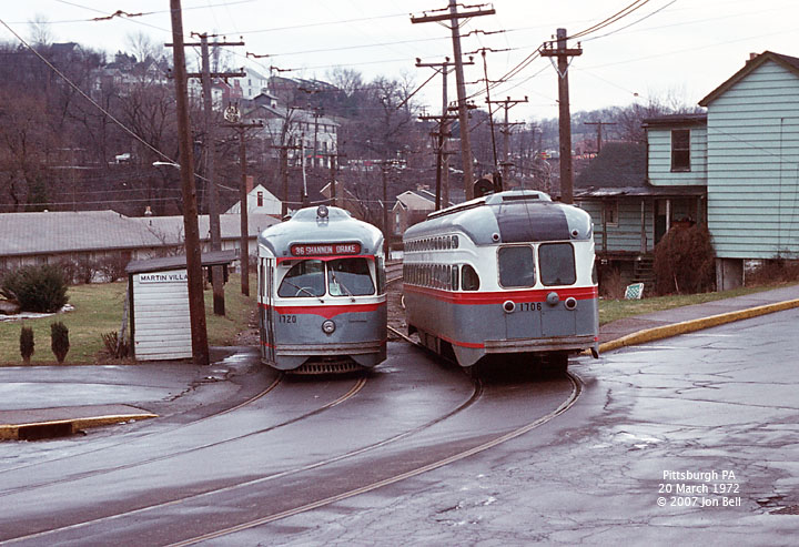
The T in Pittsburgh began operation in the early 80s when PCC streetcars were still in operation (the last PCC-operated route was discontinued on September 4, 1999).
In 2009, the LRT routes had their route numbers replaced with colours, similar to VIVA routes in York Region.
System Highlights and Route Details
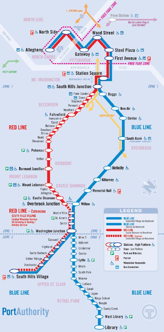
Item Notes Number of lines 3 Total length 42.3 km Total stations
High level platform28
Only 14 serve the second car of a 2-car trainTotal stops
Low level boarding37
None serve the second car of a 2-car trainLoading Platform at door level at stations (1 m above track)
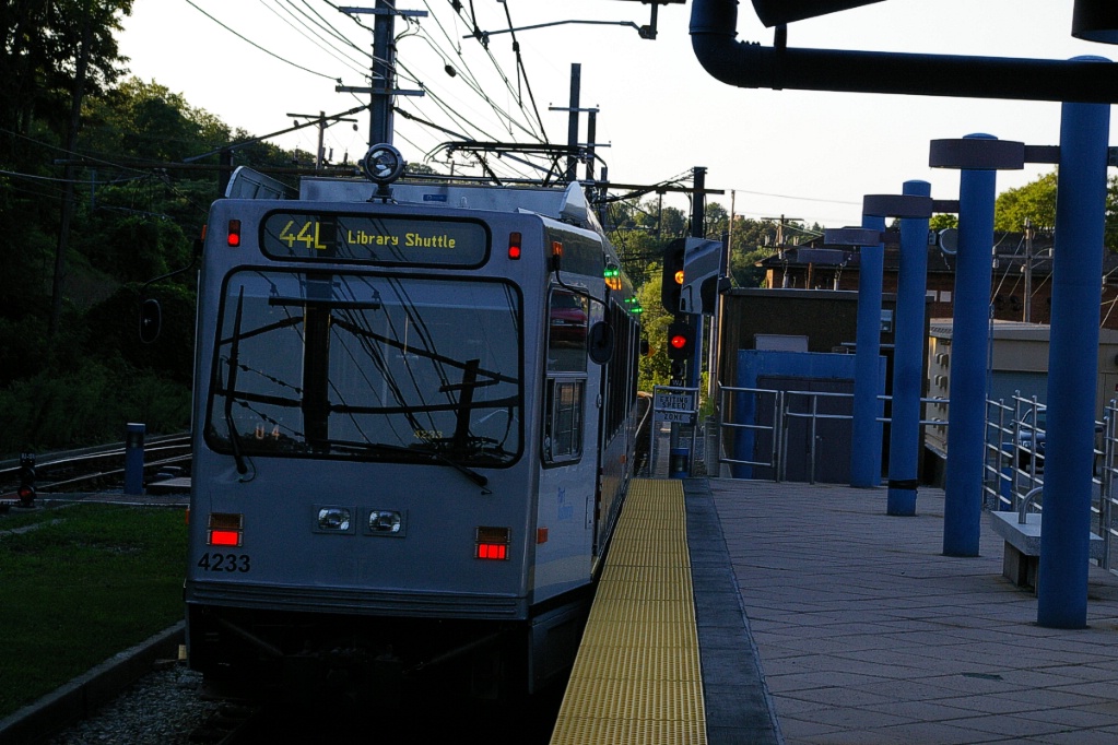
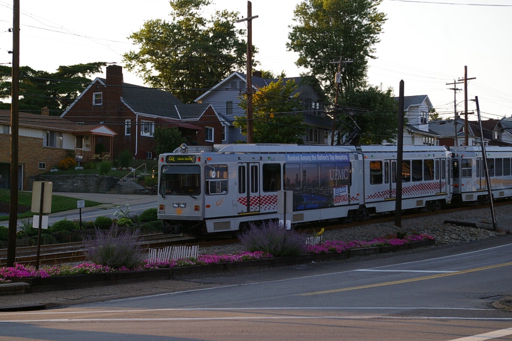
Low platform using front door with steps at stopsFleet 55 Siemens SD-400 (rebuilt by CAF in 2005-6)
28 CAF LRVSeats 62 passengers, room for 150 standees
3 bi-fold doors per side
Additional low-level door at each end
90 km/h top speed
24.9 m (82') long articulated, 6-axle
Track gauge: 5'-2.5" (1588 mm)
High floor for 100% of seating space and doors
Steps at low-level doorFare collection Some stations have fare collectors
Payment onboard at all other locations
Daytime: paid upon boarding for inbound,
paid upon leaving when outbound;
Evenings: paid upon boarding both directionsFare integration Transfers are an additional US$1.00 Airport service No direct airport service.
On March 25, 2012 the North Shore Connector added two stations north of the Allegheny River. During construction, the Gateway Center station was closed and LRT operations terminated at the Wood Street station:
|
|
| Length | 19.4 km |
|---|---|
| Stations/stops | 16 / 8 |
| Right of way | Downtown portion in subway and Panhandle tunnel Panhandle Bridge over Monongahela River Transit tunnel shared with busway Private right of way South Hills Junction to South Hills Village |
| Service frequency | 12 minutes rush hours (5:00 to 8:30 am, 3:00 to 6:00 pm) 15 minutes mid-days 15 minutes evenings (last outbound at 12:30 am) Weekend service provided by Red Line |
| Opening |
July 3, 1985 |
| Closing | Late 1993, due to deteriorating conditions of bridges |
|
|
| Length | 25.4 km |
|---|---|
| Stations/stops | 18/16 |
| Right of way | Downtown portion in subway and Panhandle tunnel Panhandle Bridge over Monongahela River Transit tunnel shared with busway Private right of way South Hills Junction to Library |
| Service frequency | 12 minutes rush hours (5:00-8:30 am, 4:00-6:00 pm) 30 minutes mid-day 30 minutes evenings (last outbound at 11:49 pm) 40 minutes Saturdays (last outbound at 11:20 pm) 60 minutes Sundays (last outbound at 11:00 pm) |
| Opening | December 1988 Library branch, service initially via Beechview November 2001 First Avenue station opened |
|
|
| Length | 13.6 km |
|---|---|
| Stations/stops | 12 / 15 (runs to Overbrook Jct) |
| Right of way | Downtown portion in subway and Panhandle tunnel Panhandle Bridge over Monongahela River Transit tunnel and Palm Garden Bridge shared with busway Private right of way South Hills Junction to Library Elevated from Palm Garden Bridge to Fallowfield Mixed with traffic from Fallowfield to Stevenson Median from Stevenson to Potomac Private right of way from Potomac to Dormont Junction Mt. Lebanon Rail Tunnels from Dormont Junction to Mt. Lebanon Private right of way from Mt. Lebanon to Castle Shannon |
| Service frequency | 10 minutes rush hours (5:00-8:30 am, 4:00-6:00 pm) 15 minutes mid-day 30 minutes evenings (last outbound at 12:30 am) 20 minutes Saturdays (last outbound at 12:30 am) 20 minutes Sundays (last outbound at 11:00 pm) |
| South Hills Village | Service to/from South Hills Village on weekends and on some weekday runs at start and end of service and around rush hours |
| Opening | July 3, 1985 Downtown subway and service to South Hills Village May 22, 1987 Rebuilt Beechview line and 2-car operation began September 3, 2007 Regular service resumed after Palm Garden Bridge closure |
| Closing | March 2007 Palm Garden Bridge closed for refurbishment Shuttle service ran between Traymore and Overbrook Jct. |
Ride Descriptions
Due to interlining, providing a complete description of a trip on each line would repeat some descriptions.
At this time, descriptions do not include the North Shore Connector extension.
| Corridor | Notes |
|---|---|
| Blue Line to Library | Full trip from downtown to Library |
| South Hills Branch | Trip on the branch from Washington Junction to South Hills Village |
| Red Line | Trip on the Beechwood line from South Hills Village to Overbook Junction |
| Brown Line | Discontinued service to South Hills Junction via Allentown is described |
Blue Line to Library
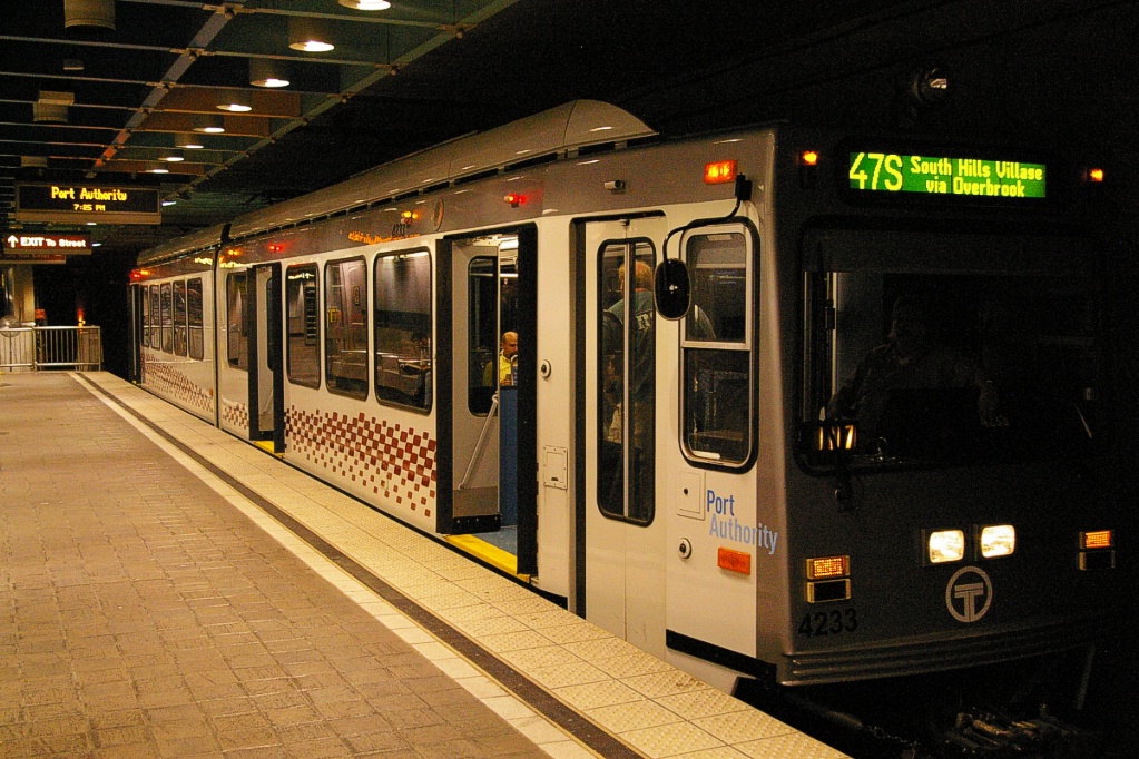
The trip on the Blue Line from downtown to Library takes approximately 41 minutes.
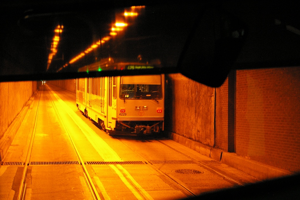
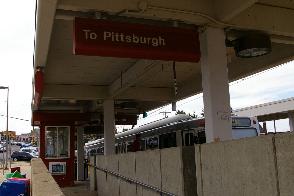
While construction continues on the North Shore Connector, the downtown terminus is the Wood Street station.
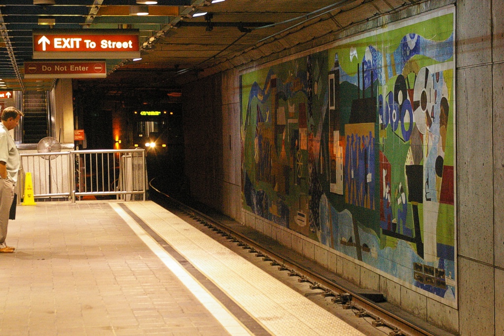
From there, the line runs under Sixth Avenue and curves a little more to the right before entering Steel Plaza.
All the underground stations have a low-level portion of the platform at one end that served PCCs that operated to these stations along the Drake line until it was discontinued in 1999.
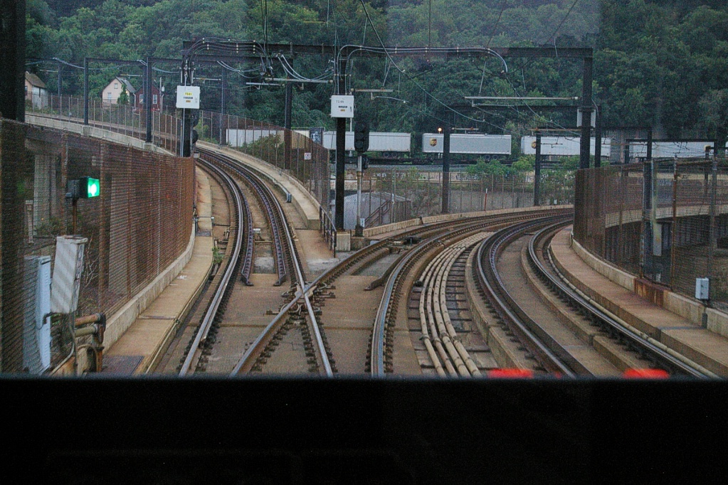
Steel Plaza is a four-track station as the underground line splits just south of this station. Tracks 1 and 2 serve the line to Wood Street, while tracks 3 and 4 serve a short branch to Penn Station. This branch is out of service at this time due to construction; when in service only two outbound afternoon trips originated from there.
After Steel Plaza, the underground section ends just before reaching the First Avenue station. From here, the line crosses over the Monongahela River using a former railway bridge. At the south end of the bridge, the main double track line curves to the west, while a single track curves to the east. The single track was used by the Brown Line when it operated.
This line branches to the west and arrives at Station Square. After this station, the line curves sharply to the left to go south through a transit tunnel. Originally for trolley service only, this tunnel now serves both the LRT and buses (as well as emergency vehicles).
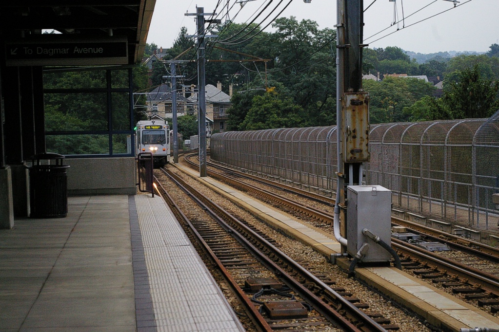
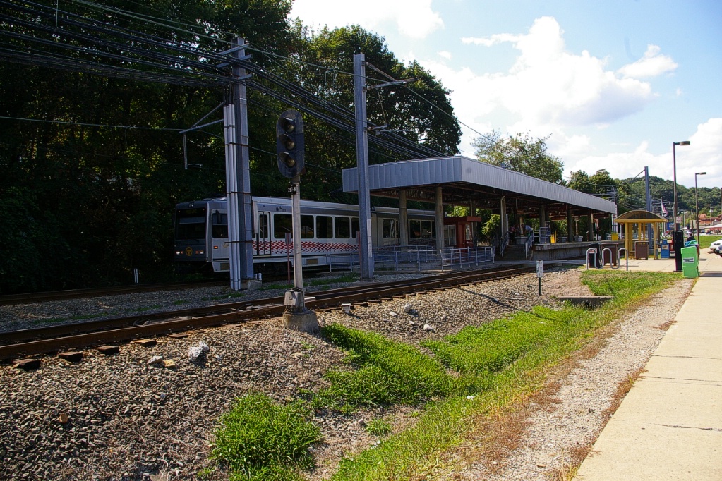
The next station is South Hills Junction that has two sets of platforms at angles next to each other. The platforms on the west are used for operations (on the right in the photo to the right), with the east platforms no longer used.
Originally, this was the junction point where the Overbook and Beechview lines met. The Overbook line used the east platforms and the Beechview line used the west. When the Overbook line was reconstructed in 1993, part of the alignment between here and Boggs station did not have sufficient clearance for LRVs, so the alignment was altered and now joins the Beechview line between here and Palm Garden station. This is why both lines now share a platform at South Hills Junction.
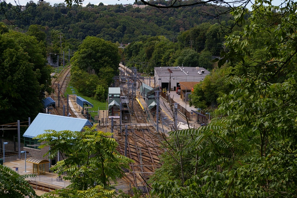
Since it is the newest part of the system, the Overbrook line has all stations with high-level platforms that are spaced more widely that other stations and stops. There are eight stations which replaced 33 streetcar stops on the former line.
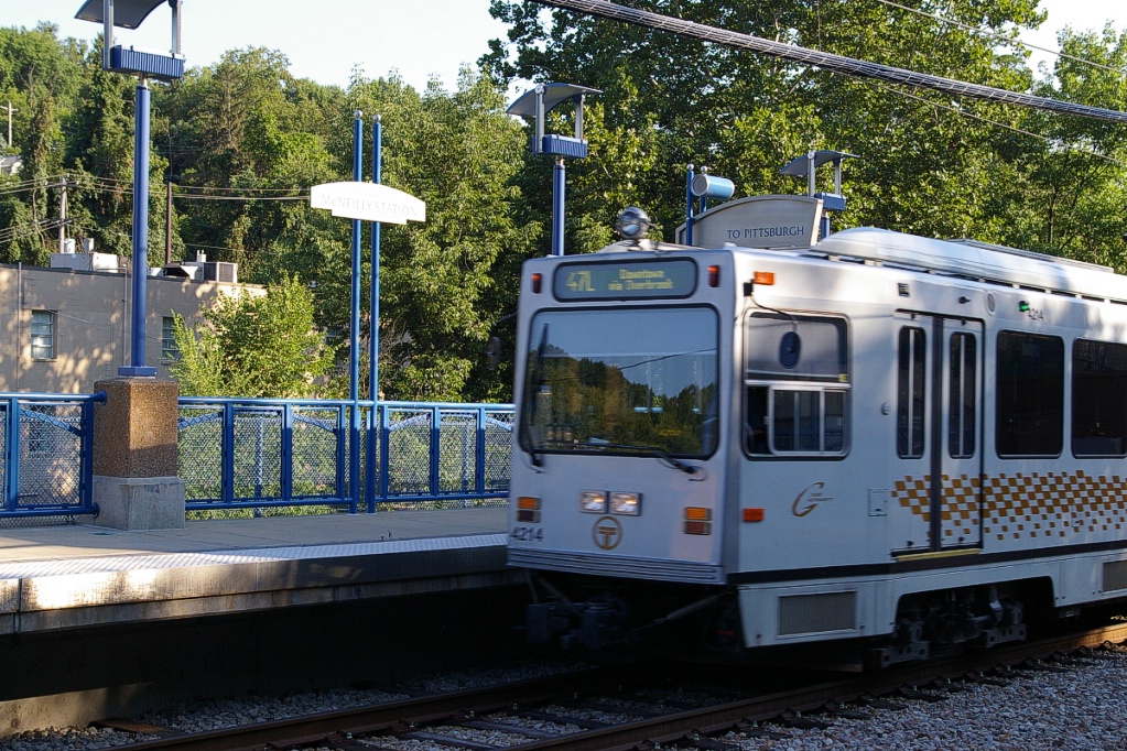
All stations on this branch have a similar look with side platforms with blue metal fixtures. The stations are Boggs, Bon Air, Denise, South Bank, McNeilly, Killarney, Memorial Hall, and Willow. There is no parking facilities at these stations, except for Memorial Hall which has 340 spaces.
At Willow, there is a pedestrian walkway connecting it with the Overbrook Junction station on the Beechview line - these are both part of the same station complex. The southern junction of the two lines is just south of these stations.
Heading towards Washington Junction, there are three low level stops where entry and exit on the train uses the low-level door to the right of the operator. These stops are Martin Villa, St. Anne's, and Smith Road. There are 130 parking spaces available at St. Anne.
Left photo shows it unloading; Right photo shows it in the pocket track.
Washington Junction has high-level side platforms and parking for 230 vehicles. North of the station there is a pocket track for turning trains.
Just south of Washington Junction, the branch to the South Hills area splits off this line to the west. This branch was originally an interurban line to Washington Pennsylvania, hence the name of the junction.
Part of the line to Washington from where it branches off the South Hills branch remained in operation with PCC streetcars until 1999. The track has since been used to test the rebuilt LRVs before they returned to revenue service.
Heading south from Washington Junction towards Library, the line takes on a rather interurban feel, with some portions traveling through wooded areas. Most of this branch, from just south of Washington Junction to just north of Library, has a simple overhead contact wire (similar to Toronto's streetcar contact wire) and not full catenary.
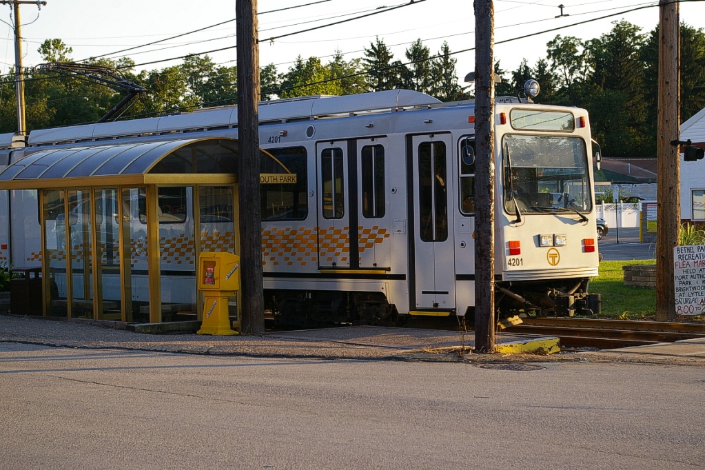
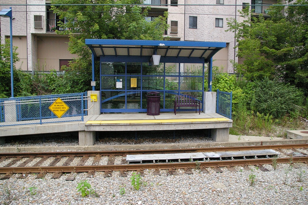
The majority of the stops along this line are low-level stops with minimal facilities. While most inbound stops have a shelter, none of the outbound stops do. Most outbound stops have little more than a concrete pad to stand on (unlike the South Park stop in the photos to the right where there is a bench and a railing).
The first stop is Mine 3, named after a coal mine that operated near the stop until 1938, Pittsburgh Terminal No. 3 Mine. The next stops are Hillcrest, Lindermer, and Center.
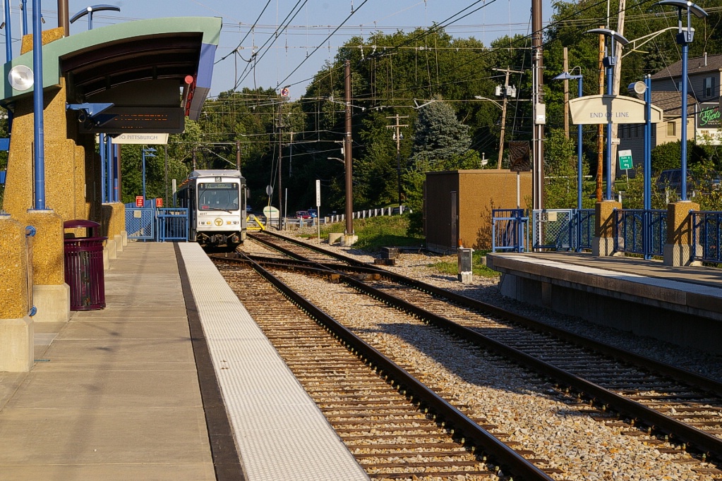
These are followed by a high-level station at Lytle. This station has 286 parking spaces, referred to as the Bethel Park Park and Ride lot.
Continuing, the next stops are Mesta, South Park, Monroe, Latimer, Sarah, Logan, King's School, Beagle, and Sandy Creek. Next is a high-level station at West Library - though, this station is not much than a high-level version of the other stops on this line, but it does have 115 parking spaces.
The end of the line is at Library, a high-level platform station that is the southern-most station in the system. This station has parking facilities for 430 vehicles. LRVs offload on one platform and proceed beyond the end of the station to turn back on a stub end track.
South Hills Branch
The trip from Washington Junction to South Hills Village, on either the Blue Line (weekdays) or the Red Line (weekends) takes approximately 5 minutes.
Branching in a west-southwest direction just south of Washington Junction, this branch serves five stops before reaching the terminal at South Hills Village.
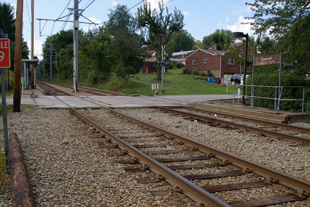
The first stop is Casswell, about 600 metres along the branch. The stop straddles a level crossing with Casswell Drive. The inbound stop is west of the road and the outbound stop is east of the road. An historic variation of this station's name has only a single s: Caswell. While all signage and route maps spells it Casswell, the Port Authority Route Finder and some local businesses make use of the other spelling.
Travelling west about another 450 metres, is the next stop, Highland. This stop is located in a cut beneath an underpass on Highland Road between Conestoga Drive and Meadowbrook Drive.
As the line curves to a southwest alignment, the third stop on the branch is Santa Barbara, only about 200 metres from Highland.
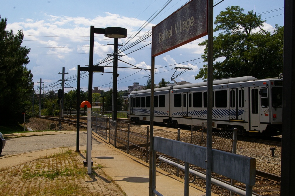
Travelling about another 550 metres, the line curves more to a south-southwest alignment and reaches the Bethel Village stop. There is no automobile level crossing at this stop, but pedestrians can easily cross between the residential neighbourhood south of the station and the big box stores a short distance to the north.

Continuing south-southwest for a little over 400 metres, the line reaches Dorchester. Just south of Dorchester, the original line continued straight where it converged to a single track line that continued for about 2.5 km to Drake Road. Service on this branch was discontinued in 1999 pending financing for its upgrade.

Existing operations branch west just south of Dorchester and continue for about 350 metres to the South Hills Village station, the terminus of this line.
Beyond the station is the South Hills Village Rail Center (SHVRC) opened at the end of this branch to provide maintenance facilities for LRV operation.
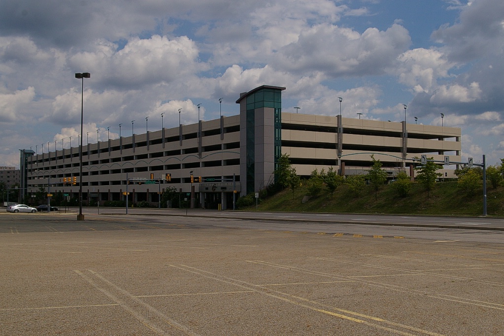
The Port Authority's first parking garage is located at South Hills Village station. It opened on May 16, 2005 and brought the number of parking spaces a the station to 2200. South Hills Village station continues to have an outdoor parking lot where parking is free, but garage parking has a charge. The cost is US$2 per day for single ticket customers, but is only US$1 per day (US$22 per month) for customers using a proximity card. A customer purchasing a monthly transit pass with parking pays US$97 per month (the price of a two-zone transit pass is US$75, making the parking cost US$22 per month.
Red Line
south end of the Palm Garden Bridge.
The ramp to the right is the South Busway.
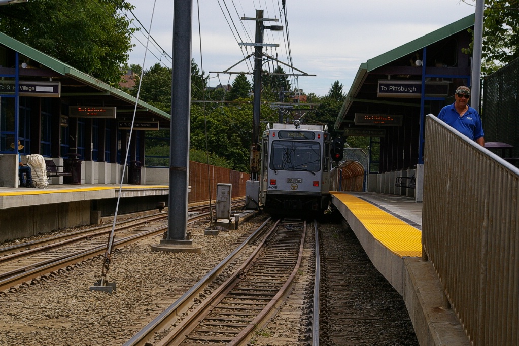
The outbound trip on the Red Line from South Hills Junction to Overbrook Junction takes approximately 21 minutes.
This line branches from the South Hills Junction station makes a stop at Palm Garden before crossing the Palm Garden Bridge over PA Route 51. This bridge is shared with the south busway. The next stop is Dawn just south of the bridge. Both Palm Garden and Dawn are low-level stops.
Continuing south, the next three stops, Traymore, Pennant, and Westfield, are also low-level stops.
Outbound LRV crossing the bridge to Fallowfield.
|
An inbound Red Line car is stopped at Fallowfield.
|
the Hampshire stop on Broadway.
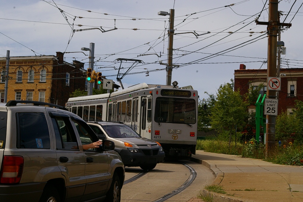
The first high-level station from South Hills Junction is at Fallowfield. It is located mostly on an overpass. Immediately south of the station, the LRT enters Broadway where it will share road space with other traffic for several stops.
The first of these stops is Hampshire, about a block away and just around the bend on Broadway.
Continuing outbound (south) on Broadway, the next four stops have a similar design.
As the line is in mixed traffic, these stops all have a low-level island platform located just before the street the stop is named after.
In order from north to south, these stops are Coast, Bellasco, Boustead, and Shiras.
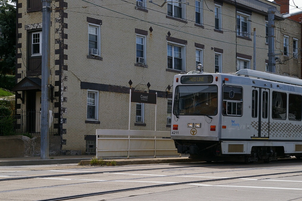
Inbound at Coast.
|
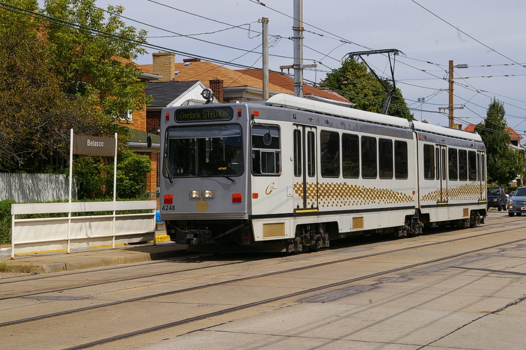
Outbound at Bellasco.
|
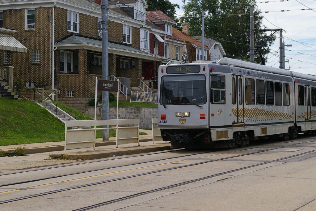
Inbound at Boustead.
|
Outbound at Shiras.
|
The next stop out is Neeld. This stop differs as it is located in an isolated median and both the inbound and outbound platforms are opposite each other.
Heading south from Neeld, Broadway curves a bit to the southwest and drops in elevation where it intersects with Wenzell Avenue. The LRT does not descend to the lower elevation, and crosses Wenzell on an overpass, with each direction of Broadway intersecting Wenzell on either side of the overpass.
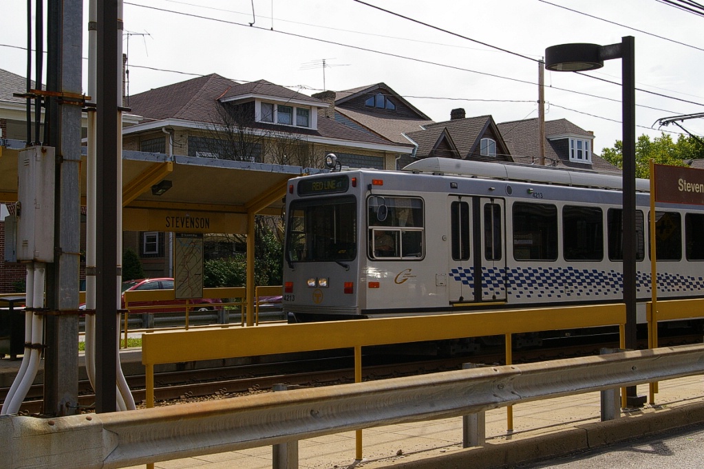
Before reaching the next stop, Stevenson, the LRT and Broadway return to the same elevation, but the LRT line remains in a median separated from traffic.
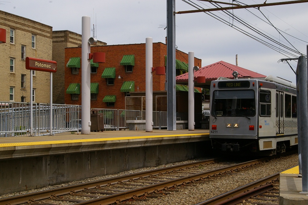
From Stevenson, the line continues in a south-west direction. Broadway ends at Potomac Avenue where the LRT crosses from being in a median on Broadway to being in its own right of way beginning with the high-level platform station at Potomac. This station has a small parking lot with 22 spaces.
From Potomac to Dormont Junction station, the line continues on this separate right of way through a residential neighbourhood. The line curves to a south-south-west alignment at the one stop in this area, Kelton that serves walk-in passengers.
Dormont Junction is a high-level platform station, with 132 parking spaces.
Inbound arriving at Dormont Jct.
|
Inbound platform at Dormont Jct.
|
Inbound approaching Dormont Jct.
|
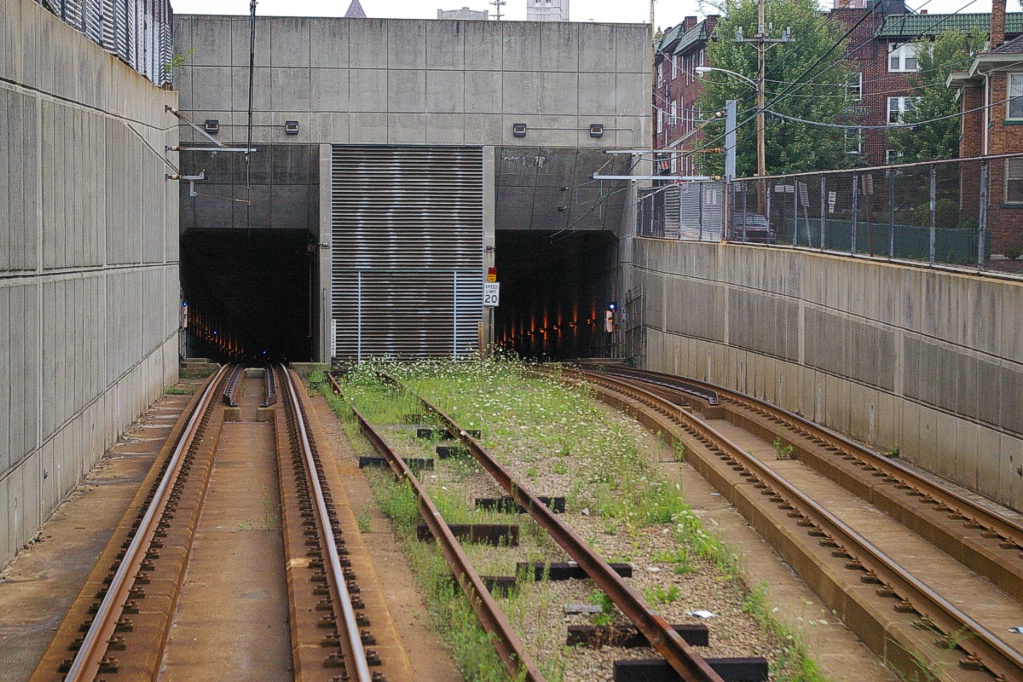
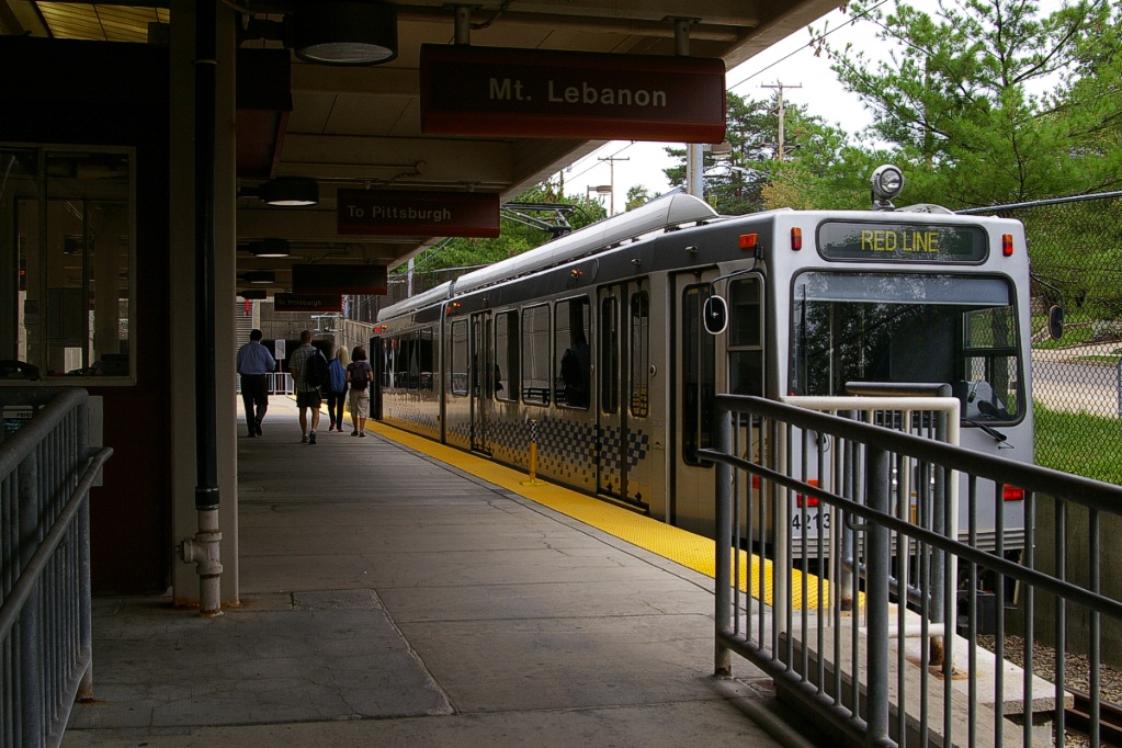
South of Dormont Junction, the line passes through the 850-910 metre long Mount Lebanon tunnel before reaching the Mount Lebanon station. The tunnel replaced eight blocks of street running on Washington Avenue (US 19) and was built in 1985 when the Dormont Junction station was rebuilt. This tunnel was the first in North America to use the New Austrian Tunnelling Method.
Through the tunnel, the line curves more to the south where Mt. Lebanon station is aligned more or less north-south. This is one of only two centre-island platforms on the entire system. Mt. Lebanon station has parking for 24 vehicles.
About 100 metres south of Mt. Lebanon station the line curves to a south-east alignment on its own right of way for about another 300 metres where it passes over Castle Shannon Boulevard.
Outbound approaching Mount Lebanon station.
|
Inbound arriving at Mt. Lebanon.
|
Inbound at Mt. Lebanon.
|
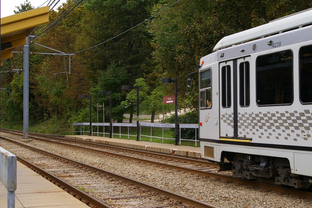
At this point, the line moves into a median along Pennsylvania Boulevard for about 300 metres before reaching the next stop at Poplar. This stop is located in a residential neighbourhood and has no parking facilities.
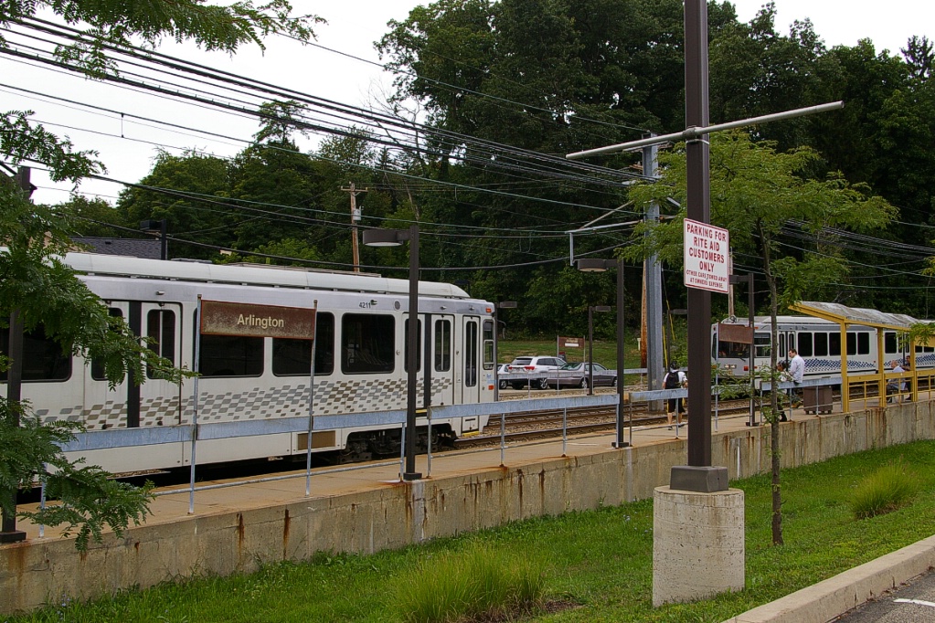
Pennsylvania Blvd continues southeast of Poplar only for about 100 metres, where the line is left in its own private right of way for about the next 500 metres until it reaches the stop at Arlington. This stop also has no parking facilities.
After Arlington, the line crosses Cooke Lane and Mt. Lebanon Boulevard, which are only about 50 metres apart as Cooke diverges from Mt. Lebanon just west of the line.
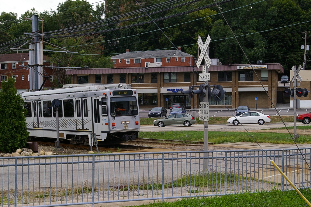
The next station is Castle Shannon, which is only another 150-200 metres southeast of the crossing with Mt. Lebanon Blvd. This station is the second station in the system with a centre-island platform, and it has parking facilities for 500 vehicles.
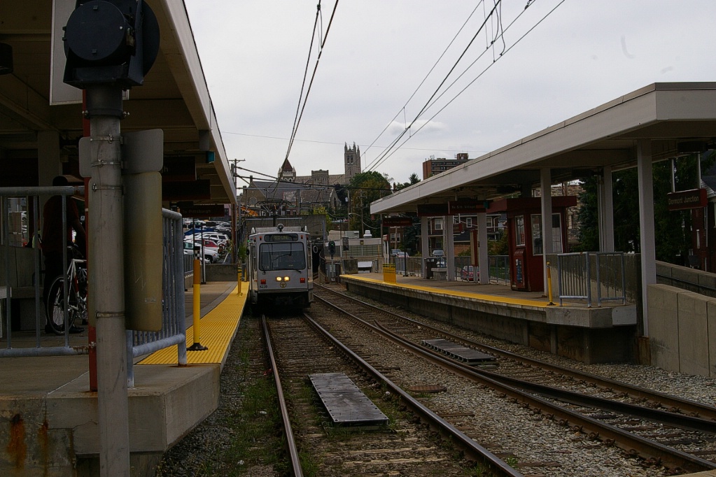
About 400 metres past Castle Shannon station is a high-level stop at Overbrook Junction. This station and the Willow station on the Overbrook line are part of the same station complex and a short footpath connects the two.
Most of the time on weekdays, the Red Line turns back at Overbrook. Early in the morning, some runs inbound start at South Hills Village as they originate from the maintenance facility located there. A few runs at the end of the operating day will terminate there as well.
Runs at the end of the morning peak service and before and after the afternoon peak service (8:45 to 10:00 am, 2:30 to 3:30 pm, and 5:45 to 7:30 pm) also continue to South Hills Village. On weekends, all Red Line service continues to South Hills Village as the Blue Line only runs to Library on weekends.
Brown Line
This route operated only during rush hours between South Hills Junction and downtown using a route that did not use the tunnel through Mt. Washington. Budget constraints in 2011 resulted in cancelling this route which took approximately 16 minutes to cover.
This line started from Gateway (Wood Street, once the North Shore Connector construction started), but after crossing the Monongahela River on the Panhandle Bridge, it branched to the east away from the other routes. This is the only route that did not use the transit tunnel to get to South Hills Junction. Instead, it climbed over Mt. Washington. In 1993, from June 6 until October 31, the Mt. Washington Transit Tunnel was closed for renovations and all routes had to follow this route to reach South Hills Junction from downtown. During that time, this route was suspended as other routes provided the service.
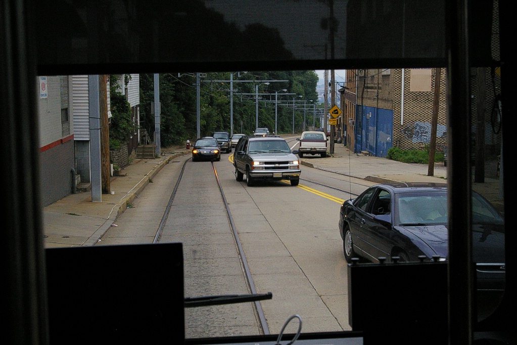
Notice the tracks on each side are in the curb lane.
There is a single track section that connects the Panhandle Bridge to Arlington Avenue. At the time of construction, CONRAIL refused to permit construction of a ramp sufficiently wide to carry two tracks over its railway line.
After leaving the Panhandle Bridge and curving to the east, the line crossed under the Liberty Bridge and climbs to join Arlington Avenue where two-track operation resumed. There were street stops along Arlington Avenue which winds as it climbs Mount Washington for about 1.5 km in a south-eastern direction before it curves to a south-western direction. It continues on Arlington Avenue for a few hundred metres before it turns westward on East Warrington Avenue.
It continues on East Warrington for about 2 km before it goes onto its own right of way to approach South Hills Junction station, using one of the west platforms at South Hills Junction.
Fares and Fare Collection
High platform stations have fare collectors during rush hours only, inbound side mornings, outbound side evenings. The exception is Station Square where fare booths are open throughout weekday daytime hours, from morning through evening rush.
Otherwise, at high platform and always at low-level stops, US$2.00 fare (cash or ticket) is paid onboard: inbound, upon boarding; outbound, upon leaving.
When fare is collected on board the vehicle, boarding and exiting must be done by the front door nearest the operator (the low door for stops, platform-level door for stations). Where a train has two cars, the second car does not serve stops nor stations without a fare collector.
| Two-car trains serve these stations: | ||
|---|---|---|
| Wood Street | Steel Plaza | First Avenue |
| Station Square | South Hills Junction | Memorial Hall |
| Willow | Washington Junction | South Hills Village |
| Lytle | Library | |
The downtown (subway) portion of the system is free to use (from Gateway to First Avenue, as are all bus trips within downtown). Trips between those stations and Station Square are US$1.50.
Cash fares to or from locations within Zone 1 (as far as Washington Junction) are US$2.00 and to or from locations in Zone 2 are US$2.60. There is a third zone, but LRT operations do not reach this zone.
During peak times, there is a US$0.50 surcharge in addition to the regular fare. Peak times are from 6-9 AM for inbound trips and between 4:00 PM and 6:30 PM for outbound trips.
Transfers cost an additional US$1.00 and are valid for 90 minutes, but must be surrendered when boarding another vehicle.
The fare structure is geared towards the use of weekly or monthly passes. The weekly pass costs US$20.00 for a single zone or US$24.00 for two zones.
The monthly pass costs US$75.00 for one zone and US$90.00 for two zones. The annual pass is 12 monthly passes for the price of 11.
There is no peak time surcharge for pass holders.
Accessibility
Accessibility is limited to stations with high-level boarding.
| Accessible access available at these stations: | ||
|---|---|---|
| Wood Street | Steel Plaza | First Avenue |
| Station Square | South Hills Junction | Fallowfield |
| Boggs | Bon Air | Potomac |
| Denise | Dormont Junction | South Bank |
| Mt. Lebanon | McNeilly | Killarney |
| Castle Shannon | Memorial Hall | Overbrook Junction |
| Willow | Washington Junction | South Hills Village |
| Lytle | West Library | Library |
Other Notes
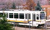
SD-400 LRV.
|
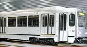
CAF LRV.
|
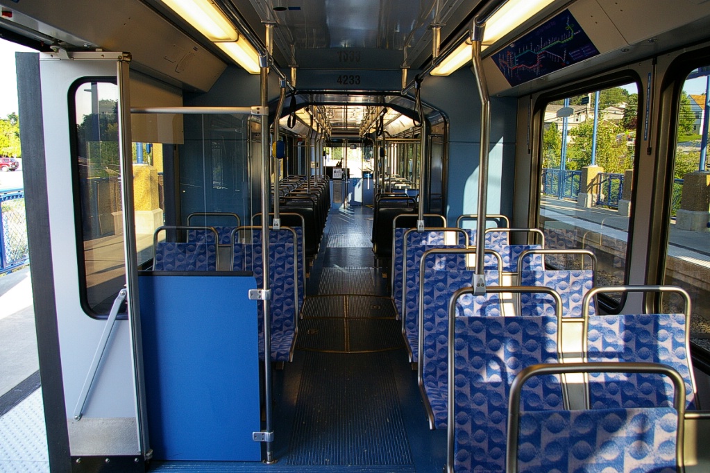
Interior view of rebuilt SD-400.
|
Current and Planned Expansion
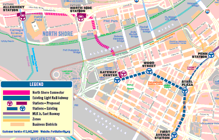
The North Shore Connector project recently completed and opened for operation on March 25, 2012. Rides between Downtown Pittsburgh and the North Shore are currently free at all times courtesy of the sponsorship of the Pittsburgh Steelers, Rivers Casino, ALCO Parking Corporation and the Stadium Authority of the City of Pittsburgh.
This project involved a 1.9 km extension to the North Shore, involving a tunnel under the Allegheny River. Two new stations were added on the North Shore and Gateway Center station in downtown was realigned for the extension.
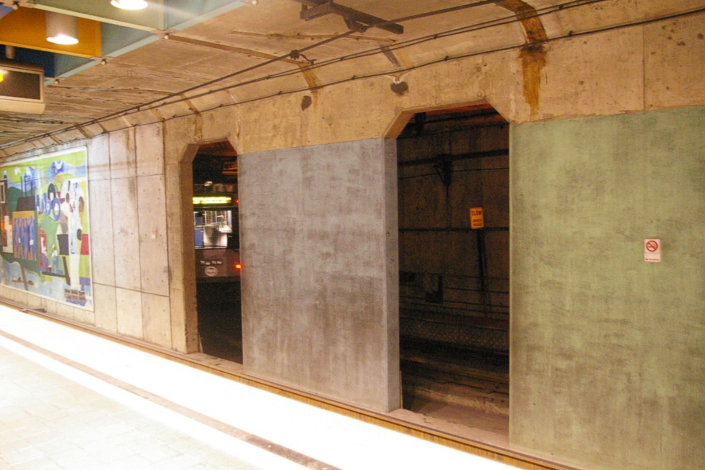
CENTRE: returning from loop. RIGHT: At platform.
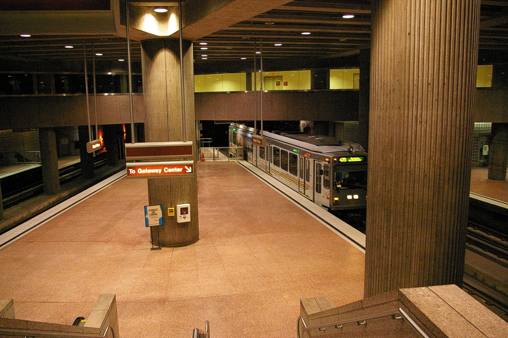
Prior to construction of the North Shore Connector, Gateway Center station had a single platform on one side of the two tracks. Inbound trains passed on the far track (separated from the platform by a wall) and turned north to loop around west, south, and return east to the platform.