Except where noted, photos by page author, January 2017
This page was last updated January 9, 2020
Send questions, comments, and photos here.

LRT in
Istanbul


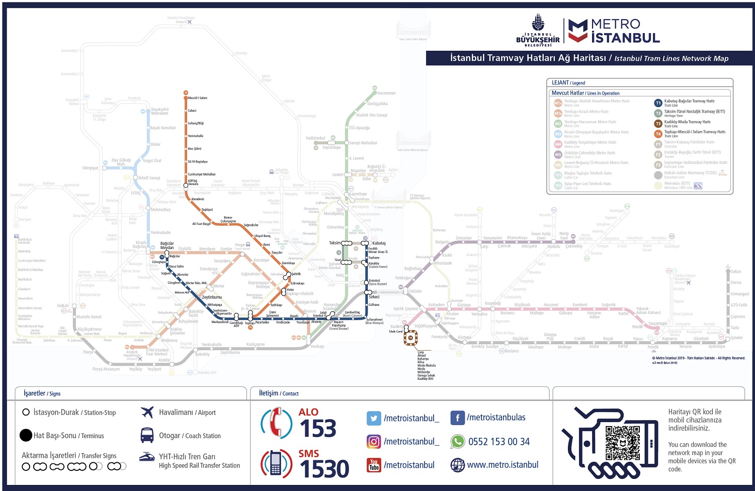
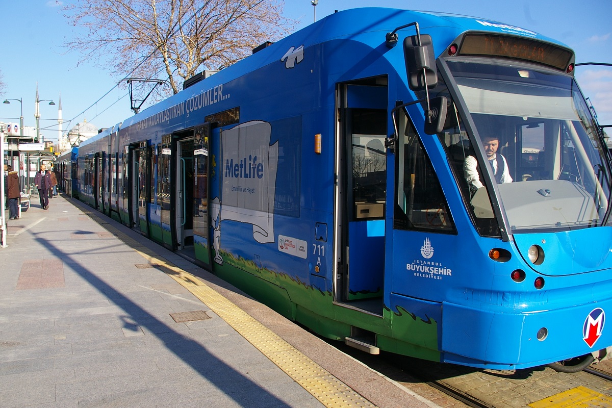
The Istanbul Tram is a modern tram system on the European side of Istanbul. The first section, the T1 opened in 1992, followed by the T2, which opened in 2006, and the T4, which opened in 2007. In 2011, the T1 and T2 were merged, retaining the T1 name. These lines are operated by Metro Istanbul (the new name of Istanbul Ulaşim A.Ş.) which belongs to the Municipality of Istanbul.
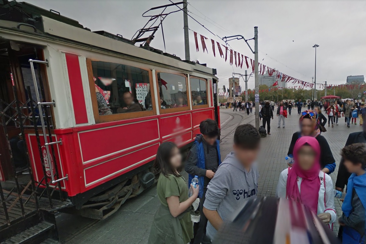
There is a short 1.6 km heritage/nostalgic tram line also on the European side that operates between Taksim square and Tünel Square. This service is referred to as line T2 on maps and is operated by İETT (İstanbul Electric Tram and Tünel Company), a separate company under the Municipality of istanbul that operates public transit other than the LRT and Metro lines.
On the Asian side of Istanbul (also known as the Anatolian side), there is another heritage tram line designated T3, that operates on a circular line that is 2.6 km long. This line is operated by Metro Istanbul.
Contents
Toronto Comparison
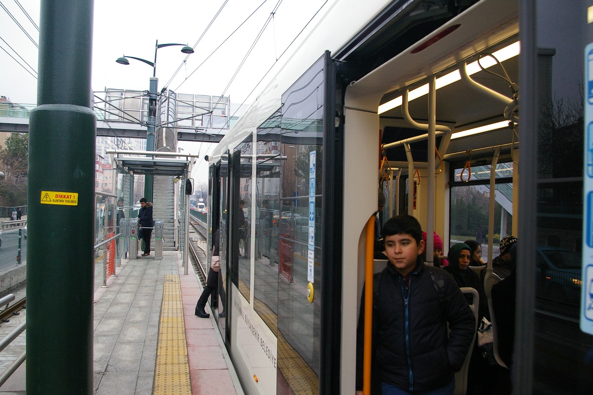
The T1 line is provides a good comparison with what LRT will be like in Toronto as it uses low-floor technology with low level platforms. Its variety of right-of-ways provides a number of ideas for implementing an LRT line. The T4 line has a number of underground station that, while high-platform, are of a similar nature to the central stations of the Crosstown LRT line.
System Highlights and Route Details
| Item | Notes |
|---|---|
| Number of lines | 4 2 LRT lines 2 heritage lines |
| Total length | 33.8 km |
| Total stations | 54 |
| Fleet | Different for each line |
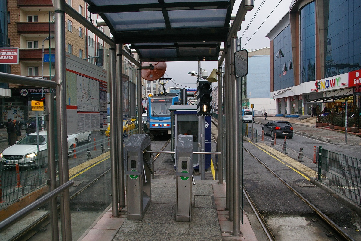
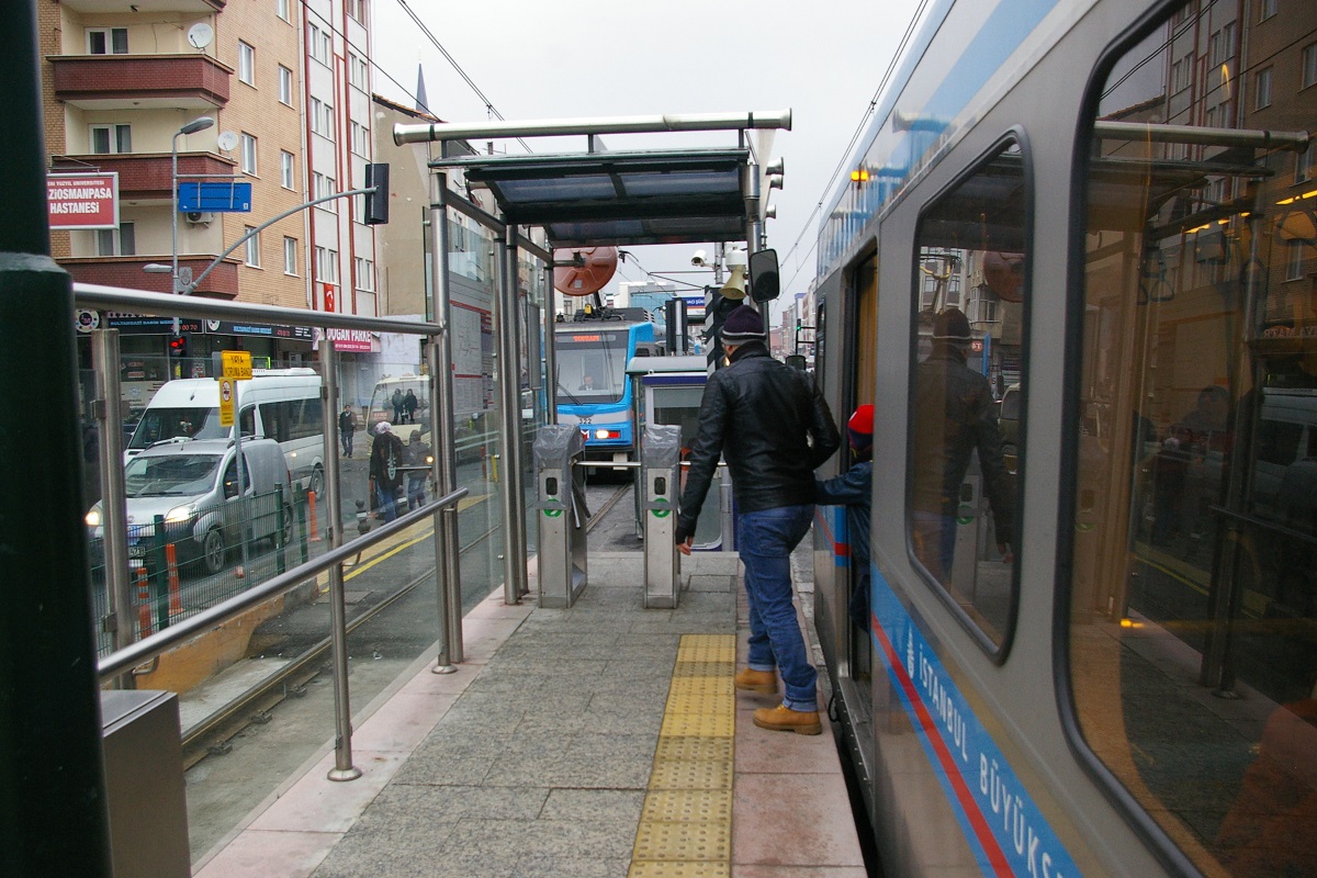
| Fare collection | Turnstile access to platforms of T1 and T4 lines. Fares are paid onboard T2 and T3 heritage trams. |
| Fare integration | Separate fare payable on each line |
| Airport service | Via metro connections |
|
|
| Length | 18.5 km |
|---|---|
| Stations | 31 1 underground |
| Track Gauge | 4'-8½" (standard gauge) |
| Fleet | 55 Bombardier Flexity Swift A32 37 Alstom Citadis X04 |
| Journey Duration | 65 minutes |
| Operational Hours | 06:00 to 00:00 |
| Right of Way | Mix of mixed traffic and middle-of-road, with some private |
| Loading | Low level platform and vehicles |
| Service Frequency | 2 minutes - peak hours |
| Fare | 2.60 ₺ (About C$0.57) using Istanbulkart |
| Connections | M1A at Zeytinburnu, Yusufpaşa, and Aksaray T4 at Topkapı M2 at Laleli Marmaray at Sirkeci F2 at Karaköy F1 at Kabataş |
| Opening Dates | June 13, 1992 from Aksaray - Beyazıt July 10, 1992 extension from Aksaray to Sirkeci October 29, 1992 extension from Aksaray to Topkapı March 10, 1994 extension from Topkapı to Zeytinburnu April 20, 1996 extension from Sirkeci to Eminönü January 1, 2005 extension from Eminönü to Findıklı June 1, 2006 extension from Findıklı to Kabataş September 15, 2006 Zeytinburnu to Bağcılar Opened as T2 high-floor line
February 3, 2011 merged T1 and T2 After single-weekend low-floor conversion of T2 |
|
|
| Length | 1.64 km |
|---|---|
| Stops | 5 |
| Track Gauge | 1000 mm (3'-3⅜") |
| Fleet | Original Istanbul tramcars, from the first-generation tramway that closed in 1966. These were restored in the 1980s for use on the heritage tramway.
During peak season, a trailer is often coupled to the motored tram for extra capacity. As of 2008, fleet includes: Car 47, built in 1913
Car 223, built in 1928 Car 410 German-built trailers 411 (1914) and 418 (1919) |
| Journey Duration | 20 minutes |
| Operational Hours | 7:00 am to 8:00 pm |
| Right of Way | On-street: Istiklal Caddesi (Independence Avenue) Single track, with a passing siding at Galatasaray Square. |
| Service Frequency | 10-20 minutes |
| Fare | 1.75 ₺ (about C$0.38) |
| Connections | F1 and M2 at Taksim F2 at Tünel |
| Opening Dates | December 29, 1990 |
|
|
| Length | 2.6 km |
|---|---|
| Stops | 10 |
| Track Gauge | 1000 mm (3'-3⅜") |
| Fleet | Tatra GT6 tramcars procured from Germany |
| Operational Hours | 7:00 am to 9:00 pm |
| Right of Way | On-street |
| Service Frequency | 10 minutes (peak hours) |
| Fare | 1.75 ₺ (about C$0.38) |
| Connections | M4 near İskele Cami stop |
| Opening Dates | November 1, 2003 |
|
|
| Length | 15.3 km |
|---|---|
| Stations | 22 7 underground 1 over viaduct 14 on surface |
| Track Gauge | 4'-8½" (standard gauge) |
| Fleet | ABB LRVs 31 DÜwag KTA (Köln Tramvay Aracı) 63 Hyundai Rotem LRV34 RTE 2014 tram built by Metro Istanbul |
| Journey Duration | 42 minutes |
| Operational Hours | 06:00 to 00:00 |
| Right of Way | Mix of private, underground, and middle-of-road |
| Loading | High level platform and vehicles |
| Service Frequency | 5 minutes - peak hours |
| Fare | 2.60 ₺ (about C$0.57) using Istanbulkart |
| Connections | T1 at Topkapı M1A and M1B at Vatan Future M7 at future Karadeniz İstasyonu between Karadeniz and Kiptas-Venezia
|
| Opening Dates | September 12, 2007 from Edirnekapı to Mescid-i Selam March 18, 2009 - extension to Topkapı |
|
|
| Length | 10.1 km |
|---|---|
| Stations | 14 |
| Track Gauge | 4'-8½" (standard gauge) |
| Journey Duration | 35 minutes (expected) |
| Power Collection | Third rail embedded in the track bed |
| Connections | T1 at Eminönü M2 at Küçükpazar Future M7 at Alibeyköy |
| Expected Opening | This line is currently under construction. Expected opening date has yet to be announced. |
 Eminönü - Alibeyköy Tram Line
Ride Descriptions
| Line | Notes | Recent Opening |
|---|---|---|
|
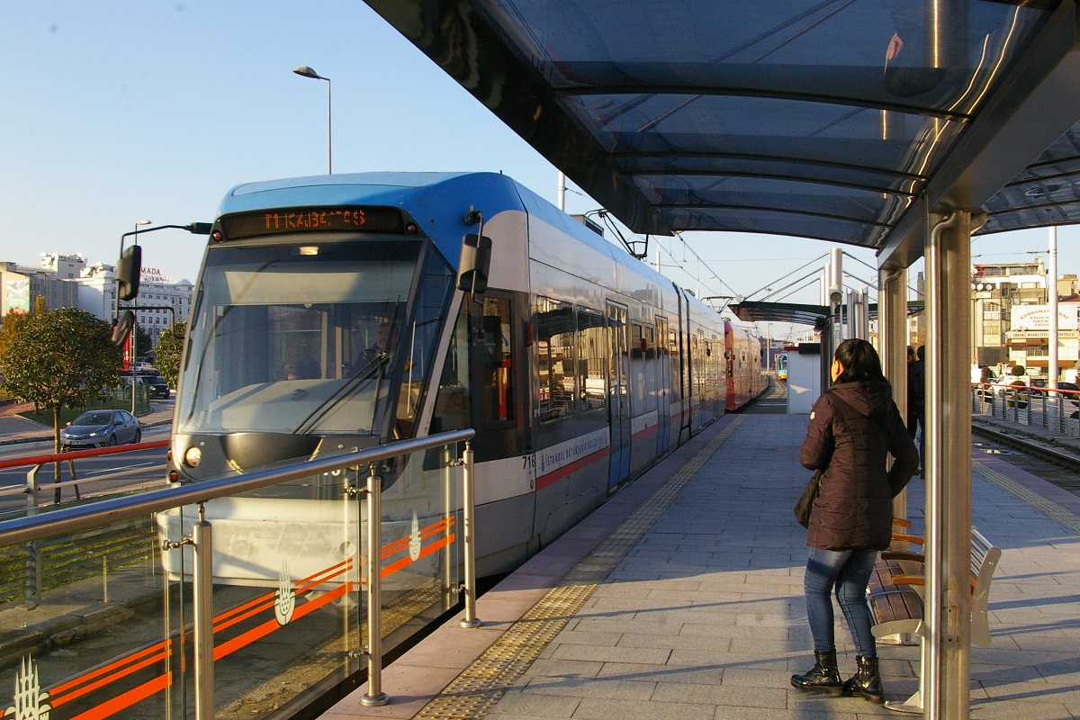
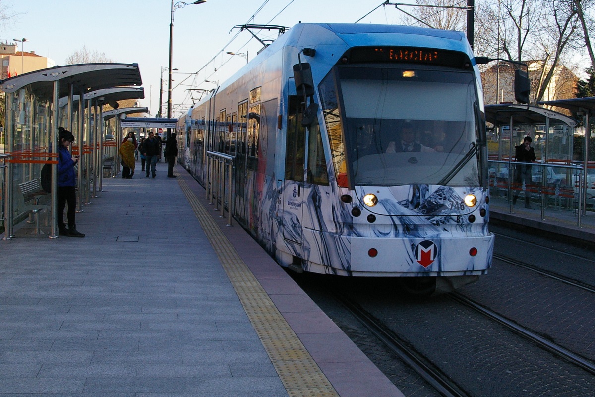
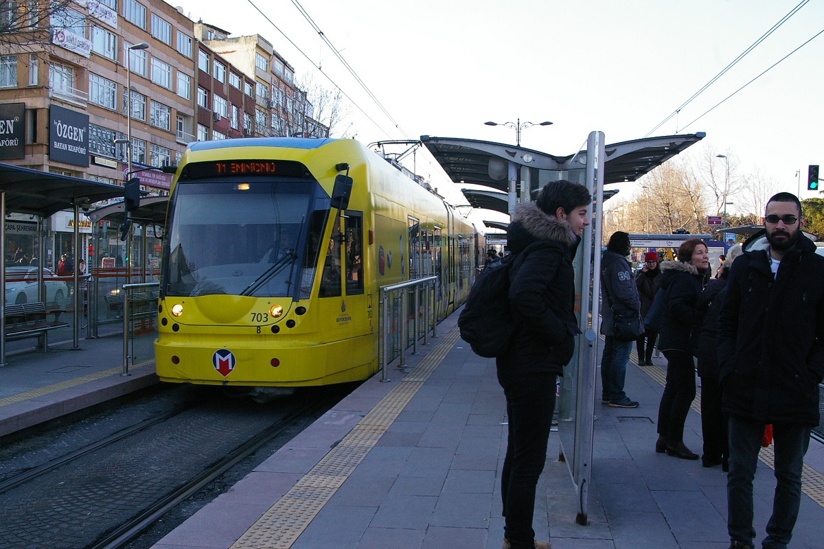
| Description from Bağcılar to Kabataş via Eminönü | February 3, 2011 |
|
| Description from Taksim Square to Tünel on İstiklal Caddesi | December 29, 1990 |
|
| Circuilar line described from from İskele Cami to Kadiköy İDO | November 1, 2003 |
|
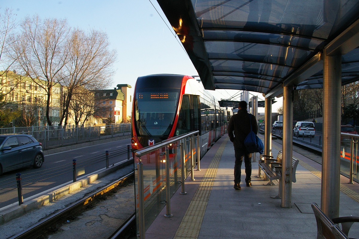
| Description from Mescid-i Selam to Topkapı | March 18, 2009 |
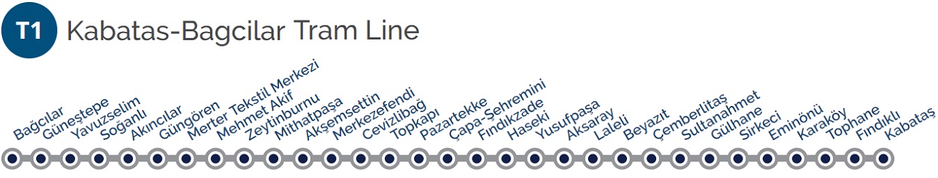
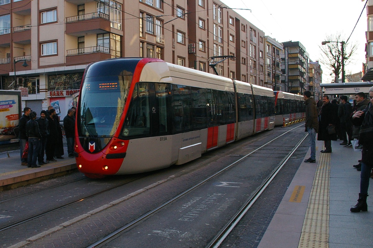
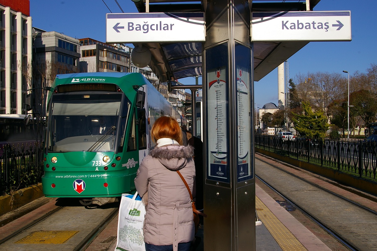
 Kabataş - Bağcılar Tram Line
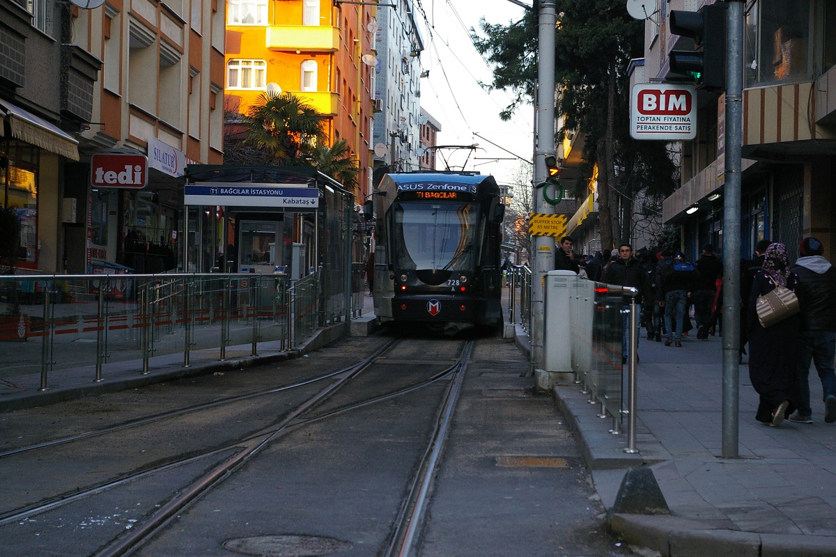
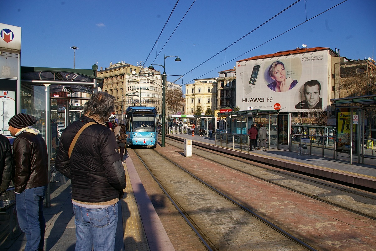
This route description starts at Bağcılar located about a 250 metre walk from the Bağcılar Meydan İstasyonu (station) on the M1B metro line. This station has a single track with a single boarding platform on its west side. See the photo to the far left.
Travelling south in mixed traffic for about 500 metres, the line reaches Güneştepe, a station with a centre platform. On the west side of the road, Necip Fazil Kisakürek Caddesi (Road), there is a park, Sehıt Özcan Canık Parki as seen in the photo to the immediate left.

(Google Street View Apr 2018)
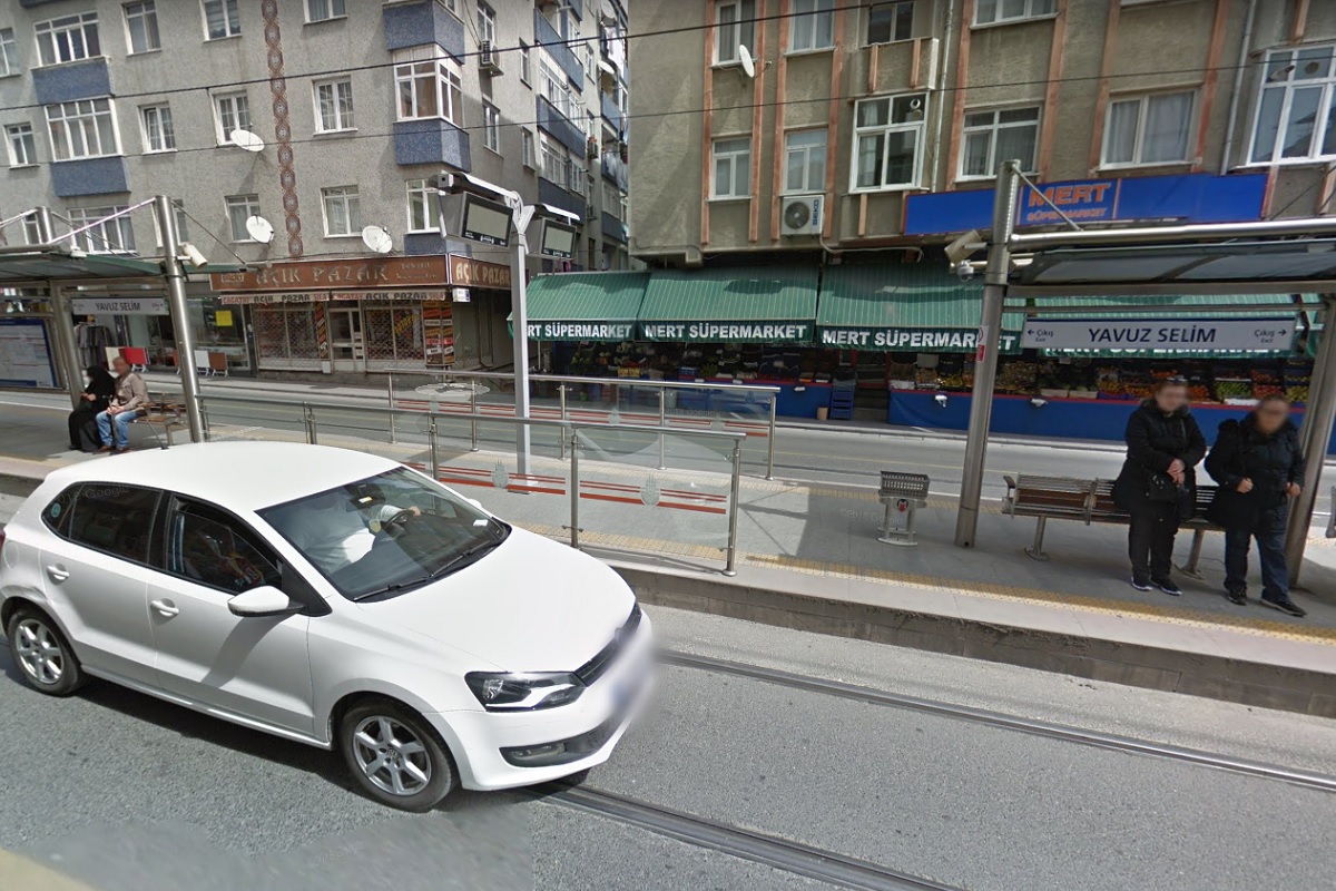
Continuing south on Necip Fazil Kisakürek Caddesi, the road curves gently towards a southeast direction over about 700 metres before it reaches Yavuz Selim İstasyonu. Yavuz Selim a has a centre-platform and can be seen in the right photos.
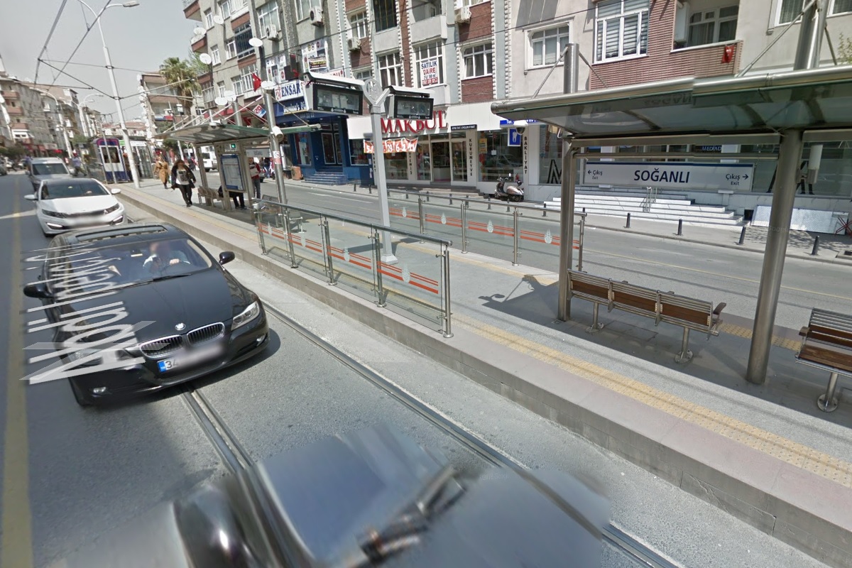
From Yavuz Selim, continuing southeast for about 400 metres, the road changes name to Abdi İpekçi Caddesi at Soğanlı Caddesi.
About another 50 metres is Soğanlı İstasyonu seen in the two photos to the left.

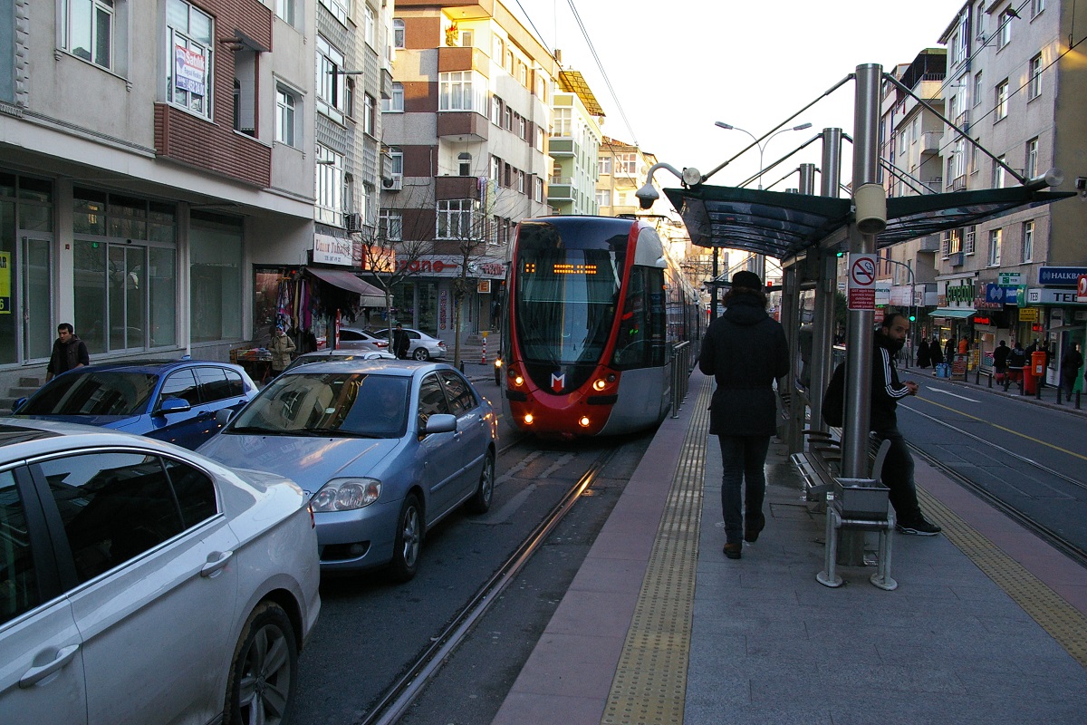
Bağcılar-bound train on the left
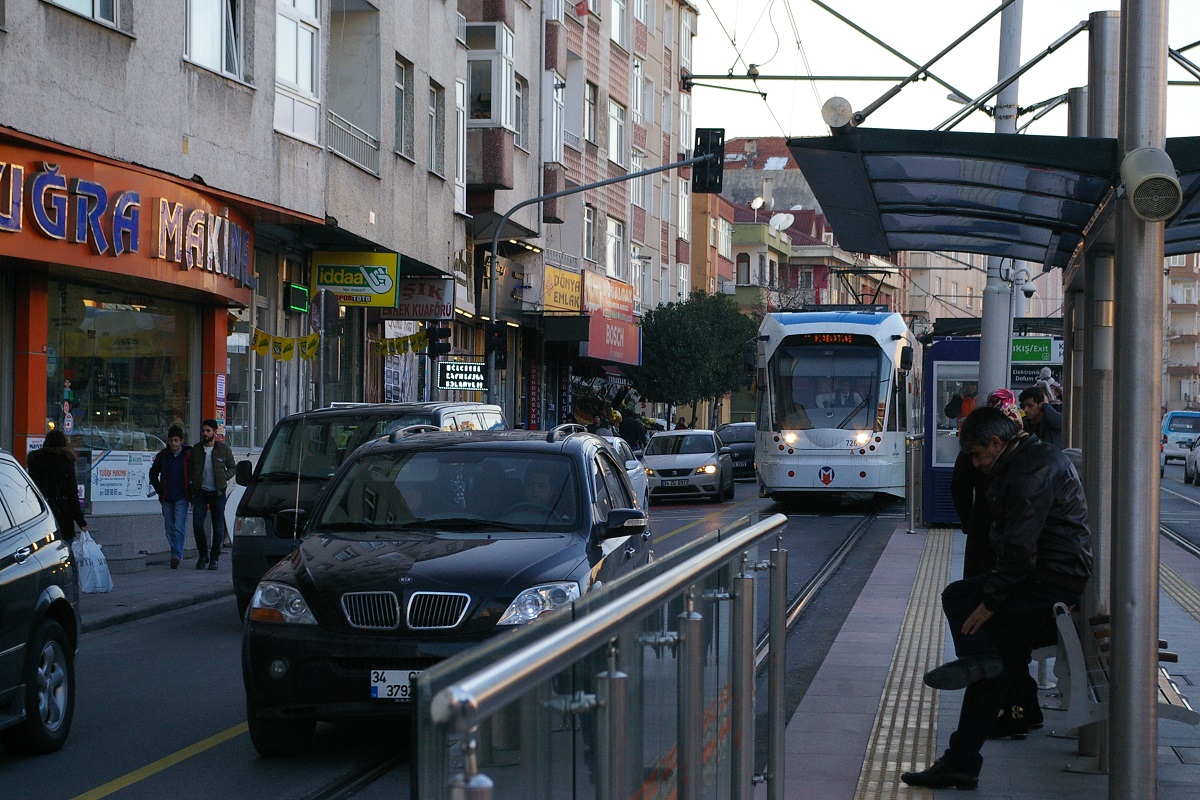
The line continues southeast with some slight curves following Abdi İpekçi Caddesi before reaching Akıncılar İstasyonu in about 900 metres. Akıncılar is also a centre-platform station seen in the photo to the immediate right.
Continuing for another 650 metres on Abdi İpekçi Caddesi, the line makes a left turn at Posta Caddesi and continues about 200 metres before making a right turn at Karadeniz Caddesi to follow that road on its east side for about 150 metres before arriving at Güngören İstasyonu, the first station on this line with side platforms seen to the far right.
(Google Street View Apr 2018)
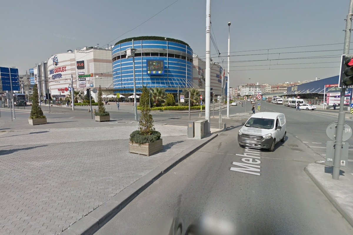
After passing through an intersection immediately southeast of Güngören İstasyonu (far left photo), the line curves right to a south-southwest direction and follows a wide island in the middle of Mehmet Akif Caddesi for about 150 metres before arriving at Merter Tekstil Merkezi, another centre-platform station in the immediate left photo.
The line continues south down the centre of Mehmet Akif Caddesi for about 700 to 750 metres where it curves a little south-southwest before arriving at Mehmet Akif İstasyonu.
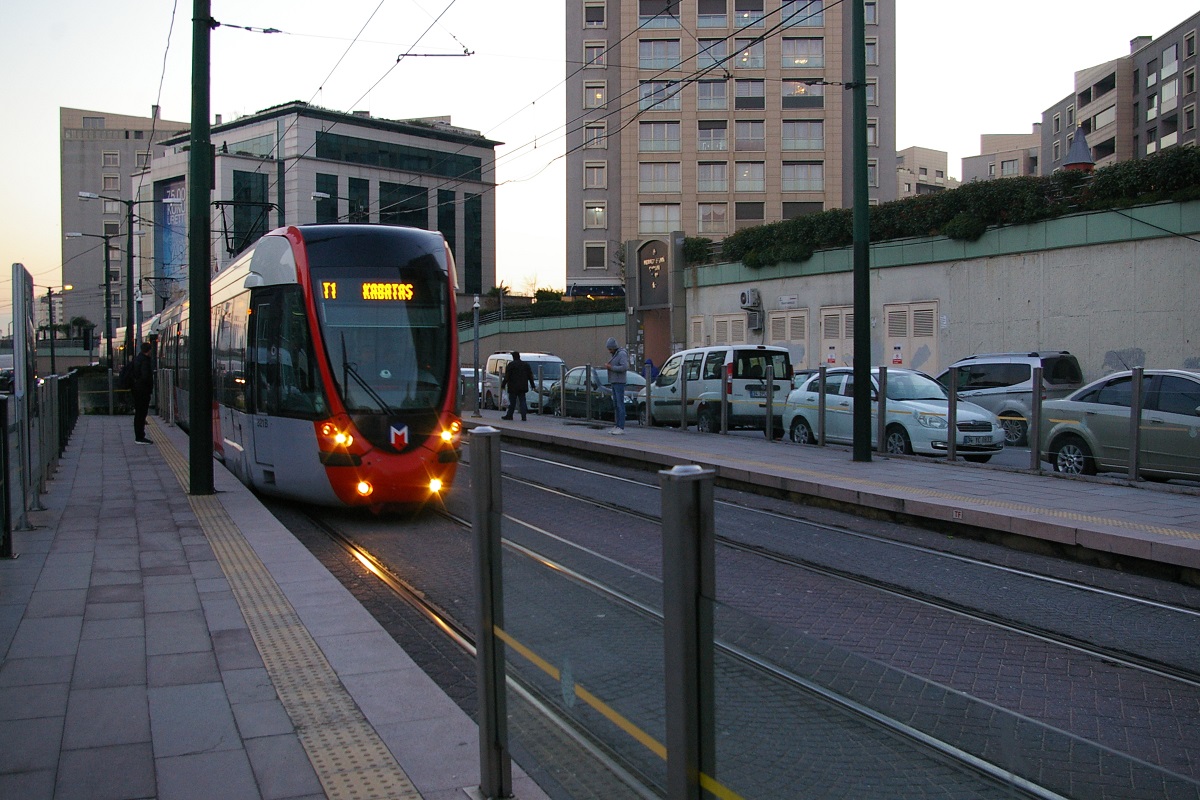
Continuing south about another 400 metres, the line curves a little to the south-southwest to cross the northbound side of Mehmet Akif Caddesi and continue on its east side for about 200 metres before making a turn to the east and travelling about another 300 metres to arrive at Zeytinburnu İstasyonu. Here, there are both side platforms and a centre-island platform for both tracks seen in the far right photo. There is also a connection with the M1A metro line with its Zeytinburnu station.
 Mithatpaşa İstasyonu platforms are just over 200 metres apart
Bağcılar-bound platform shown on the left is west of the Kabataş-bound platform shown on the right
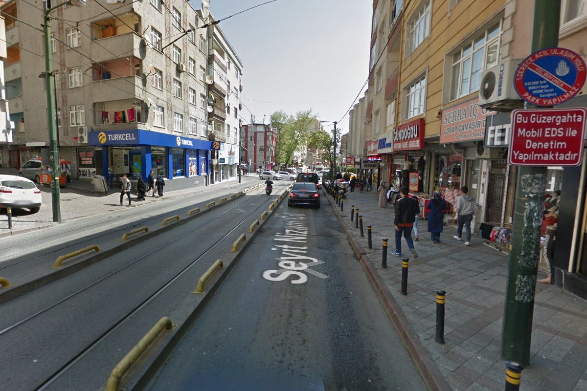
Continuing east about 500 metres, the line passes the intersection with Mevlana Caddesi where it moves to the centre of Seyit Nizam Caddesi and continues about another 550 metres. At this point, it passes the Bağcılar-bound platform of Mithatpaşa İstasyonu, as seen in the far left photo. The Kabataş-bound platform of Mithatpaşa İstasyonu is still a little more than 200 metres further east, shown in the immediate left photo.
(Google Street View Apr 2018)
At this point, the line is in mixed traffic, but the Kabataş-bound track has limited access for motor vehicles - they can only enter and leave the lane at main intersections as shown in the photo to the immdiate right. The limited-access centre lane continues for the nearly 500 metres east from Mithatpaşa İstasyonu until the line reaches Akşemsettin İstasyonu where the road right of way of Seyit Nizam Caddesi widens to allow both tracks to be separate from road traffic.

The line continues east another 200 metres until the intersection with Gümüşsuyu Davutpaşa Caddesi where it curves north and follows the east side of that road. After about 800 metres, the line shifts a little west as it crosses Yeni Çiftlik Caddesi to continue on Gümüşsuyu Davutpaşa Caddesi about another 50-100 metres before arriving at Merkez Efendi İstasyonu. This station, seen in the far left photo, has side platforms.
Continuing north along Gümüşsuyu Davutpaşa Caddesi, after about 500 metres the line crosses Mevlevihane Caddesi and curves northeast entering an off-street right of way. About 60 metres into the right of way is Cevizlibağ-AÖY (Atatürk Öğrenci Yurdu) İstasyonu.
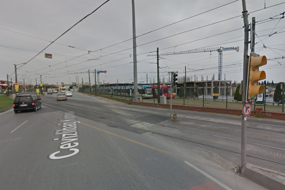

Remaining in a separate right of way, the line continues northeast about 350 metres where it crosses the eastbound lanes of Cevizlibağ Köprüsü to enter the median of that street where a storage yard is located on the north side of the line, shown in the immediate photo to the right. Continuing almost eastward for about 130 metres, the line enters Topkapı İstasyonu, located beneath an underpass in the far right photo.
As the line leaves Topkapı, it continues in the median of the road, now named Topkapı Kavşaği. After about 400 metres, the line and road cross an overpass and curve to a southeast direction as the road changes name to Turgut Ozal Millet Caddesi. Pazartekke İstasyonu is about another 300 metres southeast. This station has side platforms, as seen in the photo to the far left. In just over another 600 metres is Çapa-Şehrernini İstasyonu that has both a centre platform and side platforms, shown in the immediate left photo.
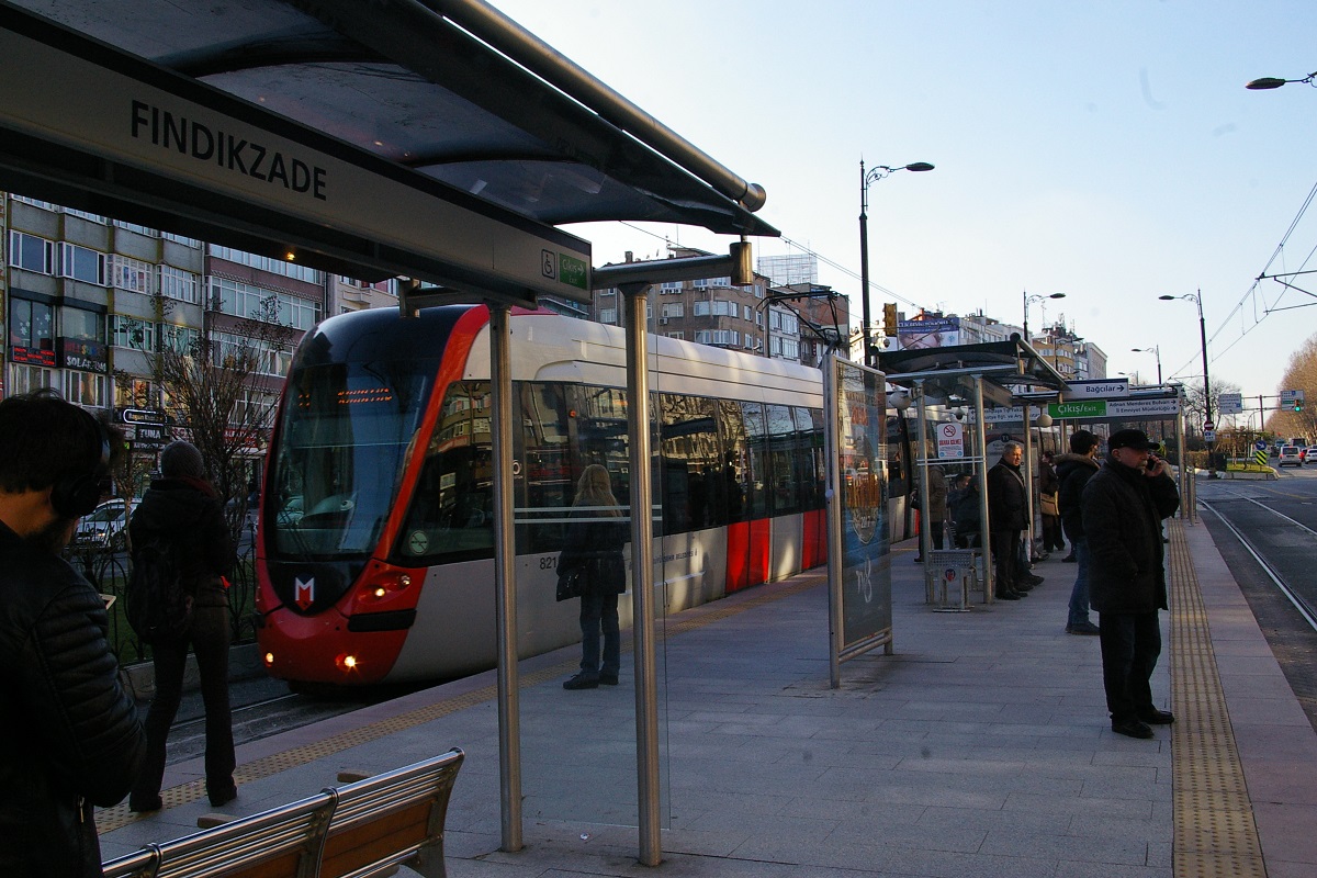
The line continues southeast on Turgut Ozal Millet Caddesi for just under 800 metres before reaching the centre-platform of Fındıkzade İstasyonu, seen to the immediate right. Then as the road curves a little towards the east-southeast direction, it only takes another 200 metres to reach Haseki İstasyonu in the far right photo.
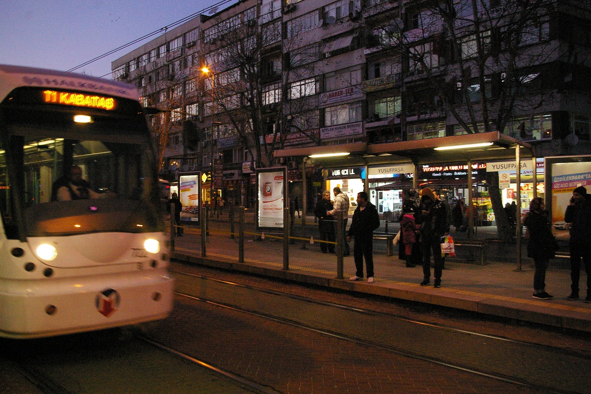
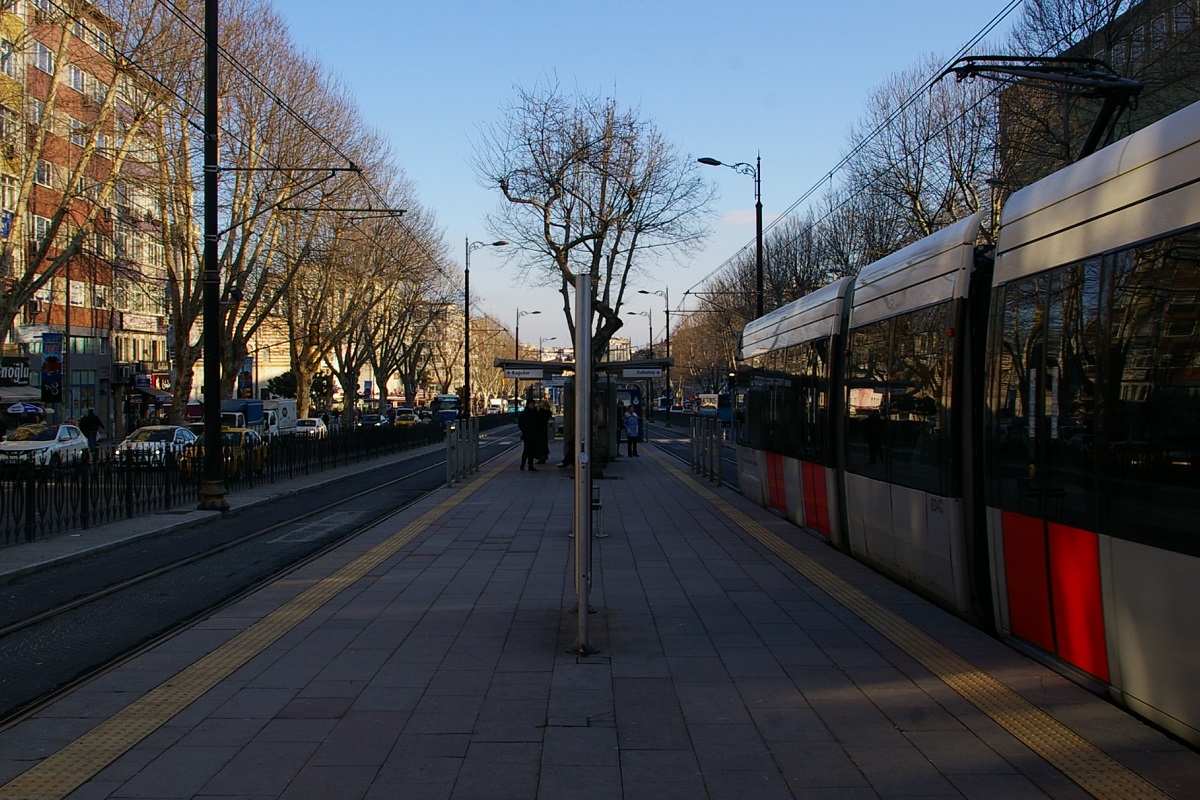
A little over 300 metres heading east-southeast on Turgut Ozal Millet Caddesi brings the line to Yusufpaşa İstasyonu, a side-platform station shown in the photo to the far left. The Aksaray station on the M1 metro line is about 200 metres north-northeast from this station.
About 100 metres past Yusufpaşa, the line curves a bit to head east for another 500 metres where it reaches Aksaray İstasyonu. At this point, the line is in the median of Ordu Caddesi, as seen in the immediate left photo.
(Google Street View Apr 2018)
Continuing east on Ordu Caddesi, the line reaches Laleli-Üniversite İstasyonu. This side-platform station, shown in the photo to the right, is a 250 metre walk north to Vezneciler station on the M2 metro line.
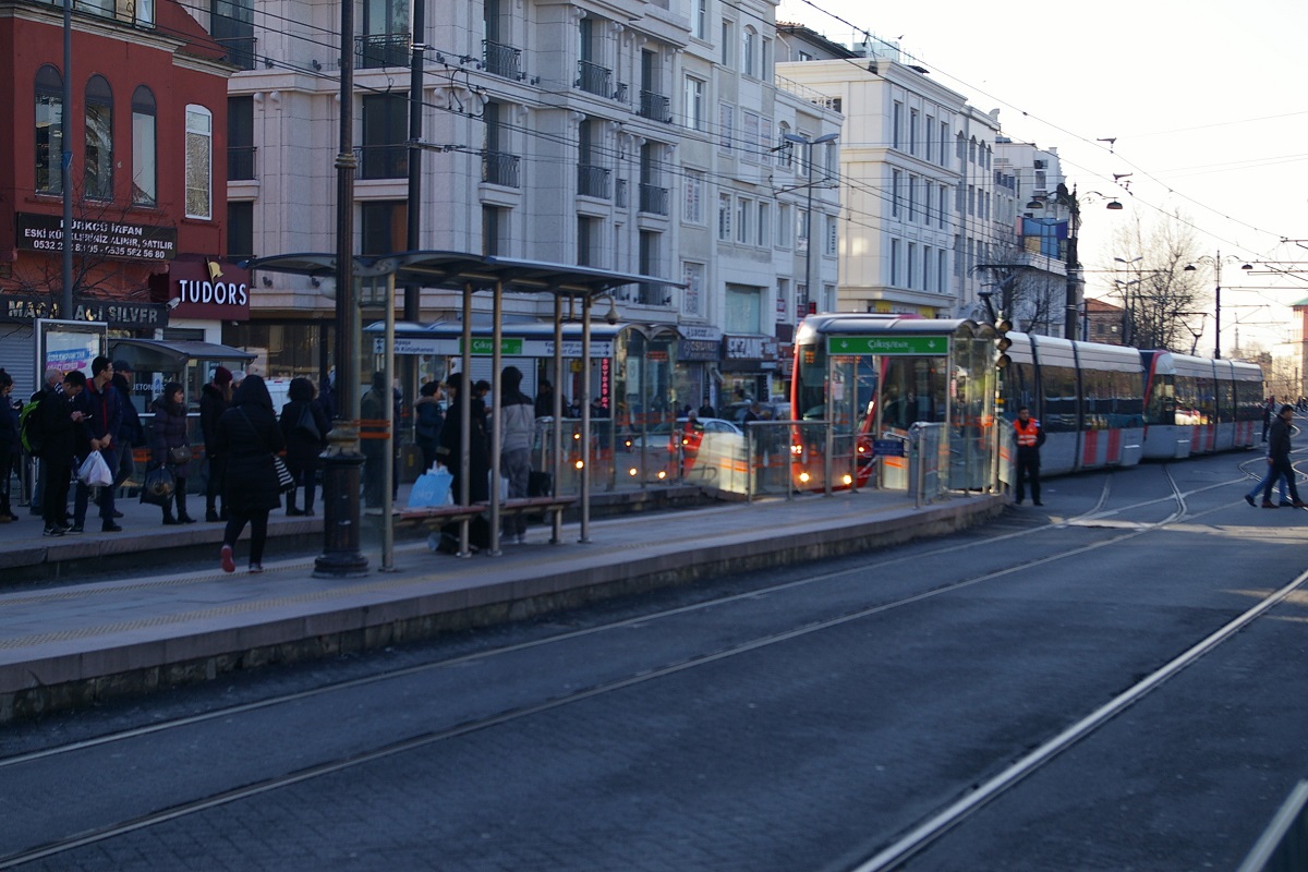
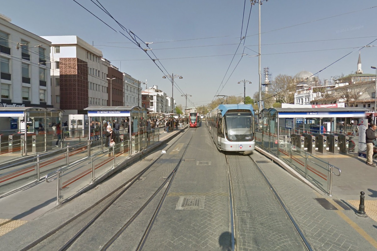
The line continues east for about 200 metres before curving with Ordu Caddesi slightly west-southwest and continues another 350-400 metres to reach Beyazıt-Kapaliçarşi İstasyonu. This station has three tracks and three platforms (two side and one island), as seen in the far right photo.

The track and platform arrangement at Beyazıt-Kapaliçarşi facilitates using this station as a turn-back location.
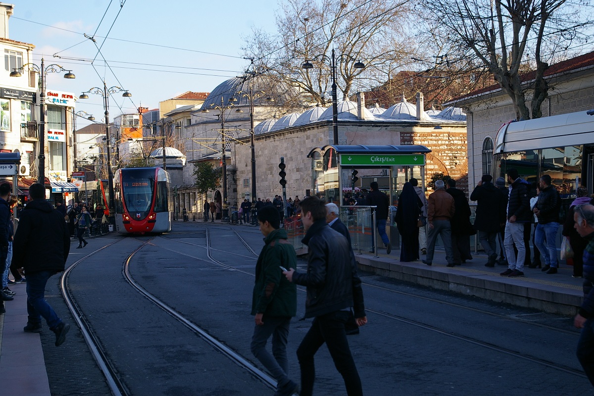
Heading east from Beyazıt-Kapaliçarşi, the trains move in mixed traffic on a narrower street named Yeniçeriler Caddesi. It's only about another 350 metres before reaching Çemberlitaş İstasyonu. English translations of the route map will show a subtitle for this station as "Burnt Column" as Çemberlitaş means "hooped stone", "burnt stone", or "burnt pillar" and refers to the Column of Constantine, a monumental Roman column located about 100 metres northeast of this station.
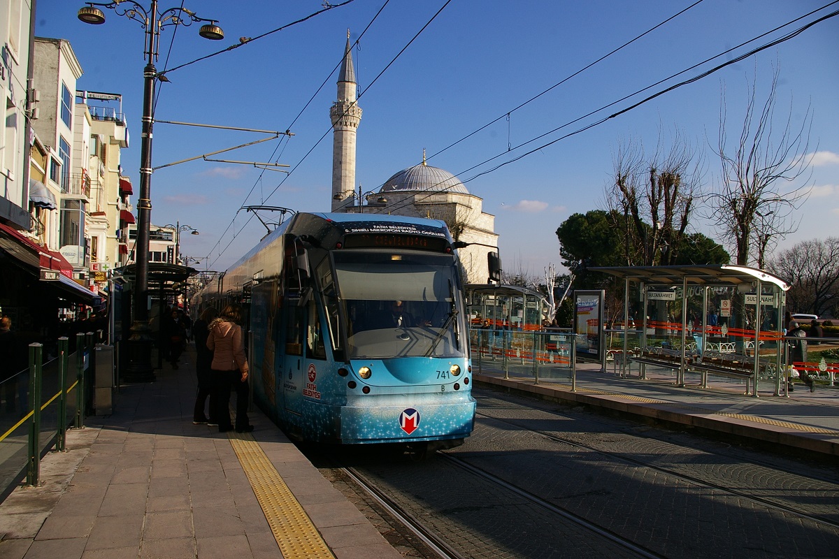
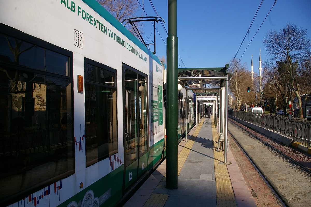
From Çemberlitaş, the street name changes to Divan Yolu Caddesi about 60 metres east and the line continues another 300 meters where the line arrives at Sultanahmet İstasyonu.
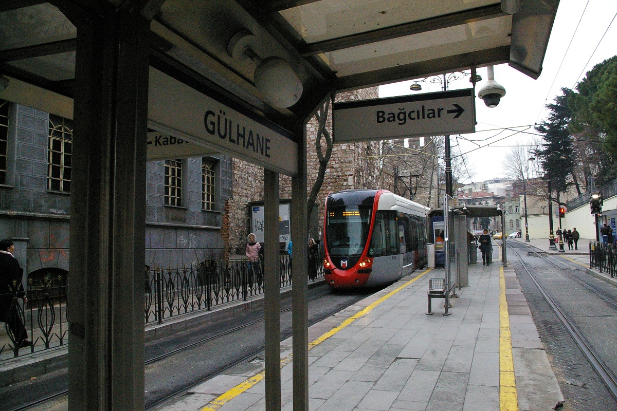
About 200 metres east of Sultanahmet, the road makes a broad 100 metre turn north, changing its name to Alemdar Caddesi as it crosses Yerebatan Cedessi about half way through the curve. In another 200 metres, the road and line curve northwest for about 100 metres before curving back north for another 150 metres where it arrives at Gülhane İstasyonu, shown in the near left photo.
Just north of Gülhane, the line leaves Alemdar Caddesi and heads northwest on Hüdavendigar Caddesi for about 400 metres. Here, the line turns to the northeast and arrives at Sirkeci İstasyonu. At this station is a transfer point with the Marmaray Sirkeci station. About 150 metres northeast of Sirkeci, the line turns northwest to follow Reşadiye Caddesi as seen in the lower photo to the far left.
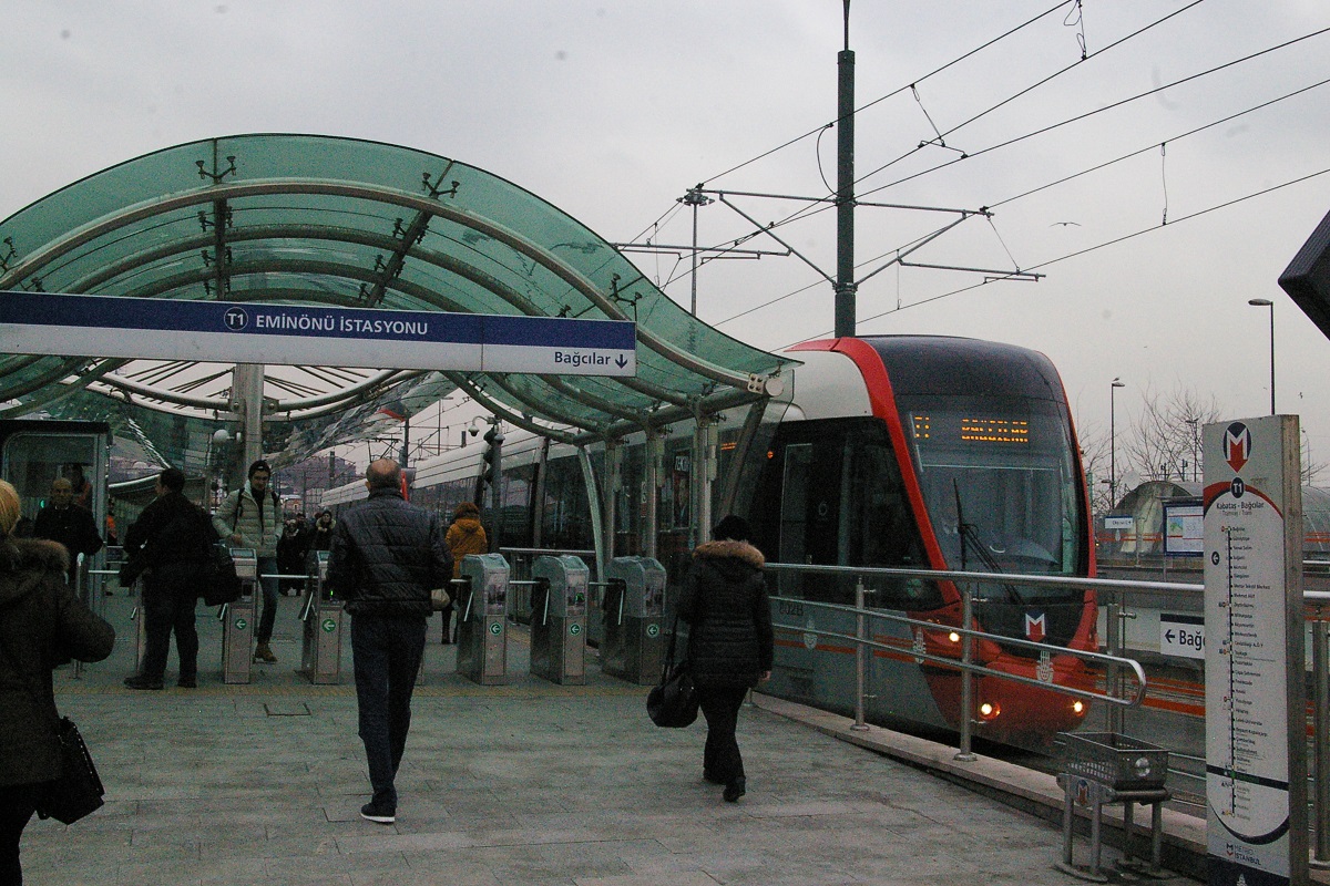
Continuing just over 300 metres from the turn, the road curves to the west and the line arrives at Eminönü İstasyonu, seen in the near left photo.
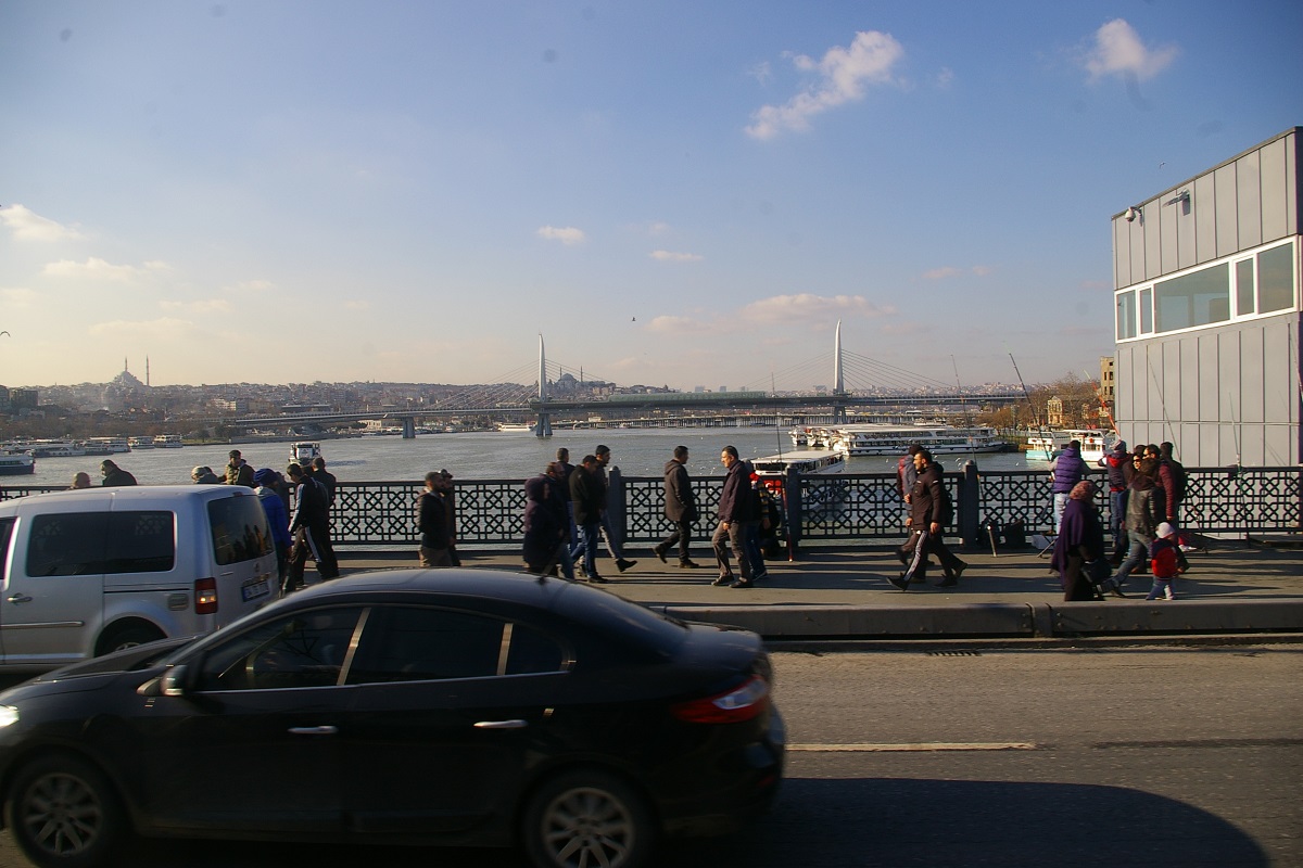
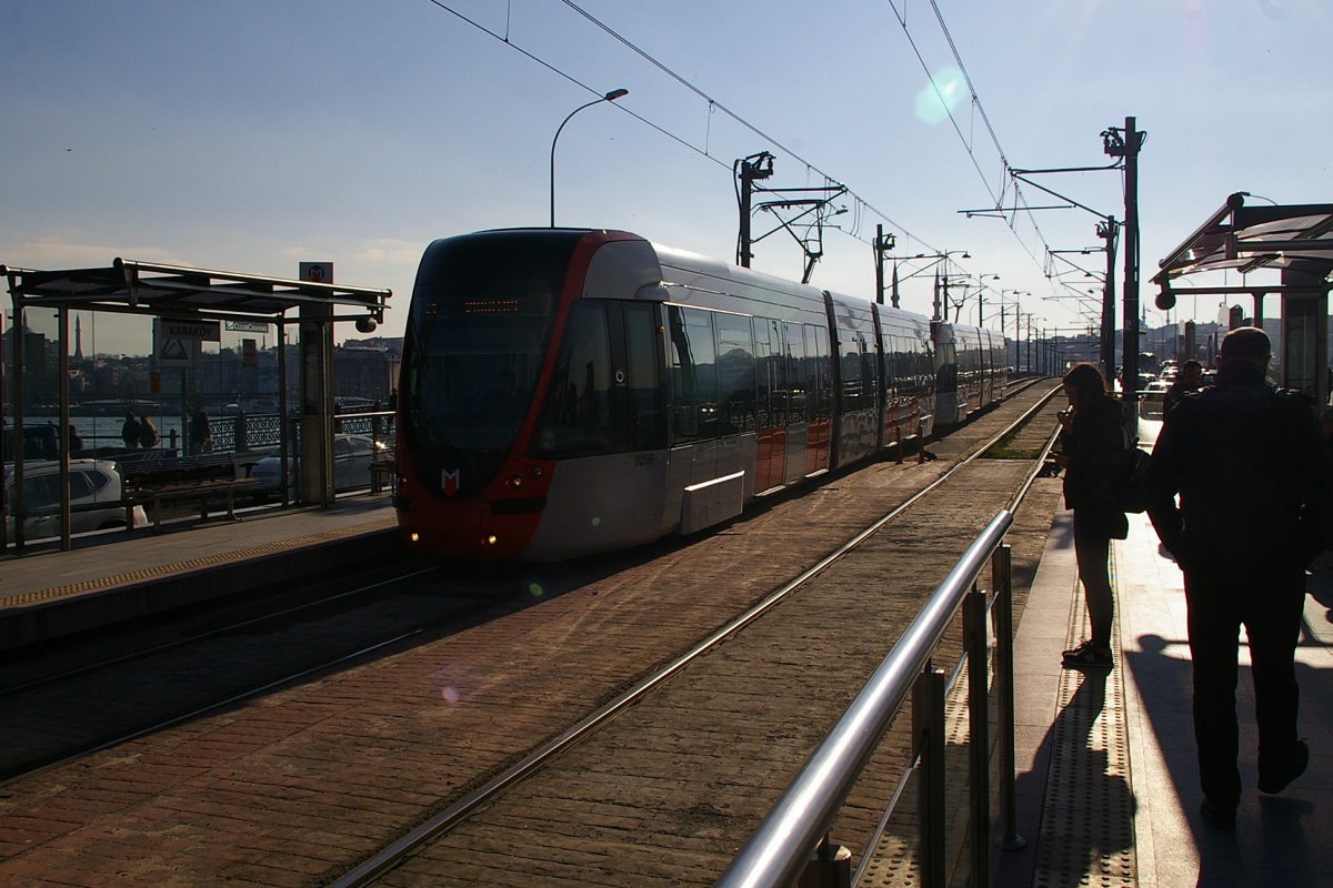
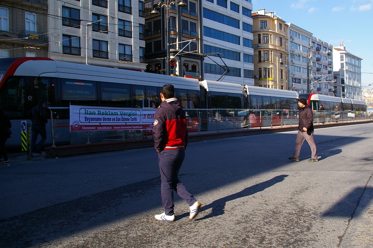
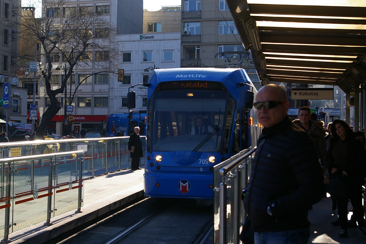
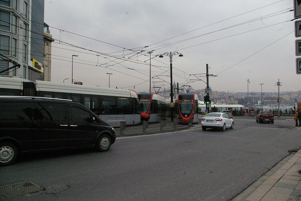
About 100 metres west of Eminönü, a wide turn to the northeast takes the road and line over the Galata Köprüsü (bridge), spanning the Golden Horn. The bridge spans 490 metres and at the northeast end of it is Karaköy İstasyonu seen in the photo to the far right and the below photo on the far left.
About 100 metres northwest of this station is the Karaköy terminal on the F2 Tünel, an underground funicular line that connects Karaköy with Beyoğlu, 573 metres away and almost 62 metres higher in altitude.
Heading almost north from Karaköy in the median of Kemeralti Caddesi, after about 100 metres the road and line curve towards a northeast direction. Continuing northeast another 550 metres has the line arriving at Tophane İstasyonu, a narrow island-platform station shown in the near left photo.
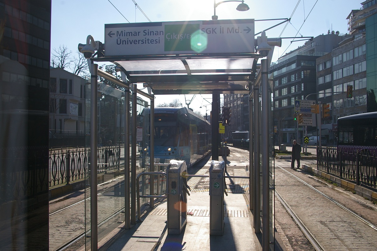
Just past Tophane, the road and line curve a bit east-northeast as the road's name changes name to Meclis-i Mebusan Caddesi at Boğazkesen Caddesi. The line follows this direction for about 800 metres before curving to a north-northeast direction and continuing about another 200 metres to reach Findıklı-Mimar Sinan Üniversitesi (MSÜ) İstasyonu, another narrow island-platform station as seen in the two photos to the right.
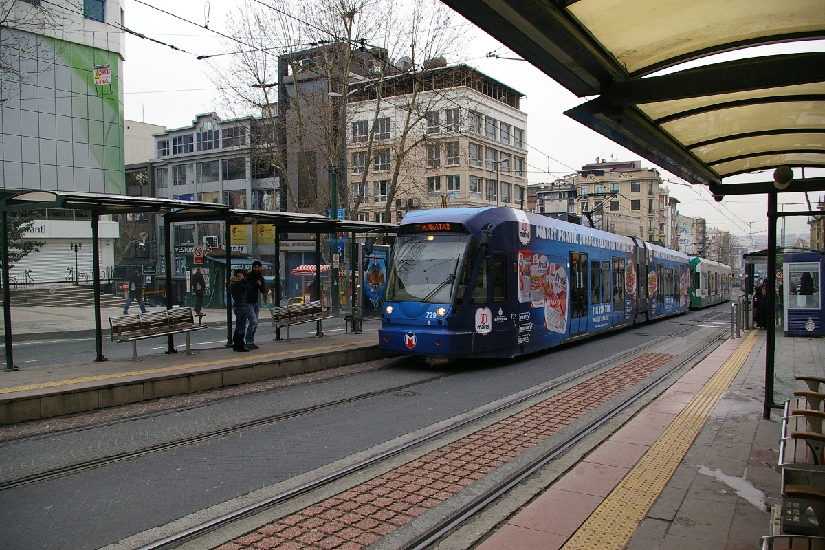
A little over 400 metres brings the line to Kabataş İstasyonu, its terminal station. At this station is the Kabataş terminal on the F1 Tramvay-Füniküler Metro, an modern funicular line that connects Kabataş with Taksim Square, 594 metres away and about 60 metres higher in altitude.
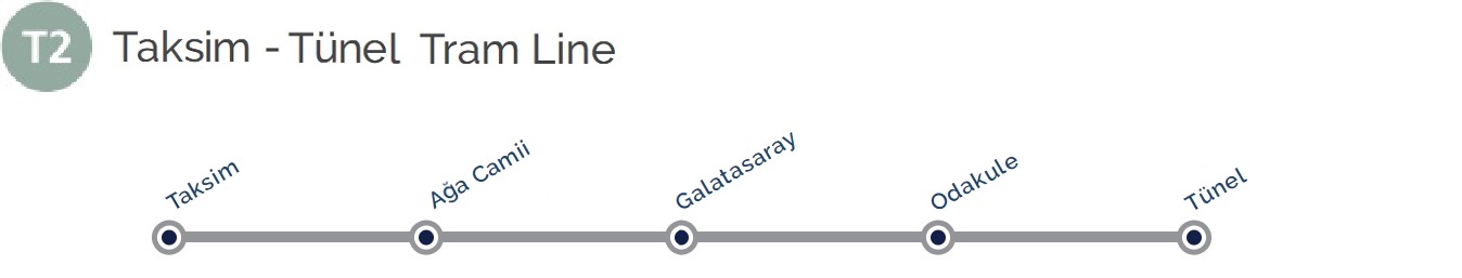
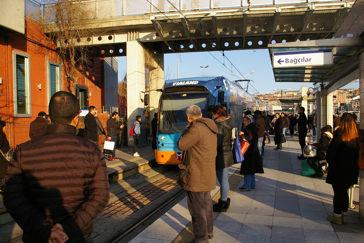
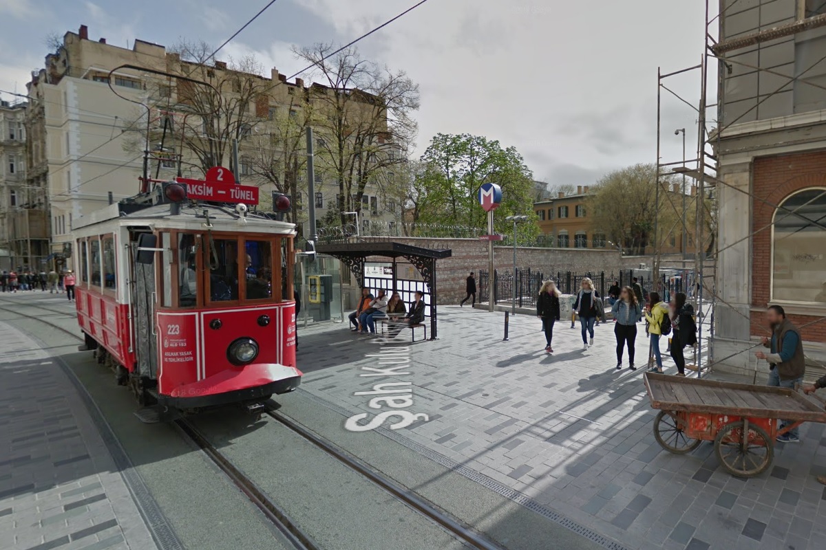
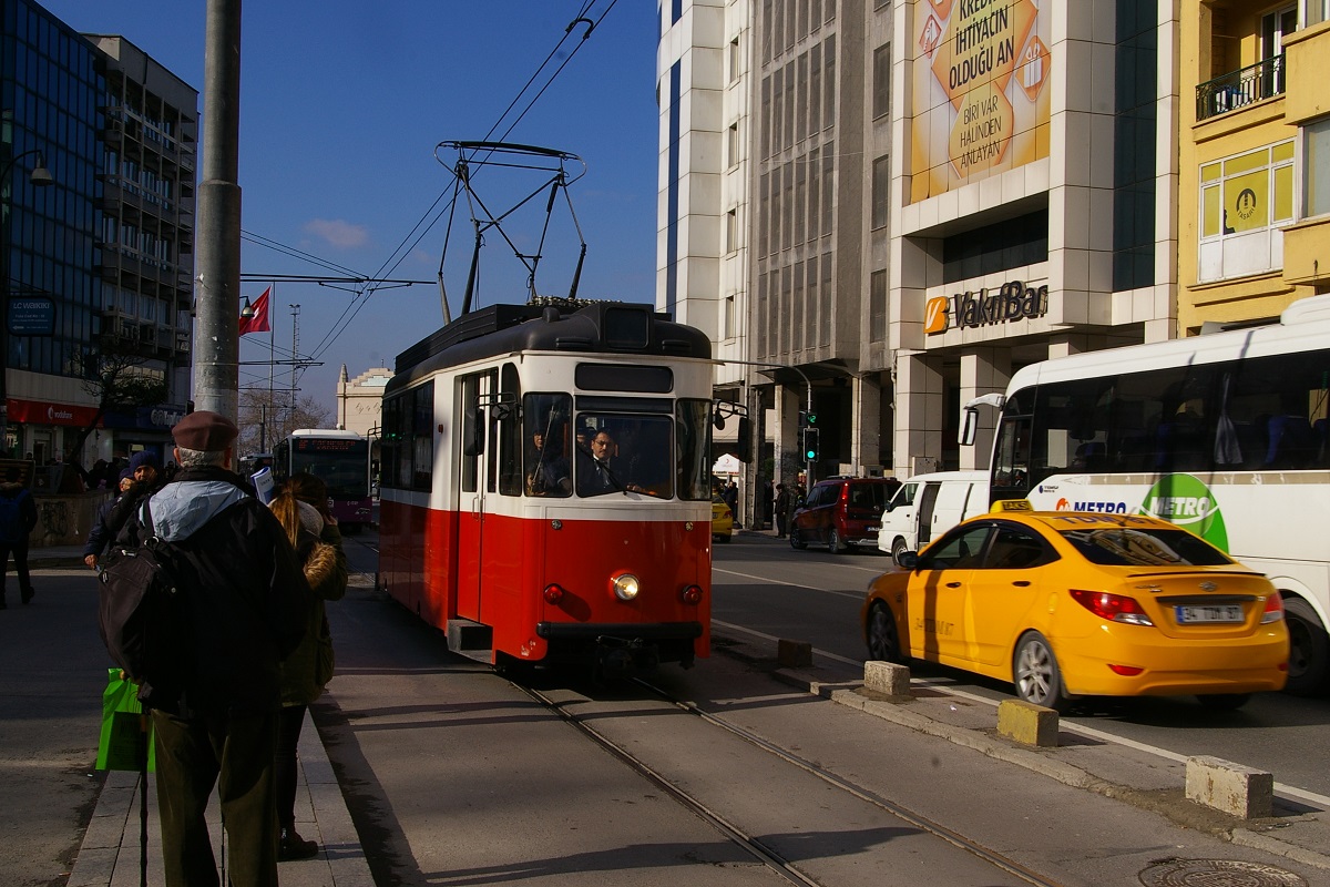
 Taksim-Tünel Nostaljik Tramvay (İETT)
(Google Street View Oct 2015)
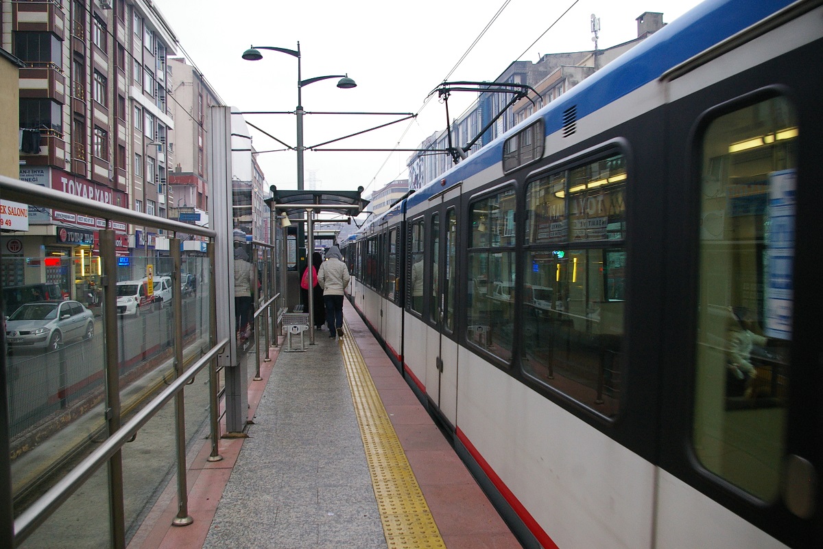
This nostalgic tram line runs between Taksim Square and Tünel on İstiklal Caddesi (Independence Avenue). This road was used by tram, bus & car, but the original tram line closed in 1962. The street was used by buses and cars until 1990, when the area (Beyoğlu) was recognized as a heritage area because of the many historic buildings and shops. The municipal authority decided to convert this area to a pedestrian zone and banned most vehicles, with taxis and delivery vehicles still permitted. The road was resurfaced in concrete with a tactile finish. Many medium trees were planted along the road and vintage street lamps and chairs were also installed. Due to the heavy pedestrian traffic, the tram can move fairly slowly, taking 20 minutes to make the 1.6 km journey.
(Google Street View Oct 2015)
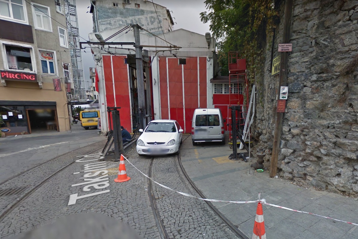
At Taksim Square, there is a loop for turning the tram around. The Taksim Square station on the F1 Tramvay-Füniküler Metro is about 100 metres east of the square, and the Taksim station on the M2 metro line is just east of the north part of the square. The loop converges into a single track heading to the southwest. About 50 metres from the loop, a track branches off to head northwest on Taksim Caddesi for about 100 metres to where a small maintenance and storage for the line exists.
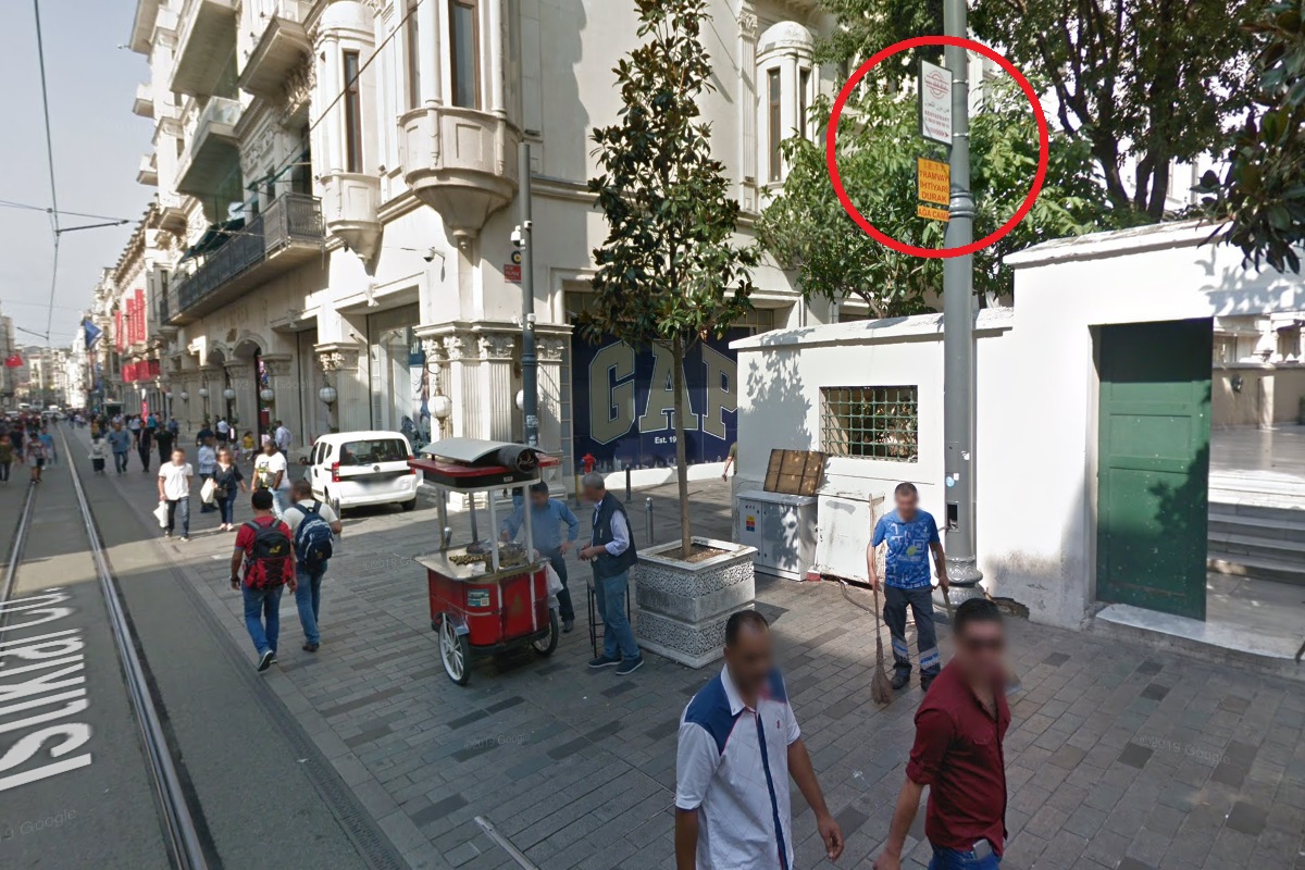
Continuing on İstiklal Caddesi for just over 350 metres, the first stop named Ağa Camii is at the intersection with Atif Yılmaz Caddesi. The marking for the stop is a small sign on a lamp post as shown in the photo to the immediate left.
(Photo from İETT website)
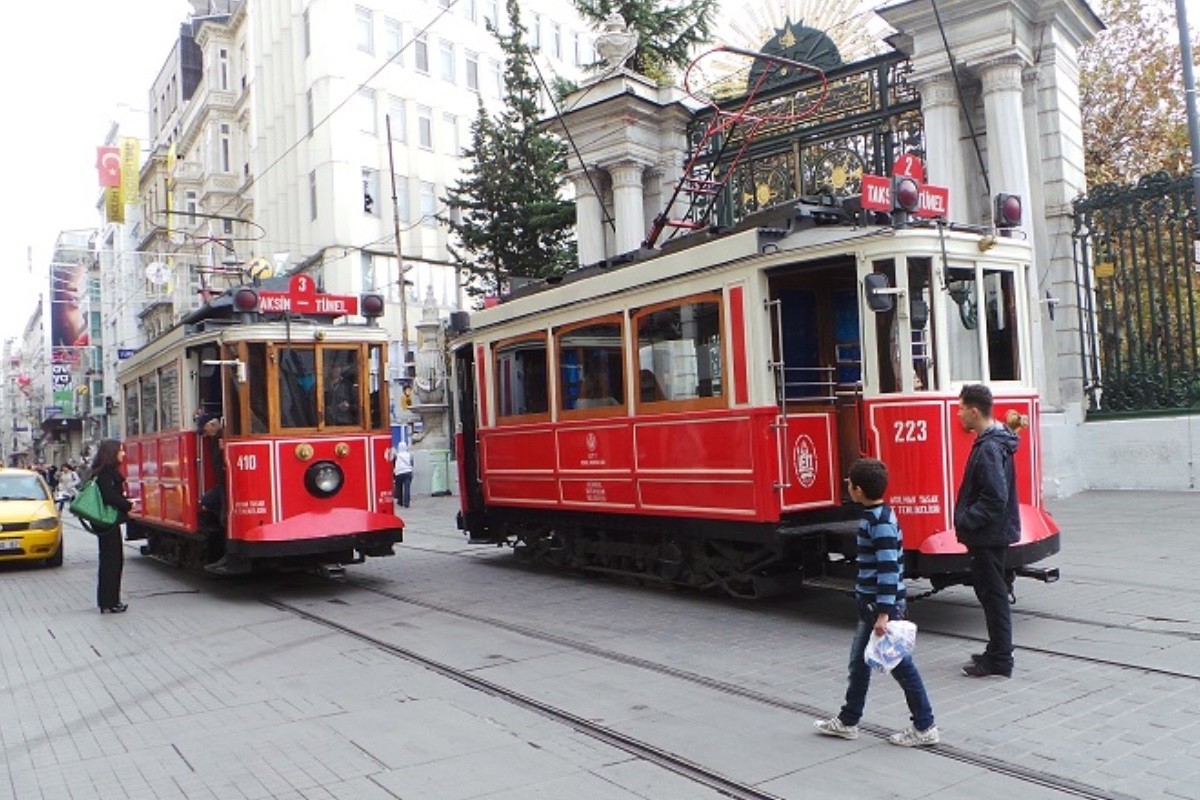
In about another 325 metres, the Galatasaray stop is reached, where there is a short section of double track for trams in opposite directions to meet.
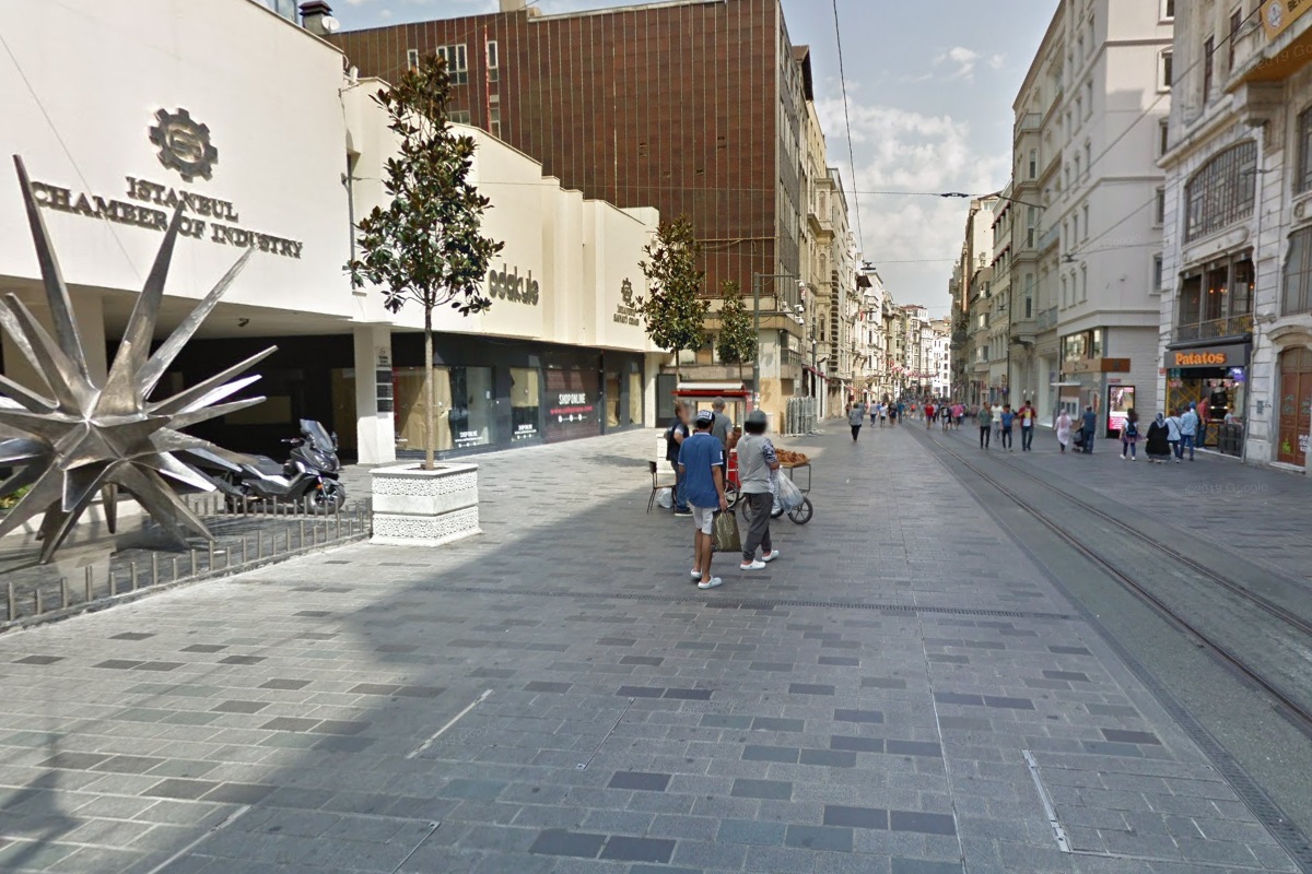
A block past Galatasaray, the street takes a slight curve to head south-southwest where it is about another 175 metres to reach Odakule stop. This stop is located in front of the Istanbul Chamber of Industry.
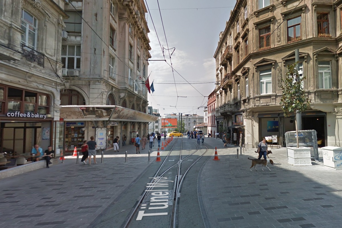
Arriving at Tünel, there is another passing siding with a single tail track beyond the end of the line. This stop is located immediately north of the Beyoğlu terminal of the F2 Tünel and about 75 metres southeast of the Şişhane station on the M2 Metro line.
Tram tracks were laid in the middle of the road as a single line, with a passing siding at Galatasaray Square that allows trams from opposite directions to pass each other. As the area is a popular entertainment and nightlife district, the driver must frequently ring the bell to clear the way of pedestrians, especially during the peak tourist season. Approximate passenger volume for this system is 6,000 people per day. Interchange with the Istanbul Metro (M2 line) is possible at Taksim and Sishane.
(Google Street View Apr 2018)
On the European side T2 line, the tramcars are original Istanbul cars, from the first-generation tramway (closed in 1966), which were restored in the 1980s for use on the heritage tramway. During peak season, a trailer is often coupled to the motored tram for extra capacity. As of 2008, the motored trams include car 47, built in 1913; car 223, built in 1928; and car 410. Trailers are 411 and 418, built in Germany in 1914 and 1919, respectively.[3]
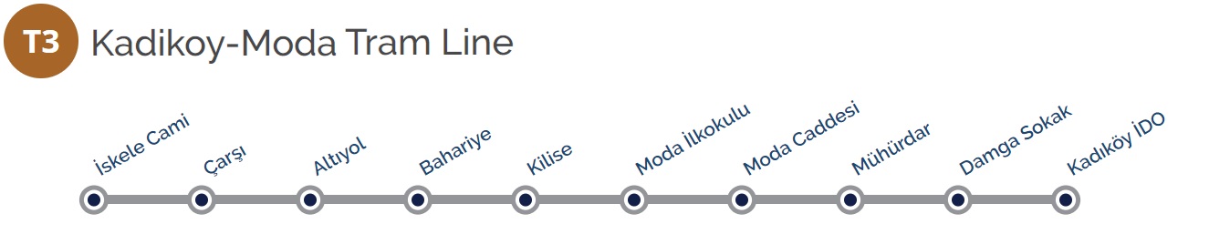
 Kadiköy - Moda Tram Line
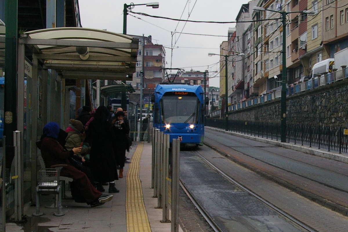
This tram line is located on the Asian side of the Bosporus, and is a single-direction circular line. The starting point is the İskele Cami stop, located just to the south of the Kadiköy station on the M4 Metro line.
The line follows the right lane of Albay Faik Sozdener Caddesi heading northeast for about 225 metres before turning righ and following the right lane of Söğütlü Çeşme Caddesi in an east-southeast direction. After a distance of about 130 metres is the Çarşi stop.

(Google Street View Aug 2018)
The line continues on Söğütlü Çeşme Caddesi for another 325 metres before turning right to the east side of General Asim Gunduz Caddesi, a pedestrian street, where it reaches the Altıyol stop in another 50 metres.
A little way south of Altıyol, the space for the track begins to be shared with southbound automobile traffic. There is a distance of about 250 metres from Altıyol to Bahariye stop.
(Google Street View Nov 2017)
The line continues on the same street for another 225 metres before reaching Kilise stop. About 70 metres south of Bahariye, there is part of a former passing siding between the intersection with Sakiz Gülü Sokak (street) and the intersection with Halil Ethem Sokak. While it has overhead wiring and a switch at its south end, the north end switch has been removed and bollards and other street decorations block the second track from the line.
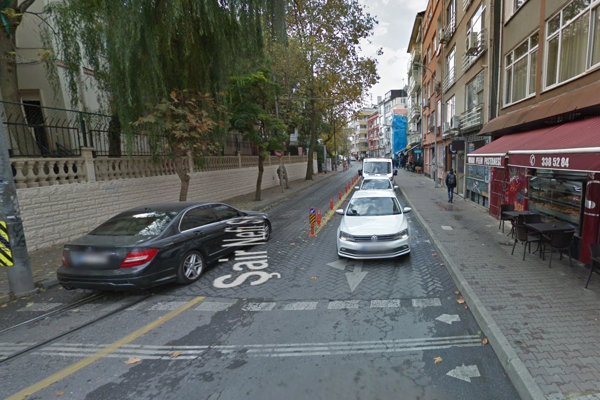
Continuing south another 175 metres, then jogging west for about 50 metres on Dr. Esat Işık Caddesi, the line then turns south again on Şair Nefi Sokak, a street with left-hand running as shown in the image to the left. In about 50 metres, the line reaches Moda İlkokulu stop.
The line continues another 75 metres before turning right to a west-northwest alignment on Cem Sokak for about 125 metres where it reaches Moda Caddesi stop, about 65 metres east of the road with that same name. It is at that road that Cem Sokak changes name to Riza Paşa Sokak.
Kadiköy İDO (Google Street View Jan 2018)
Another 320 metres and the line reaches Mühürdar stop.
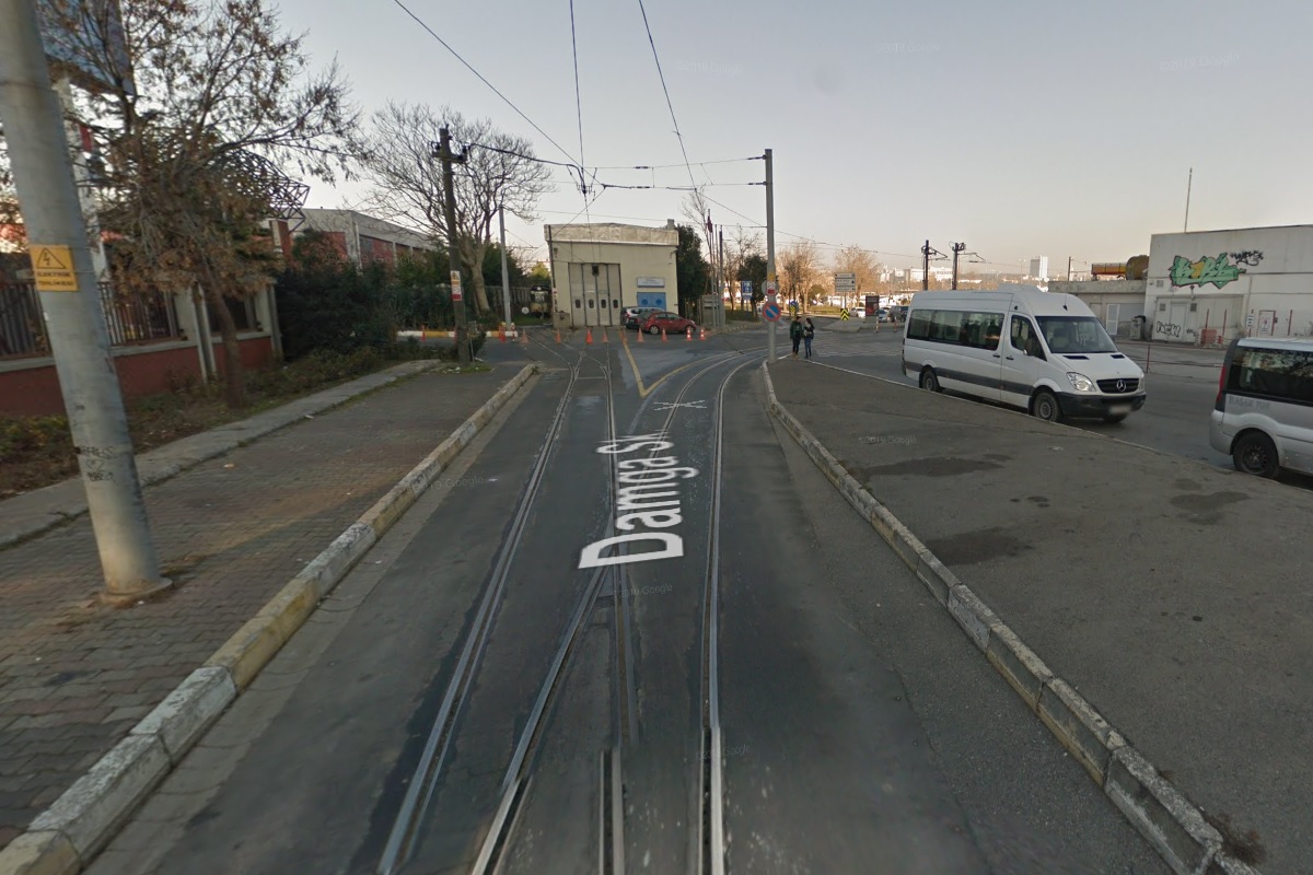
Continuing for 50 metres, the line turns right again to head north-northeast on Mühürdar Caddesi. This road curves to the north-northwest in about 150 metres and continues for about 175 metres where Damga Sokak stop is located. From there, it's another 125 metres before turning to a northeast alignment for about 50 metres where the line reaches its final stop, Kadiköy İDO, just east of the small depot for this line located just north of the intersection of Albay Faik Sozdener Caddesi and Damga Sokak, seen in the image to the right. The loop continues in a northeast direction for about 130 metres to once again reach İskele Cami stop.
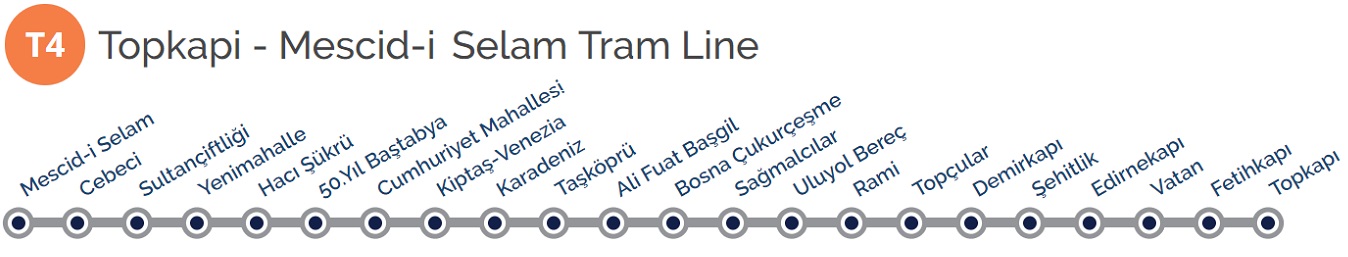
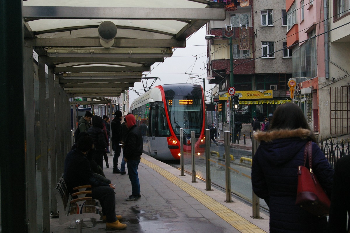
 Topkapı - Mescid-i Selam Tram Line
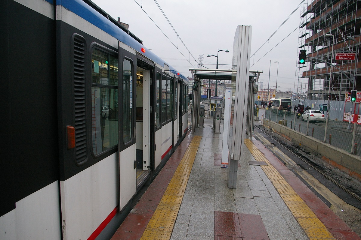
Mescid-i Selam İstasyonu facing southeast
This route description starts at its north end at Mescid-i Selam İstasyonu, a centre-platform station situated in the median of Eski Edirne Asfalti (road) with a northwest-southeast alignment, shown in the left photo. There is a maintenance and storage depot for this line about a kilometre beyond the line, northwest of this station.
(Google Street View Mar 2018)
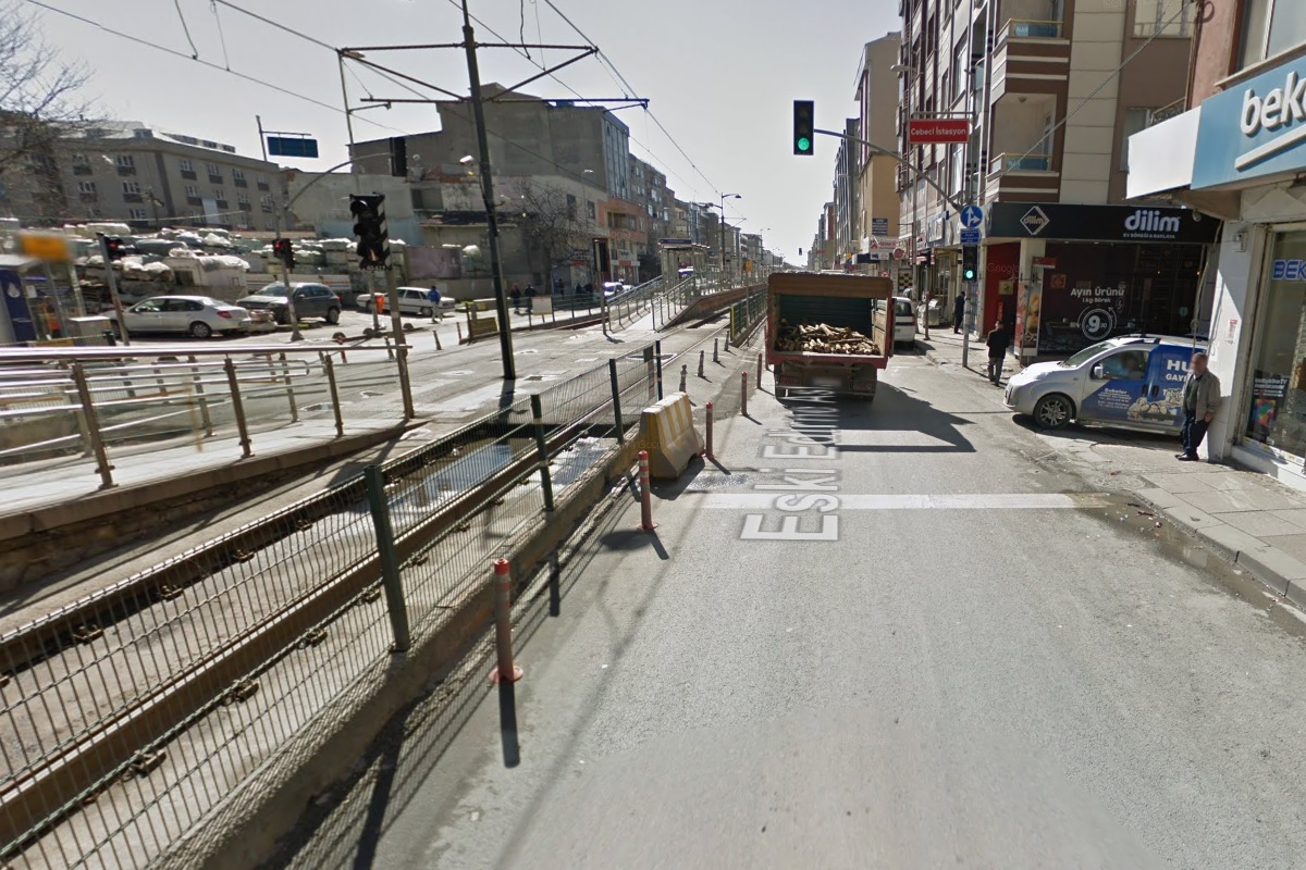
Departing Mescid-i Selam in a southeast direction, the line and Eski Edirne Asfalti curve a little to an east-southeast direction for about 200 metres before curving back to a southeast direction to arrive at Cebeci İstasyonu, shown to the immediate right, about a total of 650 metres from Mescid-i Selam. Due to limited street width, a number of stations on this line, starting with Cebeci, have separate centre-island northbound and southbound platforms, usually separated by an intersection with a side street. Each platform is only wide enough to serve one side and has a glass barrier on the other. At Cebeci, the southbound platform is located north of the northbound platform, as seen in the image to the far right.

The line continues to follow Eski Edirne Asfalti straight for about 650 metres before reaching Sultançiftliği İstasyonu. Similar to Cebeci, Sultançiftliği has its southbound platform located north of the northbound platform, shown in the photo to the far left.
Continuing staight in the same direction for about 500 metres, the line and road curve to a south orientation for another 100 metres where it reaches Yenimahalle İstasyonu, shown in the photo to the immediate left. Yenimahalle has the same platform arrangement as the previous two stations, seen in the photo on the immediate left.
There is about an 850 metre trip further south to reach Hacı Şükrü İstasyonu, the fourth station with the staggered platforms, as seen in the two photos to the right.

Google street view images of Hacı Şükrü İstasyonu from August 2015. Left photo shows the new southbound platform under construction, right photo shows the original platform serving both directions.
This arrangement was not the original design, as a single centre-island platform served both directions originally. In order to increase space on the platform, additional platforms were built. This can be seen at Hacı Şükrü in the August 2015 photos to the left.
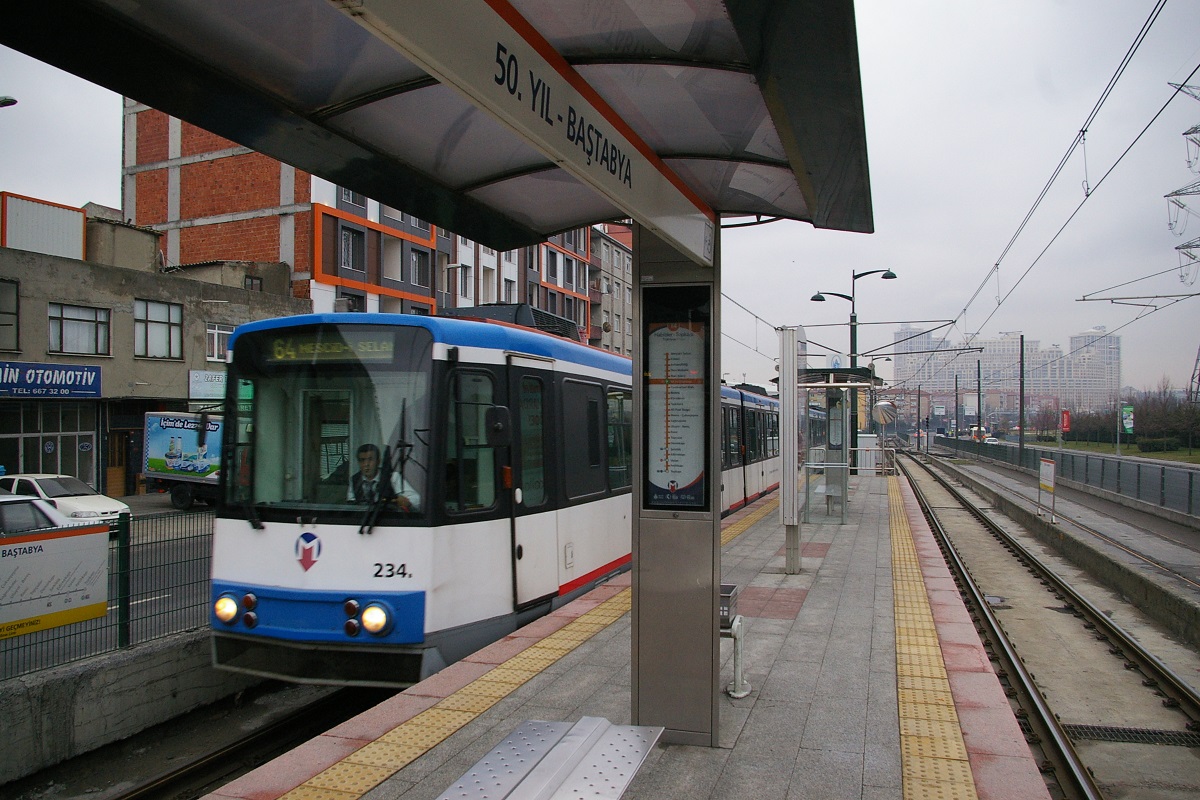
50. Yil-Baştabya İstasyonu
The line continues to follow Eski Edirne Asfalti for another 500 metres, curving southeast about half that distance, before reaching 50. Yil-Baştabya İstasyonu. This is the first station with a single centre-island platform for both directions since Mescid-i Selam, seen in the photo to the immediate right. In another 650 metres southeast, the line arrives at Cumhuriyet Mah. İstasyonu, shown in the far right photo.

There is a distance of about 500 metres to the next station, Kiptas-Venezia İstasyonu, located close to the Eski Edirne Asfalti overpass of E80, Istanbul Çevre Yolu.
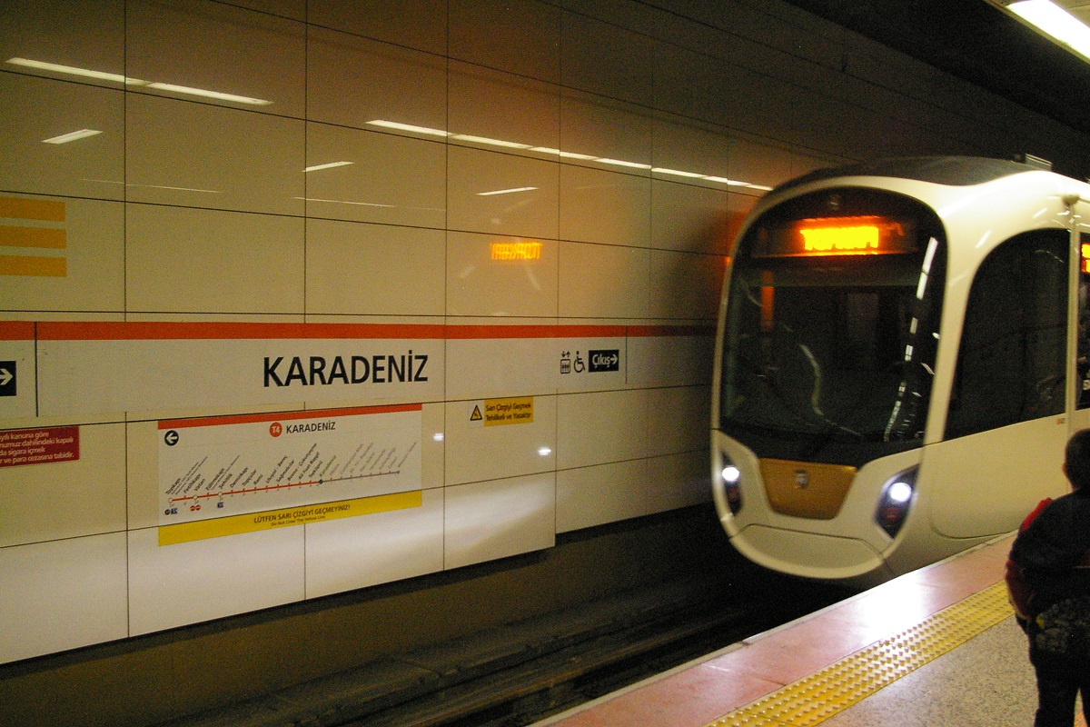
About 225 metres southeast of Kiptas-Venezia, the line descends into a tunnel portal and continues another 500 metres to reach Karadeniz İstasyonu. This underground station has a centre-island platform as can be seen in the photo to the far left.
Bosna-Çukurçeşme İstasyonu
The line continues under Eski Edirne Asfalti for another 650 metres to reach Taşköprü İstasyonu, another underground centre-island platform station shown to the immediate left.
It's about another 775 metres to Ali Fuat Başgil İstasyonu, the third underground centre-island platform station shown to the immediate right.
Continuing southeast under Eski Edirne Asfalti for about 475 metres, the street and the line curves to head south-southeast where the line emerges from a portal to be in the centre of Eski Edirne Asfalti. The line continues at grade for another 400 metres where it reaches Bosna-Çukurçeşme İstasyonu, a centre-island platform station shown to the far right.

Another 175 metres has the road and the line curve to a southeast direction, and in another 400 metres, it arrives at Sağmalcılar İstasyonu, shown at the far left.
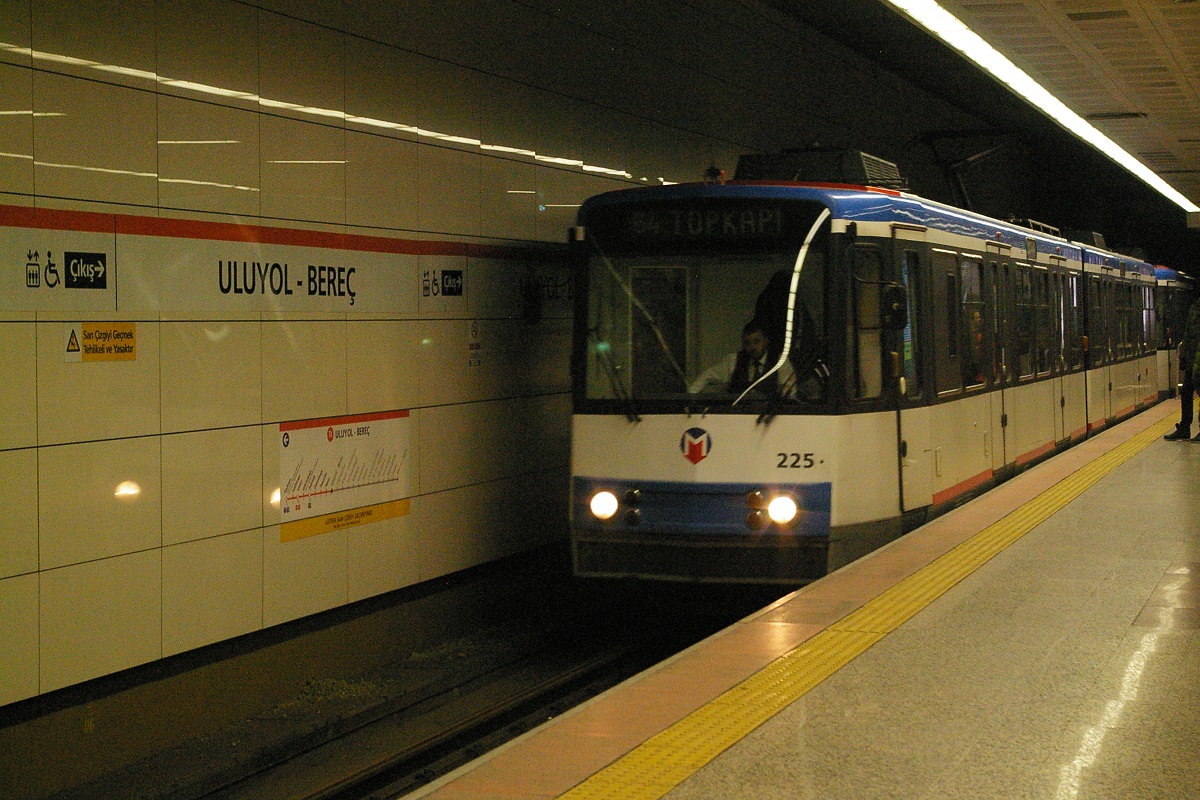
Just southeast of Sağmalcılar, the line descends for about 200 metres to a portal where it reaches Uluyol-Bereç İstasyonu once underground. This is the fouth centre-island underground station.
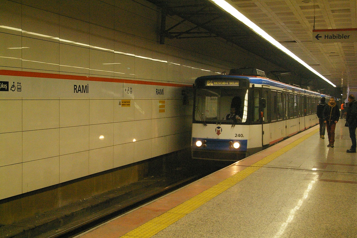
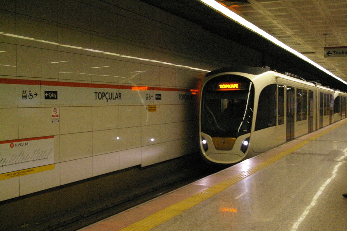
The line continues under Eski Edirne Asfalti for about 500 metres, then the road changes name to Rami Kişla Caddesi. The line continues under this road for about another 750 metres before reaching Rami İstasyonu, the fifth centre-island underground station, shown to the immediate right. Continuing underground, it is only another 550 metres before reaching Topçular İstasyonu, the sixth of these underground stations shown to the far right.
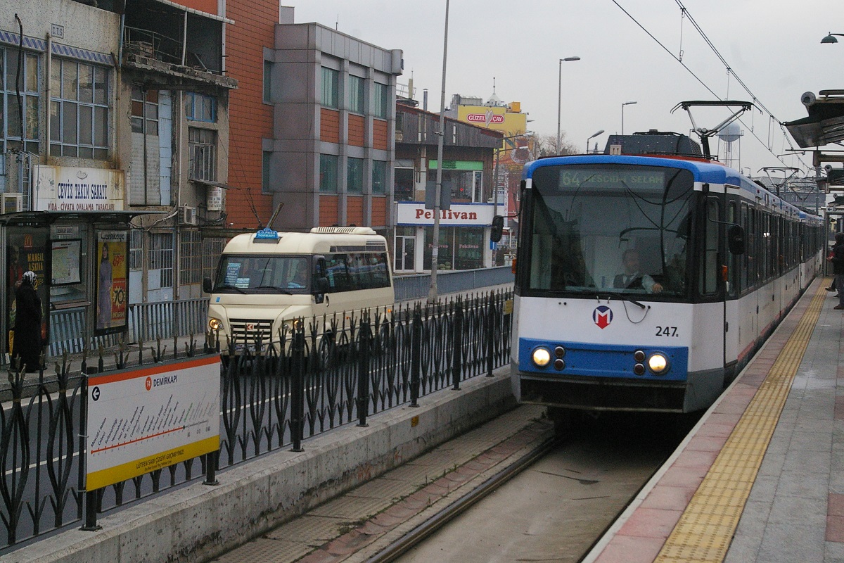
The line continues for about 350 metres where it emerges through a portal and continues at grade in the middle of Rami Kişla Caddesi. In another 250 metres, it reaches Demirkapı İstasyonu, a centre-island platform station shown to the far left.
Continuing about 125 metres, the road and line crosses an overpass and curves to an east-southeast direction where its name changes to Edirnekapı Rami Caddesi. The line continues for about 375 metres where it reaches Şehitlik İstasyonu, shown to the immediate left. This station is a centre-island platform station, however it has a narrow outside platform on the Topkapı-bound side that is not used by passengers.
at Edirnekapı İstasyonu
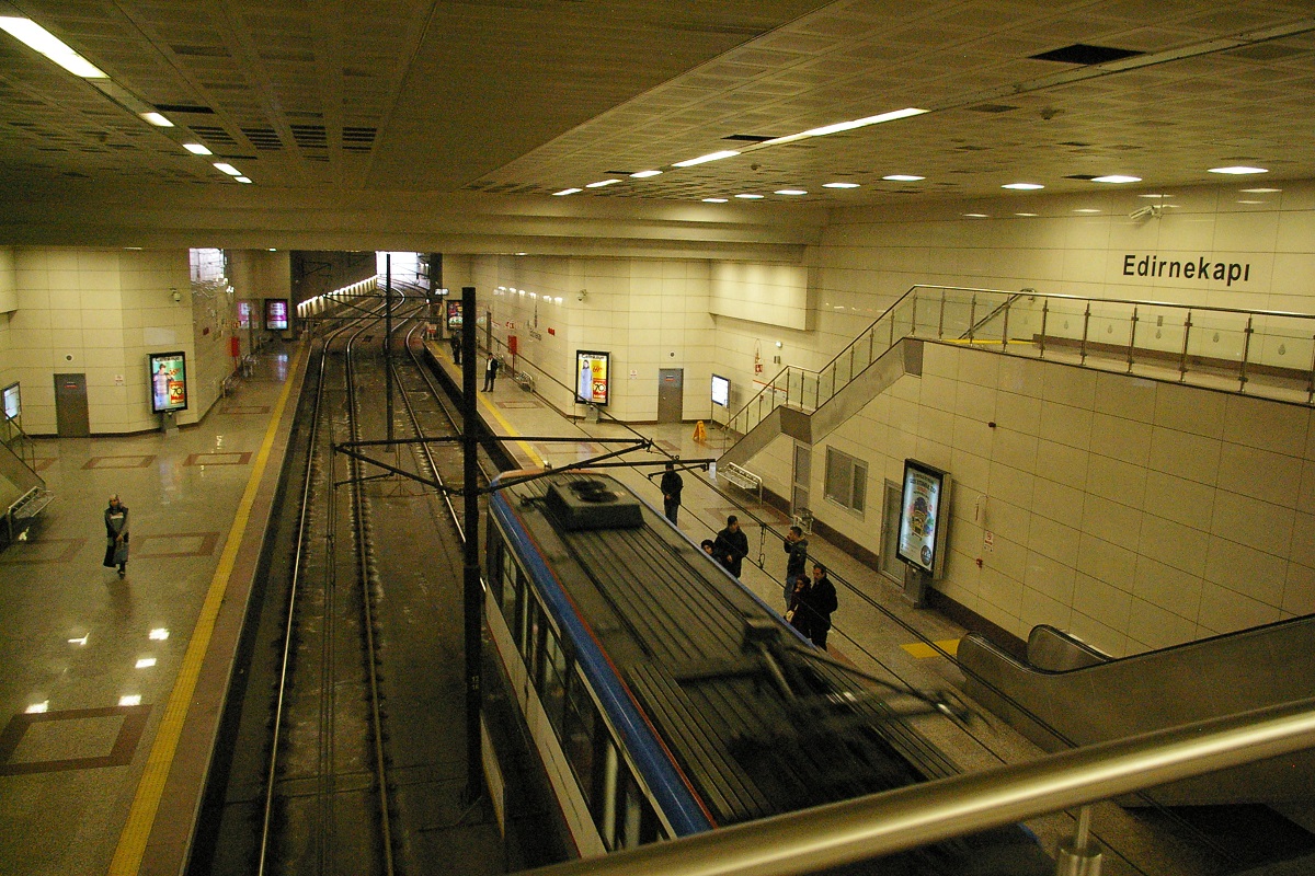
In 450 metres, the line dives below grade to a portal to curve underground for another 150 metres where it reaches Edirnekapı İstasyonu. This is the last underground station on this line and the only one with side platforms, as seen in the photo to the immediate right.


Out of Edirnekapı, the line makes a turn to the southwest and continues underground for about 300 metres before emerging from a portal to continue on the north side of Beylerbeyi Caddesi. It continues for about another 375 metres where it climbs over offramp roads to reach Vatan İstasyonu. This station, seen in the far right photo, has side platforms and is less than a 150 metre walk from the Ulubatli station on the M1A and M1B metro lines.
Continuing southwest, it is another 500 metres to Fetihkapı İstasyonu, another side-platform station shown at the far left.
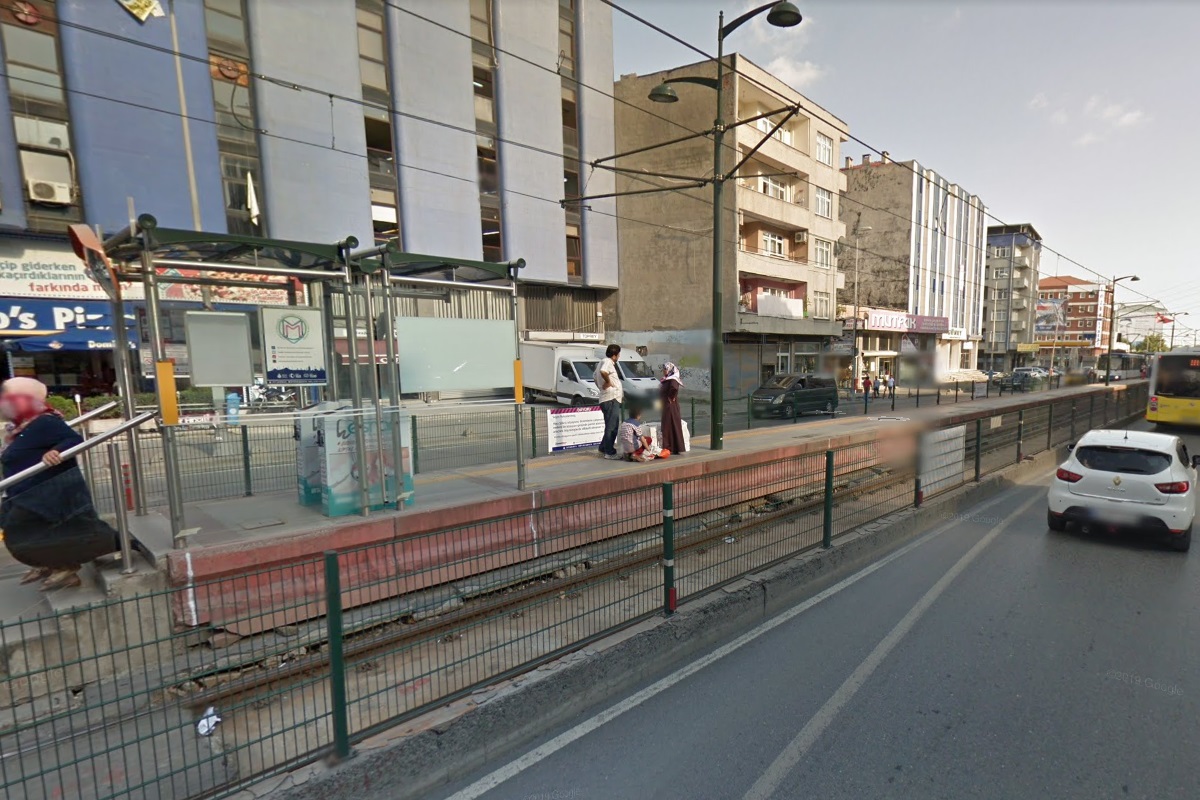
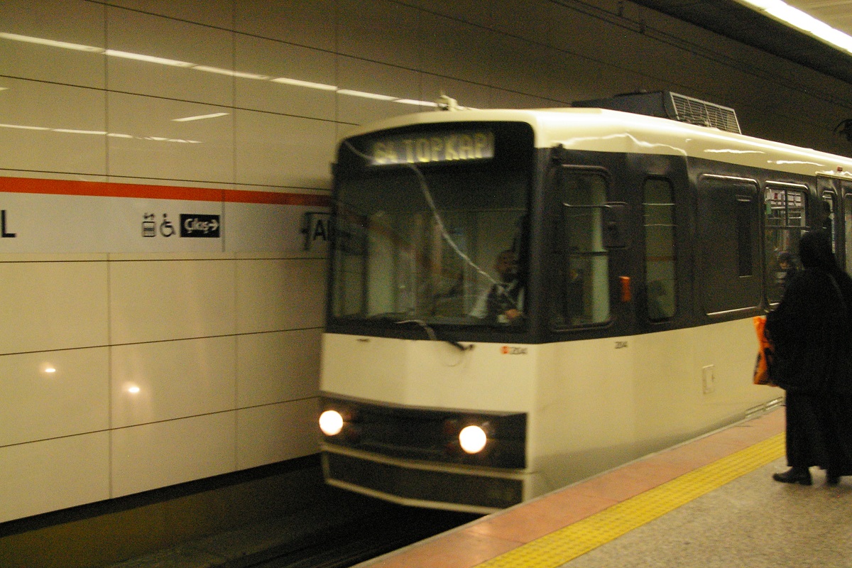
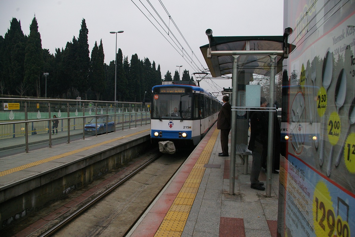
The line continues about another 450 metres, curving to a west-southwest direction to reach Topkapı İstasyonu. Seen in the immediate left photo, this station's platform is less than a 100 metre walk to the Topkapı station on the T1 tram line.
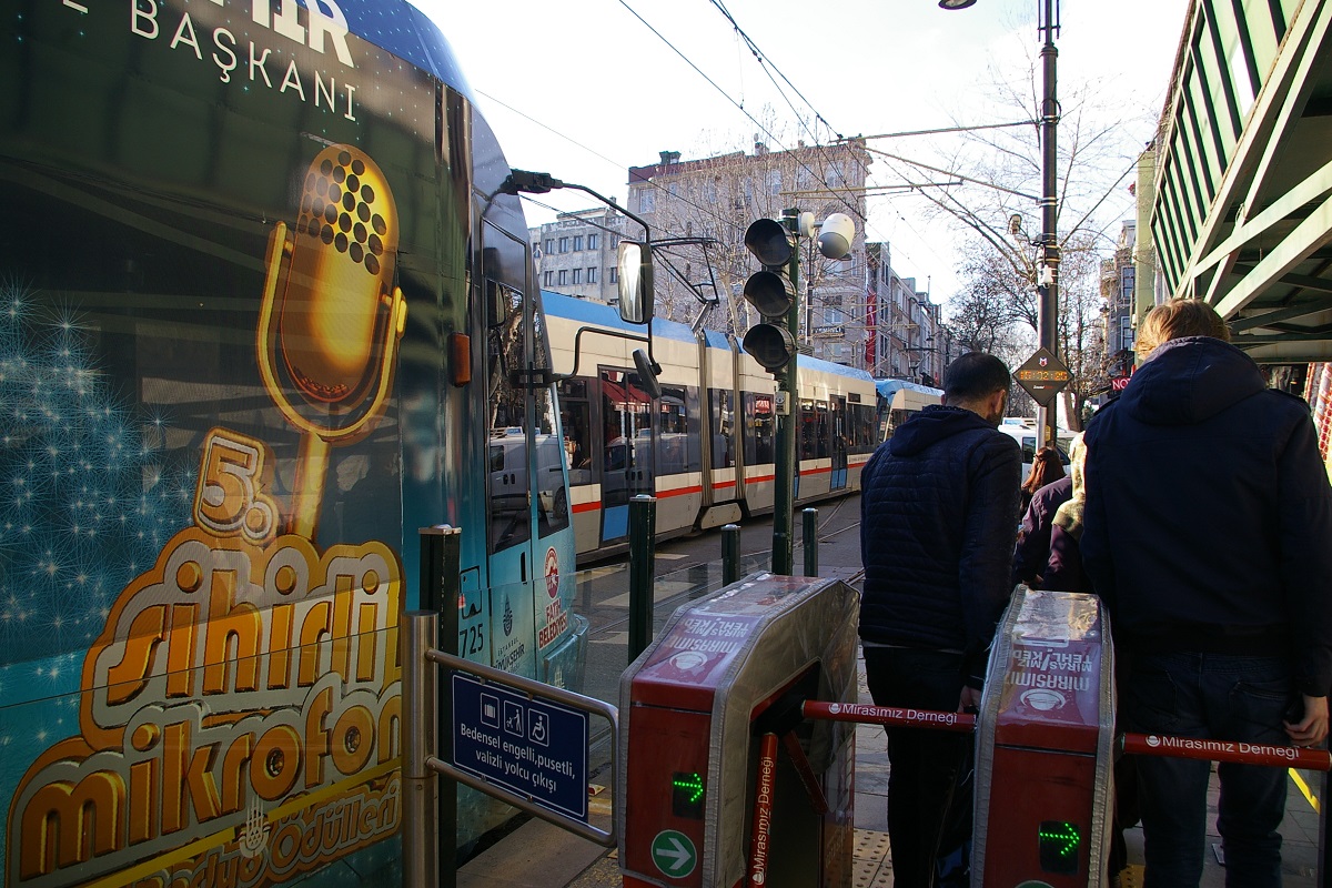
Fares and Fare Collection
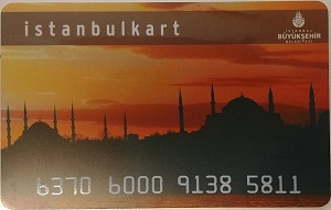
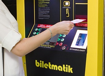
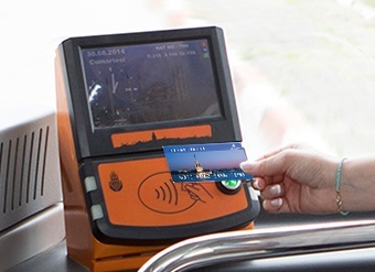
All fare payment is by use of electronic fare cards. If using transit for more than a few boardings, the most economic way to go is by purchasing an Istanbulkart, shown to the left, for a cost of 6 ₺ (about C$1.32) and then it is loaded with any amount for use to pay fare when entering a station or boarding a bus. When using the Istanbulkart, the fare is 2.60 ₺ (about C$0.57), but when transferring to another vehicle, only 1.85 ₺ (about C$0.41) is charged.
Alternatively, an electronic ticket may be purchased for 1, 2, 3, 5, or 10 rides. A single ride costs 5 ₺ (about C$1.10), while a 2-ride ticket is 8 ₺, a 3-ride ticket is 11 ₺, a 5-ride ticket is 17 ₺, and a 10-ride ticket is 32 ₺.
When using the electronic ticket, there is no discount when transferring between vehicles, each boarding counts as one ride.
For the same price as a 10-ride ticket, one can purchase an Istanbulkart and load it with 26 ₺ - the price of 10 fares using Istanbulkart. However if even one of the 10 fares paid involve transferring, the Instanbulkart will cost less.
Accessibility
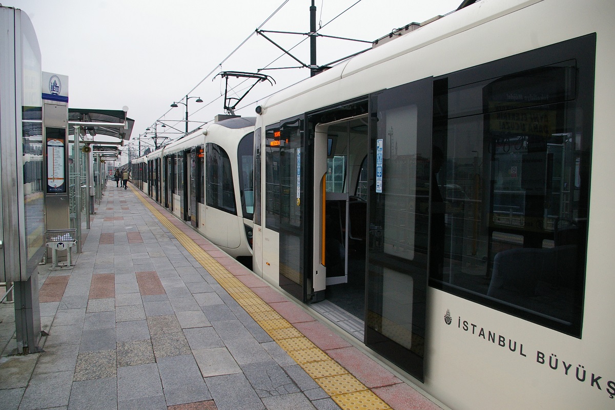
T1 and T4 have step-free access from platform to tram. T1 has step-free access to low-level platforms, but not all T4 stations have step-free access.
T2 and T3 heritage trams are not step-free.
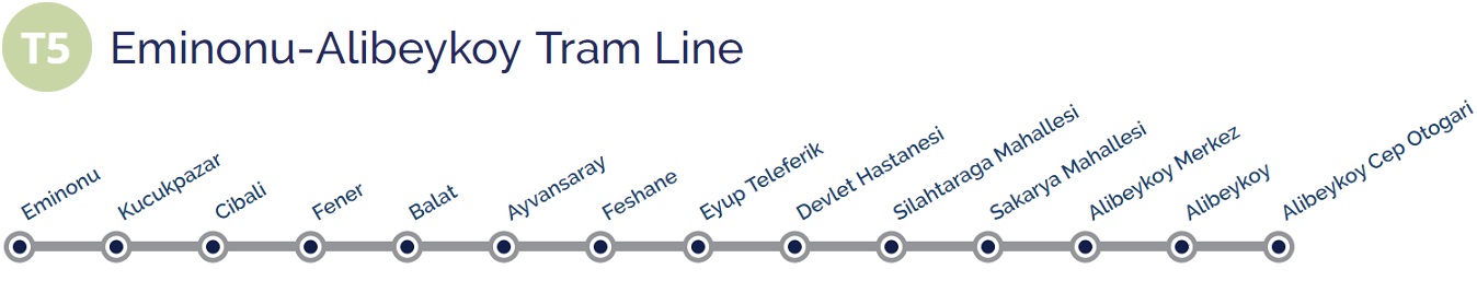
Current and Planned Expansion
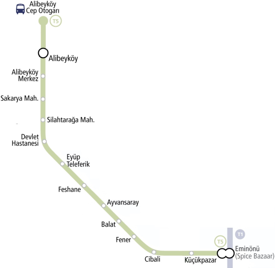
A new line T5 is under construction that starts at the Eminönü İstasyonu with T1 and follows the Golden Horn west coast to Alibeyköy with 14 stations. See the image to the right. Construction on this line started November 9, 2016.
Two other projects are under way. The first will connect Eyup Square and Bayrampasa Square and to connect with T5 Eminonu-Alibeykoy tram line in Feshane area. This line will connect with the T4 line and the M1A and M1B Metro lines.
The second has a line from the M1B Menderes Station area, and extend to YTU Davutpasa Campus through Esenler pedestrian walk.