This page was last updated October 14, 2012
Send questions, comments, and photos here.

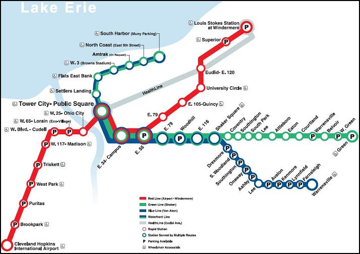
LRT in
Cleveland


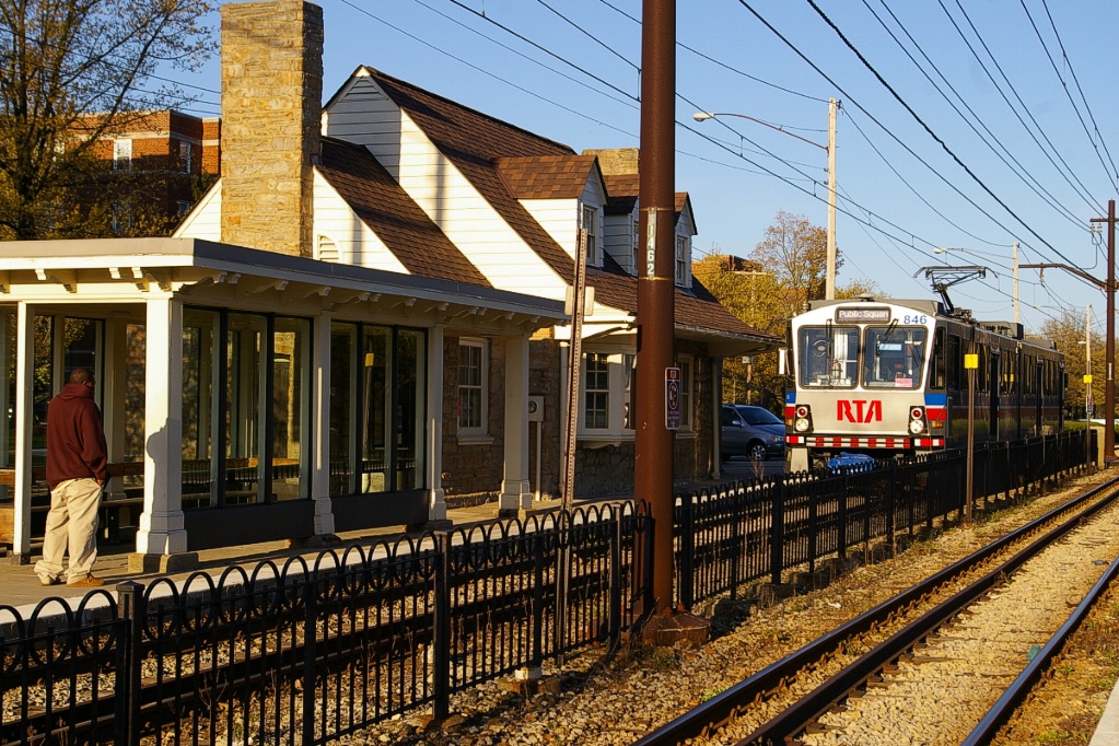
Public transit in Cleveland is operated by the Greater Cleveland Regional Transit Authority, or RTA. In addition to operating two LRT routes, the RTA also operates an HRT route (that interlines with the two LRT routes for three stations) and the bus operations. These three routes are officially called "RTA Rapid Transit", but referred to locally as The Rapid.
The entire LRT operation operates in its own right of way, sometimes totally isolated from other traffic, and sometimes in roadway medians.
Contents
Toronto Comparison
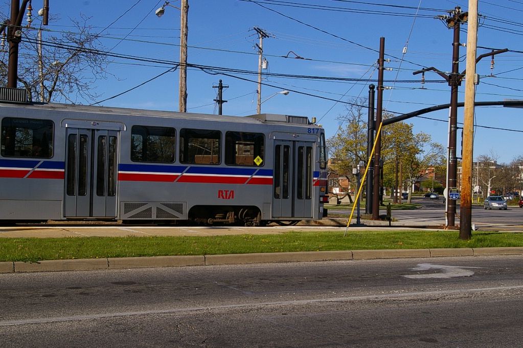
The Shaker and Van Aken branches operate in road medians similar to planned LRT lines in Toronto.
System Highlights and Route Details
| Item | Notes |
|---|---|
| Number of lines | 2 (interlined downtown) |
| Total length | 29 km |
| Total stations | 35 (3 stations shared with Red Line metro) |
| Right of way |
Private right of way downtown |
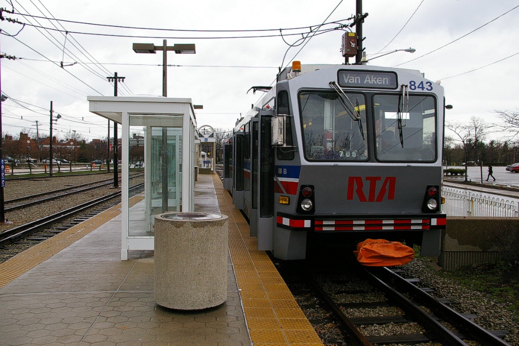
| Loading | Low level platform, cars have steps |
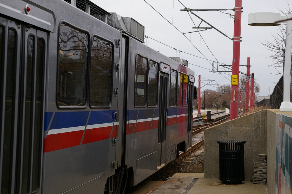
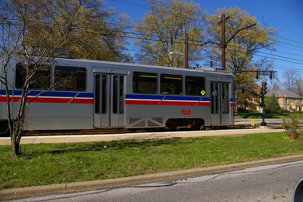
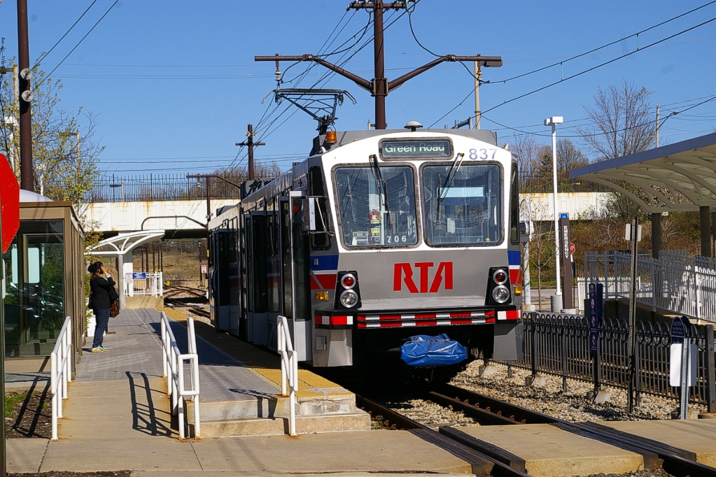
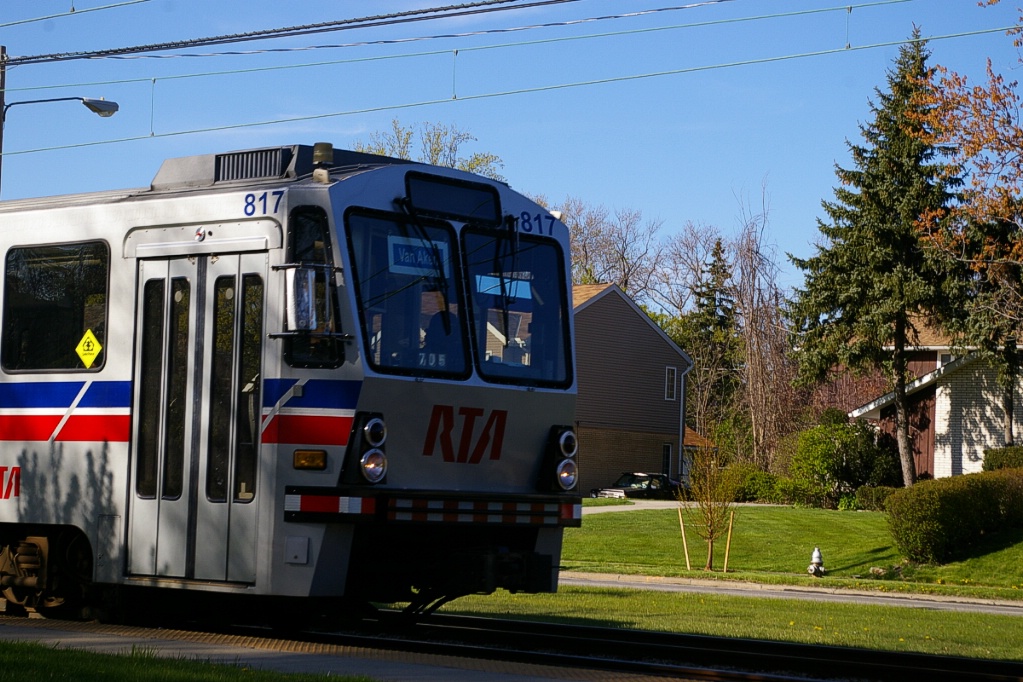
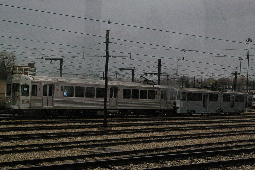
| Fleet | 48 Cleveland LRVs by
AnsaldoBreda Seats 84 passengers, room for 186 standees 23.5 m long 3 double folding doors per side (1.3 m wide) 90 km/h top speed 100% high floor (1.016 m above rails) Click here to see a brochure (1.4 MB) |
| Fare collection | Self service, barrier free, proof of payment Free fare zone downtown |
| Fare integration | Fares same as bus and metro fares Transfers valid between each for 90 minutes |
| Airport service |
No LRT service to airport |
The Red Line is an HRV (metro, pantograph-powered) line that shares three stations and track with the LRT lines. Most of the Red Line is surface or elevated, with the exception of the Airport station which is underground. Cleveland was the first North American city to have rapid transit serving their airport.
| 67 Blue Line: Van Aken | |
| Stations | 23 9 shared with Green Line 3 shared with Green and Red Lines |
|---|---|
| Service frequency | 10 minutes rush hours (6:30-9 am, 4:30-6:30 pm) 30 minutes mid-day and evenings 20 minutes early mornings (from 4:00 am) |
| Opening | April 11, 1920 - East 55th to Lynnfield July 20, 1930 - East 55th to Tower City July 20, 1930 - Lynnfield to Warrensville Rd January, 1948 - Drexmore station added October 11, 1981 - re-opening as LRT system October 30, 1981 - official dedication as LRT system July 10,1996 - extension from Tower City to South Harbor August 12,1999 - West 3rd station added |
| 67A Green Line: Shaker | |
| Stations | 23 9 shared with Blue Line 3 shared with Blue and Red Lines |
|---|---|
| Service frequency | 10 minutes rush hours (6:30-9 am, 4:30-6:30 pm) 30 minutes mid-day and evenings 20 minutes early mornings (from 5:30 am) |
| Opening | December 17, 1913 - original 2.6 km - Coventry to Attleboro May 20, 1915 - extension to Courtland April 11, 1920 - extension to East 55th 1928 - extension from Courtland to Warrensville July 20, 1930 - East 55th to Tower City 1936 - extension from Warrensville to Green October 11, 1981 - re-opening as LRT system October 30, 1981 - official dedication as LRT system July 10,1996 - extension from Tower City to South Harbor August 12,1999 - West 3rd station added |
Ride Descriptions
Both the Green and Blue lines are interlined from South Harbor to Shaker Square, with about half of the service on both routes terminating at Tower City-Public Square. For this reason, descriptions of travel will be in three sections: South Harbor to Shaker Square, followed by the Green route from Shaker Square to Green, and the Blue route from Shaker Square to Warrensville:
| Corridor | Notes |
|---|---|
| South Harbor to Shaker Square | Interlined portion of both lines |
| Green Line | Non-interlined portion of Green Line from Shaker Square to Green |
| Blue Line | Non-interlined portion of Blue Line from Shaker Square to Warrensville |
South Harbor to Shaker Square
The trip from South Harbor to Shaker Square takes approximately 22 minutes.
There are cross-over tracks on the approach side of the station, but far side is usually used.
The waterfront extension is served by both the Blue and Green lines, but on a frequency that is half or less than the frequency of the rest of each line's frequency to Tower City-Public Square.
Trains usually leave South Harbor on the opposite route to how it arrived (Green arrival leaves as Blue, and Blue arrival leaves as Green). Weekday service from Tower City-Public Square to South Harbor is as follows:
- Before 9 am: every third Blue line LRT, returning on the Green line
- 9 am to 5 pm: every Green line LRT, returning on the Blue line
- 5:30 to 7 pm: every second or third Blue line LRT, returning on the Green line
- After 7 pm: every Green line LRT, returning on the Blue line
On Saturdays, Sundays, and Holidays every Green line LRT goes to South Harbor and returns on the Blue line.
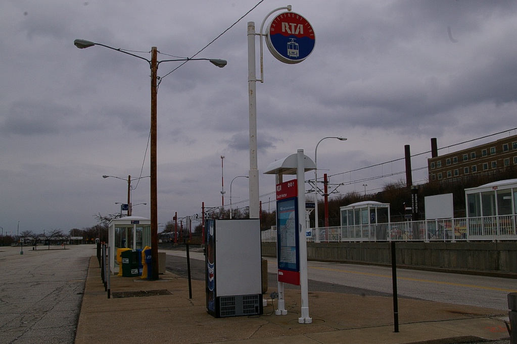
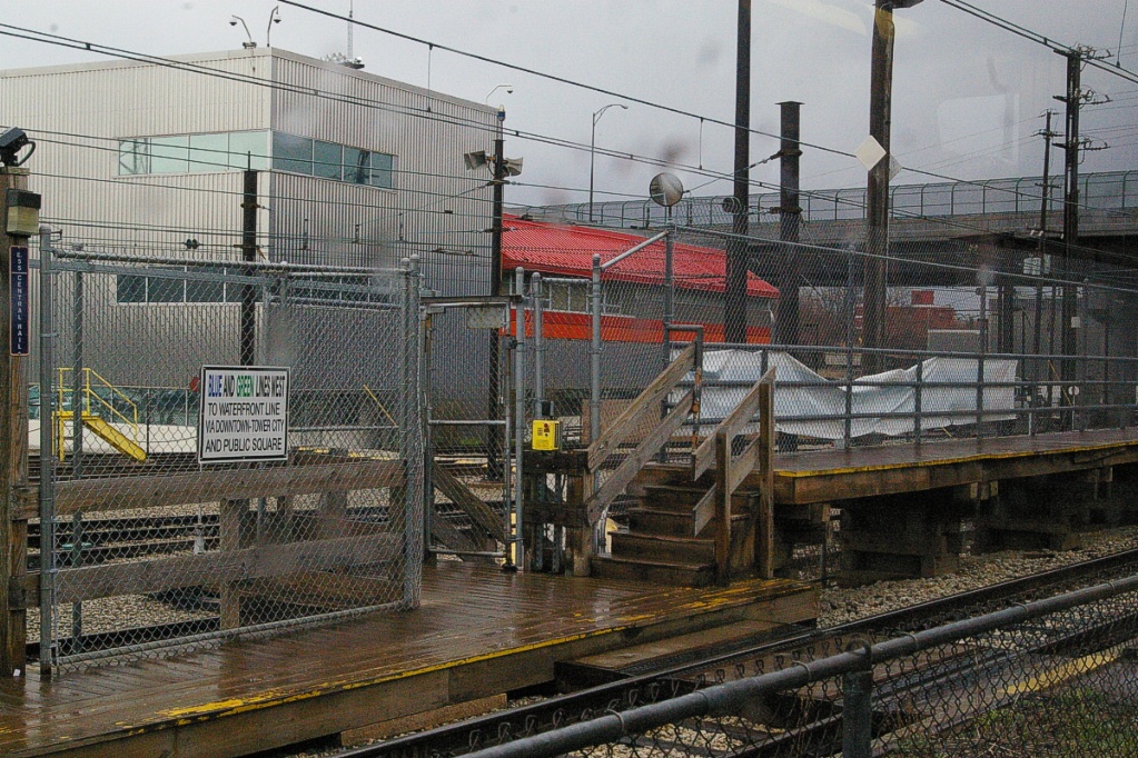
The South Harbor station has side platforms, with display signs indicating which platform will be used to board the next train. It is common for arriving LRTs to enter on the south track, unload, and move beyond the end of the station to wait until a few minutes before its scheduled departure time. At that time, it crosses over and returns on the north track for boarding before departure.
More or less parallel to the shoreline with Lake Erie, the line moves in a southwest direction past the North Coast station. The next station is Amtrak, where trains only stop on request. The LRT tracks are between the railway station and the platform used by Amtrak trains.
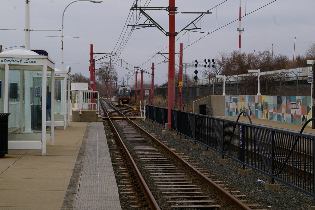
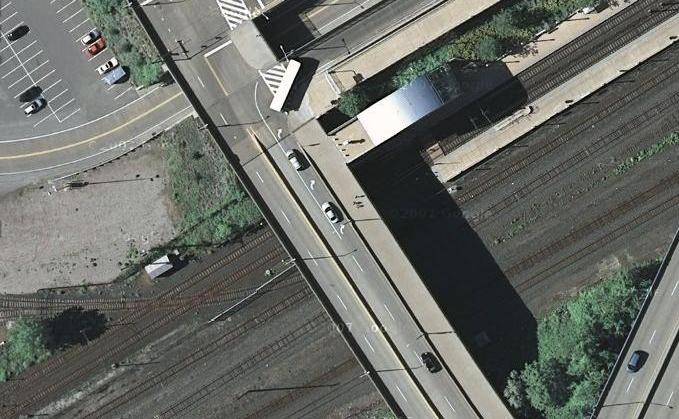
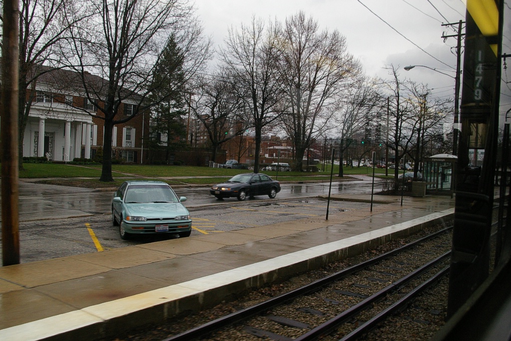
Further to the southwest is West 3rd Street, the station that serves the Cleveland Browns Stadium. West of this station, the line passes under West 3rd Street and crosses a grade crossing with a railway spur (see photo to the right).

Shortly after this, the line passes below the 9th Street underpass and curves to the right and begins climbing in height. As it climbs, it makes slightly more than a 180 degree turn to the left as it passes over the railway corridor before curving to the right again and returning to grade level before arriving at Flats East Bank station (see photo to the left).
From Flats East Bank to just past Settlers Landing, the line is at grade in its own private right of way. The line crosses roads in two places with railway-type crossings.
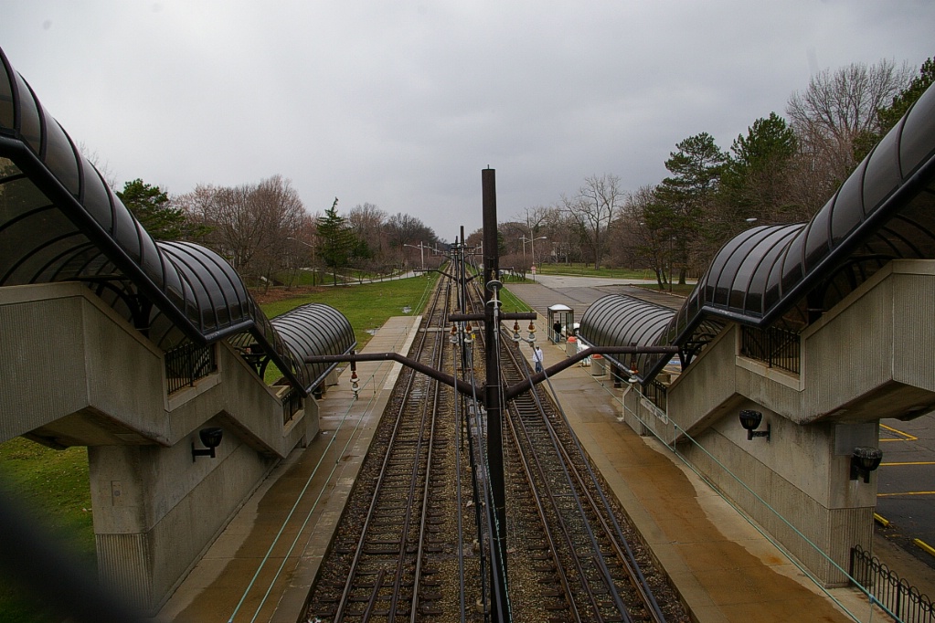
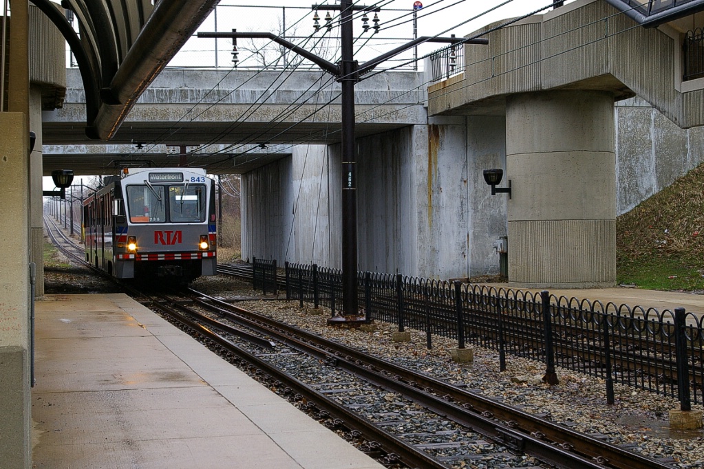
After the second level crossing, the line makes a 90 degree turn to the left to head in a northeast direction where it drops in grade to enter the Tower City-Public Square complex. As the line drops, the two tracks separate as the tracks of the Red Line (HRT) approach to join the alignment. The Red Line uses high level platforms at the opposite end of the station from the LRT platform.
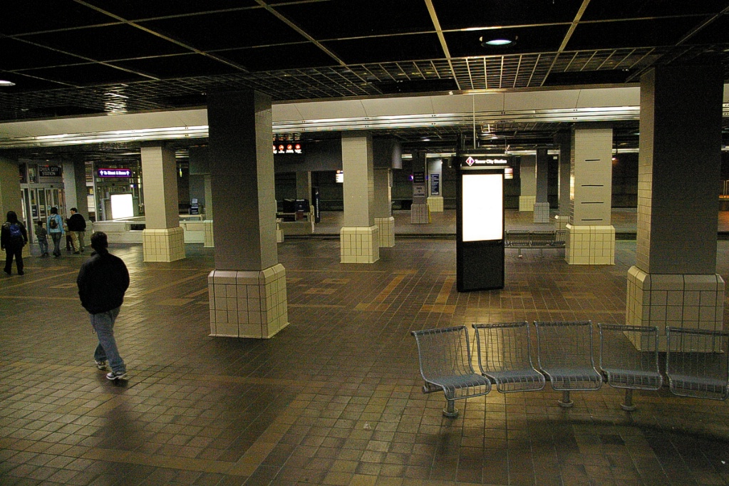
Though the station is under the Tower City complex, the line is not actually underground. In the covered portion, the line makes close to a 90 degree turn to the right to head in a southeast direction. The complex was originally built for railway use, so approaches involve former railway right of ways.
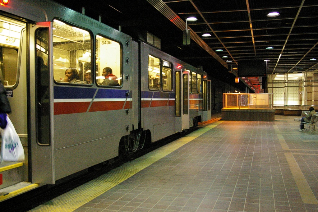
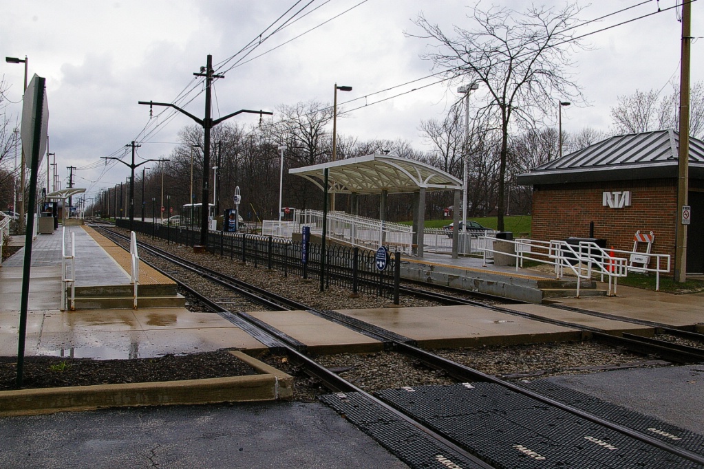
The next two stations, E34 Campus and E55, also serve the Red line, but using the same tracks. For this reason, each station has both a high and a low level platform (see photo to the left). Just before reaching E55, the line curves slightly to be on a more east-west alignment.
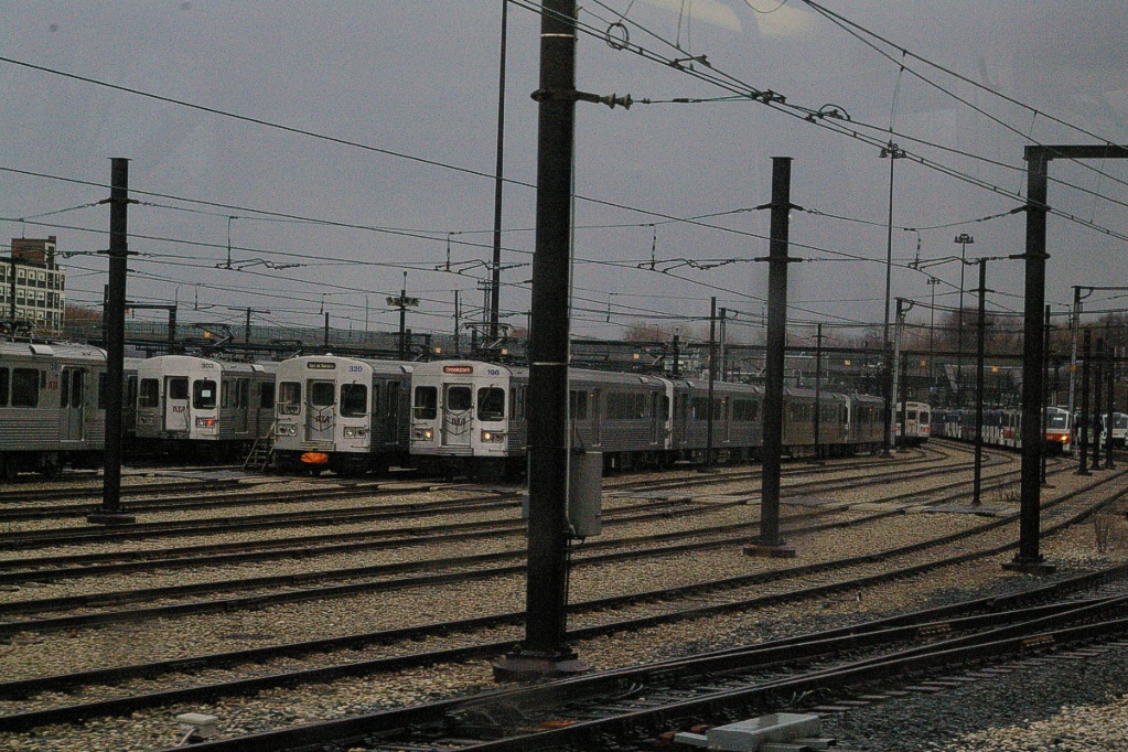
Yard at E55 station.
|


Heading east from E55 station, the Red Line separates from the LRT lines as the LRT lines curve to a southeast direction. See the satellite image to the right.
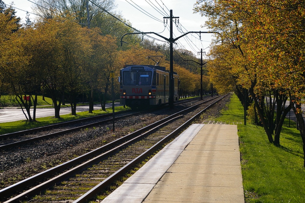
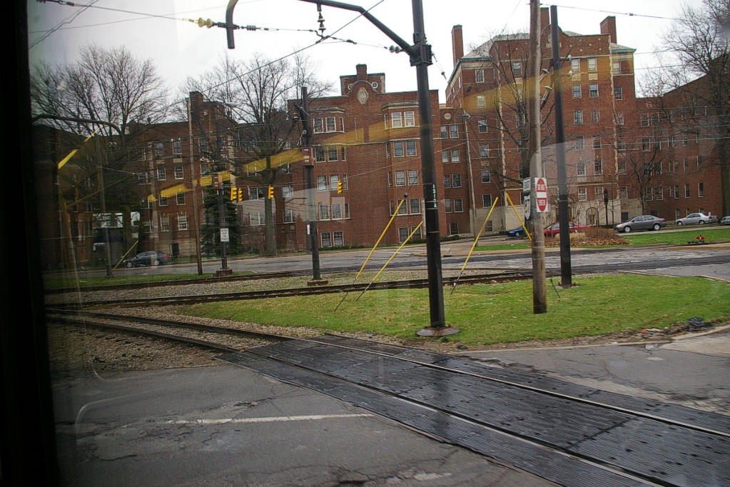
From here, the right of way continues to follow a former railway right of way to the Woodhill station. At this point, the line is traveling east. At the east end of the station, the line passes under the intersection of Buckeye Road, Woodhill Road, and Shaker Boulevard (see image to the left).
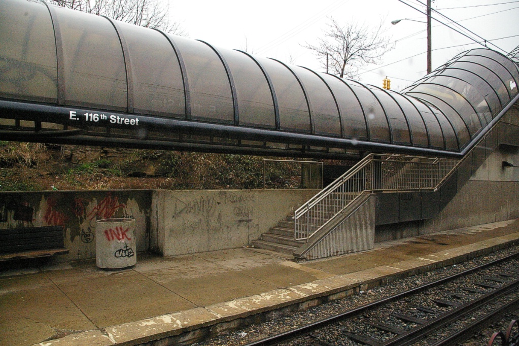
The line continues to the east in a ravine between the eastbound and westbound lanes of Shaker Boulevard. Passing E116 station, the line continues and levels out with Shaker Boulevard before reaching Shaker Square.
At this point, the line is at the same level as Shaker Boulevard. Its right of way is in a wide median (about 30 metres wide). The Shaker Square station is immediately to the west of Shaker Square (the road), and the junction where the Blue and Green lines split is about 200 metres east of Shaker Square station.
Inbound LRV arriving at Shaker Square.
|
Green Line - Shaker Square to Green
The trip from Shaker Square to Green on the Green Line takes approximately 13 minutes.
East of the junction at Shaker Square, there is a centre pocket track for a short distance to hold a train if needed. The line proceeds along a wide median on Shaker Boulevard that, for the most part, has mature trees that partially obscure the LRT from vehicle traffic.
The first stop, Coventry, is just over 350 metres from the junction. This stop is named after Coventry Road and has platforms on the west side of the intersection (nearside for outbound, farside for inbound). There is a Tudor-style station house on the inbound platform.

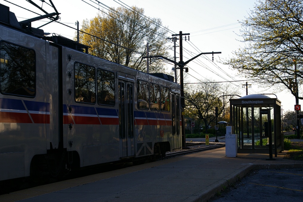
Southington is the next stop with nearside platforms, about 550 metres from Coventry. This stop is named after Southington Road. This stop has the same name as the stop on the same cross street on the Blue Line, which is located about 1 km south along Southington Road.
At a distance of just over 450 metres from Southington, the next stop is South Park, at South Park Boulevard. This stop also has nearside platforms.
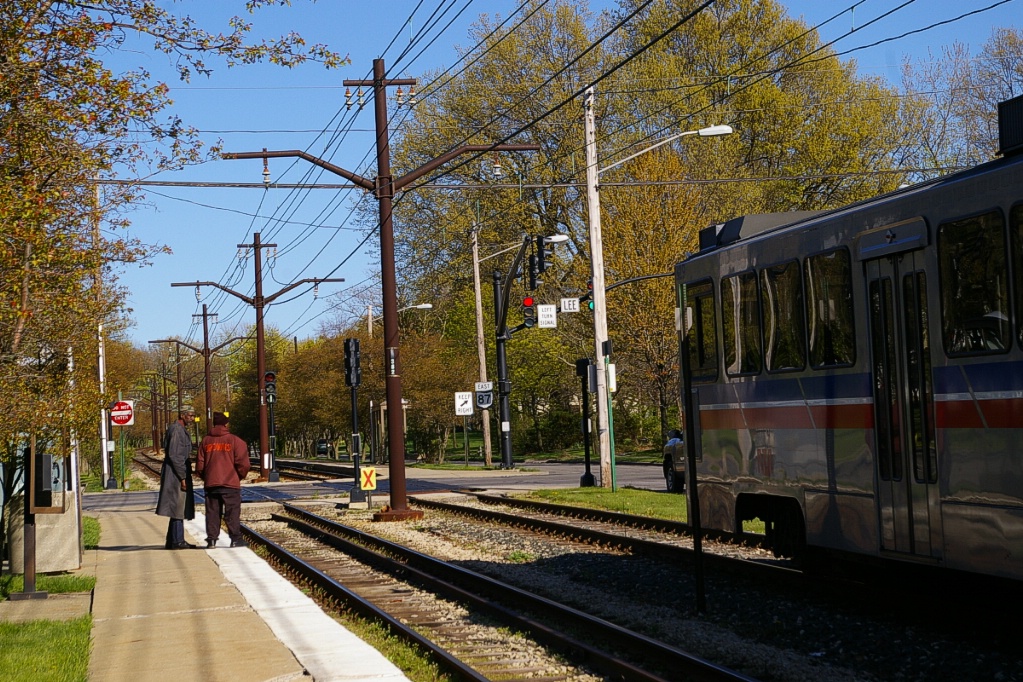
The following stop is Lee, about another 550 metres. This stop has both platforms on the west side of the intersection with Lee Road. This stop has the same name as the station on the same cross street on the Blue Line, which is located about 1.7 km south of this stop.
As Shaker Boulevard shifts a little to the south in an S-curve, the next stop is Attleboro, about 600 metres from Lee and has nearside platforms.
Travelling another 700 metres to the east, the next stop is Eaton, located at the intersection with Eaton Road (on the north side of Shaker) and Torrington Road (on the south side). This stop has nearside platforms.
Courtland is the next stop 550 metres further east, named after the cross street, Courtland Road. The intersection also has Manchester Road (from the southwest) and Montgomery Road (from the southeast).
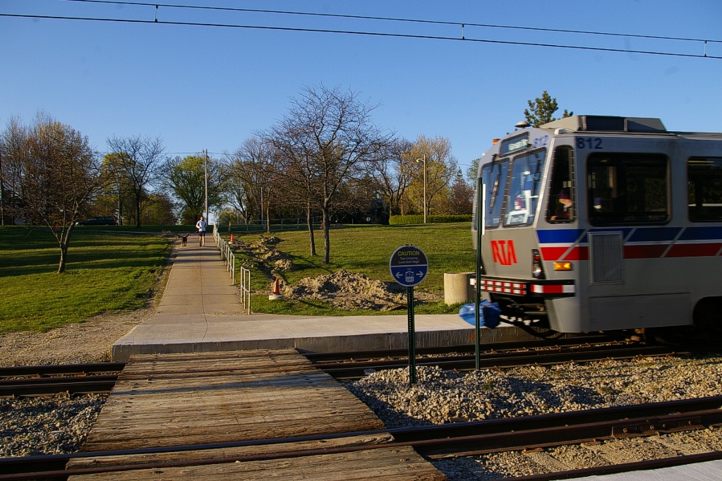
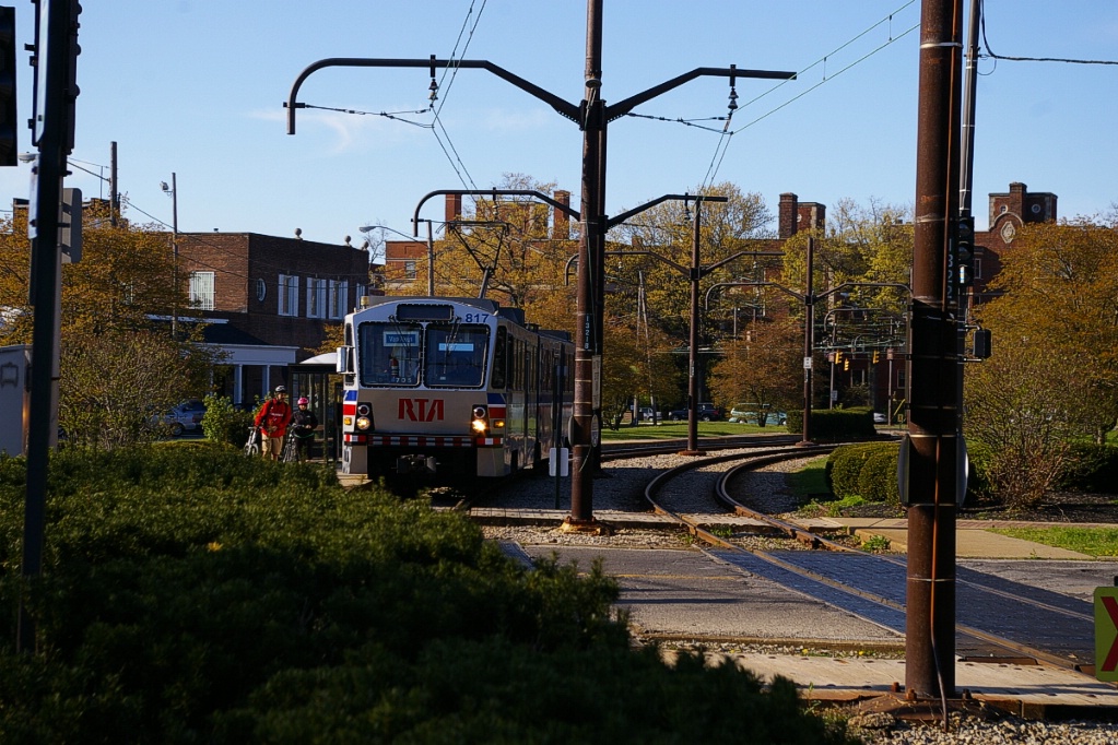
Warrensville is the next station, about 500 metres from Courtland. About 200 metres before reaching Warrensville, each side of Shaker Boulevard separate further, each to about 100 metres from the LRT line, as they climb to leave the LRT right of way in a ravine between them. Warrensville has a look similar to other ravine/cutting stations such as E116 in the South Harbor to Shaker Square section. Warrensville Center Road is the only grade separated road crossing the Green Line east of Shaker Square (Green Road is grade separated, but it is beyond the station and is not over the revenue operations part of the line). This station has the same name as the station on the same cross street on the Blue Line, which is located about 1.7 km south of this station.
Each side of Shaker Boulevard converge slightly to become about 150 metres apart on the north and south sides of the ravine right of way. The first stop, almost 800 metres from Warrensville, is Belvoir. This stop has walk-in access from nearby residential neighbourhoods. Its platforms are slightly staggered with the outbound platform about one and a half LRV lengths further west than the inbound platform.
The West Green stop is about 500 metres east of Belvoir. This side platform stop serves the west end of the parking facilities at Green.
The distance from West Green to Green is only about 150 metres, room for the crossover tracks. Beyond Green, a single tail track and a loop exists. The loop was used in the days of single-ended PCC operation. The loop is no longer used, and it remains the only loop on the entire RTA system.
Green Road station.
|
Beyond the end of the tail track, there are a few additional support poles for the overhead wiring that were installed anticipating a future extension of the line.
Blue Line - Shaker Square to Warrensville
The trip from Shaker Square to Warrensville on the Blue Line takes approximately 13 minutes.

just east of the junction.
The Blue Line branches off of Shaker Boulevard and onto Van Aken Boulevard. This road has a wide median, approximately 25 metres wide. The LRT right of way runs down the middle of this median with grass, bushes, or trees between it and the road. For some stretches there are angle parking spaces, often on both sides of the right of way. Except for the last two stations, Farnsleigh and Warrensville, all the stops along Van Aken Boulevard have nearside platforms.
The line has its first stop, Drexmore, about 200 metres from the junction. The stop is named after the cross street, Drexmore Road. Angle parking is available on both sides of the line on the east side of the intersection (the side with the inbound platform). At this point, Van Aken is heading in a southeast direction.

The next stop is South Woodland, about 500 metres from Drexmore. Angle parking is available on both sides of the line on the west side of the intersection (the side with the outbound platform), and on the inbound side of the line adjacent to the inbound platform.
Another 500 metres along Van Aken is the Southington stop, named after the cross street. Angle parking is available next to each platform. This stop has the same name as the stop on the same cross street on the Green Line, which is located about 1 km up Southington Road from this stop.
The next stop is Onaway, named after Onaway Road. It is about 550 metres from Southington. Angle parking is only available next to the inbound platform at this stop.
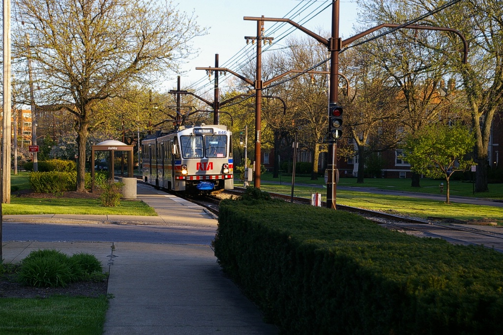
Continuing another 500 metres, the line arrives at Ashby. Angle parking is only available on the inbound side of the line across from the outbound platform.
After leaving Ashby, Van Aken Boulevard curves to the left to an eastbound alignment, taking much of the 700 metres to the next stop at Lee Road. Before reaching Lee station, the LRT right of way descend to a lower grade as the line passes under Lee Road, the only underpass on the Van Aken branch. Lee station has a look similar to other stations just below the grade of the surroundings, such as E116 pictured in the South Harbor to Shaker Square section.
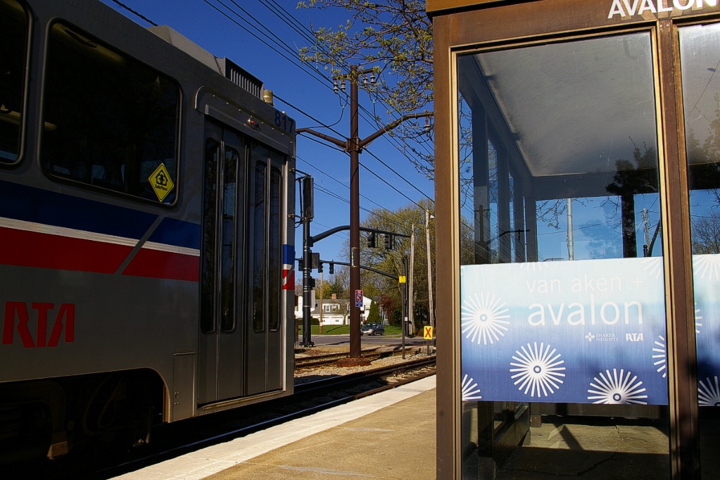
After Lee, the tracks return to the same grade as Van Aken Boulevard. The next stop, about 500 metres east of Lee, is Avalon. Though named after the cross street, Avalon Road, the intersection also includes Daleford Road (northwest and southeast) and Dorchester Road (northeast). Angle parking is available on both sides of the line on the side of the intersection with the inbound platform, and on the inbound side of the line opposite the outbound platform. This stop has the same name as the stop on the same cross street on the Green Line, which is located about 1.7 km north of this stop.
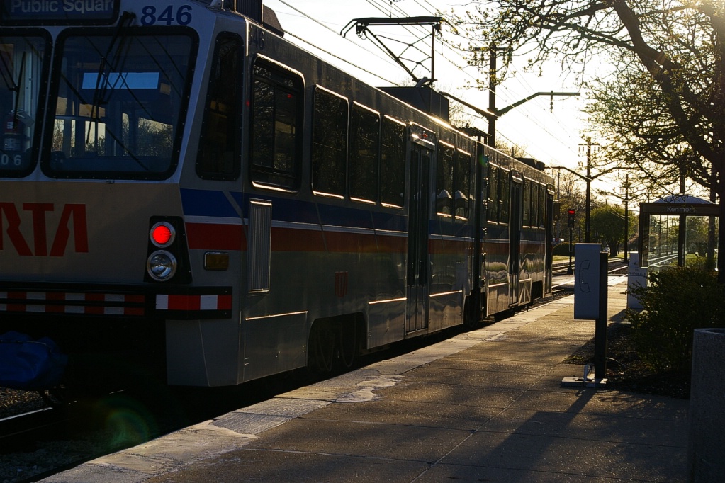
The next stop, Kenmore, is about 450 metres east at Kenmore Road. This intersection also includes Glencairn Road (northwest and southeast) and Ingleside Road (southwest and northeast). Angle parking is available on both sides of the line on the east side of the intersection (where the inbound platform is located).
Lynnfield is the next stop, at the intersection with Lynnfield Road (south of Van Aken) and Parkland Drive (north of Van Aken), as well as Northwood Road (northwest and southeast). A small former station building stands on the westbound platform. The building is now used by a day spa. This station is about 500 metres east of Kenmore and has angle parking available on both sides of the line adjacent to the inbound platform.
There is a distance of about 600 metres to the next stop, Farnsleigh. The line and Van Aken Boulevard curve to a southeast alignment just before Farnsleigh Road.
The Farnsleigh stop has its platforms partly on this curve. Angle parking is available on both sides of the line at the west end of the stop.
The distance from Farnsleigh to the terminal station Warrensville is only about 100 metres, with that distance being taken up with the intersection with Farnsleigh Road and crossover tracks. There is also a third track at Warrensville for LRV storage. This stop has the same name as the stop on the same cross street on the Green Line, which is located about 1.7 km north of this stop.
LRT at Warrensville station on Blue Line.
|
Warrensville station has an island platform. The only other island platform is at Tower City-Public Square. |
Fares and Fare Collection
On westbound LRV trips, fares are collected or checked upon exit, while on eastbound trips they are collected or checked upon boarding.
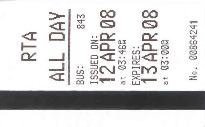
Cash fare is US$2.25 or a 5-trip farecard may be purchased for US$11.25
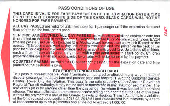
An all-day pass may be purchased for US$5.00 and is valid from its first use until the following day at 3:00 am.
A 7-day pass is available for US$22.50 valid for seven days from first use, and a monthly pass is available for US$85.00
Accessibility
All of the waterfront stations, with the exception of Amtrak, are accessible through the use of a ramp and high level platform at one end of the station.
Additionally, Tower City-Public Square and Shaker Square stations are accessible on the interlined part of the routes. The two terminal stations on each route, Green and Warrensville are also accessible.
Other Notes
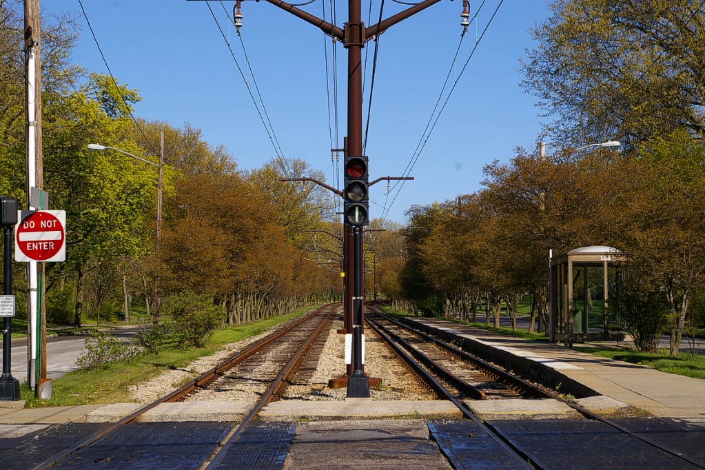
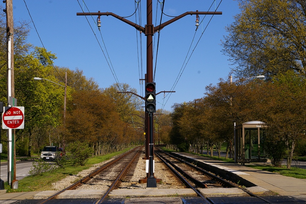
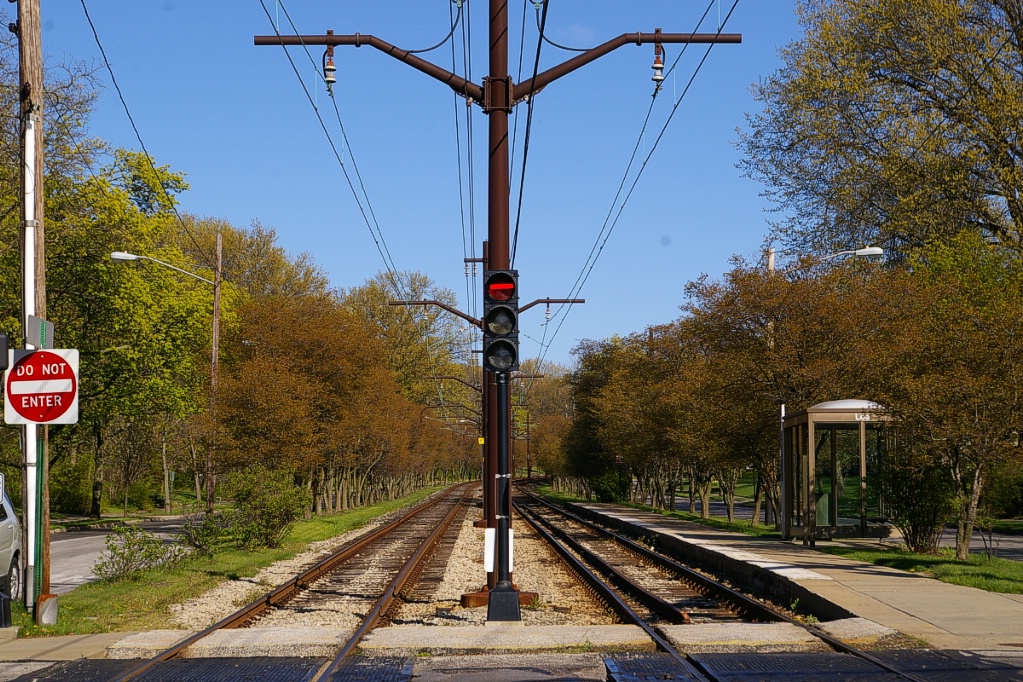
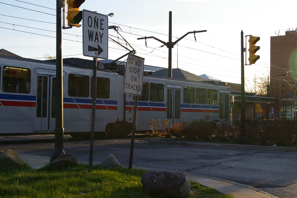
Where LRT lines run in a median, they cross streets under signal control. LRT signals use red horizontal bar, flashing white triangle, and white vertical bar indications (see photos to the right). This avoids confusing road traffic.
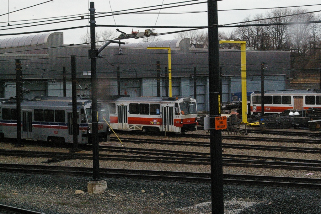
Maintenance facilities for the LRT lines is shared with the Red Line (HRT), located next to the E55 station, which is shared by all lines.
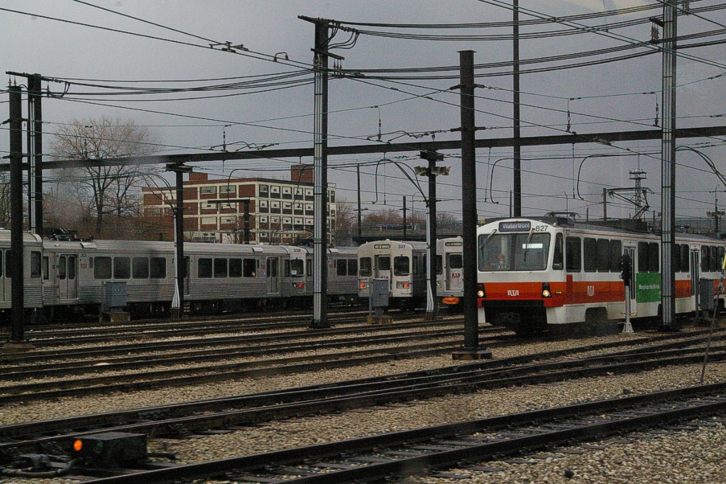
Yard at E55 station serves Red Line (HRT) vehicles as well as Blue and Green
Line (LRT) vehicles.
|
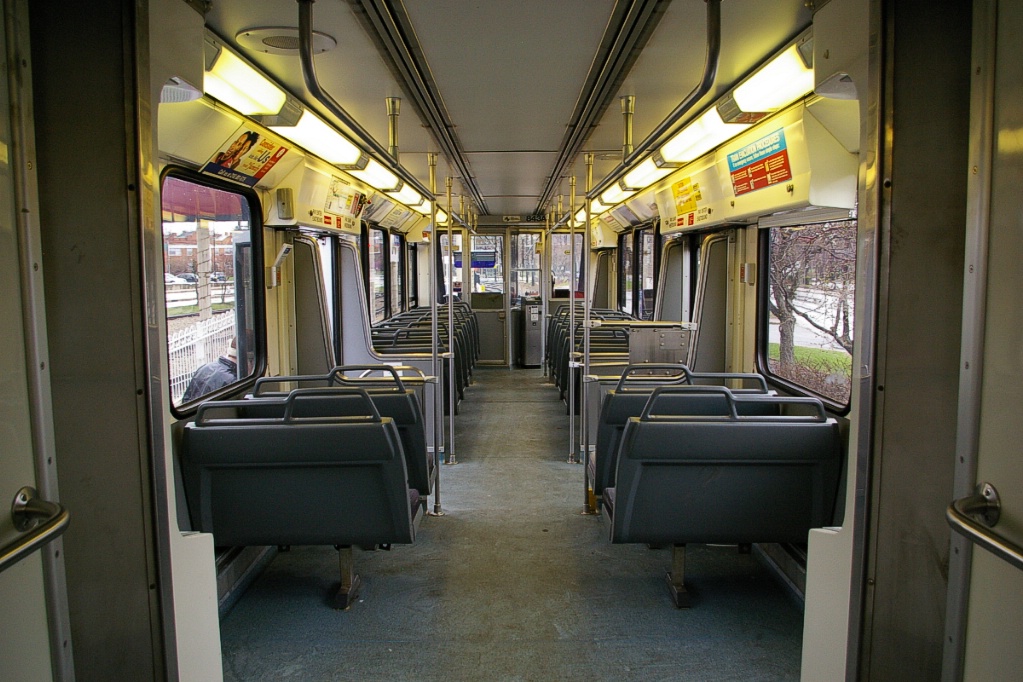
LRV interior.
|
Current and Planned Expansion
The only expansion plan currently in the works is a 500 metre extension to the Blue Line.
The Warrensville station is located in the median of Van Aken Boulevard, in the northwest quadrant of Warrensville Centre Road and Chagrin Boulevard. Van Aken runs on a northwest-southeast alignment meeting the other two at their intersection and becoming Northfield Road in the southeast quadrant. Funding is already in place to realign the intersection of these four roads and construction will begin later in 2012.
Once the intersection is realigned, it is expected to extend the Blue Line across the intersection along with the construction of a new Intermodal Transit Center in the southeast quadrant of the intersection.