This page was last updated May 8, 2012
Send questions, comments, and photos here.

LRT in
Baltimore


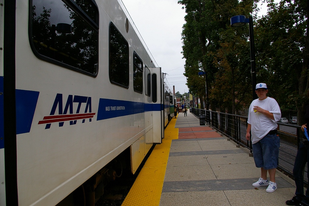
Transit in Baltimore is operated by the Maryland Transit Administration, under the state Department of Transportation. The Light Rail system consists of a single line with two branches at the south end and a short spur downtown to the rail station. Three routes operate interlined, but there are no route number or colour designations on the trains. Trains are distinguished by their destination sign.
Contents
Toronto Comparison
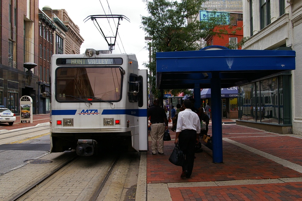
While much of the Baltimore Light Rail system operates in its own right of way, downtown it operates on streets either exclusively or mixed with traffic.
Baltimore is a good example of interlining or branch operations.
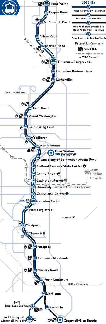
System Highlights and Route Details
Item Notes Number of lines 3 (mostly interlined) Total length 48.3 km Total stations 33 Right of way Downtown: mixed with traffic
Outside downtown: mostly dedicated, former railway right-of-wayLoading Low level platform, cars have steps
Platform 20 cm above trackFleet 53 vehicles by ABB Traction
97 km/h top speed
Seats 85 passengers, room for 91 standing
29 m long
4 double folding doors per side (1.3 m wide)
High floor for 100% of seating spaceRidership 28,152 weekdays; 8,712,170 annually
(2010 figures)Fare collection Self service, barrier free, proof of payment Fare integration Full integration with passes.
No transfers with single fares.Airport service Direct service to BWI Airport Terminal Opening April 3,1992
Timonium to Camden Yards
August 30,1992
South to Patapsco
April 2,1993
South to Linthicum
June 30,1993
South to Cromwell/Glen Burnie
Completing the initial 36 km
September 9,1997
7 km north to Hunt Valley
December 6, 1997
Spurs to Penn Station, and BWI Airport
1998
Hamburg Street station, special events only
2005
Hamburg Street station; full-time operationClosures August 19, 2003 to June 27, 2004
Camden Yards to North Linthicum double-tracking
January 2 to December 4, 2005
North Avenue to Timonium double-tracking
January 2, 2005 to February 26, 2006
Timonium to Hunt Valley double-tracking
| Cromwell/Glen
Burnie to Timonium (peak) or Hunt Valley (off-peak) |
|
| Stations | 30 during peak service 24 during off-peak service All but 2 interlined with other routes |
|---|---|
| Service frequency | 20 minutes rush hours (start of service-10 am, 4-6 pm) 30 minutes mid-days, evenings, and weekends |
| BWI Airport to Hunt Valley | |
| Stations | 30 All but 2 interlined with other routes |
|---|---|
| Service frequency | 20 minutes rush hours (start of service-10 am, 4-6 pm) 30 minutes mid-days, evenings, and weekends |
| Camden Yards to Penn Station | |
| Stations | 8 All but 1 interlined with other routes |
|---|---|
| Service frequency | 30 minutes at all times |
Ride Descriptions
Since Baltimore's Light Rail is a single line with branches, the description will cover the system from the south to the north beginning with the BWI Airport branch and the Glen Burnie branch. This will be followed by the trip to the north end (note: details and photos only cover the line to Cold Spring Lane!). The final description will cover the short branch to Penn Station.
| Corridor | Notes | Opened |
|---|---|---|
| BWI Branch | West branch at the south end | June 30, 1993 |
| Glen Burnie Branch | East branch at the south end | December 6, 1997 |
| Linthicum to Hunt Valley | Main LRT corridor | Stages from April 3, 1992 to April 2, 1993 |
| Penn Station branch | Short spur to railway station | December 6, 1997 |
BWI Branch
The trip from BWI Airport to Linthicum takes about 9 minutes.
The LRT station at BWI Airport has an island platform between two tracks. Service from this station is every 20 minutes during rush hours, and every 30 minutes at all other operating times.
BWI has no parking facilities specifically for the LRT, but there is general paid parking available. The station is roughly on a southeast-to-northwest alignment, with the terminal building at its southeast end, and therefore has no tail tracks beyond the station.
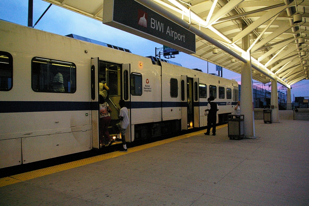
BWI Airport.
|
Single track approach to BWI.
|
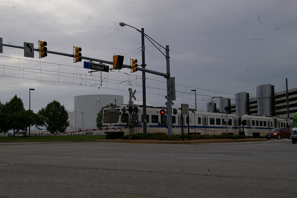
Between BWI Business District and BWI. The line here is parallel to Terminal
Road as it crosses MD-170.
|
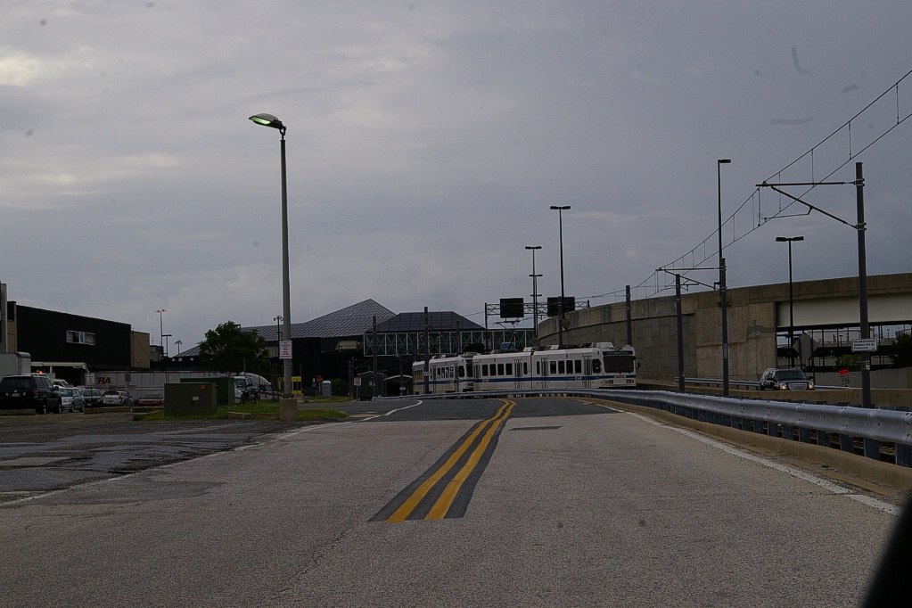
The line exits the station and immediately converges into a single track for about 320 metres before diverging again into a double-track line. The line follows on the side of Elm Road until just east of Terminal Road where it curves northward to follow on the east side of Terminal Road.
After crossing MD-170, the line curves east to arrive at the BWI Business District station. This station has side platforms and a small parking lot for 36 vehicles.
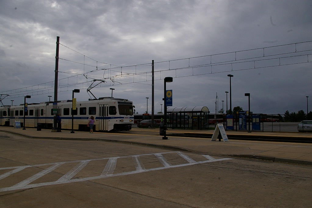
BWI Business District station.
|
The line continues to the east and slightly to the north for about 2.3 km where it curves northward and joins the other branch. There is about another 400 metres before reaching Linthicum station.
Glen Burnie Branch
The trip from Cromwell/Glen Burnie to Linthicum, takes about 6 minutes.
The Cromwell/Glen Burnie LRT station has three platforms: two side platforms and a centre island platform. This station is the southern end of the line and has tail tracks running about 150 metres south of the station. The parking lot at this station is west of the platforms and has room for 795 vehicles. There is an LRV maintenance facility just north of the station and its parking lot, but trains may reach it via tracks north of the station, or via a switch back south of the station.
The line is situated on the west side of Baltimore Annapolis Boulevard. If the line were to be extended southward, a bridge would be necessary to take it over Dorsey Road (MD-176) as its elevation at this point is significantly higher than the road.
Leaving Cromwell/Glen Burnie, the line follows Baltimore Annapolis Blvd for about 1.3 km to Ferndale, passing under I-97 just over 400 metres north of Cromwell/Glen Burnie.
Ferndale has an island platform and in addition to having Baltimore Annapolis Blvd on its east side, it also has North Broadview Blvd on its west side. The area around Ferndale is predominantly residential. There is no parking facilities nor connecting transit routes at Ferndale.
The line continues north between North Broadview and Baltimore Annapolis for about 450 metres where Baltimore Annapolis curves away, but Orchard Road takes its place flanking the line. Continuing between these two streets, occasionally in a cutting, the line travels for about another 1.5 km until it reaches the junction with the branch to BWI.
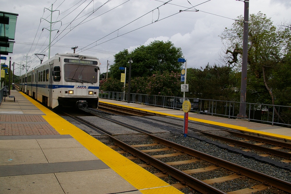
Linthicum to Hunt Valley
The trip from Linthicum to Hunt Valley, takes about 71 minutes.
NOTE: this description only covers the trip to Cold Spring Lane - description and photos of the rest of the trip are welcome and may be submitted by email.

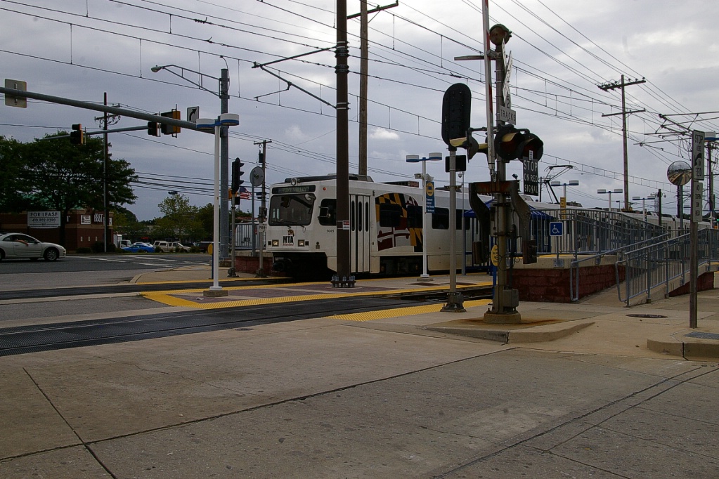
Linthicum station is located about 400 metres north of where the junction between the Cromwell/Glen Burnie and BWI Airport branches meet. This station has side platforms and the line is in a slight cutting at this location. There are no parking facilities nor connecting transit routes at Linthicum.
A bicycle/hiking trail (the BWI trail) is immediately on the west side of the line from just north of the junction and continues for about another 400 metres north of Linthicum to West Maple Road.

BWI-bound LRT arriving at North Linthicum.
|
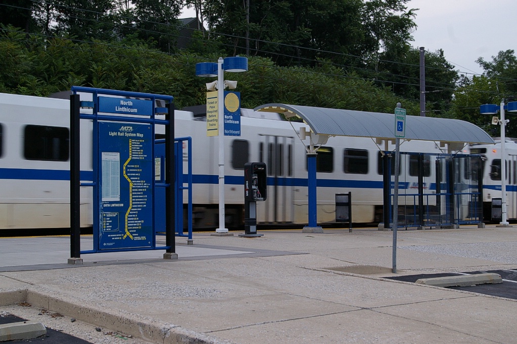
Northbound LRT at North Linthicum.
|
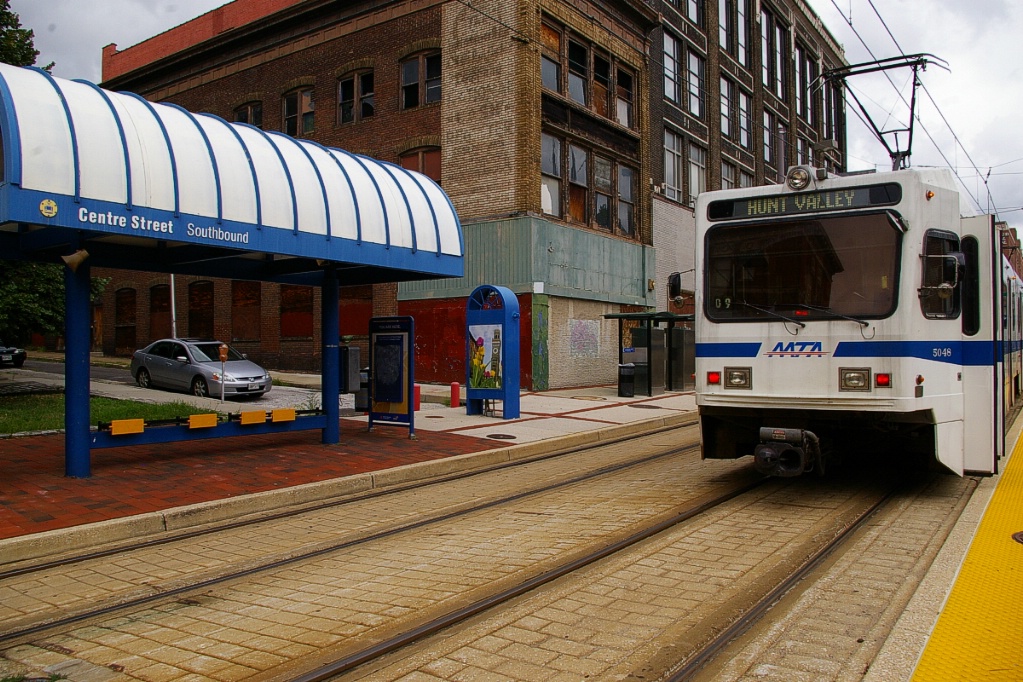
The line travels about 1.6 km to North Linthicum station, passing under I-695 about 1.1 km from Linthicum station.
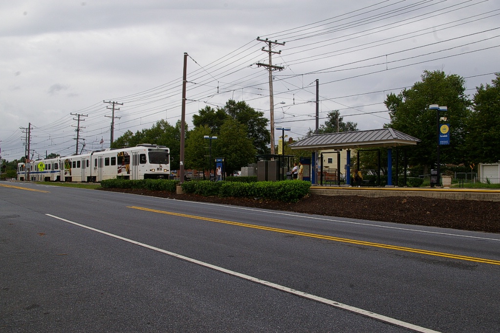
North Linthicum station has side platforms and parking on its east side for 347 vehicles. There are no connecting transit routes at this station.
There is a distance of about 900 metres to the next station at Nursery Road, named after that road. This station has side platforms and a small parking lot on its west side for 37 vehicles. There is one connecting bus route at Nursery Road.
The next station is about 1.5 km further north, passing under I-895 (Harbor Tunnel Throughway) along the way. This station is Baltimore Highlands and has side platforms, parking space for 50 vehicles, but no connecting transit routes.
Patapsco station is a little over 800 metres north of Baltimore Highlands. This side-platform station has parking for 216 vehicles on its west side, along with connections for six bus routes.
After leaving the station and passing over Patapsco Avenue, the line curves a little to the northwest to parallel a railway line for about 800 metres. The LRT then passes through a fly-under to cross under the railway line and continue in a northward direction for about another 1.1 km before reaching Cherry Hill station. Cherry Hill has no parking facilities, but there are connections to three bus routes.
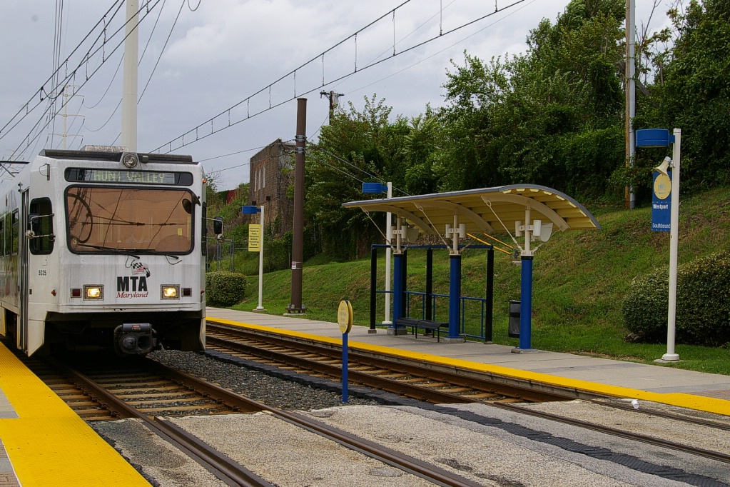
Another 600 metres to the north is Westport station, situated at the west end of the harbour. This station also has side platforms, no parking facilities, but does have connections to two bus routes.
From Westport, the line travels about 800 metres before becoming elevated for another 1400 metres as it passes under I-95 and over the northwestern portion of the harbour.
The line returns to ground level and arrives at Hamburg Street station, which is located on the east side of M&T Bank Stadium. This station was added to the system in 1998 when the stadium was constructed, initially as a special events only station. In 2005 did this became a full time station.
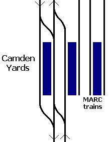
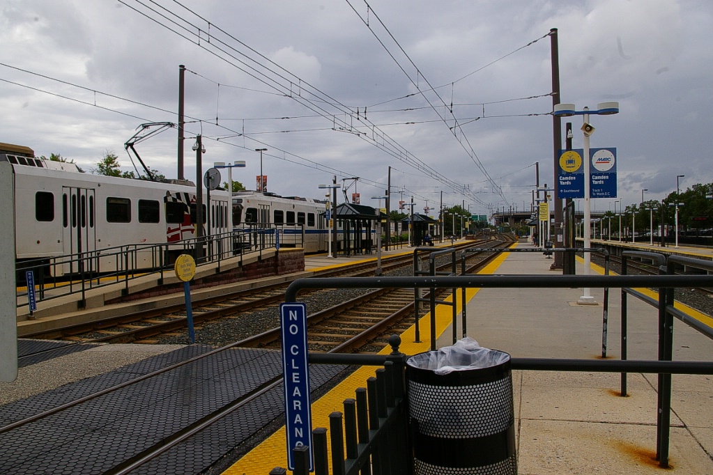
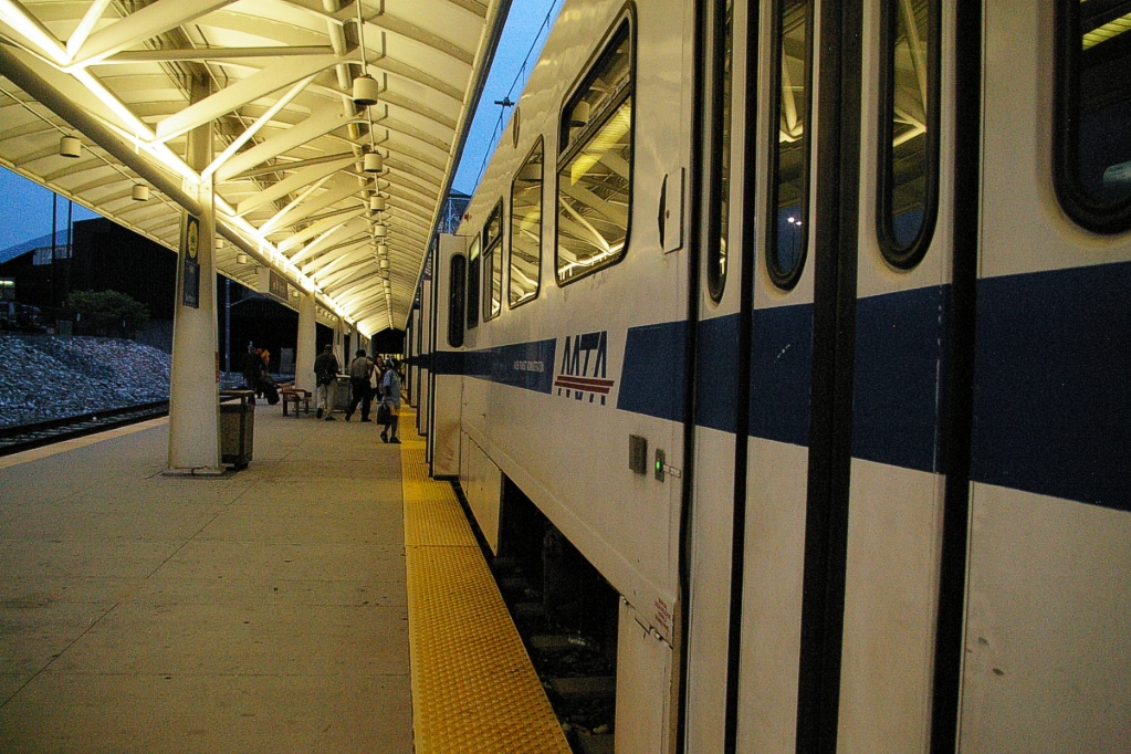
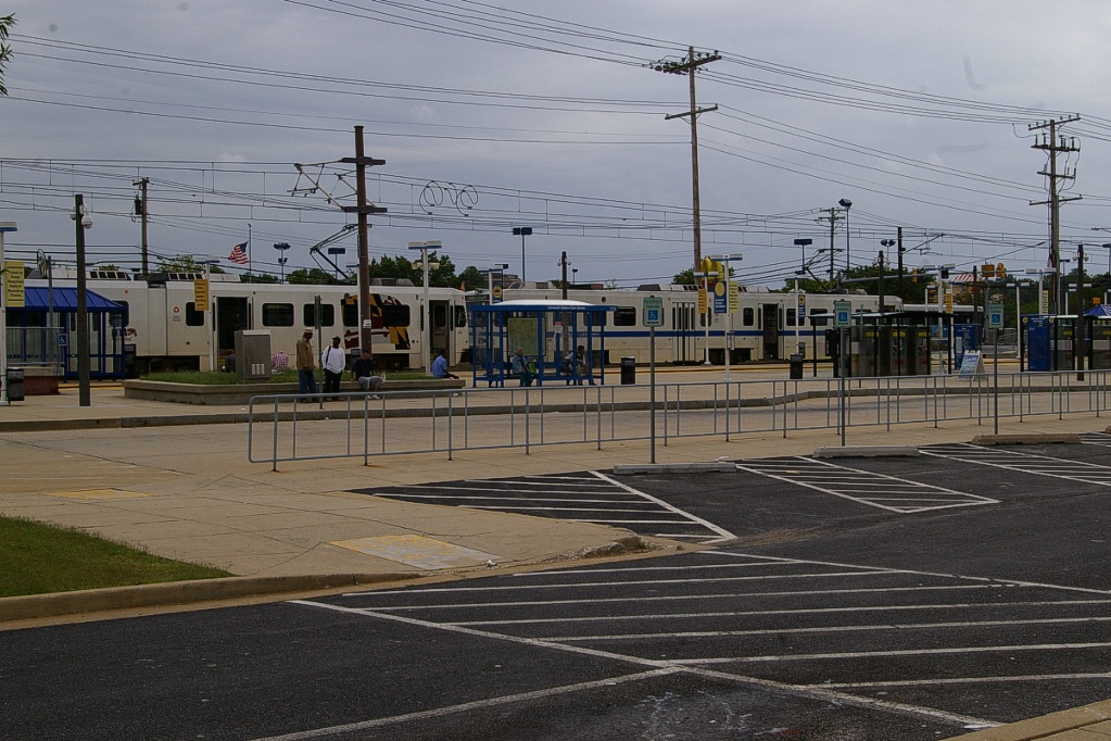
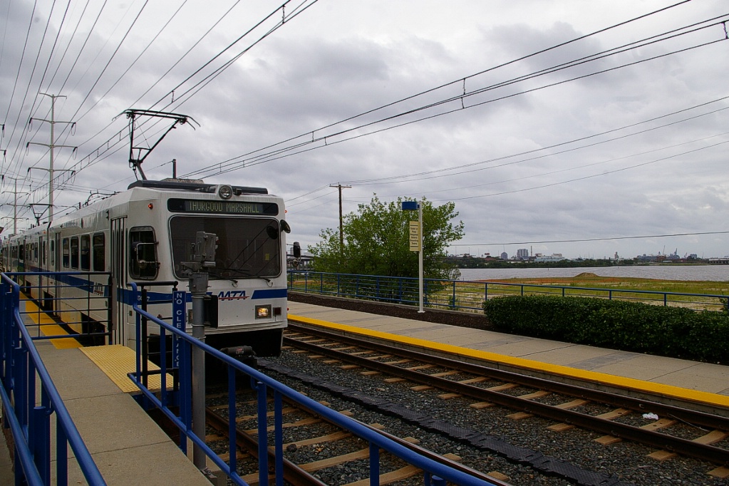
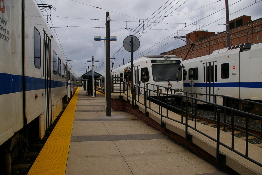
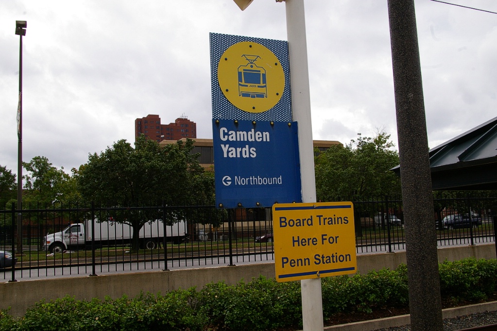
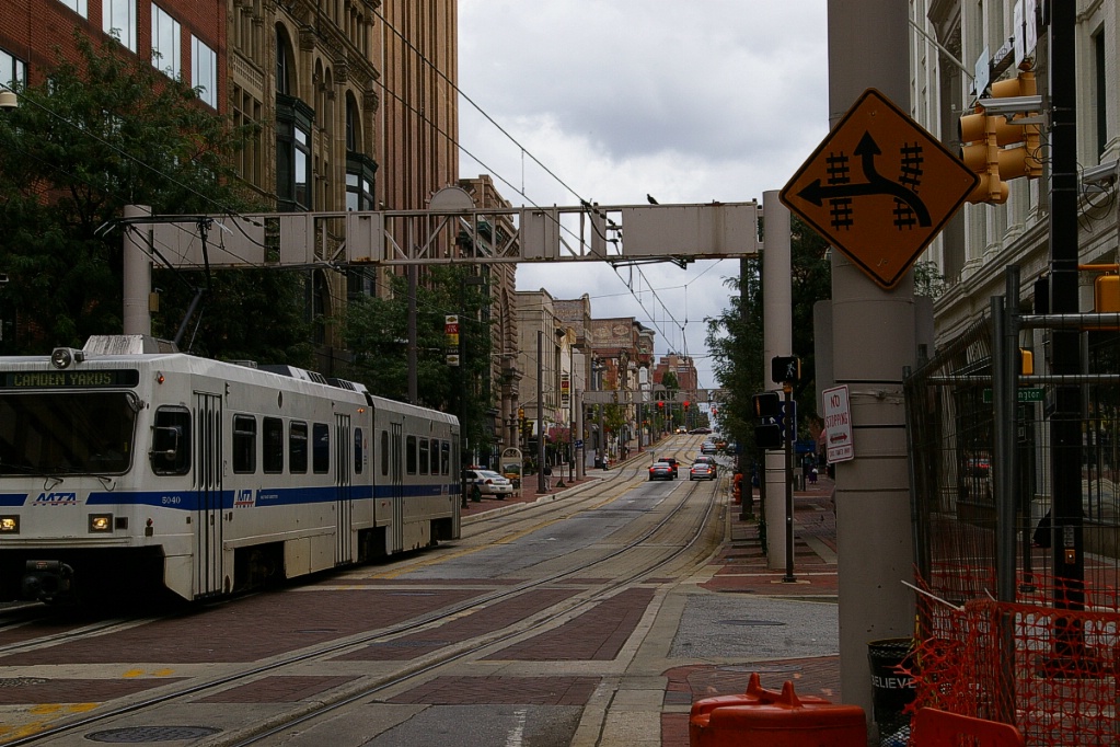
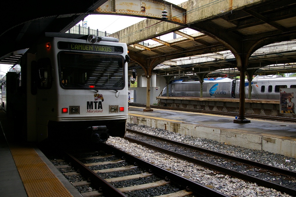
There is about 600 metres from Hamburg Street to Camden Yards. Camden Yards has three tracks, with the middle track providing a layover space for the downtown service between here and Penn Station. This station also has three stub-end tracks that are served by MARC commuter trains that are located immediately to the west of the LRT tracks.

Looking north at Camden Yards, a single-car LRV from Penn Station is arriving.
|
Looking south from left-to-right: Northbound, Penn Station-bound, and
Cromwell-bound.
|

Camden Yards: LRT tracks on left, MARC tracks on right.
|
Camden Yards.
|
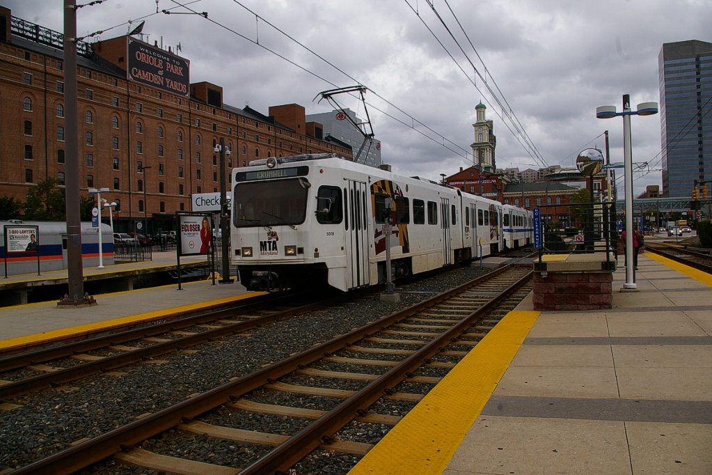
Cromwell-bound LRV arriving at Camden Yards.
|
Continuing north from Camden Yards, the first stop is Convention Center, only two blocks away (about 250 metres), but still on the west side of Howard Street.
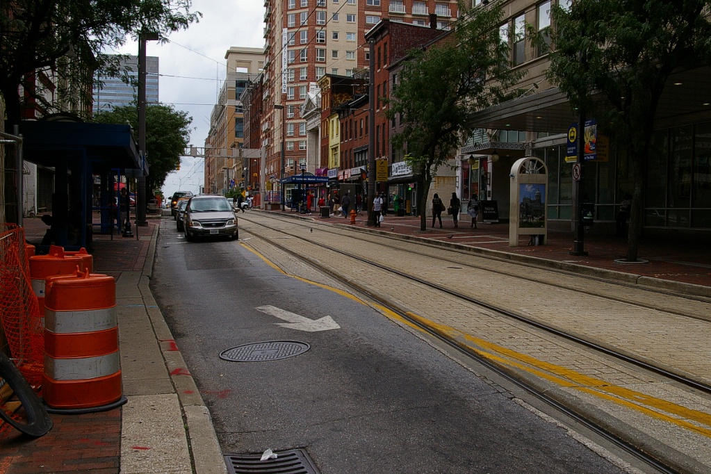
After Convention Center, the line moves onto Howard Street where it sometimes runs in reserved lanes and sometimes mixed with other traffic.
The next stop is University Center-Baltimore Street, about 350 metres north of Convention Center. Here, the platforms are opposite each other on the west side of the street with southbound traffic on the east side of the street.
A few blocks north, the southbound platform for the Lexington Market stop is located a between Marion Street and Lexington. At Lexington, the northbound track swings to the east side of the road for the platform in the block between Lexington and Clay Street. At the same time the track swings from the centre of the road to the curb lane, the traffic lane does the opposite (see photos below).
South view on Howard Street at Lexington: northbound traffic stops about
50 metres back as tracks begin to shift to the east side road.
|
North view on Howard Street where traffic must stop at Lexington: traffic
must shift to the centre lane for the next couple of blocks.
|
By the time the line reaches the Centre Street stop, both tracks are side by side on the west side of Howard Street.
The line continues on Howard Street for about 650 metres until it gets to Martin Luther King Jr Boulevard. As it passes through this intersection, it shifts to its own right of way on the east side of the street where the Cultural Center-State Center stop is located.
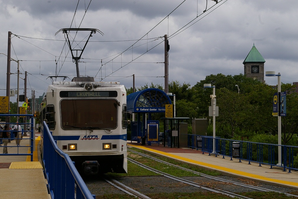
Cromwell-bound at Cultural Center-State Center.
|
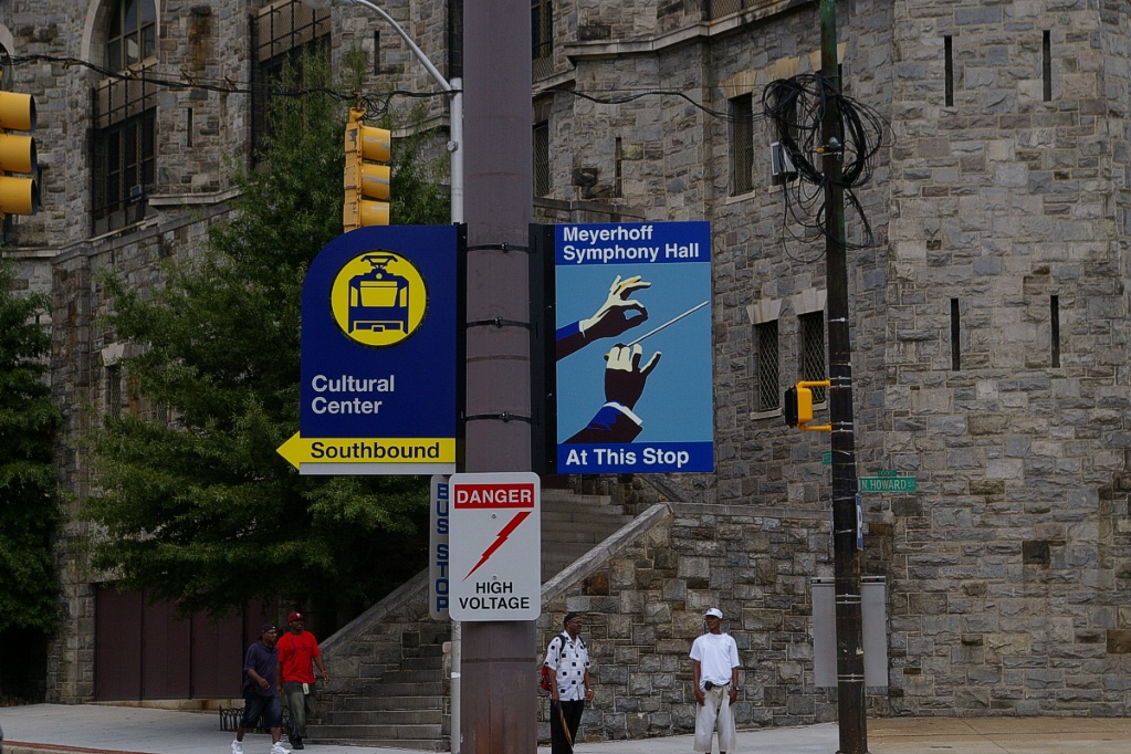
Local signage at Cultural Center-State Center.
|
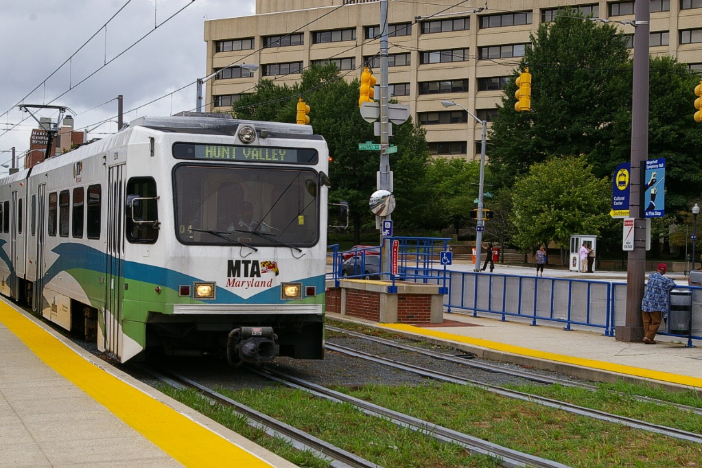
Northbound LRV arriving at Cultural Center-State Center.
|
Portions of the track at the Cultural Center-State Center stop have grass growing between the rails. None of the downtown stops have any parking facilities, but several other transit routes are available at each stop.
North of Cultural Center-State Center, the line continues on the east side of Howard Street for about 350 metres before it swings about 100 metres to the east in an S-curve before arriving at the University of Baltimore-Mount Royal stop.
The University of Baltimore-Mount Royal stop is located due north of Mount Royal station (former B&O station, now part of Maryland Institute College of Art), immediately on the east side of a rail line that is in a cutting. It is just north of this stop where the branch to Penn Station leaves this line.
North of the University of Baltimore-Mount Royal stop, the line parallels I-83 for about 200 metres until it passes over the rail corridor, where it curves north again to pass under I-83 (Jones Falls Expressway). The North Avenue station is located just north of North Avenue. This station has three tracks. A maintenance facility is located just north of this stop, so additional rush hour trains are often taken out of service at North Avenue.
From North Avenue, the line follows I-83, travelling about 3.2 km to Woodberry station. The line crosses under I-83 to its west side about 600 metres south of Woodberry. This station has side platforms but no parking facilities. There are connections to three bus routes at Woodberry.
Continuing north for about 1.6 km, the line reaches Cold Spring Lane station. This station also has side platforms and no parking facilities, but has a connection with one bus route.
As mentioned above, the author of this page did not have sufficient time to complete the journey to Hunt Valley. If you can provide the details and any photos of any part of the line from Cold Spring Lane to Hunt Valley, please email your details.
Penn Station branch
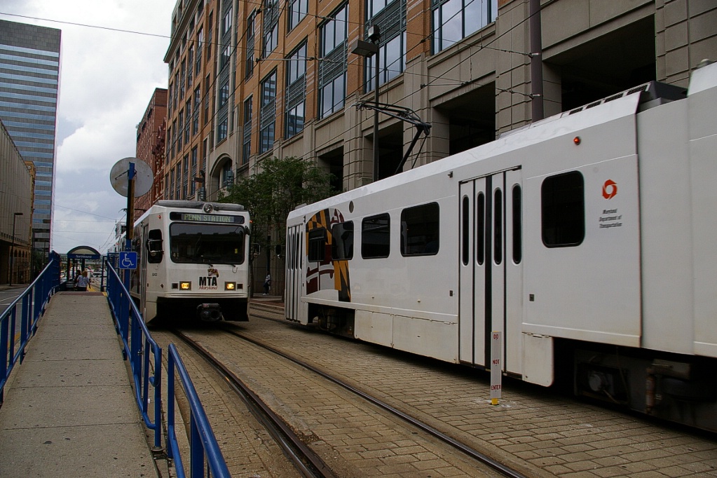
The trip from University of Baltimore-Mount Royal to Penn Station, takes about 3 minutes.
Just north of the University of Baltimore-Mount Royal stop, the line branches to the east and immediately converges to a single track. This single track heads east and drops to a lower elevation where other rail lines are located. It travels about 500 metres to its terminus at Penn Station where it uses the southern-most platform.
Penn Station has no parking facilities specifically for the LRT, but there is general paid parking available. There are connections with four bus routes, as well as MARC and Amtrak trains.
Service from here to Camden Yards runs every 30 minutes usually using a single car train. The total trip only takes about 20 minutes, so there is a layover at each end totalling about ten minutes.
Fares and Fare Collection
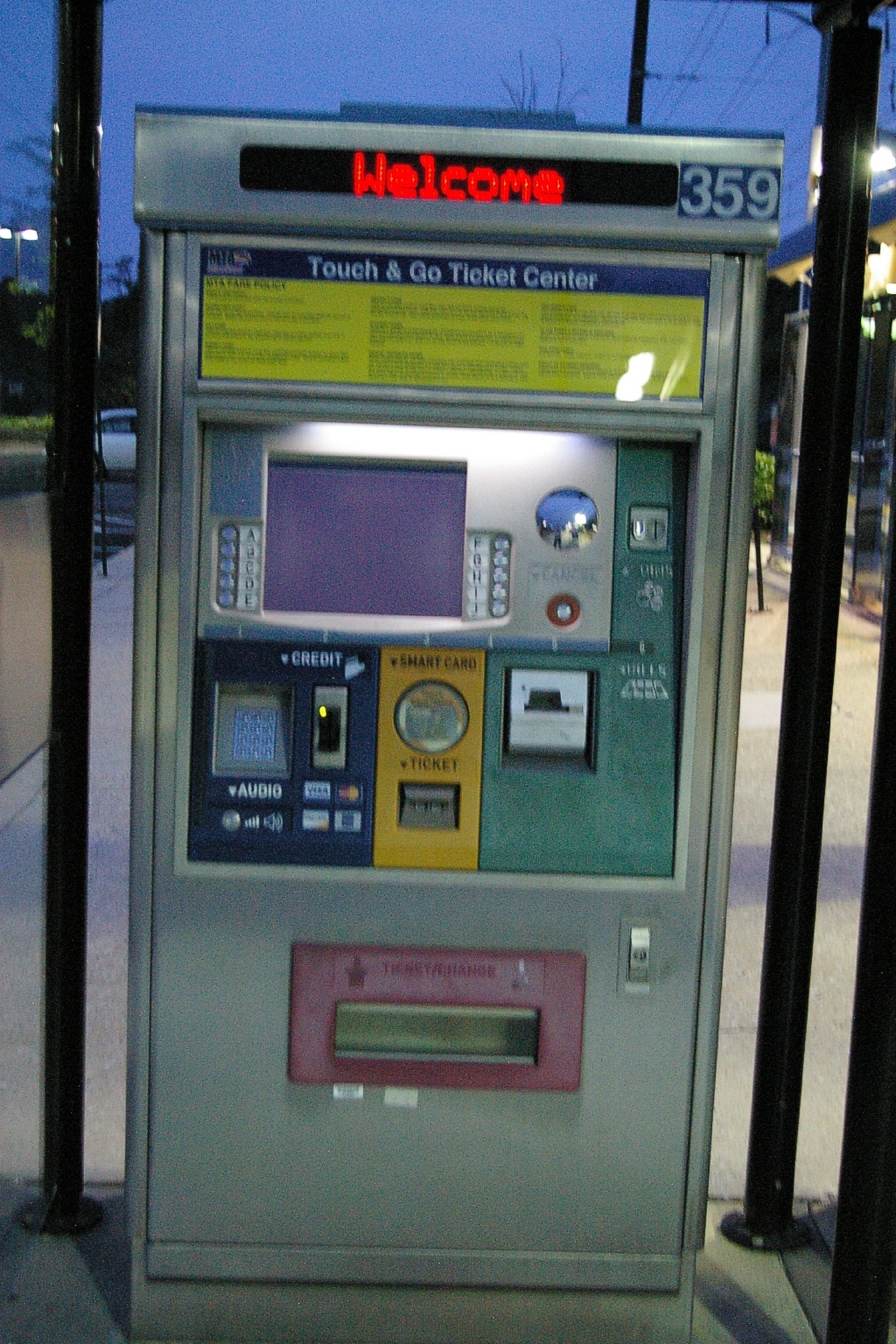
In Baltimore, a single fare costs US$1.60 - one may change Light Rail trains, but no other transferring is permitted with a single fare.
At LRT stations, fares may be purchased from vending machines on platforms.
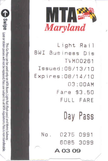
A Day Pass is available for US$3.50 that allows unlimited use until 3 am the following day on the LRT, buses, and subway.
Weekly passes cost US$16.50 and monthly passes are US$64.
Random fare inspections take place. Being caught without a valid fare can result in a fine.
Accessibility
Baltimore's LRVs are not low floor, but platforms are low. The doors immediately behind the driver's cab have fold-down platforms for wheel chair and stroller access. During operation, the leading door is spotted at the high-level ramp and the door is only opened if needed.
Other Notes
Current and Planned Expansion

|
The Baltimore Red Line is a proposed 14-mile light rail line connecting the areas of Woodlawn, Edmondson Village, West Baltimore, downtown Baltimore, Harbor East, Fells Point, Canton, and the Johns Hopkins Bayview Medical Center with direct connections to existing Metro Subway, Light Rail, MARC Train and local bus services. |

|
The Baltimore Purple Line is a proposed 6-mile light rail line extending from New Carrollton in Prince George's County to Bethesda in Montgomery County. It would provide a direct connection to the Metrorail (Washington DC) Red, Green and Orange Lines. The Purple Line would also connect to MARC Train, Amtrak and local bus services. |