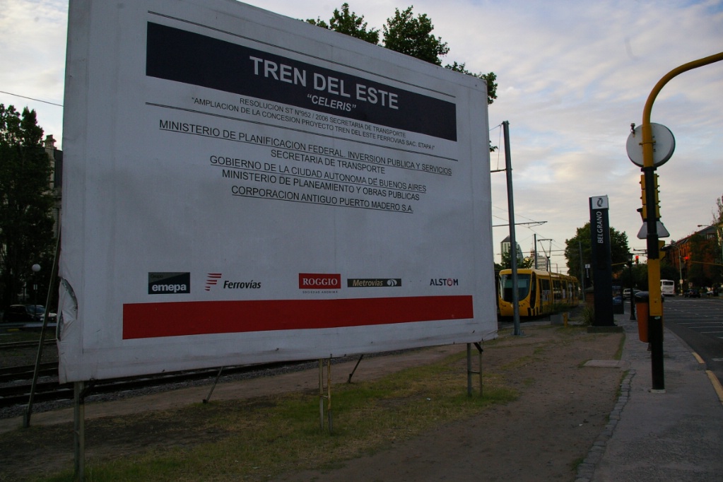
Additional information on the railway company operating Celeris, see the Ferrovías website at http://www.ferrovias.com.ar

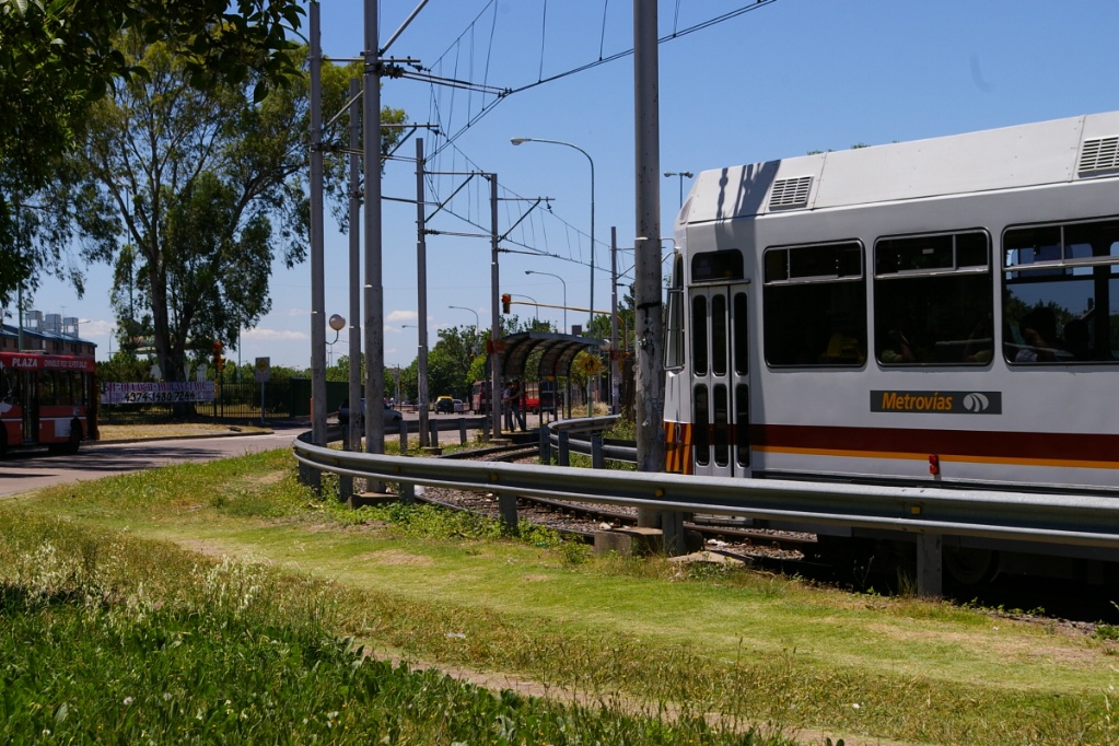
A Premetro line, known as Línea P, provides service further into the suburbs beyond the end of Metro Line E. This line is operated by the private operator Metrovías, who also operate the Metro system. Originally, this was known as Línea E2, it is now officially designated "Línea P", though destination signs show an "E2" with a "PM" (Premetro) logo.
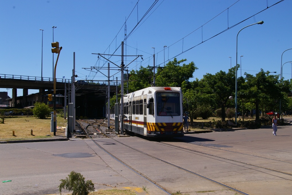
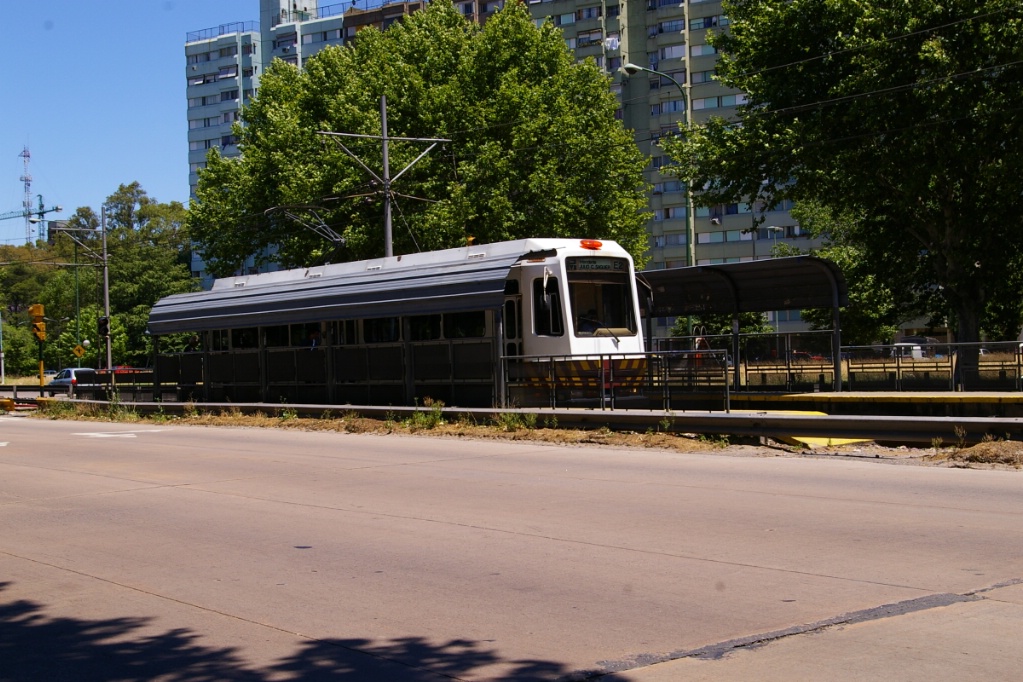
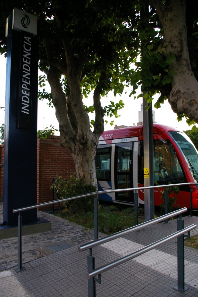
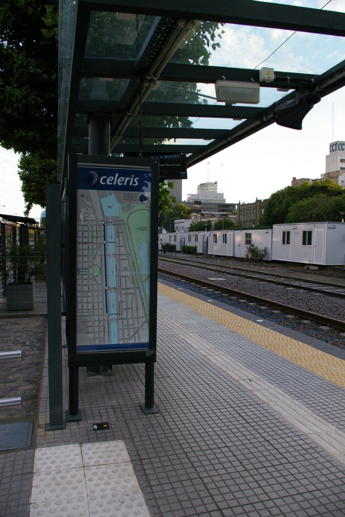
A newer downtown line, Tranvía del Este, also known as Celeris, is 2 km in length and operates in the Puerto Madero neighbourhood and is operated by the railway company Ferrovías.
Línea P provides an excellent example of using LRT as a more appropriate transit mode for extending service radially outwards. Instead of extending the subway system beyond the central area where the capacity of a full metro system is needed, an LRT line can provide an excellent means to extend service without the same high costs.
Cereris is a smaller, simpler example of Toronto's Harbourfront LRT using newer low floor technology.
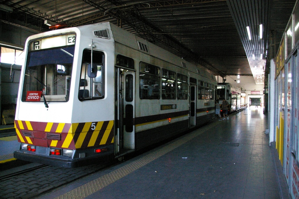
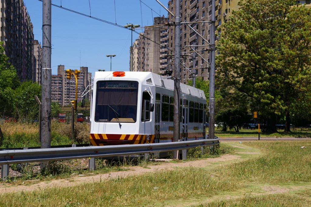
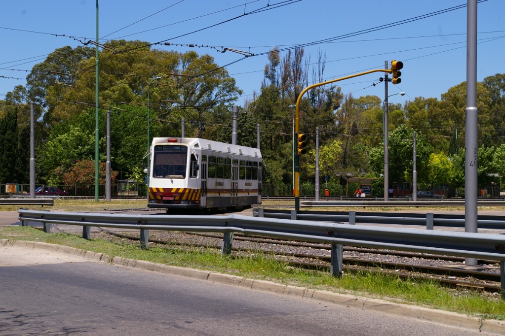
Premetro at Intendente Saguier
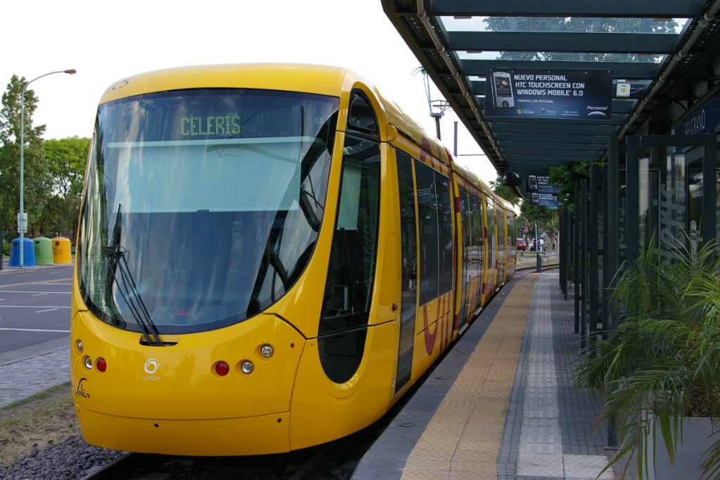
Citadis 302 at Belgrano
| System Highlights | ||
Number of lines: |
2, service by separate operators |
|
Total length: |
9.2 km |
|
| Total stations: | 20 |
|
| Línea P fleet: | 25 Premetro LRVs | |
| Original 4 LRVs built using new bodies on 1913 subway under frames | ||
| Another 4 LRVs built using spare subway parts | ||
| Fabrica
de Material Ferroviario constructed 17 new
vehicles with electrical components from Siemens |
||
| Celeris fleet: | 2 Alstom Citadis 302 on loan from Mulhouse France | |
| Premetro details: | Seats 32 passengers; room for over 100 standees (at 6 pass/m²) | |
| 15.5 m long | ||
| 3 folding doors per side, centre door is double | ||
| 70 km/h top speed | ||
| High floor with two steps up from platform height about 35 cm above rail | ||
| Citadis details: | Seats 64 passengers (48 fixed seats, 16 folding); total capacity 170 | |
| 32.85 m long, 5 sections | ||
| 6 sliding/plug doors per side (2 single at each end, 4 double) | ||
| 80 km/h top speed | ||
| Low floor for 100% of seating space and doors; 35 cm above rail | ||
| Airport service: | No transit service to airport | |
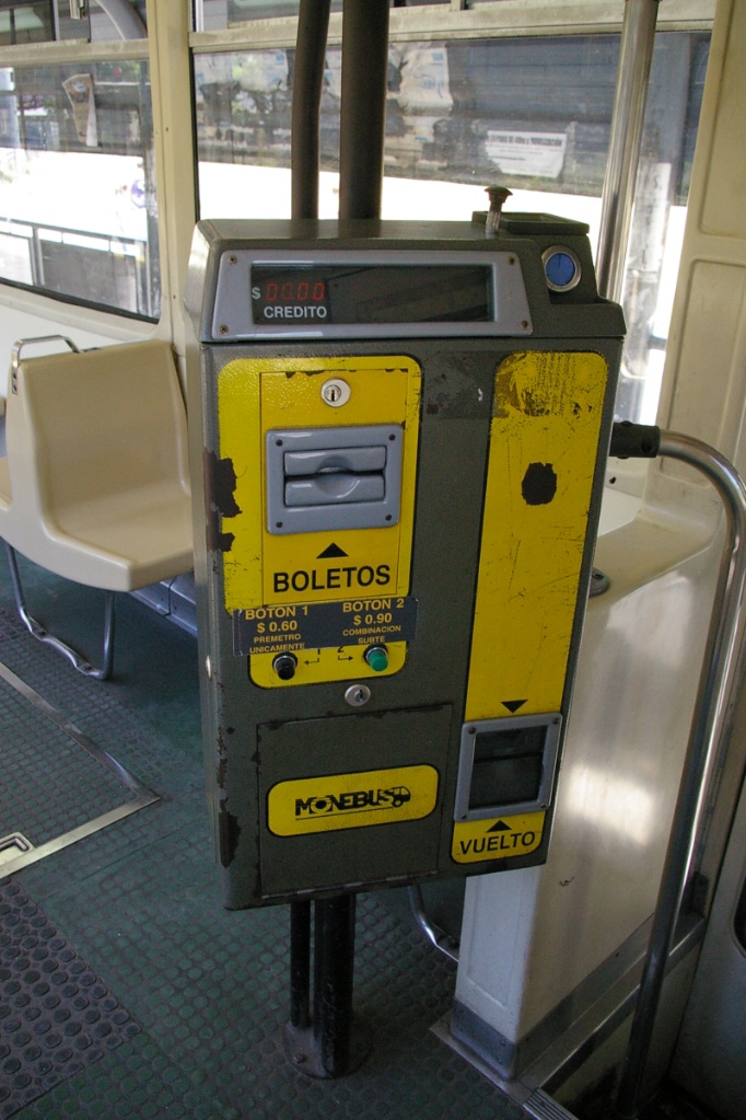
Línea P Fare collection:
Purchased onboard, Línea P fare is AR$0.60 for a single trip without transfer to the subway, or AR$0.90 with transfer to the subway.
| Línea P | ||
Length: |
7.2 km |
|
| Stations: | 17 |
|
ROW: |
Mostly median ROW with ballasted tie track |
|
| Some median ROW with concrete encased track | ||
| Some totally private ROW | ||
| 900 metres in mixed traffic from Intendente Saguier to Balbastro | ||
| Service frequency: | 10 minutes (Intendente Saguier to Pola) | |
| 20 minutes on each branch (to Centro Civico and Grl Savio) | ||
| Hours of Service: | Monday to Saturday: roughly 5:30 am to 9:00 pm outbound | |
| 6:00 am to 9:30 pm inbound | ||
| Sundays: service begins roughly 8:00 am outbound, 8:30 am inbound | ||
| Ridership: | 2.85 million per year | |
| Fare collection: | Self service purchase on board from fare machine | |
| Fare integration: | Subte fare good to board this line; passengers boarding this line | |
| have option of paying lower fare for LRT only | ||
| Opening: | April 28,1987 (to Ana Marie Janer) | |
| June 1987 (to Villa Soldati) | ||
| August 27,1987 | ||
At the time this page was created, AR$1.00 was about C$0.38
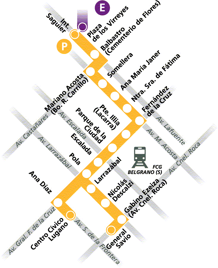
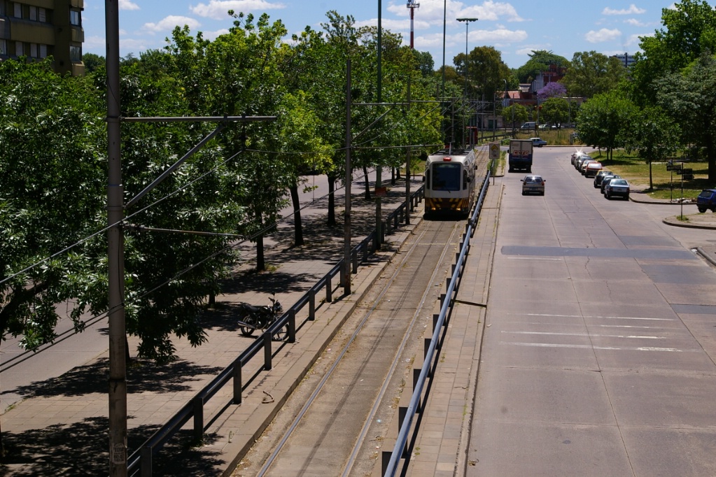
Here is a description of the route on Línea P which takes approximately 22 minutes to Centro Civico and 24 minutes to General Savio:
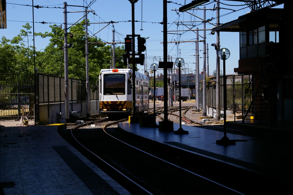
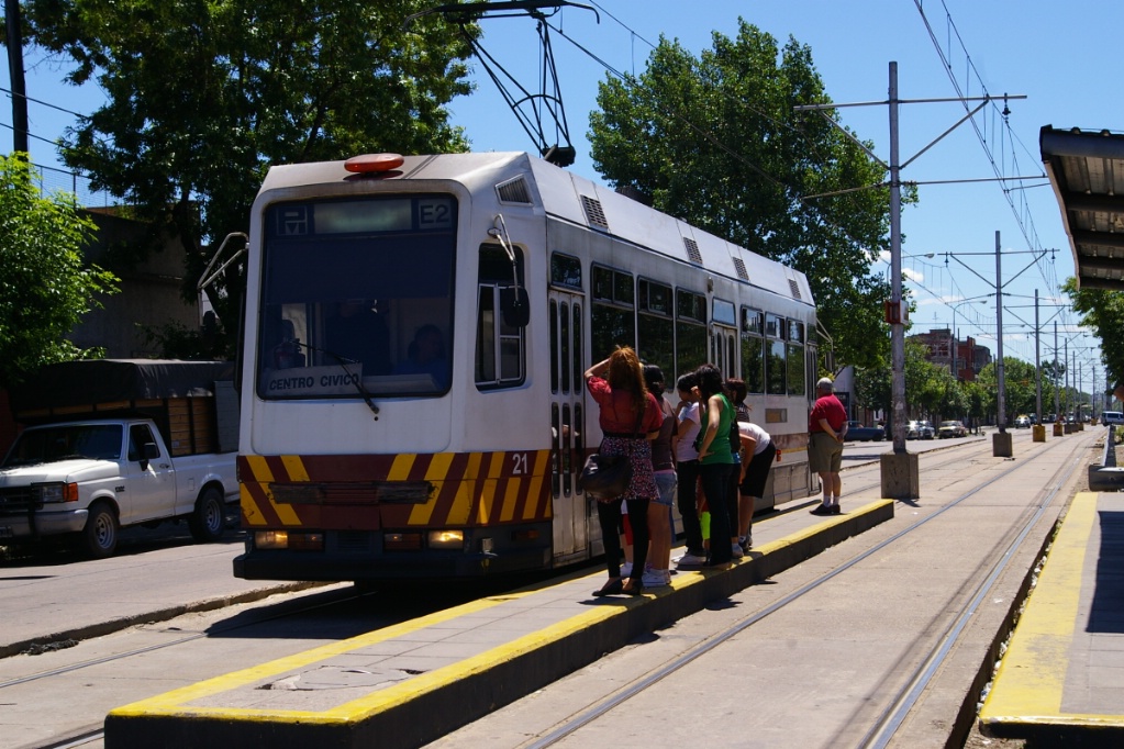
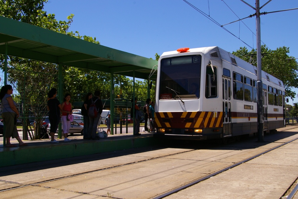
As seen from the passenger platform, an inbound LRV arrives at Intendente Saguier
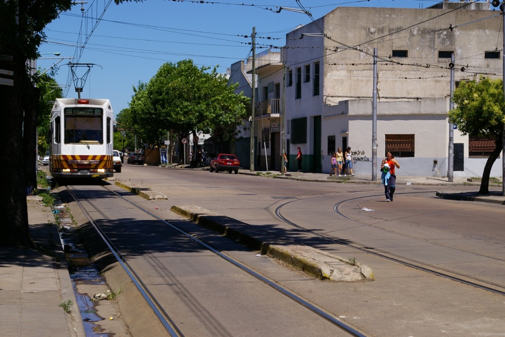
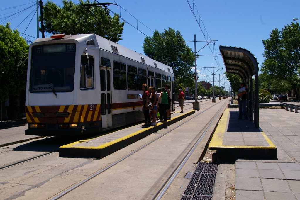
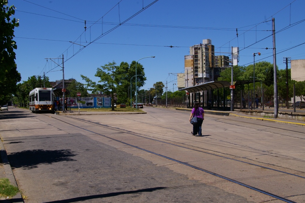
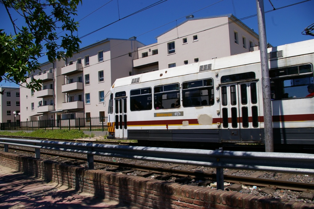
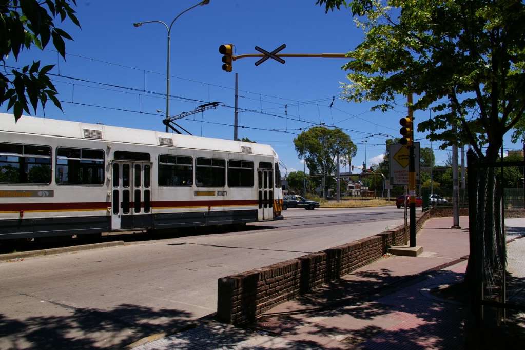
At the end of the Línea E subway line at Plaza de los Virreyes station, the Premetro, known as Línea P, has its terminal station named Intendente Saguier. In Buenos Aires, stations are generally named after the cross street or locality, so in most cases stations on connecting lines do not have the same name.
Intendente Saguier is an indoor terminal where passengers can easily transfer between Línea E and Línea P. There are two tracks inside the building, but only the one closest to the passenger entrance is used for public access. LRVs in active service are stored on both tracks at this station, and the track not used for passenger boarding has a service pit for maintenance work. There is a separate carhouse, but it is used for long term storage. In normal operations, only about a half dozen LRVs are used, but they are regularly rotated in and out of service with other vehicles.
Inbound LRV arriving at Intendente Saguier
An inbound and outbound meet just beyond Balbastro where the line has entered a median ROW
Outbound LRV arriving at Balbastro
What looks like an island is actually the platform for this stop.
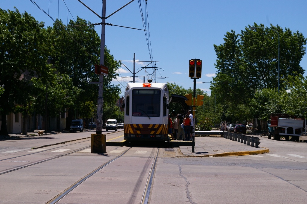
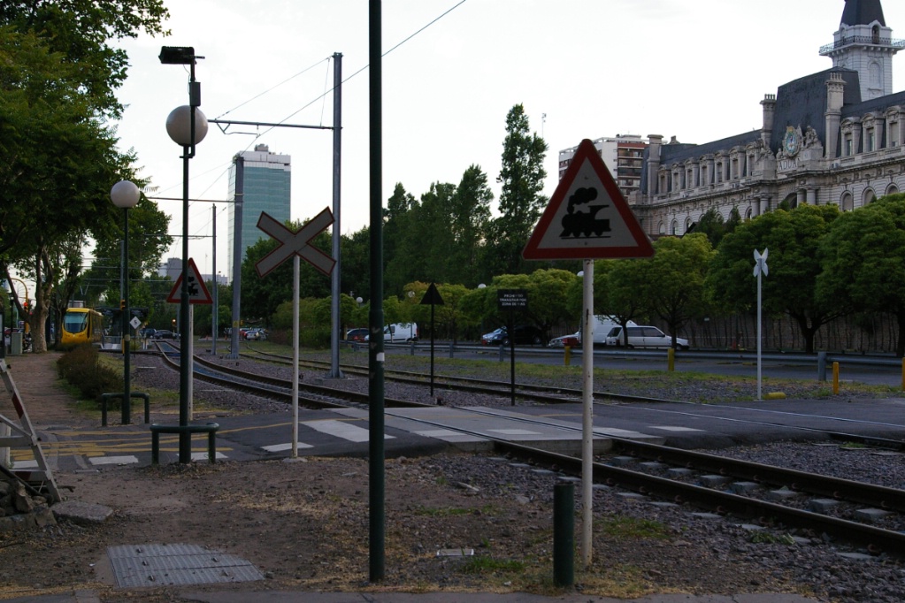
Upon leaving Intendente Saguier and crossing over to the outbound track, the line crosses over a cross street under signal protection and joins Avenida Lafuente. Here it runs in mixed traffic for about 900 metres to the stop at Balbastro. This stop has a single, narrow, centre platform that is about the width of a typical island at many GTA intersections.
Just past Balbastro, the line enters a median right of way for about 300 metres before turning off of Avenida Lafuente and onto Castañares where it heads over to the next parallel road, Avenida Mariano Acosta. This jog is about 500 metres.
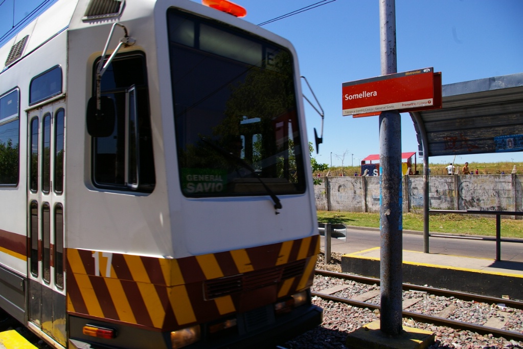
Onbound LRV arrives at Somellera
Immediately after turning onto Avenida Mariano Acosta, the first stop has that name.
Most of the stops on this line have a similar look, as can be seen in the photo to the right. The platforms are level with the first step on the vehicles, and is at a height similar to the floor on a low floor vehicle. Platforms are not very wide, though they are wider than the island platform at Balbastro. There is a shelter over the platform, but there are no seats nor garbage cans.
With a distance from Mariano Acosta of between 400 and 500 metres, the next stop is Somellera. There is a similar distance to the follwing stop, Ana María Janer.
This inbound LRV makes a stop at Mariano Acosta before turning onto Castañares
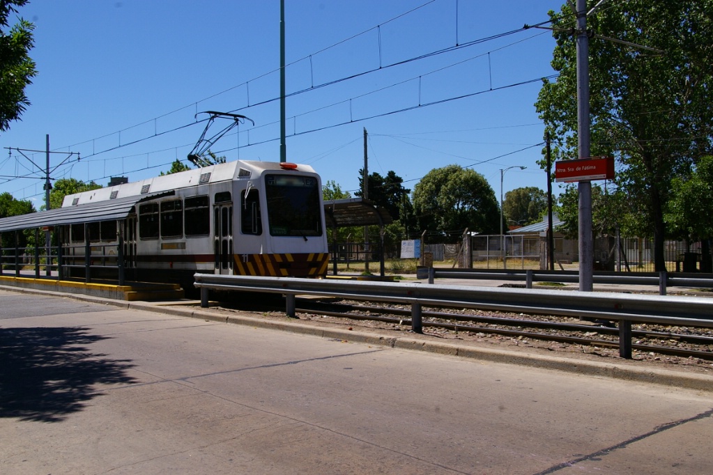
Outbound LRV at Nuestra Señora de Fátima
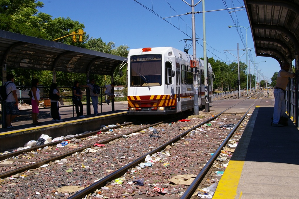
Inbound LRV arrives at Ana María Janer
The stop at Ana María Janer was originally called Fuerza Aerea (Spanish for "Air Force"). This stretch of the line has a particularly noticeable level of litter, as can be seen in the photo to the left.
From Ana María Janer, there is a short distance of about 100 metres to the next stop, Nuestra Señora de Fátima. Following this stop, there is a distance of about 300 metres before reaching Fernández de la Cruz, which is at the intersection with Avenida General Francisco Fernández de la Cruz. This part of the line from Nuestra Señora de Fátima to Fernández de la Cruz has a concrete right of way in the median of the road.
The stop at Fernández de la Cruz has an island platform that serves the outbound LRVs. This platform is of similar width to the one at Balbastro and has no shelter.
This inbound LRV is approaching Avenida General Francisco Fernández de la Cruz
At Fernández de la Cruz, the outbound platform is on the left. This platform is narrower than most and has no shelter.
Typically, people will wait under the shelter of the inbound platform and cross to the other platform as an outbound LRV is arriving.
Photo on the right shows an inbound LRV.
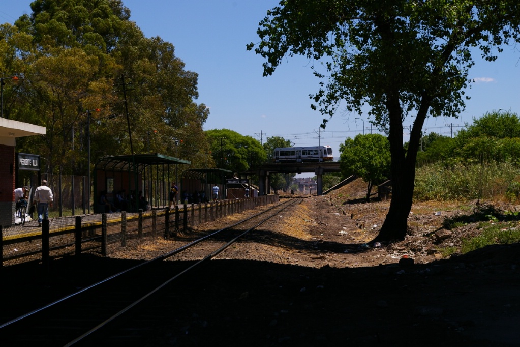
Outbound LRV crosses bridge over commuter rail line between Pte. Illia and Parque de la Ciudad
After crossing Avenida General Francisco Fernández de la Cruz, outbound LRVs turn at the first street, Valparaiso. This is a one-way street and the track is at the left side of the road. The next stop, Presidente Illia, is about 300 metres down this street, just before where it is met by the outbound track. The outbound track runs in the right-hand lane of another street, Veracruz to turn at Avenida Mariano Acosta. Adjacent to this LRT stop, is the Presidente Illia commuter rail stop on the Belgrano Sur rail line.
Just where the two directions rejoin, the line crosses a street named Lacarra where Valparaiso and Veracruz end. With the LRT line parallel to the railway at this location, Lacarra has crossing signals that operate for either LRT or trains using the crossing. After crossing Lacarra, the LRT line enters its own private right of way where is climbs to a bridge that crosses over the railway line.
This outbound LRV at Pte. Illia is on Valparaiso, while the inbound platform is on Veracruz. The two directions join together here before crossing Lacarra and onto a private ROW.
Outbound arriving at Escalada
This outbound LRV is just about to leave the concrete ROW just past Escalada
The next stop is Parque de la Ciudad where there are actually two separate stops (with platforms) serving this park, though only one shows on the route map. Shortly before reaching these stops, the right of way becomes aligned with Avenida General Francisco Fernández de la Cruz. Here, it is parallel to the road rather than in a median.
The following stop is Escalada (about 1.2 km from Pte. Illia), where the right of way is in full concrete for about 100 metres on either side of the stop.
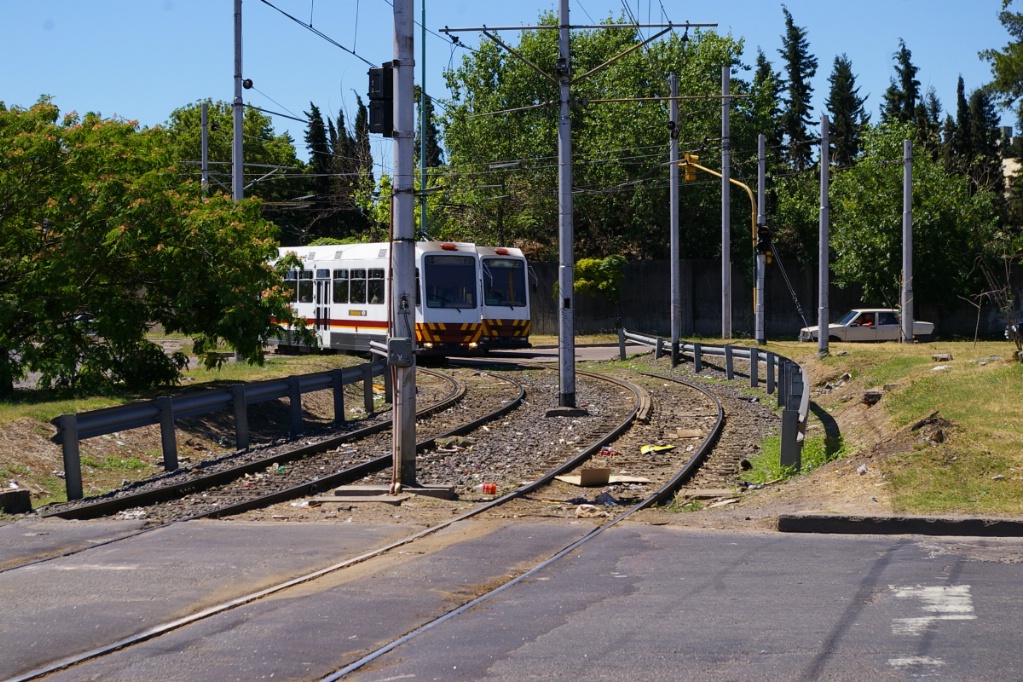
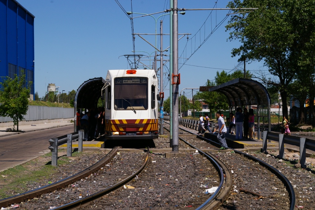
Inbound just departing Pola
About 1 km after Escalada is Pola, the final stop that is shared by both branches of the LRT.
This inbound LRV is rounding the curve towards Ana Diaz
From Pola, there is a distance of only about 200 metres to the first stop on either branch, and these stops are barely 100 metres apart from each other.
The shorter branch has only two stops and a single track. The first stop, Ana Diaz, is immediately after the junction and is parallel with Avenida General Francisco Fernández de la Cruz.
After this stop, the track curves through a field and crosses Díaz Avelino where it enters a median on Santiago De La Frontera and goes another few hundred metres to the final stop at Centro Cívico Lugano. This road has large apartment blocks on each side of it with shops on a second level. There is a bridge between the two second level shops about 100 metres from the Centro Cívico stop (photo to the right is taken from this bridge).
This outbound LRV is heading up the median of Santiago De La Frontera
towards Centro Cívico Lugano
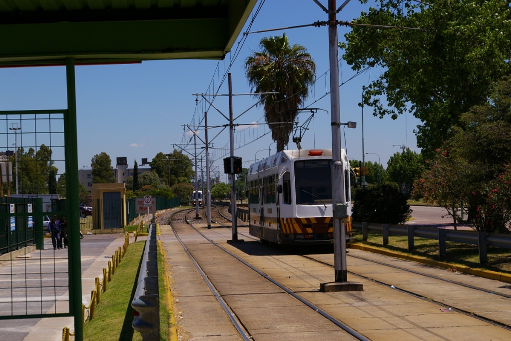
Inbound departing from Larrazábel curving towards Pola
Outbound turning from Avenida
Larrazábel to Avenida Cnel. Roca
Inbound approaching Nicolás Descalzi
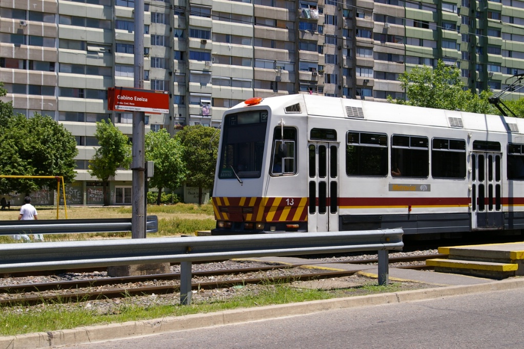
Outbound departing Gabino Ezeiza
The longer branch has two tracks and curves to the left after leaving Pola and enters a median right of way on Avenida Larrazábel to make its first stop on that street named Larrazábel. There are two more stops on this street, each about 500 metres apart. The first is Nicolás Descalzi and the second is Gabino Ezeiza.
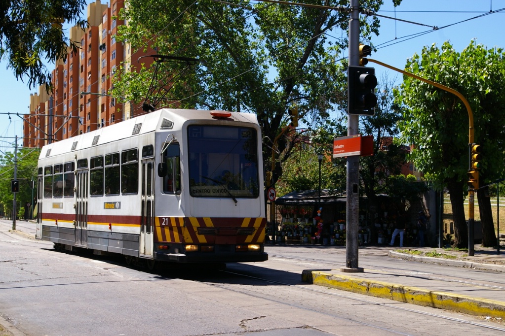
Just past Gabino Ezeiza, the line turns right at Avenida Cnel. Roca where it is also in a median right of way. The line travels for about another 400 metres along Avenida Cnel. Roca where it reaches the final stop of General Savio, located just before Santiago De La Frontera. The tracks continue past the stop where there is a turn back crossover.
Outbound at General Savio after turning back at crossover
beyond stop
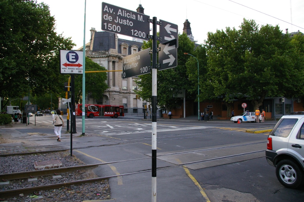
Celeris is built on a railway ROW parallel to Avenida Alicia Moreau de Justo.
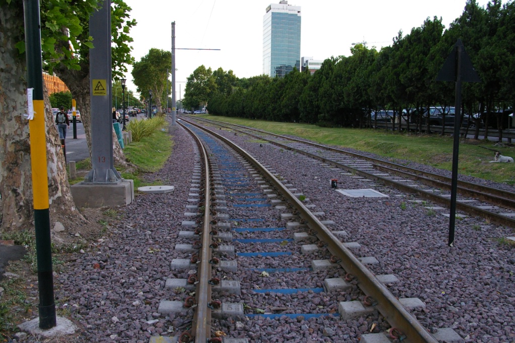
The line is built with ballasted tie construction using ties consisting of two concrete pads held together with a steel bar.
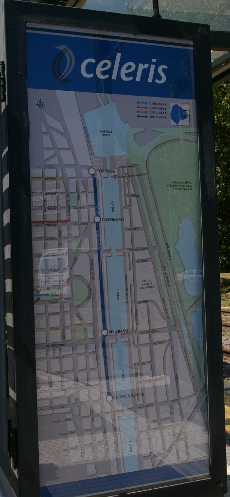
| Tranvía del Este / Celeris | ||
Length: |
2.0 km |
|
| Stations: | 4 |
|
ROW: |
Open ROW parallel to street with railway ROW |
|
| Signalled crossings with streets and driveways | ||
| Most of line is single track, except at Belgrano | ||
| Ballasted tie construction, using French ties (see photo to far left) | ||
| Service frequency: | 15 minutes | |
| Fare collection: | Self service purchase on platform from TVM or personel | |
| AR$1 fare; no transfers to other services | ||
| Opening: | July 25, 2007 | |
Here is a description of the route on Celeris:
One of the Citadis LRVs sits out of service just west of Independencia
With only a 2 km length, there is only a single track for operation on this line, with one station having two tracks where the two LRVs can meet. This line runs on the west side of Avenida Alicia Moreau de Justo and stations are named after the cross street where they are located.
Its southern terminus is Independencia (on the north side of Avenida Independencia). Here there is a single platform on the east side of the track.
The distance to the next station, Belgrano (on the north side of Avenida Belgrano) is about 600 metres. Belgrano station has a centre platform as the track splits into two tracks on approach from either side of this station.
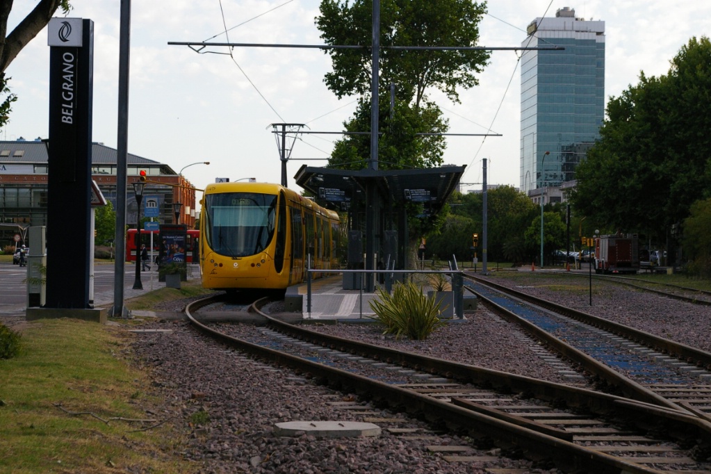
Belgrano is the only station with two tracks.
When both LRVs are in operation,
this is where they must meet.
Driveway crossing north of Belgrano
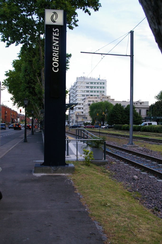
The longest stretch between stations occurs between Belgrano and Corrientes (on the north side of Avenida Corrientes), which is roughly 800 metres. Corrientes station is the closest station to the Subte (subway/metro system). Even so, the Leandro N. Alem station on Línea B is located three blocks to the west at the intersection of Avenida Corrientes and Avenida Leandro N. Alem.
Despite this, the Peurto Madero TBA commuter rail station is on the south side of Avenida Corrientes. This station is served by five morning trains and four afternoon trains.
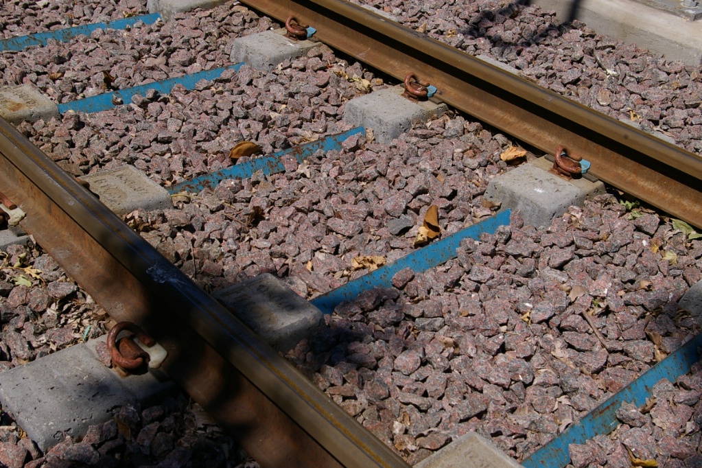
A closer look at the track construction showing the ties comprised of concrete pads held in gauge by steel bars
![]()
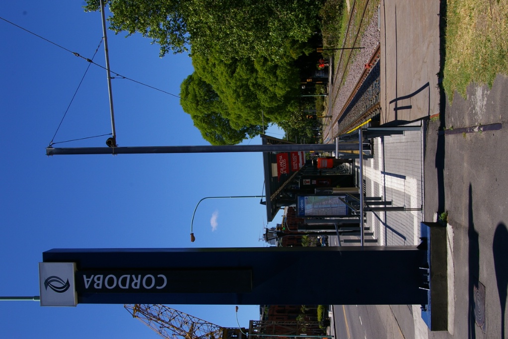 After another
stretch of about 600 metres long and you are at the
northern terminus of Córdoba (just south of Avenida
Córdoba).
After another
stretch of about 600 metres long and you are at the
northern terminus of Córdoba (just south of Avenida
Córdoba).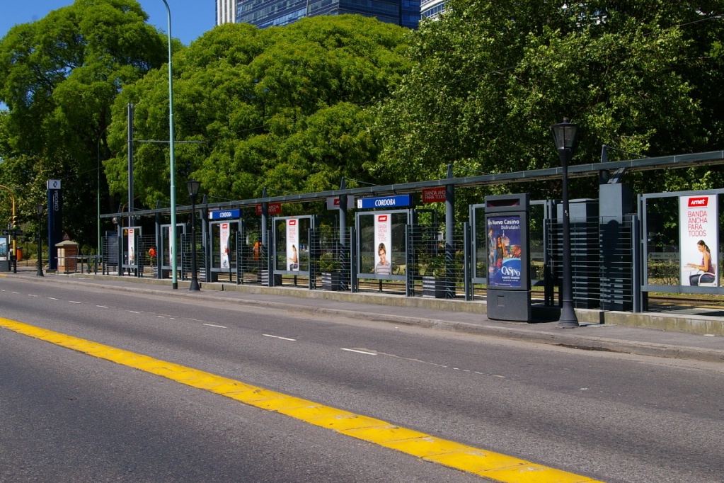
Córdoba station as seen from the east side
of Avenida Alicia Moreau de Justo
Send questions, comments, and photos hereThis page last updated October 13, 2010